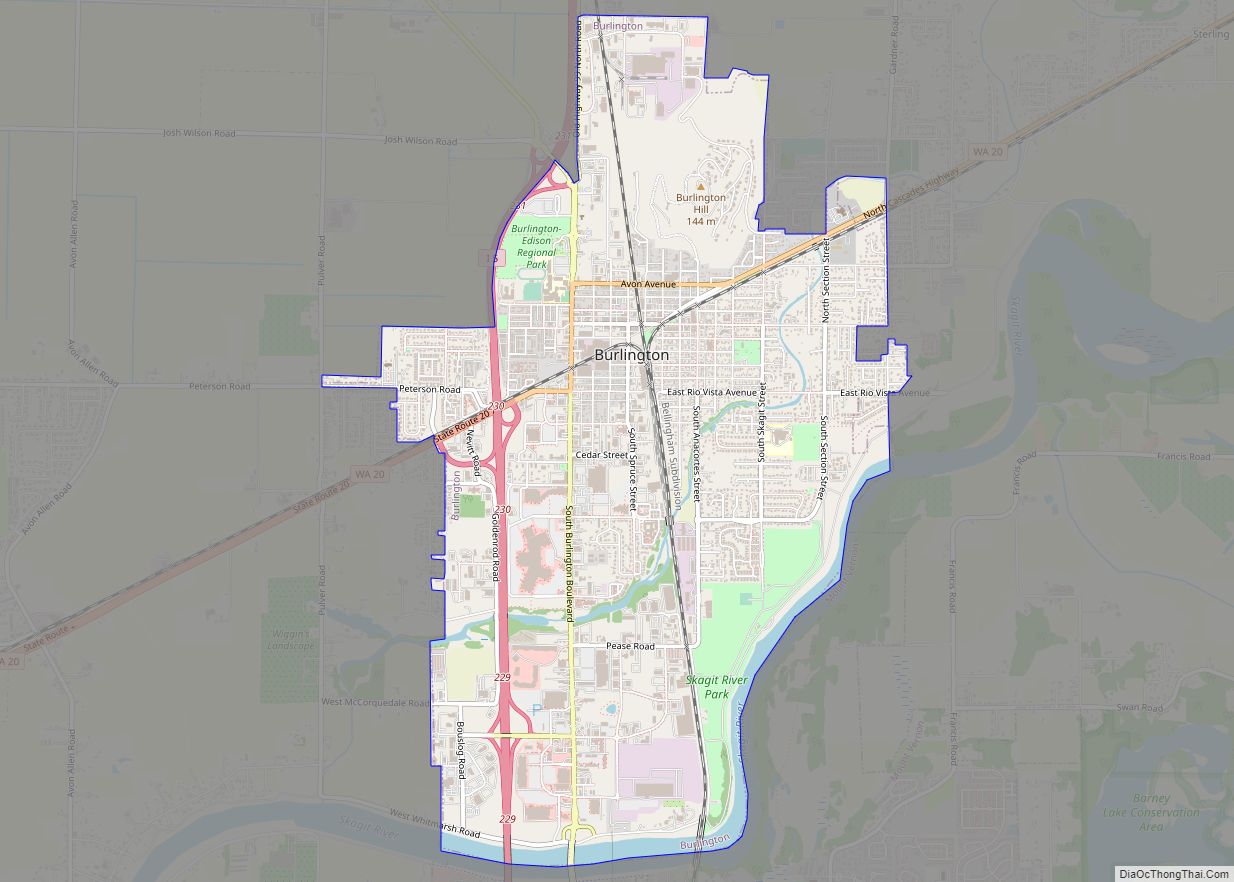
Burlington is a city in Skagit County, Washington, United States. Its population was recorded as 9,152 in the 2020 census. Burlington is located approximately halfway between Seattle and Vancouver, B.C. The city is included in the Mount Vernon–Anacortes, Washington Metropolitan Statistical Area.
| Name: | Burlington city |
|---|---|
| LSAD Code: | 25 |
| LSAD Description: | city (suffix) |
| State: | Washington |
| County: | Skagit County |
| Incorporated: | June 16, 1902 |
| Elevation: | 30 ft (9.1 m) |
| Total Area: | 4.44 sq mi (11.49 km²) |
| Land Area: | 4.28 sq mi (11.08 km²) |
| Water Area: | 0.16 sq mi (0.41 km²) 3.62% |
| Total Population: | 9,152 |
| Population Density: | 2,137.8/sq mi (825.4/km²) |
| ZIP code: | 98233 |
| Area code: | 360 |
| FIPS code: | 5308920 |
| GNISfeature ID: | 1512052 |
| Website: | burlingtonwa.gov |
Online Interactive Map
Click on ![]() to view map in "full screen" mode.
to view map in "full screen" mode.
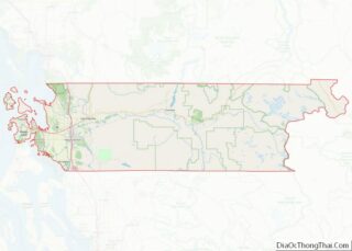
Burlington location map. Where is Burlington city?


History
Burlington began as a logging camp, established by John P. Millett and William McKay, in 1882. It was officially incorporated on June 16, 1902.
Originally, Burlington’s businesses were centered on Fairhaven Avenue. Today, Fairhaven Avenue is the center of Burlington’s old downtown, which has since been revitalized.
In 2007, the city opened a new library and city hall.
Indigent defense ruling
In December 2013, U.S. District Judge Robert Lasnik determined that Burlington had systematically violated its duty to offer effective legal representation to defendants who couldn’t afford an attorney. The ruling required Burlington and Mount Vernon to hire a public defense supervisor to ensure their defense system complies with constitutional standards.
2016 shooting
On September 24, 2016, five people were shot and killed at Cascade Mall in Burlington.
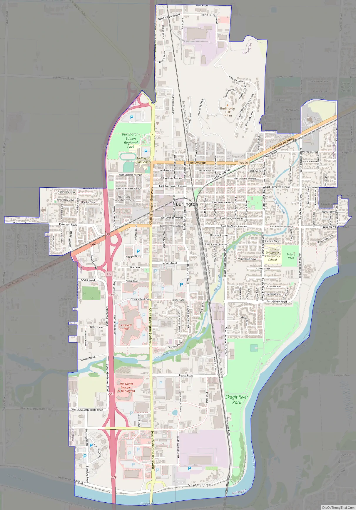
Burlington Road Map
Burlington city Satellite Map
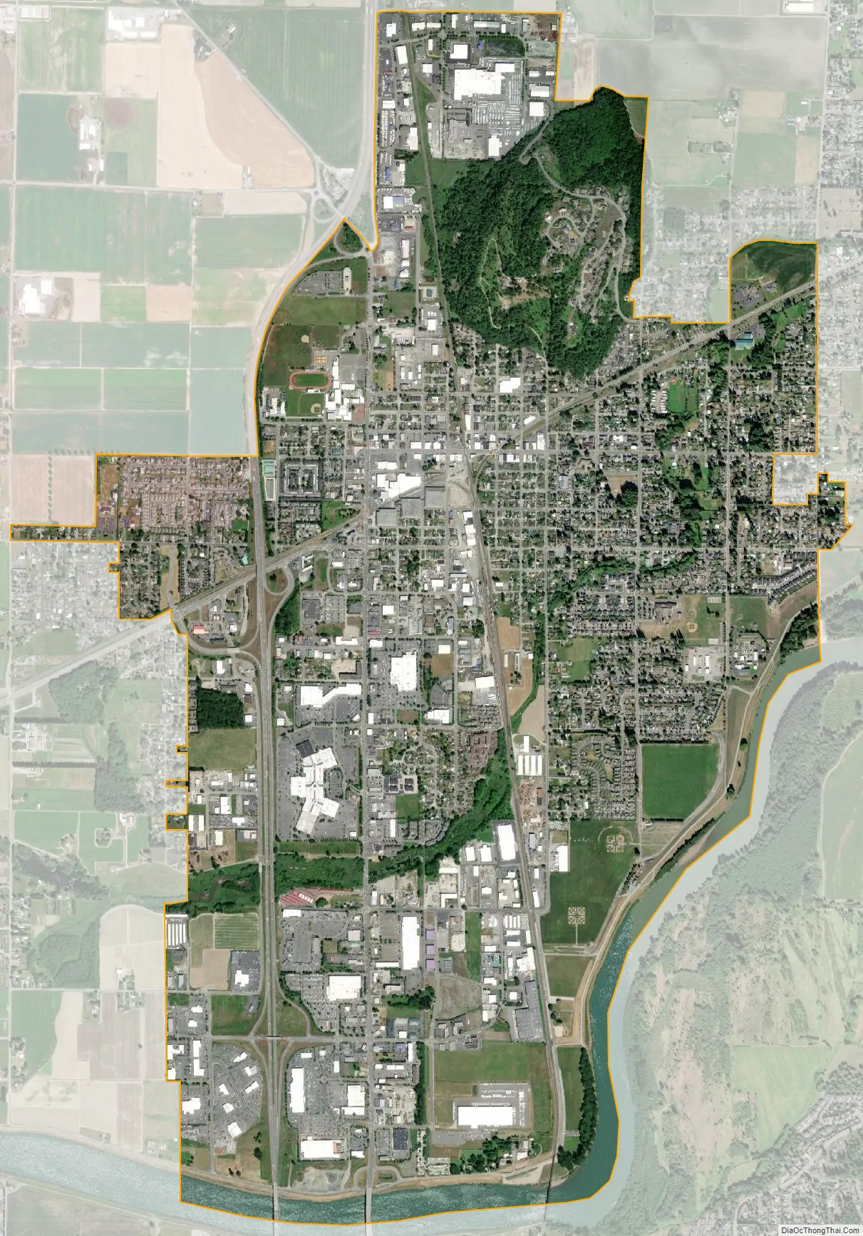
Geography
According to the United States Census Bureau, the city has a total area of 4.42 square miles (11.45 km), of which 4.26 square miles (11.03 km) is land and 0.16 square miles (0.41 km) is water.
Flooding
The Skagit River has a long history of flooding, which has affected Burlington as well as other communities in the Skagit Valley. A 1909 newspaper article describes how a dike broke upriver “and a mountain of water came rushing down the Skagit valley and quickly inundated [Burlington]”. Burlington is protected by a system of dikes under the jurisdiction of Skagit County Dike District #12, which was originally incorporated in 1895.
See also
Map of Washington State and its subdivision:- Adams
- Asotin
- Benton
- Chelan
- Clallam
- Clark
- Columbia
- Cowlitz
- Douglas
- Ferry
- Franklin
- Garfield
- Grant
- Grays Harbor
- Island
- Jefferson
- King
- Kitsap
- Kittitas
- Klickitat
- Lewis
- Lincoln
- Mason
- Okanogan
- Pacific
- Pend Oreille
- Pierce
- San Juan
- Skagit
- Skamania
- Snohomish
- Spokane
- Stevens
- Thurston
- Wahkiakum
- Walla Walla
- Whatcom
- Whitman
- Yakima
- Alabama
- Alaska
- Arizona
- Arkansas
- California
- Colorado
- Connecticut
- Delaware
- District of Columbia
- Florida
- Georgia
- Hawaii
- Idaho
- Illinois
- Indiana
- Iowa
- Kansas
- Kentucky
- Louisiana
- Maine
- Maryland
- Massachusetts
- Michigan
- Minnesota
- Mississippi
- Missouri
- Montana
- Nebraska
- Nevada
- New Hampshire
- New Jersey
- New Mexico
- New York
- North Carolina
- North Dakota
- Ohio
- Oklahoma
- Oregon
- Pennsylvania
- Rhode Island
- South Carolina
- South Dakota
- Tennessee
- Texas
- Utah
- Vermont
- Virginia
- Washington
- West Virginia
- Wisconsin
- Wyoming