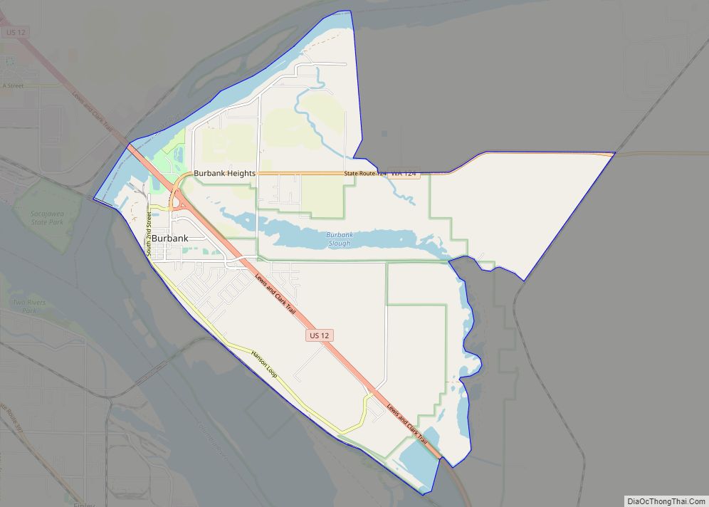
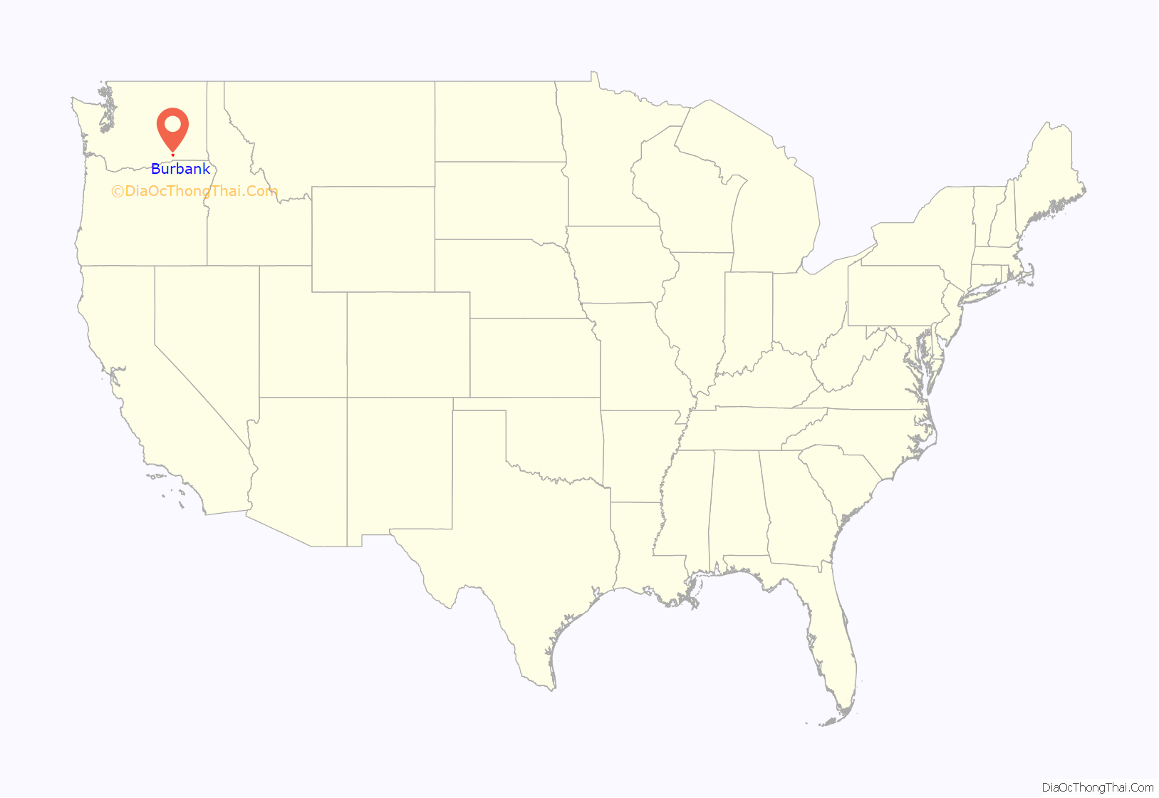
Burbank is a census-designated place (CDP) in Walla Walla County, Washington, United States, where the Snake River meets the Columbia. The population was 3,291 at the 2010 census. Named for Luther Burbank, the city is located just east of Pasco and Kennewick, across the Snake and Columbia Rivers, respectively. Burbank is part of the Tri-Cities, WA urban area, despite being located in the Walla Walla metropolitan area (which includes all of Walla Walla and Columbia counties).
| Name: | Burbank CDP |
|---|---|
| LSAD Code: | 57 |
| LSAD Description: | CDP (suffix) |
| State: | Washington |
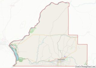
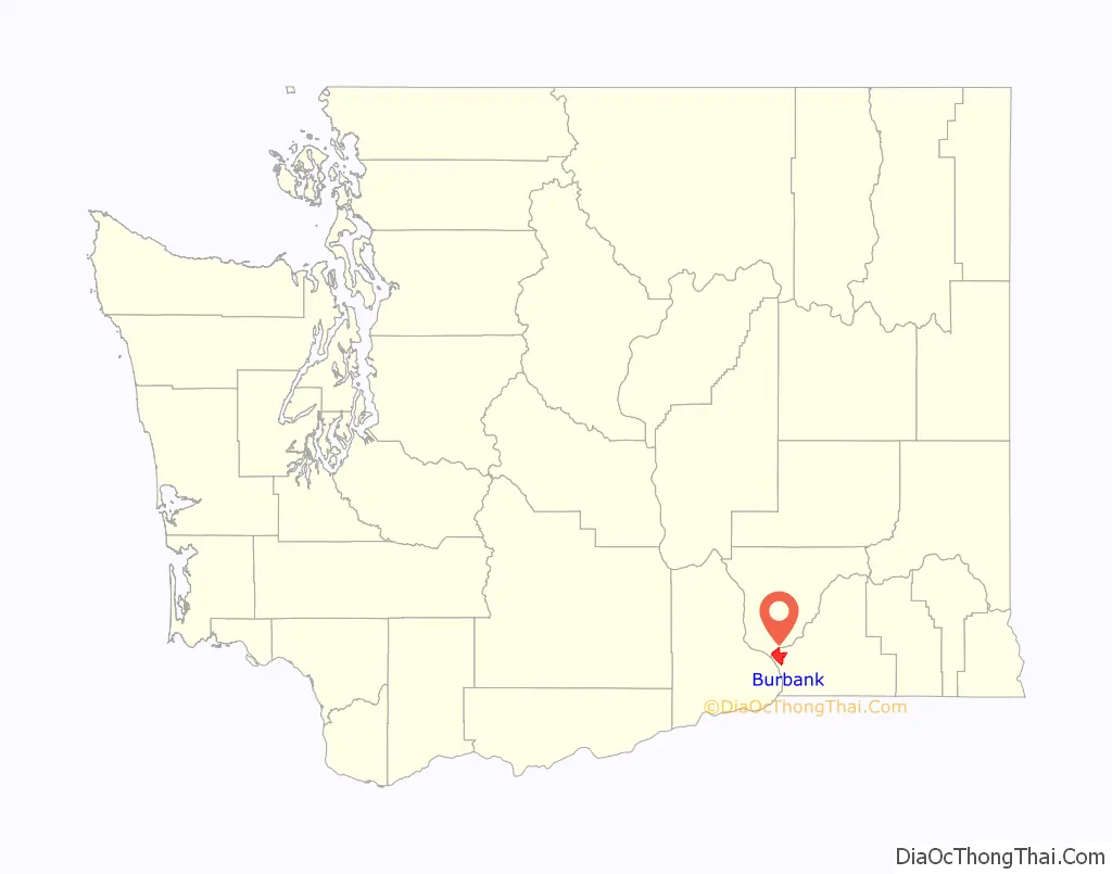
| County: | Walla Walla County |
| Elevation: | 374 ft (114 m) |
| Land Area: | 13.3 sq mi (34.4 km²) |
| Water Area: | 1.7 sq mi (4.4 km²) |
| Population Density: | 249.0/sq mi (96.1/km²) |
| ZIP code: | 99323 |
| Area code: | 509 |
| FIPS code: | 5308780 |
| GNISfeature ID: | 1512048 |
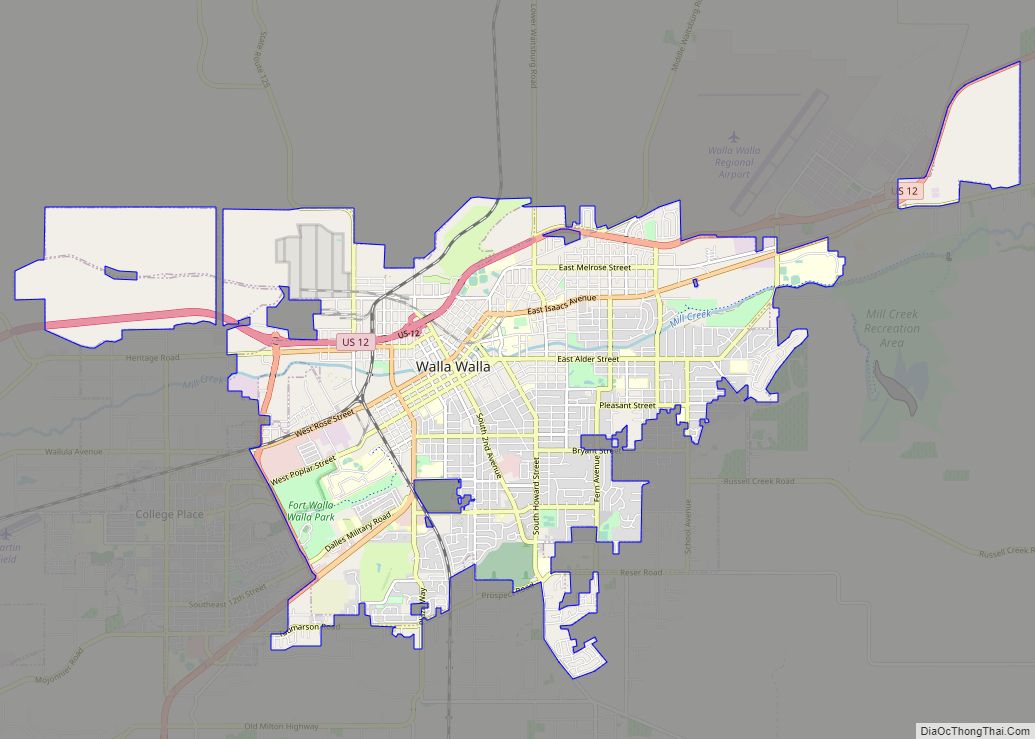
Online Interactive Map
Click on ![]() to view map in "full screen" mode.
to view map in "full screen" mode.
Burbank location map. Where is Burbank CDP?
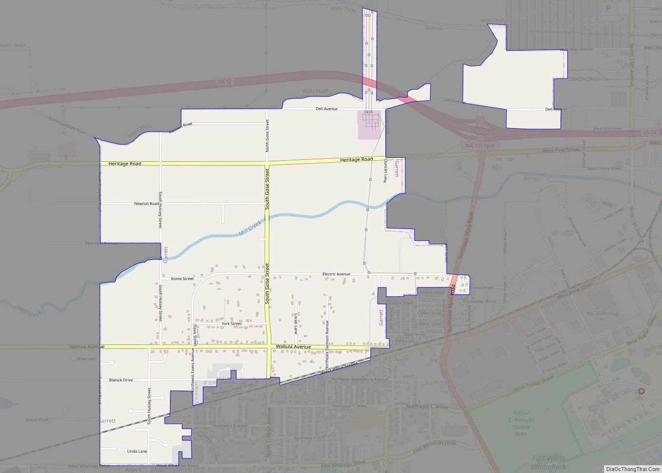
Burbank Road Map

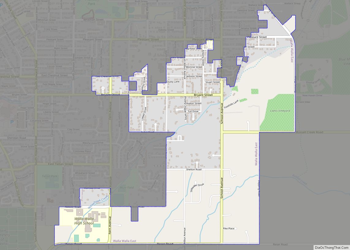
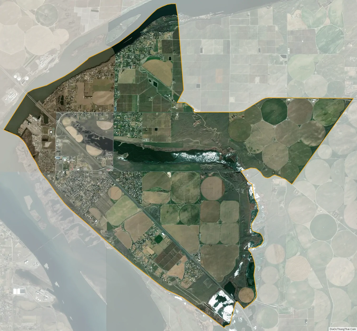
Burbank city Satellite Map
Geography
Burbank Washington is located at 46°11′43″N 119°0′2″W / 46.19528°N 119.00056°W / 46.19528; -119.00056 (46.195392, -119.000477).
According to the United States Census Bureau, the CDP has a total area of 15.0 square miles (38.8 km), of which, 13.3 square miles (34.4 km) of it is land and 1.7 square miles (4.4 km) of it (11.36%) is water.
Climate
According to the Köppen Climate Classification system, Burbank has a semi-arid climate, abbreviated “BSk” on climate maps.
The highest temperature ever measured in Washington state was recorded at the nearby Ice Harbor Dam, at 118 °F (47.8 °C), on August 5, 1961 (The same temperature has also been recorded in July elsewhere).
See also
Map of Washington State and its subdivision:- Adams
- Asotin
- Benton
- Chelan
- Clallam
- Clark
- Columbia
- Cowlitz
- Douglas
- Ferry
- Franklin
- Garfield
- Grant
- Grays Harbor
- Island
- Jefferson
- King
- Kitsap
- Kittitas
- Klickitat
- Lewis
- Lincoln
- Mason
- Okanogan
- Pacific
- Pend Oreille
- Pierce
- San Juan
- Skagit
- Skamania
- Snohomish
- Spokane
- Stevens
- Thurston
- Wahkiakum
- Walla Walla
- Whatcom
- Whitman
- Yakima
- Alabama
- Alaska
- Arizona
- Arkansas
- California
- Colorado
- Connecticut
- Delaware
- District of Columbia
- Florida
- Georgia
- Hawaii
- Idaho
- Illinois
- Indiana
- Iowa
- Kansas
- Kentucky
- Louisiana
- Maine
- Maryland
- Massachusetts
- Michigan
- Minnesota
- Mississippi
- Missouri
- Montana
- Nebraska
- Nevada
- New Hampshire
- New Jersey
- New Mexico
- New York
- North Carolina
- North Dakota
- Ohio
- Oklahoma
- Oregon
- Pennsylvania
- Rhode Island
- South Carolina
- South Dakota
- Tennessee
- Texas
- Utah
- Vermont
- Virginia
- Washington
- West Virginia
- Wisconsin
- Wyoming