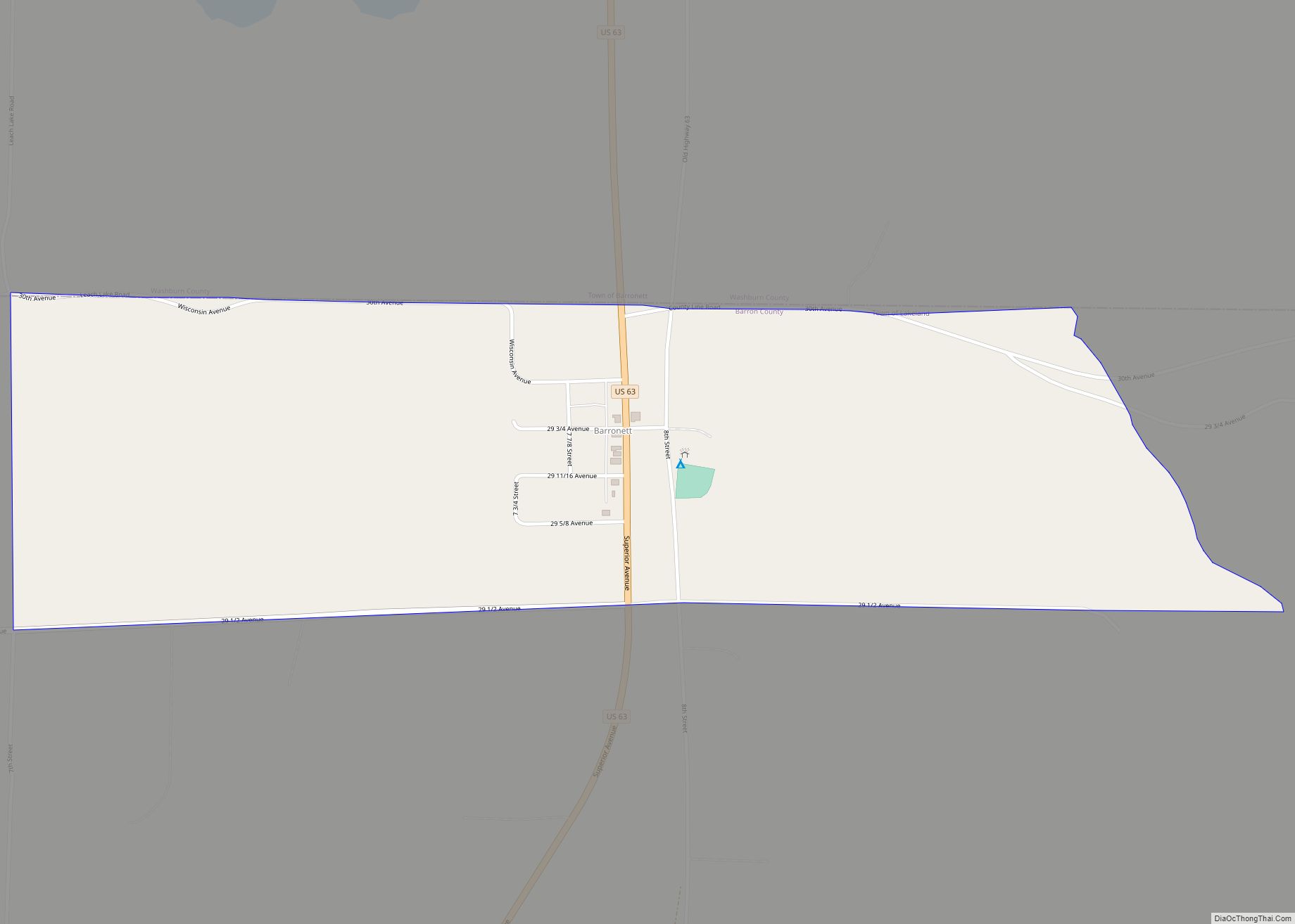
Map of Barneveld village, Wisconsin
Barneveld is a village in Iowa County, Wisconsin, United States. The population was 1,331 at the 2020 census. It is part of the Madison Metropolitan Statistical Area. The community was named after John of Barneveld of the Netherlands. Barneveld village overview: Name: Barneveld village LSAD Code: 47 LSAD Description: village (suffix) State: Wisconsin County: Iowa ... Read more
Map of Barneveld village, Wisconsin
Map of Baraboo city
Baraboo is a city in the Midwest and the county seat of Sauk County, Wisconsin, United States. The largest city in the county, Baraboo is the principal city of the Baraboo Micropolitan Statistical Area which comprises a portion of the Madison Combined Statistical area. Its 2020 population was 12,556. It is situated on the Baraboo ... Read more
Map of Baraboo city
Map of Bangor village, Wisconsin
Bangor is a town in La Crosse County, Wisconsin, United States. It is part of the La Crosse, Wisconsin Metropolitan Statistical Area. The population was 570 at the 2010 census. The Village of Bangor is located partially within the town. Bangor village overview: Name: Bangor village LSAD Code: 47 LSAD Description: village (suffix) State: Wisconsin ... Read more
Map of Bangor village, Wisconsin
Map of Beloit city, Wisconsin
Beloit is a city in Rock County, Wisconsin, United States. As of the 2020 census, the city had a population of 36,657 people. Beloit is a principal city of the Janesville-Beloit Metropolitan Statistical Area and is included in the Madison Combined Statistical Area. Beloit city overview: Name: Beloit city LSAD Code: 25 LSAD Description: city ... Read more
Map of Beloit city, Wisconsin
Map of Belmont village, Wisconsin
Belmont is a town in Lafayette County, Wisconsin, United States. The population was 767 at the 2010 census, up from 676 at the 2000 census. The village of Belmont is located in the southeastern part of the town. The unincorporated community of Leslie close to the center of the town. Belmont village overview: Name: Belmont ... Read more
Map of Belmont village, Wisconsin
Map of Bloomer city
Bloomer is a city in Chippewa County, Wisconsin, United States. As of the 2010 census, the population of the city of Bloomer was 3,539. Bloomer city overview: Name: Bloomer city LSAD Code: 25 LSAD Description: city (suffix) State: Wisconsin County: Chippewa County Elevation: 994 ft (303 m) Total Area: 3.10 sq mi (8.03 km²) Land Area: 2.95 sq mi (7.64 km²) Water Area: ... Read more
Map of Bloomer city
Map of Blanchardville village
Blanchardville is a village in Iowa and Lafayette counties in the U.S. state of Wisconsin. The population was 825 at the 2010 census. Of this, 648 were in Lafayette County, and 177 were in Iowa County. The Iowa County portion of Blanchardville is part of the Madison Metropolitan Statistical Area. Blanchardville village overview: Name: Blanchardville ... Read more
Map of Blanchardville village
Map of Blair city, Wisconsin
Blair is a city in Trempealeau County, Wisconsin, along the Trempealeau River. The population was 1,366 at the 2010 census. Blair is on the former Green Bay and Western Railroad, which ran down the Trempealeau River valley to Winona, Minnesota. Blair city overview: Name: Blair city LSAD Code: 25 LSAD Description: city (suffix) State: Wisconsin ... Read more
Map of Blair city, Wisconsin
Map of Black Earth village
The Town of Black Earth is located in Dane County, Wisconsin, United States. The population was 510 at the 2020 census. Black Earth village overview: Name: Black Earth village LSAD Code: 47 LSAD Description: village (suffix) State: Wisconsin County: Dane County FIPS code: 5507800 Online Interactive Map Black Earth online map. Source: Basemap layers from ... Read more
Map of Black Earth village
Map of Black Creek village, Wisconsin
Black Creek is a town in Outagamie County, Wisconsin, United States. The population was 1,251 at the 2020 census. The Village of Black Creek (governed separately) and the unincorporated community of Binghamton are located in the town. The unincorporated community of Five Corners is also located partially in the town. Black Creek village overview: Name: ... Read more
Map of Black Creek village, Wisconsin
Map of Biron village
Biron is a village in Wood County, Wisconsin, United States. The population was 839 at the 2010 census. It is the site of ND Paper’s Biron Mill. Biron village overview: Name: Biron village LSAD Code: 47 LSAD Description: village (suffix) State: Wisconsin County: Wood County Elevation: 1,024 ft (312 m) Total Area: 6.28 sq mi (16.26 km²) Land Area: 4.64 sq mi ... Read more
Map of Biron village
Map of Boscobel city
Boscobel is a city in Grant County, Wisconsin, United States. The population was 3,286 at the 2020 census. Approximately 0.6 mi. (1 km) to the north of the city, across a riparian swamp, is the Wisconsin River. U.S. Route 61 crosses the Wisconsin River at Boscobel. To the south, the city is bordered by the Town of ... Read more
Map of Boscobel city