Beloit is a city in Rock County, Wisconsin, United States. As of the 2020 census, the city had a population of 36,657 people. Beloit is a principal city of the Janesville-Beloit Metropolitan Statistical Area and is included in the Madison Combined Statistical Area.
| Name: | Beloit city |
|---|---|
| LSAD Code: | 25 |
| LSAD Description: | city (suffix) |
| State: | Wisconsin |
| County: | Rock County |
| Founded: | 1836 |
| Incorporated: | February 24, 1846 (village) March 31, 1856 (city) |
| Elevation: | 751 ft (228.9 m) |
| Land Area: | 17.33 sq mi (44.89 km²) |
| Water Area: | 0.33 sq mi (0.84 km²) |
| Population Density: | 2,115.0/sq mi (816.6/km²) |
| Area code: | 608 |
| FIPS code: | 5506500 |
| Website: | beloitwi.gov |
Online Interactive Map
Click on ![]() to view map in "full screen" mode.
to view map in "full screen" mode.
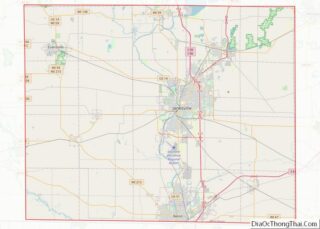
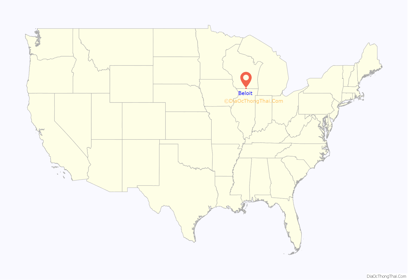
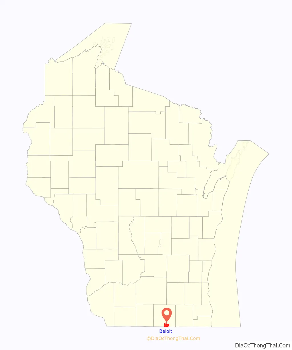
Beloit location map. Where is Beloit city?
History
Twelve men in Colebrook, New Hampshire, created the “New England Emigrating Company” in October 1836 and sent Horace White to find a suitable region of Wisconsin in which to settle. The level fields and the water power of Turtle Creek and “unlimited gravel” in the area around what is now Beloit fixed the site of the village and farms. White purchased the land. At the same time as the Colebrook settlers, six families from Bedford, New Hampshire, arrived and settled in the region. They said the Rock River Valley had a “New England look” that made them feel at home. The village was platted in 1838 and was planned with wide streets, building on the New England model.
Beloit was originally named New Albany (after Albany, Vermont) in 1837 by its founder, Caleb Blodgett. The name was changed to Beloit in 1838. The name was coined to be reminiscent of Detroit.
Beloit lays claim to such inventions as the speedometer, John Francis Appleby’s twine binder, and Korn Kurls, which resemble Cheetos, was the original puffed cheese snack.
Historic buildings
Beloit’s 1889 Water Tower Place began demolition in 1935, which was halted because of the cost. A historic pump station is nearby.
The Fairbanks Flats were built in 1917 to house the rush of African Americans moving to the area from the Southern United States.
Pearsons Hall of Science was designed by the architectural firm Burnham and Root for Beloit College as a science center.
The Lathrop-Munn Cobblestone House was originally built for politician John Hackett.
The Castle at 501 Prospect was built as First Presbyterian Church in 1902. It now operates as a Performing Arts Center and Music School.
Downtown Beloit and the riverfront
Downtown Beloit is the city’s historic economic, cultural and social center. North of the confluence of the Rock River and Turtle Creek, the downtown is anchored by a core of historic buildings and the Ironworks office and industrial campus. Beloit’s riverfront park system, mainly Riverside Park, extends north of downtown along the east bank toward the Town of Beloit.
Downtown Beloit is one of two inaugural members of the Wisconsin Main Street designation.
Railroad heritage
Beloit was served by the Chicago, Milwaukee, St. Paul and Pacific Railroad, better known as the Milwaukee Road, and the Chicago & North Western Railroad (C&NW). In its 1980 bankruptcy, the Milwaukee Road disposed of the Southwestern Line. The Union Pacific Railroad, which took over the C&NW, operates in Beloit today over a remnant of the former Milwaukee Road, providing a rail connection to Fairbanks-Morse Engine manufacturing facility. The Canadian Pacific Railway operates other trackage in Beloit. The city also had an electric interurban railroad.
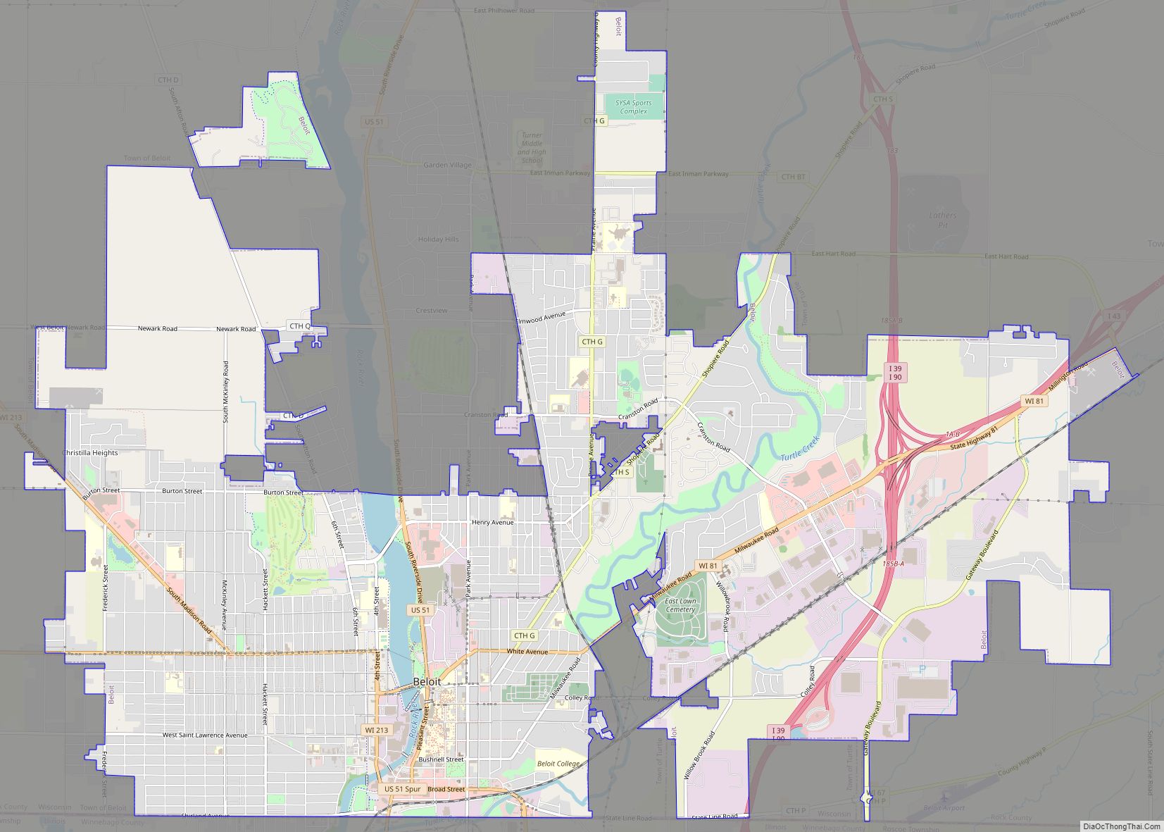
Beloit Road Map
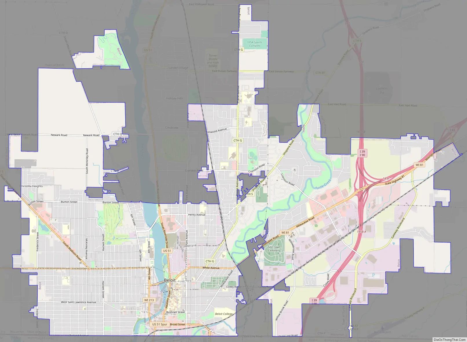
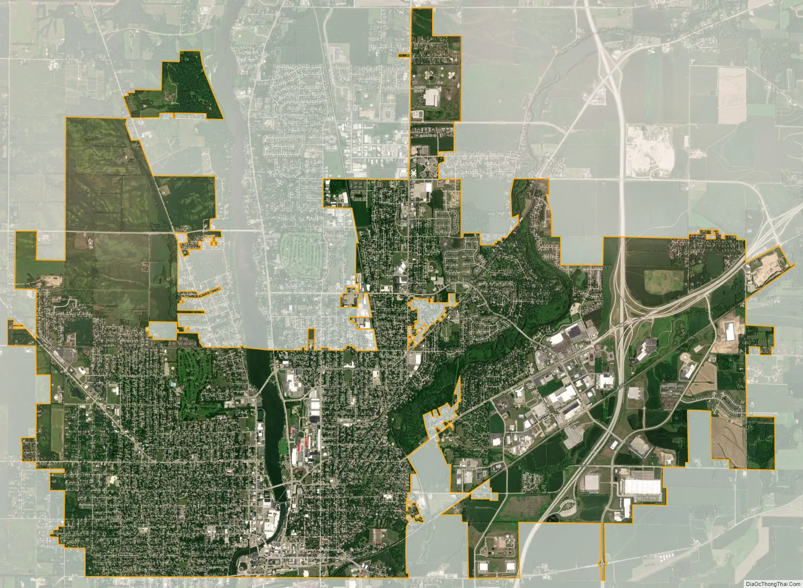
Beloit city Satellite Map
Geography
According to the United States Census Bureau, the city has an area of 17.66 square miles (45.74 km), of which 17.33 square miles (44.88 km) is land and 0.33 square miles (0.85 km) is water. Location: 42°30′30″N 89°01′54″W / 42.50833°N 89.03167°W / 42.50833; -89.03167.
The city is adjacent to the Town of Beloit, Town of Turtle, and the Illinois municipality of South Beloit.
Most of Beloit’s development is occurring on the east side, adjacent to Interstates 39/90 and Interstate 43, where the city annexed rural land for Beloit Gateway Industrial Park, as well as in the newly revitalized downtown along the Rock River.
See also
Map of Wisconsin State and its subdivision:- Adams
- Ashland
- Barron
- Bayfield
- Brown
- Buffalo
- Burnett
- Calumet
- Chippewa
- Clark
- Columbia
- Crawford
- Dane
- Dodge
- Door
- Douglas
- Dunn
- Eau Claire
- Florence
- Fond du Lac
- Forest
- Grant
- Green
- Green Lake
- Iowa
- Iron
- Jackson
- Jefferson
- Juneau
- Kenosha
- Kewaunee
- La Crosse
- Lafayette
- Lake Michigan
- Lake Superior
- Langlade
- Lincoln
- Manitowoc
- Marathon
- Marinette
- Marquette
- Menominee
- Milwaukee
- Monroe
- Oconto
- Oneida
- Outagamie
- Ozaukee
- Pepin
- Pierce
- Polk
- Portage
- Price
- Racine
- Richland
- Rock
- Rusk
- Saint Croix
- Sauk
- Sawyer
- Shawano
- Sheboygan
- Taylor
- Trempealeau
- Vernon
- Vilas
- Walworth
- Washburn
- Washington
- Waukesha
- Waupaca
- Waushara
- Winnebago
- Wood
- Alabama
- Alaska
- Arizona
- Arkansas
- California
- Colorado
- Connecticut
- Delaware
- District of Columbia
- Florida
- Georgia
- Hawaii
- Idaho
- Illinois
- Indiana
- Iowa
- Kansas
- Kentucky
- Louisiana
- Maine
- Maryland
- Massachusetts
- Michigan
- Minnesota
- Mississippi
- Missouri
- Montana
- Nebraska
- Nevada
- New Hampshire
- New Jersey
- New Mexico
- New York
- North Carolina
- North Dakota
- Ohio
- Oklahoma
- Oregon
- Pennsylvania
- Rhode Island
- South Carolina
- South Dakota
- Tennessee
- Texas
- Utah
- Vermont
- Virginia
- Washington
- West Virginia
- Wisconsin
- Wyoming