Map of Eagle town, Colorado
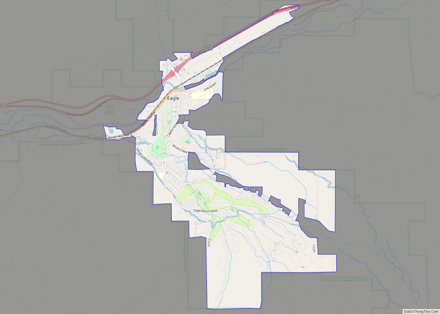
The Town of Eagle is the Statutory Town that is the county seat of Eagle County, Colorado, United States. The town population was 7,511 at the 2020 United States Census, a +15.41% increase since the 2010 United States Census. Eagle is the part of the Edwards, CO Micropolitan Statistical Area. The town has an extensive ... Read more
Map of Eagle town, Colorado
Map of Eads town
Eads is the Statutory Town that is the county seat and the most populous municipality of Kiowa County, Colorado, United States. The town population was 672 at the 2020 United States Census. Eads town overview: Name: Eads town LSAD Code: 43 LSAD Description: town (suffix) State: Colorado County: Kiowa County Elevation: 4,219 ft (1,286 m) Total Area: ... Read more
Map of Eads town
Map of Eckley town
The Town of Eckley is a statutory town located in Yuma County, Colorado, United States. The town population was 232 at the 2020 United States Census. Eckley town overview: Name: Eckley town LSAD Code: 43 LSAD Description: town (suffix) State: Colorado County: Yuma County Elevation: 3,907 ft (1,191 m) Total Area: 0.473 sq mi (1.225 km²) Land Area: 0.473 sq mi (1.225 km²) ... Read more
Map of Eckley town
Map of Eaton town, Colorado
The Town of Eaton is a Statutory Town located in Weld County, Colorado, United States. The town population was 5,802 at the 2020 United States Census, a +32.92% increase since the 2010 United States Census. Eaton is a part of the Greeley, CO Metropolitan Statistical Area and the Front Range Urban Corridor. Eaton town overview: ... Read more
Map of Eaton town, Colorado
Map of Edgewater city, Colorado
The City of Edgewater is a home rule municipality located in Jefferson County, Colorado, United States. The city population was 5,005 at the 2020 United States Census. Edgewater is surrounded by Denver to the east, Lakewood to the south and west, and Wheat Ridge to the north. The city is a part of the Denver–Aurora–Lakewood, ... Read more
Map of Edgewater city, Colorado
Map of El Moro CDP
El Moro is an unincorporated community and a census-designated place (CDP) located in and governed by Las Animas County, Colorado, United States. The population of the El Moro CDP was 216 at the United States Census 2020. The Trinidad post office (Zip Code 81082) serves the area. El Moro CDP overview: Name: El Moro CDP ... Read more
Map of El Moro CDP
Map of El Jebel CDP
El Jebel is an unincorporated community and a census-designated place (CDP) located in and governed by Eagle County, Colorado, United States. The CDP is a part of the Edwards, CO Micropolitan Statistical Area. The population of the El Jebel CDP was 4,130 at the United States Census 2020. The Carbondale Post Office (ZIP Code 81623) ... Read more
Map of El Jebel CDP
Map of Edwards CDP, Colorado
Edwards is an unincorporated town, a post office, and a census-designated place (CDP) located in and governed by Eagle County, Colorado, United States. Edwards is the principal town of the Edwards, CO Micropolitan Statistical Area. The Edwards post office has the ZIP Code 81632. At the United States Census 2020, the population of the Edwards ... Read more
Map of Edwards CDP, Colorado
Map of Eldorado Springs CDP
Eldorado Springs is an unincorporated community, a census-designated place (CDP) and a post office located in and governed by Boulder County, Colorado, United States. The CDP is a part of the Boulder, CO Metropolitan Statistical Area. The Eldorado Springs post office has the ZIP code 80025 (post office boxes). At the 2020 United States census, ... Read more
Map of Eldorado Springs CDP
Map of Eldora CDP, Colorado
Eldora (pronounced el-DOH-ruh), previously known as “Eldorado” then “El-Dora”, then Eldora or Camp Eldorado, and still called Happy Valley, is an unincorporated community and a census-designated place (CDP) located in and governed by Boulder County, Colorado, United States. The CDP is a part of the Boulder, CO Metropolitan Statistical Area. The population of the Eldora ... Read more
Map of Eldora CDP, Colorado
Map of Elbert CDP, Colorado
Elbert is an unincorporated town, a post office, and a census-designated place (CDP) located in and governed by Elbert County, Colorado, United States. The CDP is a part of the Denver–Aurora–Lakewood, CO Metropolitan Statistical Area. The Elbert post office has the ZIP Code 80106. At the United States Census 2020, the population of the Elbert ... Read more
Map of Elbert CDP, Colorado
Map of Empire town, Colorado
The historic Town of Empire is a Statutory Town located in Clear Creek County, Colorado, United States. The town population was 345 at the 2020 United States Census, a +22.34% increase since the 2010 United States Census. The town is a former mining settlement that flourished during the Colorado Silver Boom in the late 19th ... Read more
Map of Empire town, Colorado