Map of Manitou Springs city
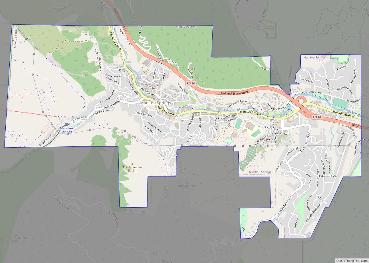
Manitou Springs is a home rule municipality located at the foot of Pikes Peak in western El Paso County, Colorado, United States. The town was founded for its natural mineral springs. The downtown area continues to be of interest to travelers, particularly in the summer, with many shops and restaurants, as well as a creekside ... Read more
Map of Manitou Springs city
Map of Mancos town
Mancos is a statutory town in Montezuma County, Colorado, United States. The population was 1,196 at the 2020 census, down from 1,336 in 2010. The town is in southwestern Colorado, at the base of Mesa Verde National Park, and holds the trademark for “Gateway to Mesa Verde”. Surrounded by rangeland and mountains, Mancos offers a ... Read more
Map of Mancos town
Map of Maysville CDP, Colorado
Maysville is an unincorporated community and a census-designated place (CDP) located in and governed by Chaffee County, Colorado, United States. The population of the Maysville CDP was 173 at the United States Census 2020. The Salida post office (Zip Code 81201) serves the area. Maysville CDP overview: Name: Maysville CDP LSAD Code: 57 LSAD Description: ... Read more
Map of Maysville CDP, Colorado
Map of Maybell CDP
Maybell is an unincorporated community and census-designated place (CDP) in and governed by Moffat County, Colorado, United States. The CDP is a part of the Craig, CO Micropolitan Statistical Area. The Maybell post office has the ZIP Code 81640. At the 2020 census, the population of the Maybell CDP was 76. The coldest ambient air ... Read more
Map of Maybell CDP
Map of Marble town, Colorado
The Town of Marble is a Statutory Town in Gunnison County, Colorado, United States. The town population was 133 at the 2020 United States Census. Marble town overview: Name: Marble town LSAD Code: 43 LSAD Description: town (suffix) State: Colorado County: Gunnison County Incorporated: 1899 Elevation: 7,993 ft (2,436 m) Total Area: 0.36 sq mi (0.93 km²) Land Area: 0.36 sq mi ... Read more
Map of Marble town, Colorado
Map of Meeker town, Colorado
Meeker is the Statutory Town in and the county seat of Rio Blanco County, Colorado, United States, that is the most populous municipality in the county. The town population was 2,374 at the 2020 United States Census. Meeker town overview: Name: Meeker town LSAD Code: 43 LSAD Description: town (suffix) State: Colorado County: Rio Blanco ... Read more
Map of Meeker town, Colorado
Map of Mead town, Colorado
The Town of Mead is a Statutory Town in Weld County, Colorado, United States. The town population was 4,781 at the 2020 United States Census. Mead town overview: Name: Mead town LSAD Code: 43 LSAD Description: town (suffix) State: Colorado County: Weld County Elevation: 5,003 ft (1,525 m) Total Area: 12.73 sq mi (32.98 km²) Land Area: 12.64 sq mi (32.75 km²) Water ... Read more
Map of Mead town, Colorado
Map of McCoy CDP
McCoy is an unincorporated town, a census-designated place (CDP), and a post office located in and governed by Eagle County, Colorado, United States. The CDP is a part of the Edwards, CO Micropolitan Statistical Area. The McCoy post office has the ZIP Code 80463. At the United States Census 2020, the population of the McCoy ... Read more
Map of McCoy CDP
Map of Midland CDP, Colorado
Midland is an unincorporated community and a census-designated place (CDP) located in and governed by Teller County, Colorado, United States. The CDP is a part of the Colorado Springs, CO Metropolitan Statistical Area. The population of the Midland CDP was 182 at the United States Census 2020. The Divide post office (Zip Code 80814) serves ... Read more
Map of Midland CDP, Colorado
Map of Merino town
The Town of Merino is a Statutory Town in Logan County, Colorado, United States. The town population was 281 at the 2020 United States Census. The town was named for the merino sheep which grazed there. Merino town overview: Name: Merino town LSAD Code: 43 LSAD Description: town (suffix) State: Colorado County: Logan County Elevation: ... Read more
Map of Merino town
Map of Meridian CDP, Colorado
Meridian is an unincorporated community and a census-designated place (CDP) located in and governed by Douglas County, Colorado, United States. The CDP is a part of the Denver–Aurora–Lakewood, CO Metropolitan Statistical Area. The population of the Meridian CDP was 4,786 at the United States Census 2020. The CDP lies in ZIP code 80112. Meridian CDP ... Read more
Map of Meridian CDP, Colorado
Map of Milliken town
Milliken is a statutory town in Weld County, Colorado, United States. The town population was 8,386 at the 2020 United States Census. Milliken town overview: Name: Milliken town LSAD Code: 43 LSAD Description: town (suffix) State: Colorado County: Weld County Elevation: 4,751 ft (1,448 m) Total Area: 12.90 sq mi (33.41 km²) Land Area: 12.81 sq mi (33.19 km²) Water Area: 0.09 sq mi (0.22 km²) ... Read more
Map of Milliken town