Map of Log Lane Village town
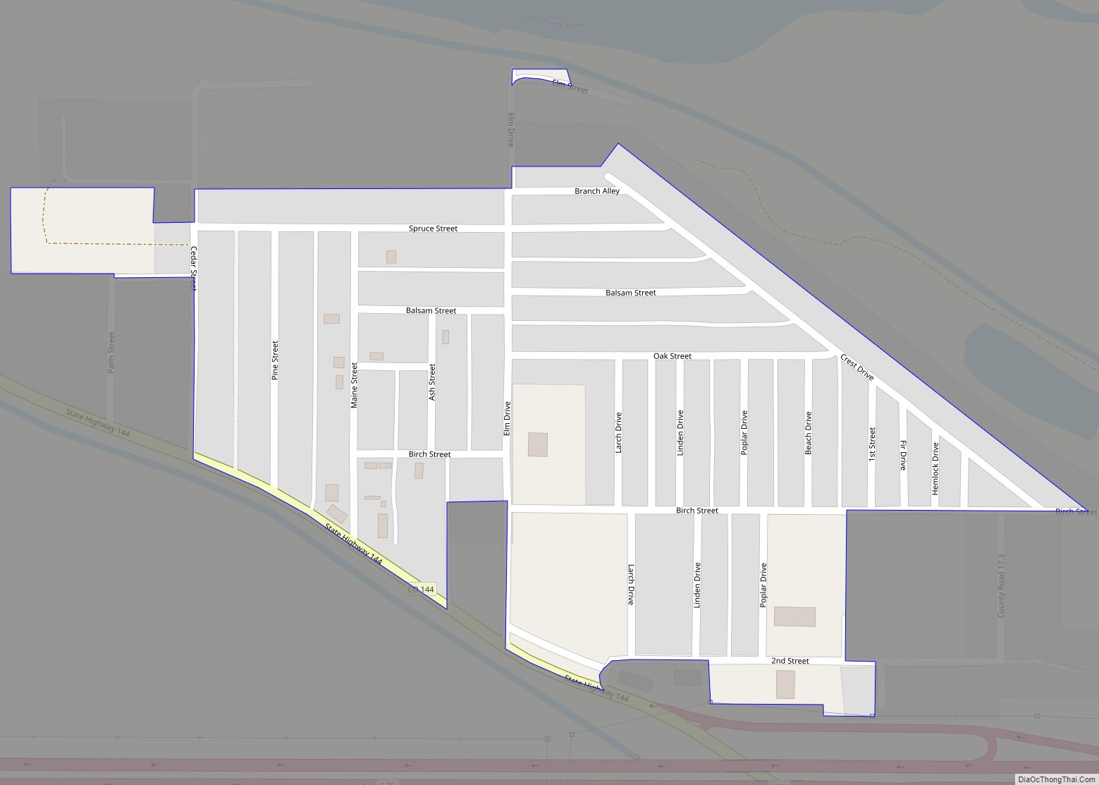
Log Lane Village is a statutory town in Morgan County, Colorado, United States. The population was 913 at the 2020 census. Log Lane Village was named from the presence of log houses in the town. Log Lane Village town overview: Name: Log Lane Village town LSAD Code: 43 LSAD Description: town (suffix) State: Colorado County: ... Read more
Map of Log Lane Village town
Map of Lochbuie town
The Town of Lochbuie (/lɒkˈbuːi/ lok-BOO-ee) is a statutory town located in Weld and Adams counties in the U.S. state of Colorado. The town population was 8,088 at the 2020 United States Census. Lochbuie town overview: Name: Lochbuie town LSAD Code: 43 LSAD Description: town (suffix) State: Colorado County: Adams County, Weld County Incorporated: May ... Read more
Map of Lochbuie town
Map of Longmont city
Longmont is a home rule municipality located in Boulder and Weld counties, Colorado, United States. Longmont is located northeast of the county seat of Boulder and 33 miles (53 km) north-northwest of the Colorado State Capitol in Denver. Longmont’s population was 98,885 as of the 2020 U.S. Census. Longmont is named after Longs Peak, a prominent ... Read more
Map of Longmont city
Map of Lone Tree city, Colorado
The City of Lone Tree is a home rule municipality located in northern Douglas County, Colorado, United States. Lone Tree is a part of the Denver–Aurora–Lakewood, CO Metropolitan Statistical Area. The city population was 14,253 at the 2020 United States Census. Lone Tree city overview: Name: Lone Tree city LSAD Code: 25 LSAD Description: city ... Read more
Map of Lone Tree city, Colorado
Map of Loma CDP, Colorado
Loma is an unincorporated town, post office, and census-designated place (CDP) located in and governed by Mesa County, Colorado, United States. It is part of the Grand Junction, CO Metropolitan Statistical Area. The Loma post office has the ZIP Code 81524. At the 2020 census, the population of the Loma CDP was 1,314. Loma CDP ... Read more
Map of Loma CDP, Colorado
Map of Loveland city, Colorado
The City of Loveland is the home rule municipality that is the second most populous municipality in Larimer County, Colorado, United States. Loveland is situated 46 miles (74 km) north of the Colorado State Capitol in Denver and is the 14th most populous city in Colorado. As of the 2020 census the population of Loveland was ... Read more
Map of Loveland city, Colorado
Map of Louviers CDP
Louviers is an unincorporated town, a post office, and a census-designated place (CDP) located in and governed by Douglas County, Colorado, United States. The CDP is a part of the Denver–Aurora–Lakewood, CO Metropolitan Statistical Area. The Louviers post office has the ZIP Code 80131 (post office boxes). At the United States Census 2020, the population ... Read more
Map of Louviers CDP
Map of Louisville city, Colorado
The City of Louisville (/ˈluːɪsvɪl/) is a home rule municipality located in southeastern Boulder County, Colorado, United States. The city population was 21,226 at the 2020 United States Census. Louisville began as a mining community in 1877, experienced a period of labor violence early in the 20th century, and transitioned to a suburban residential community ... Read more
Map of Louisville city, Colorado
Map of Manassa town
The Town of Manassa is the Statutory Town that is the most populous municipality in Conejos County, Colorado, United States. The town population was 947 at the 2020 United States Census. Manassa town overview: Name: Manassa town LSAD Code: 43 LSAD Description: town (suffix) State: Colorado County: Conejos County Founded: 1851 Elevation: 7,690 ft (2,344 m) Total ... Read more
Map of Manassa town
Map of Lyons town, Colorado
The Town of Lyons is a Statutory Town in Boulder County, Colorado, United States. The town population was 2033 at the 2010 United States Census, up from 1585 at the 2000 United States Census. Lyons is located at the confluence of North St. Vrain Creek and South St. Vrain Creek, 20 miles (32 km) east of ... Read more
Map of Lyons town, Colorado
Map of Lynn CDP, Colorado
Lynn is an unincorporated community and a census-designated place (CDP) located in and governed by Las Animas County, Colorado, United States. The population of the Lynn CDP was 11 at the United States Census 2020. The Aguilar post office (Zip Code 81020) serves the area. Lynn CDP overview: Name: Lynn CDP LSAD Code: 57 LSAD ... Read more
Map of Lynn CDP, Colorado
Map of Manzanola town
The Town of Manzanola is a Statutory Town in Otero County, Colorado, United States. The town population was 341 at the 2020 United States Census. Manzanola town overview: Name: Manzanola town LSAD Code: 43 LSAD Description: town (suffix) State: Colorado County: Otero County Elevation: 4,255 ft (1,297 m) Total Area: 0.28 sq mi (0.74 km²) Land Area: 0.28 sq mi (0.74 km²) Water ... Read more
Map of Manzanola town