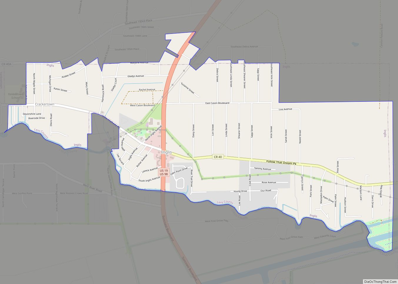
Map of Indiantown village
Indiantown is a village in Martin County, Florida, United States. The population was 6,560 at the 2020 census. It is a rural community in the interior of Florida’s Treasure Coast region, first established in the early 1900s, then incorporated on December 31, 2017. The village is governed by a mayor and council elected at-large, while ... Read more
Map of Indiantown village
Map of Interlachen town
Interlachen is a town in Putnam County, Florida, United States. The population was 1,403 at the 2010 census. The town is part of the Palatka Micropolitan Statistical Area and was named by a gentleman named Mr. Berkelmann from Germany who lived in Interlachen when the town was being incorporated. He said that since the town ... Read more
Map of Interlachen town
Map of Inverness city, Florida
Inverness is a city and the county seat of Citrus County, Florida, United States. As of the 2020 census, the population was 7,543. 10,950-acre (4,430 ha) It is near the Flying Eagle Preserve. Inverness city overview: Name: Inverness city LSAD Code: 25 LSAD Description: city (suffix) State: Florida County: Citrus County Elevation: 49 ft (15 m) Total Area: ... Read more
Map of Inverness city, Florida
Map of Inverness Highlands South CDP
Inverness Highlands South is a census-designated place (CDP) in Citrus County, Florida, United States. As of the 2010 census, the population was 6,542, up from 5,781 in 2000. Inverness Highlands South CDP overview: Name: Inverness Highlands South CDP LSAD Code: 57 LSAD Description: CDP (suffix) State: Florida County: Citrus County Total Area: 5.61 sq mi (14.54 km²) Land ... Read more
Map of Inverness Highlands South CDP
Map of Inverness Highlands North CDP
Inverness Highlands North CDP overview: Name: Inverness Highlands North CDP LSAD Code: 57 LSAD Description: CDP (suffix) State: Florida County: Citrus County FIPS code: 1233958 Online Interactive Map Inverness Highlands North online map. Source: Basemap layers from Google Map, Open Street Map (OSM), Arcgisonline, Wmflabs. Boundary Data from Database of Global Administrative Areas. Inverness Highlands ... Read more
Map of Inverness Highlands North CDP
Map of Islamorada, Village of Islands village
Islamorada (also sometimes Islas Morada) is an incorporated village in Monroe County, Florida, United States. It is located directly between Miami and Key West on five islands—Tea Table Key, Lower Matecumbe Key, Upper Matecumbe Key, Windley Key and Plantation Key—in the Florida Keys. As of the 2020 census, the village had a population of 7,107, ... Read more
Map of Islamorada, Village of Islands village
Map of Iona CDP, Florida
Iona is an unincorporated community and census-designated place (CDP) in Lee County, Florida, United States. The population was 16,908 at the 2020 census, up from 15,404 at the 2010 census. It is part of the Cape Coral-Fort Myers, Florida Metropolitan Statistical Area. A strong EF2 tornado struck the town on January 16, 2022, causing major ... Read more
Map of Iona CDP, Florida
Map of Inwood CDP, Florida
Inwood is a census-designated place (CDP) in Polk County, Florida, United States. The population was 6,925 at the time of the 2000 United States Census. It is part of the Lakeland–Winter Haven Metropolitan Statistical Area. Inwood CDP overview: Name: Inwood CDP LSAD Code: 57 LSAD Description: CDP (suffix) State: Florida County: Polk County Elevation: 144 ft ... Read more
Map of Inwood CDP, Florida
Map of Ives Estates CDP
Ives Estates is a census-designated place (CDP) in Miami-Dade County, Florida. The population was 25,005 at the 2020 census, up from 19,525 in 2010. Ives Estates CDP overview: Name: Ives Estates CDP LSAD Code: 57 LSAD Description: CDP (suffix) State: Florida County: Miami-Dade County Elevation: 10 ft (3 m) Total Area: 2.76 sq mi (7.15 km²) Land Area: 2.55 sq mi (6.60 km²) ... Read more
Map of Ives Estates CDP
Map of Istachatta CDP
Istachatta is an unincorporated community and census-designated place (CDP) in Hernando County, Florida, United States. The population was 116 at the 2010 census, up from 65 at the 2000 census. The name “Istachatta” is derived from a Seminole word meaning “man snake”. Istachatta CDP overview: Name: Istachatta CDP LSAD Code: 57 LSAD Description: CDP (suffix) ... Read more
Map of Istachatta CDP
Map of Island Walk CDP
Island Walk is an unincorporated area and a census-designated place (CDP) in Collier County, Florida, United States. As of the 2020 United States census, there were 2,812 people, 1,511 households and 1,085 families residing in the CDP. The population was 3,035 at the 2010 census. It is part of the Naples–Marco Island Metropolitan Statistical Area. ... Read more
Map of Island Walk CDP
Map of Jan Phyl Village CDP
Jan Phyl Village is a census-designated place (CDP) in Polk County, Florida, United States. The population was 5,633 at the 2000 census. It is part of the Lakeland–Winter Haven Metropolitan Statistical Area. Jan Phyl Village CDP overview: Name: Jan Phyl Village CDP LSAD Code: 57 LSAD Description: CDP (suffix) State: Florida County: Polk County Elevation: ... Read more
Map of Jan Phyl Village CDP