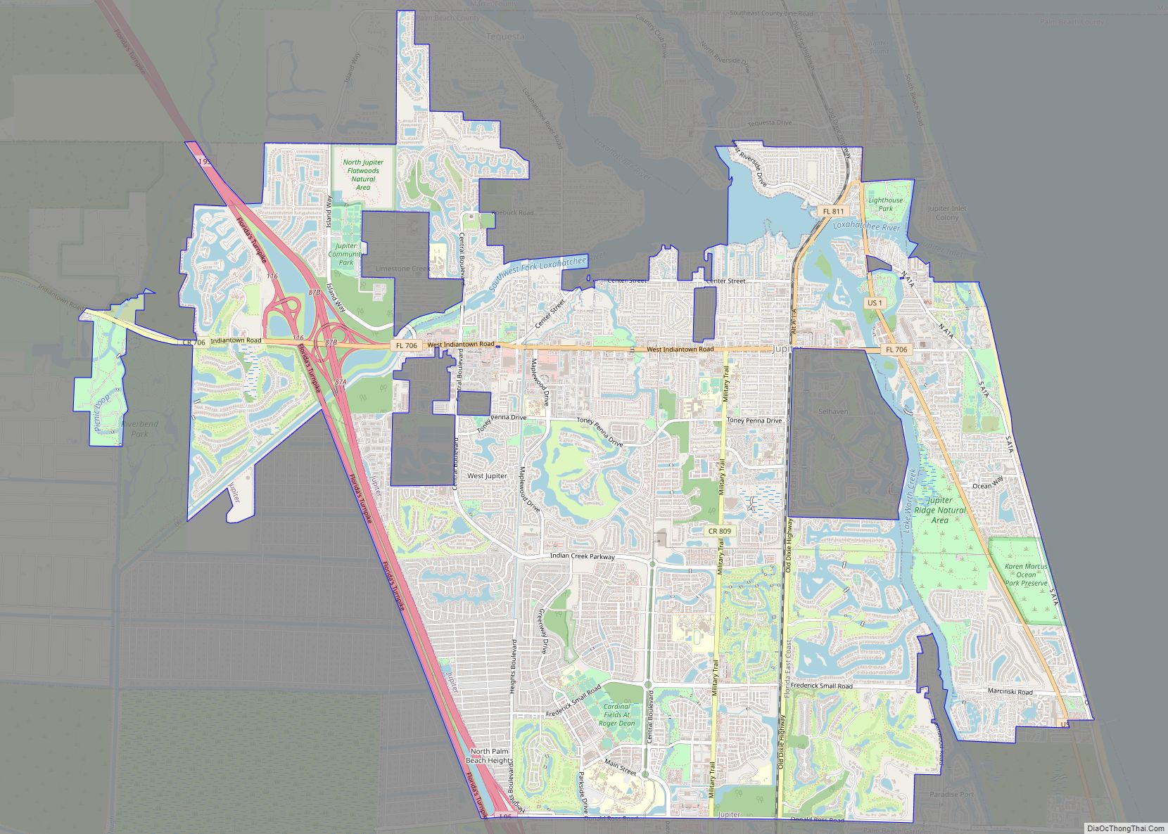
Map of Jupiter Island town
The town of Jupiter Island is located on the barrier island called Jupiter Island, in Martin County, Florida, United States; the town is part of Florida’s Treasure Coast. The town is located next to the unincorporated community of Hobe Sound. The population of Jupiter Island was 804 at the 2020 census. Some of the wealthiest ... Read more
Map of Jupiter Island town
Map of Jupiter Inlet Colony town
Jupiter Inlet Colony is a town in Palm Beach County, Florida, United States. The population was 405 at the 2020 census. Jupiter Inlet Colony town overview: Name: Jupiter Inlet Colony town LSAD Code: 43 LSAD Description: town (suffix) State: Florida County: Palm Beach County Elevation: 7 ft (2 m) Total Area: 0.21 sq mi (0.54 km²) Land Area: 0.15 sq mi (0.40 km²) ... Read more
Map of Jupiter Inlet Colony town
Map of Kendall West CDP
Kendall West is a census-designated place and unincorporated community in Miami-Dade County, Florida, west of the Florida Turnpike. The population was 36,536 at the 2020 census. Kendall West CDP overview: Name: Kendall West CDP LSAD Code: 57 LSAD Description: CDP (suffix) State: Florida County: Miami-Dade County Elevation: 8 ft (2 m) Total Area: 3.01 sq mi (7.80 km²) Land Area: ... Read more
Map of Kendall West CDP
Map of Kendale Lakes CDP
Kendale Lakes is a census-designated place (CDP) and a suburb of Miami in Miami-Dade County, Florida, United States. The population was 55,646 at the 2020 census. Kendale Lakes CDP overview: Name: Kendale Lakes CDP LSAD Code: 57 LSAD Description: CDP (suffix) State: Florida County: Miami-Dade County Elevation: 8 ft (2 m) Total Area: 8.61 sq mi (22.29 km²) Land Area: ... Read more
Map of Kendale Lakes CDP
Map of Kathleen CDP
Kathleen is a census-designated place (CDP) in Polk County, Florida, United States. The population was 3,280 at the 2000 census. It is part of the Lakeland–Winter Haven Metropolitan Statistical Area. Kathleen CDP overview: Name: Kathleen CDP LSAD Code: 57 LSAD Description: CDP (suffix) State: Florida County: Polk County Elevation: 144 ft (44 m) Total Area: 7.23 sq mi (18.73 km²) ... Read more
Map of Kathleen CDP
Map of Kensington Park CDP
Kensington Park is a census-designated place (CDP) in Sarasota County, Florida, United States. The population was 3,901 at the 2010 census. It is part of the Bradenton–Sarasota–Venice Metropolitan Statistical Area. Kensington Park CDP overview: Name: Kensington Park CDP LSAD Code: 57 LSAD Description: CDP (suffix) State: Florida County: Sarasota County Elevation: 20 ft (6 m) Total Area: ... Read more
Map of Kensington Park CDP
Map of Kenneth City town
Kenneth City is a town in southern Pinellas County, Florida, between St. Petersburg and Pinellas Park, United States. The population was 4,980 at the 2010 US Census. Kenneth City town overview: Name: Kenneth City town LSAD Code: 43 LSAD Description: town (suffix) State: Florida County: Pinellas County Incorporated: April 30, 1957 (1957-04-30) Elevation: 20 ft (6 m) Total Area: 0.75 sq mi ... Read more
Map of Kenneth City town
Map of Kendall CDP, Florida
Kendall is an unincorporated area and census-designated place in Miami-Dade County, Florida. At the 2020 census, the area had a population of 80,241. Kendall CDP overview: Name: Kendall CDP LSAD Code: 57 LSAD Description: CDP (suffix) State: Florida County: Miami-Dade County Elevation: 13 ft (4 m) Total Area: 16.60 sq mi (43.00 km²) Land Area: 16.10 sq mi (41.70 km²) Water Area: 0.50 sq mi ... Read more
Map of Kendall CDP, Florida
Map of Key Colony Beach city
Key Colony Beach is a municipality in the middle of the Florida Keys, Monroe County, Florida, United States. The population was 790 at the 2020 census. Key Colony Beach city overview: Name: Key Colony Beach city LSAD Code: 25 LSAD Description: city (suffix) State: Florida County: Monroe County Elevation: 3 ft (1 m) Total Area: 0.65 sq mi (1.68 km²) ... Read more
Map of Key Colony Beach city
Map of Key Biscayne village
Key Biscayne is an island town in Miami-Dade County, Florida, United States. The population was 14,809 at the 2020 census, up from 12,344 in 2010. Key Biscayne village overview: Name: Key Biscayne village LSAD Code: 47 LSAD Description: village (suffix) State: Florida County: Miami-Dade County Incorporated: June 18, 1991 Elevation: 3 ft (1 m) Total Area: 1.71 sq mi ... Read more
Map of Key Biscayne village
Map of Kenwood Estates CDP
Kenwood Estates is a census-designated place (CDP) in Palm Beach County, Florida, United States. Its population was 1,435 as of the 2020 census. Kenwood Estates is located between Greenacres and Palm Springs; State Road 809 (Military Trail) passes through the community. More specifically, the CDP is defined from Attleboro Avenue westward to Haverhill Road, while ... Read more
Map of Kenwood Estates CDP
Map of Keystone Heights city
Keystone Heights is a city located in southwestern Clay County, Florida, United States. The population of the city was 1,446 at the 2020 census and increased to 1,478 in 2021. The city’s name is derived from the state of Pennsylvania‘s nickname, the “Keystone State”. Keystone Heights is the southwestern most city in the Jacksonville metropolitan ... Read more
Map of Keystone Heights city