Map of Marco Island city
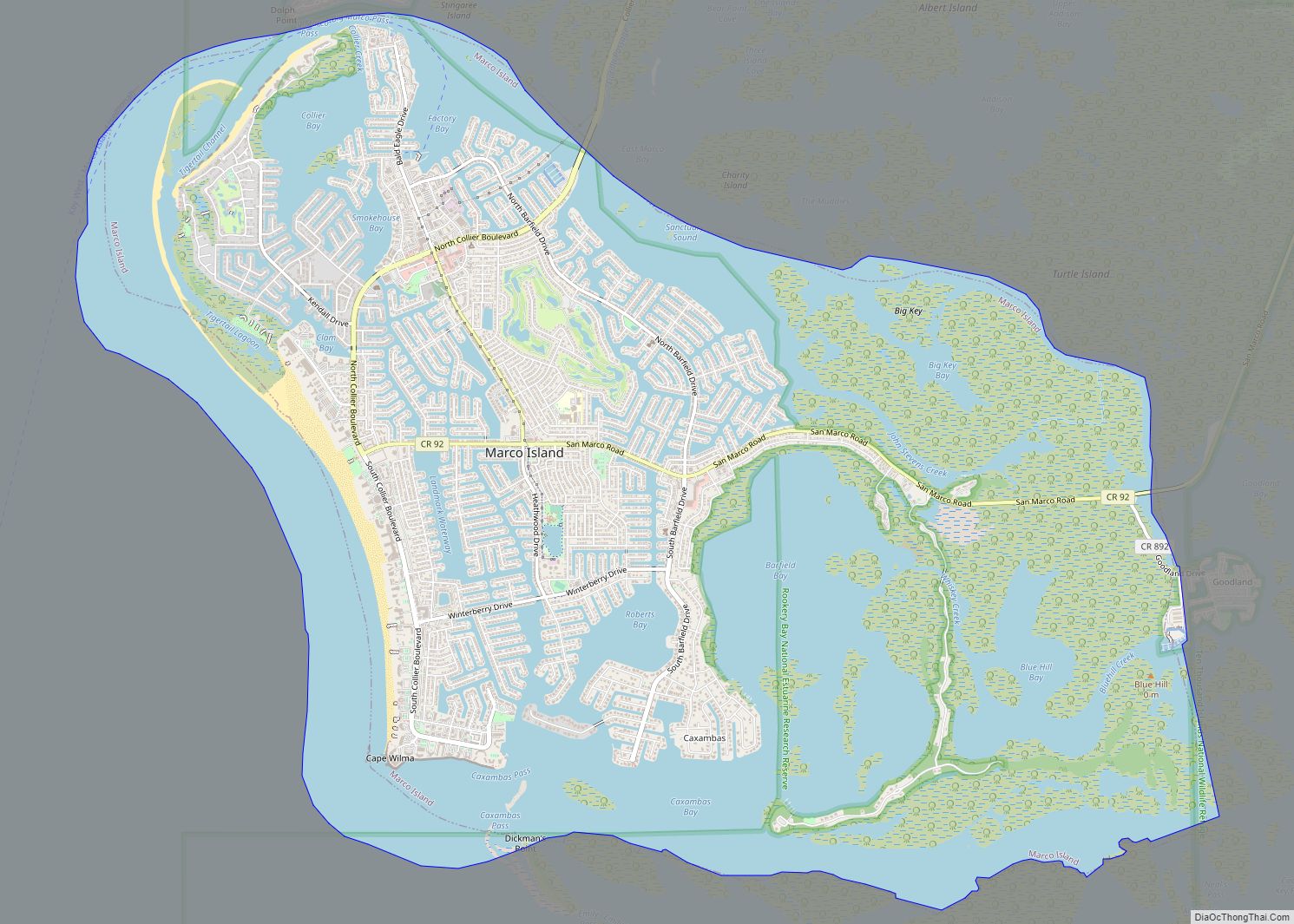
Marco Island is a city and barrier island in Collier County, Florida, located 20 miles (32 km) south of Naples on the Gulf Coast of the United States. It is the largest barrier island within Southwest Florida’s Ten Thousand Islands area, which extends southerly to Cape Sable. Marco Island is home to an affluent beach community ... Read more
Map of Marco Island city
Map of Marathon city, Florida
Marathon is a city in the middle of the Florida Keys, in Monroe County, Florida, United States. As of the 2020 census, the city had a population of 9,689, up from 8,297 in 2010. Marathon city overview: Name: Marathon city LSAD Code: 25 LSAD Description: city (suffix) State: Florida County: Monroe County Elevation: 3 ft (1 m) ... Read more
Map of Marathon city, Florida
Map of Mary Esther city
Mary Esther is a city in Okaloosa County, Florida, United States. The population was 3,851 at the 2010 census. It is part of the Fort Walton Beach–Crestview–Destin Metropolitan Statistical Area. Mary Esther city overview: Name: Mary Esther city LSAD Code: 25 LSAD Description: city (suffix) State: Florida County: Okaloosa County Elevation: 23 ft (7 m) Total Area: ... Read more
Map of Mary Esther city
Map of Marineland town
The town of Marineland was established in 1940 and is in Flagler and St. Johns counties, Florida, United States. The population was 16 in the 2010 census. Marineland is located 18 miles (29 km) south of St. Augustine along Route A1A. The Marineland marine park and the town of Marineland have become synonymous, however many do ... Read more
Map of Marineland town
Map of Marianna city, Florida
Marianna is a city in and the county seat of Jackson County, Florida, United States, and it is home to Chipola College. The population was 6,102 at the 2010 census. In 2018 the estimated population was 7,091. The official nickname of Marianna is “The City of Southern Charm”. Marianna city overview: Name: Marianna city LSAD ... Read more
Map of Marianna city, Florida
Map of Matlacha Isles-Matlacha Shores CDP
Matlacha Isles-Matlacha Shores is an unincorporated community and census-designated place (CDP) in Lee County, Florida, United States. The population was 227 at the 2020 census, down from 229 at the 2010 census. It is part of the Cape Coral-Fort Myers, Florida Metropolitan Statistical Area. Matlacha Isles-Matlacha Shores CDP overview: Name: Matlacha Isles-Matlacha Shores CDP LSAD ... Read more
Map of Matlacha Isles-Matlacha Shores CDP
Map of Mascotte city
Mascotte is a city in Lake County, Florida, United States. As of the 2020 census, the population was 6,609, up from 5,101 in 2010. It is part of the Orlando–Kissimmee–Sanford Metropolitan Statistical Area. Mascotte city overview: Name: Mascotte city LSAD Code: 25 LSAD Description: city (suffix) State: Florida County: Lake County Elevation: 92 ft (28 m) Total ... Read more
Map of Mascotte city
Map of Masaryktown CDP
Masaryktown is an unincorporated community and census-designated place (CDP) in Hernando County, Florida, United States. The population was 1,077 at the 2020 census. It is named after the first president of Czechoslovakia, Tomáš Garrigue Masaryk. Masaryktown CDP overview: Name: Masaryktown CDP LSAD Code: 57 LSAD Description: CDP (suffix) State: Florida County: Hernando County Elevation: 62 ft ... Read more
Map of Masaryktown CDP
Map of Matlacha CDP
Matlacha ( /ˈmætləʃeɪ/ (listen) MAT-lə-shay “MAT-la-shay”) is a census-designated place (CDP) in Lee County, Florida, United States. As of the 2020 census, the CDP had a population of 598. It is part of the Cape Coral-Fort Myers, Florida Metropolitan Statistical Area. Matlacha is an “Old Florida” fishing village, home to many brightly colored art galleries, ... Read more
Map of Matlacha CDP
Map of McGregor CDP, Florida
McGregor is a census-designated place (CDP) in Lee County, Florida, United States. The population was 7,976 at the 2020 census. It is part of the Cape Coral-Fort Myers, Florida Metropolitan Statistical Area. A strong EF2 tornado struck the town on January 16, 2022, causing major damage. McGregor CDP overview: Name: McGregor CDP LSAD Code: 57 ... Read more
Map of McGregor CDP, Florida
Map of Mayo town, Florida
Mayo, Florida is a town and the only municipality in Lafayette County, Florida, United States. The population was 1,237 at the 2010 census. It is the county seat of Lafayette County. In August 2018, Mayo temporarily changed its name to Miracle Whip as an advertising stunt with Kraft’s Miracle Whip brand. Mayo town overview: Name: ... Read more
Map of Mayo town, Florida
Map of Meadow Woods CDP
Meadow Woods is a census-designated place and an unincorporated suburban development area located in southern Orange County, Florida, United States, between Orlando International Airport and Kissimmee. The population was 25,558 at the 2010 census, up from 11,286 in 2000. It is part of the Orlando–Kissimmee–Sanford, Florida Metropolitan Statistical Area. Meadow Woods CDP overview: Name: Meadow ... Read more
Map of Meadow Woods CDP