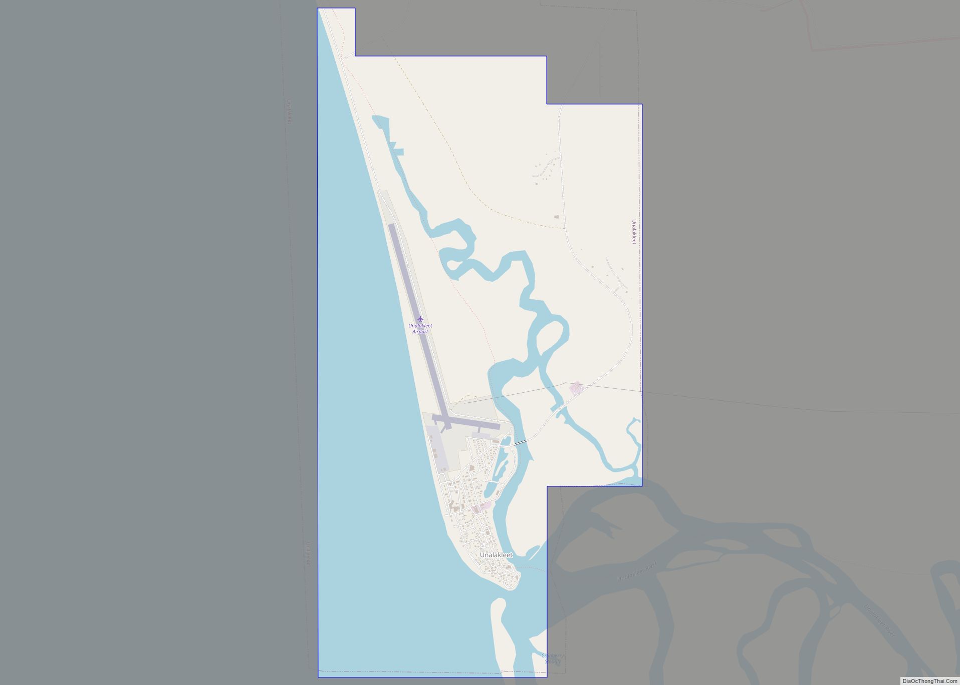
Map of Ugashik CDP

Map of Ugashik CDP

Ugashik (Ugaasaq in Sugpiaq) is a census-designated place (CDP) in Lake and Peninsula Borough, Alaska, United States. The population was 4 at the 2020 census, down from 12 in 2010. Ugashik CDP overview: Name: Ugashik CDP LSAD Code: 57 LSAD Description: CDP (suffix) State: Alaska County: Lake and Peninsula Borough Elevation: 30 ft (9 m) Total Area: … Read more

Map of Tyonek CDP

Map of Tyonek CDP

Tyonek or Present / New Tyonek (Dena’ina: Qaggeyshlat – ″little place between toes”) is a census-designated place (CDP) in Kenai Peninsula Borough in the U.S. state of Alaska. As of the 2020 census the population was 152, down from 171 in 2010. In 1973, the community formed the Tyonek Native Corporation (TNC) under the Alaska … Read more

Map of Utqiagvik city

Map of Utqiagvik city

Utqiagvik city overview: Name: Utqiagvik city LSAD Code: 25 LSAD Description: city (suffix) State: Alaska FIPS code: 0281920 Online Interactive Map Utqiagvik online map. Source: Basemap layers from Google Map, Open Street Map (OSM), Arcgisonline, Wmflabs. Boundary Data from Database of Global Administrative Areas. Utqiagvik location map. Where is Utqiagvik city? Utqiagvik Road Map Utqiagvik … Read more

Map of Upper Kalskag city

Map of Upper Kalskag city

Upper Kalskag (Russian: Аппер-Калскаг) is a city in Bethel Census Area, Alaska, United States. It is thirty miles west of Aniak. At the 2010 census the population was 210, down from 230 in 2000. Upper Kalskag city overview: Name: Upper Kalskag city LSAD Code: 25 LSAD Description: city (suffix) State: Alaska County: Bethel Census Area … Read more

Map of Unalaska city

Map of Unalaska city

The City of Unalaska (Aleut: Iluulux̂; Russian: Уналашка) is the main population center in the Aleutian Islands. The city is in the Aleutians West Census Area, a regional component of the Unorganized Borough in the U.S. state of Alaska. Unalaska is located on Unalaska Island and neighboring Amaknak Island in the Aleutian Islands off mainland … Read more

Map of Wainwright city

Map of Wainwright city, Alaska

Wainwright (/ˈweɪnraɪt/; Ulġuniq in Iñupiaq), also known as Ulguniq or Kuuk, is a city in North Slope Borough, Alaska, United States. At the 2020 census the population was 628, making it the third largest city in the North Slope Borough, up from 556 in 2010. The community was named after Wainwright Lagoon, which in turn … Read more

Map of Venetie CDP

Map of Venetie CDP

Venetie (/ˈviːnɪtaɪ/ VEEN-i-ty; Vįįhtąįį in Gwich’in), is a census-designated place (CDP) in Yukon–Koyukuk Census Area, Alaska. At the 2010 census, the population was 166, down from 202 in 2000. It includes the Village of Venetie, a Gwich’in tribal entity designated in the 1971 Alaska Native Claims Settlement Act. Venetie CDP overview: Name: Venetie CDP LSAD … Read more

Map of Valdez city

Map of Valdez city, Alaska

Valdez (/vælˈdiːz/ val-DEEZ; Alutiiq: Suacit) is a city in the Chugach Census Area in the U.S. state of Alaska. According to the 2020 US Census, the population of the city is 3,985, up from 3,976 in 2010. It is the third most populated city in Alaska’s Unorganized Borough. The city was named in 1790 after … Read more

Map of Wales city

Map of Wales city, Alaska

Wales (Inupiaq: Kiŋigin, IPA: [kiŋiɣin]; Russian: У́эйлс, romanized: Weyls) is a city in the Nome Census Area, Alaska, United States. At the 2010 census the population was 145, down from 152 in 2000. It is the westernmost city on the North American mainland, although Adak, located on Adak Island, is the westernmost city in Alaska. Wales Airport … Read more

Map of White Mountain city

Map of White Mountain city

White Mountain (Inupiaq: Nasirvik, Nachirvik, or Nachizrvik) is a city in Nome Census Area, Alaska, United States. The population was 190 at the 2010 census, down from 203 in 2000. The city is an Iġaluŋmiut (Fish River tribe) Inupiat village, with historical influences from and relationships with Qawiaraq (Mary’s Igloo Inupiat and Golovin and Elim … Read more

Map of Whale Pass city

Map of Whale Pass city

Whale Pass is a second class city in Prince of Wales-Hyder Census Area, Alaska, United States. The population was 31 at the 2010 census, down from 58 in 2000. Whale Pass city overview: Name: Whale Pass city LSAD Code: 25 LSAD Description: city (suffix) State: Alaska County: Prince of Wales-Hyder Census Area Elevation: 128 ft (39 m) … Read more

Map of Whittier city

Map of Whittier city, Alaska

Whittier is a city at the head of the Passage Canal in the U.S. state of Alaska, about 58 miles (93 km) southeast of Anchorage. The city is within the Chugach Census Area, one of the two entities established in 2019 when the former Valdez–Cordova Census Area was dissolved. It is also a port for the … Read more