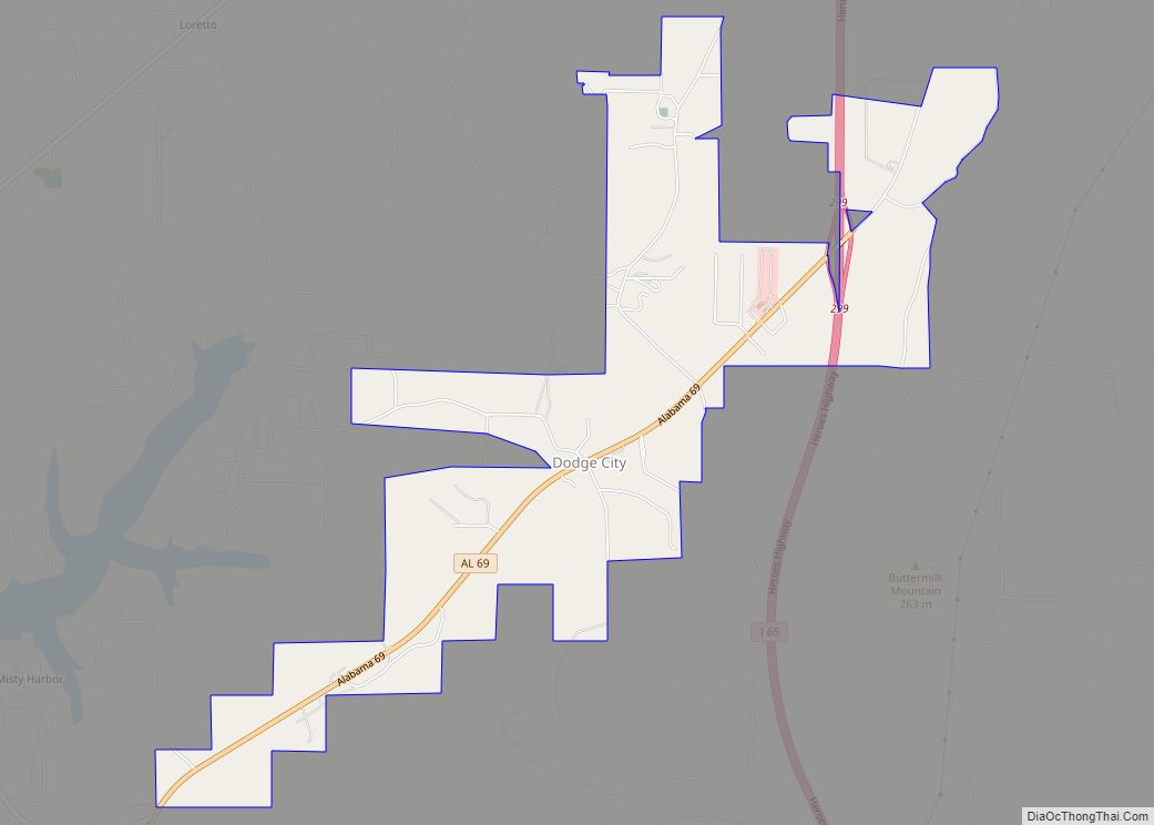
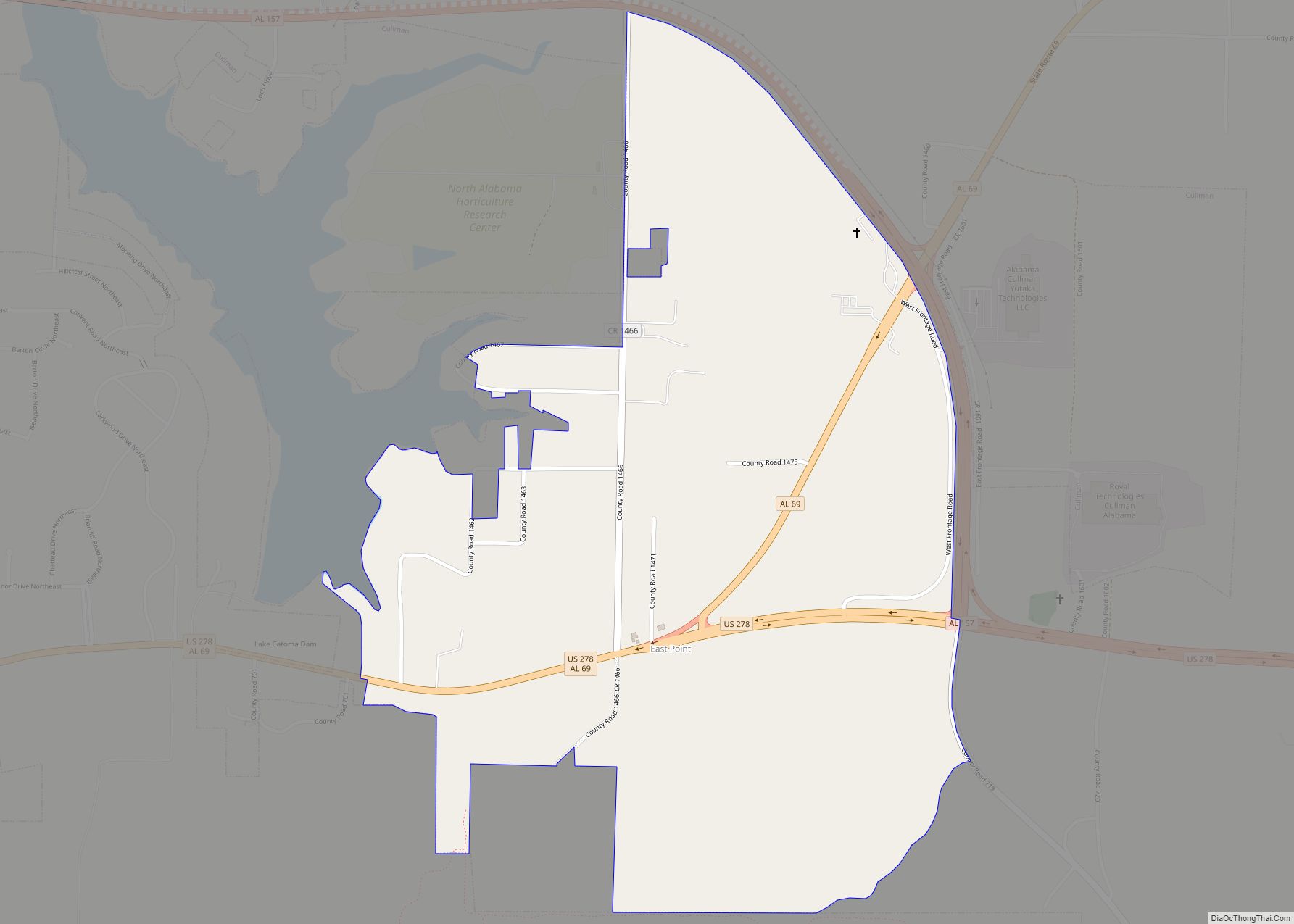
Map of Detroit city

Map of Detroit town, Alabama

Detroit is a town in Lamar County, Alabama, United States. It was incorporated in 1955. At the 2010 census the population was 237, down from 247 in 2000. The prior name of the town was Millville due to the many mills built in the late 1800s. Detroit town overview: Name: Detroit town LSAD Code: 43 … Read more

Map of Demopolis city

Map of Demopolis city

Demopolis is the largest city in Marengo County, in west-central Alabama. The population was 7,162 at the time of the 2020 United States census, down from 7,483 at the 2010 census. The city lies at the confluence of the Black Warrior River and Tombigbee River. It is situated atop a cliff composed of the Demopolis … Read more

Map of Double Springs town

Map of Double Springs town

Double Springs is a town in Winston County, Alabama, United States. The city is the county seat of Winston County. The county seat was initially located at Houston, but by referendum in 1883, Double Springs prevailed and it was removed to there. It was incorporated on May 17, 1943. At the 2010 census the population … Read more

Map of Dothan city

Map of Dothan city

Dothan (/ˈdoʊθən/ DOH-thən) is a city in and the county seat of Houston County in the U.S. state of Alabama. A slight portion of the city extends into Dale and Henry counties. It is Alabama’s eighth-largest city, with a population of 71,072 at the 2020 census. It is near the state’s southeastern corner, about 20 … Read more

Map of Dora city

Map of Dora city, Alabama

Dora is a city in Walker County, Alabama, United States. Dora city overview: Name: Dora city LSAD Code: 25 LSAD Description: city (suffix) State: Alabama County: Walker County Elevation: 394 ft (120 m) Total Area: 7.92 sq mi (20.51 km²) Land Area: 7.91 sq mi (20.49 km²) Water Area: 0.01 sq mi (0.03 km²) Total Population: 2,297 Population Density: 290.43/sq mi (112.13/km²) ZIP code: 35062 Area code: … Read more

Map of Dozier town

Map of Dozier town

Dozier /ˈdoʊʒər/ is a town in Crenshaw County, Alabama, United States. At the 2020 census, the population was 285. Dozier was incorporated in 1907. Dozier town overview: Name: Dozier town LSAD Code: 43 LSAD Description: town (suffix) State: Alabama County: Crenshaw County Elevation: 240 ft (73 m) Total Area: 2.96 sq mi (7.67 km²) Land Area: 2.95 sq mi (7.64 km²) Water Area: … Read more

Map of Douglas town

Map of Douglas town, Alabama

Douglas is a town in Marshall County, Alabama, United States. Douglas, a part of the Huntsville–Decatur Combined Statistical Area, had a population of 761 as of the 2020 census. The town incorporated in 1978. Douglas town overview: Name: Douglas town LSAD Code: 43 LSAD Description: town (suffix) State: Alabama County: Marshall County Elevation: 945 ft (288 m) … Read more

Map of Dunnavant CDP

Map of Dunnavant CDP

Dunnavant, also spelled Dunavant, is a census-designated place and unincorporated community in Shelby County, Alabama, United States. Its population was 981 as of the 2010 census. The community’s name is probably derived from a local family. A post office was established in 1897 and was in operation until it was closed in 1958. Dunnavant CDP … Read more

Map of East Point CDP

Map of East Point CDP, Alabama

East Point is a census-designated place and unincorporated community in Cullman County, Alabama, United States. Its population was 172 as of the 2020 census. East Point CDP overview: Name: East Point CDP LSAD Code: 57 LSAD Description: CDP (suffix) State: Alabama County: Cullman County Elevation: 810 ft (250 m) Total Area: 0.98 sq mi (2.54 km²) Land Area: 0.97 sq mi (2.53 km²) … Read more

Map of East Brewton city

Map of East Brewton city

East Brewton is a city in Escambia County, Alabama, United States. It was incorporated in October 1918. At the 2020 census, the population was 2,293. The community grew around Fort Crawford, a fort built to protect early settlers of the area. East Brewton city overview: Name: East Brewton city LSAD Code: 25 LSAD Description: city … Read more

Map of Dutton town

Map of Dutton town, Alabama

Dutton is a town in Jackson County, Alabama, United States. It was incorporated in 1963. As of the 2010 census, the population of the town was 315, up from 310 in 2000. Dutton is located atop Sand Mountain. Dutton town overview: Name: Dutton town LSAD Code: 43 LSAD Description: town (suffix) State: Alabama County: Jackson … Read more

Map of Edwardsville town

Map of Edwardsville town, Alabama

Edwardsville is a town in Cleburne County, Alabama, United States. At the 2020 census, the population was 206. From 1867 to 1906, it served as the Cleburne County Seat. In 1880 and 1890, it was the most populous community in the county. It reached its population zenith of 448 in 1900 when it fell behind … Read more