Map of Roanoke CDP, Louisiana
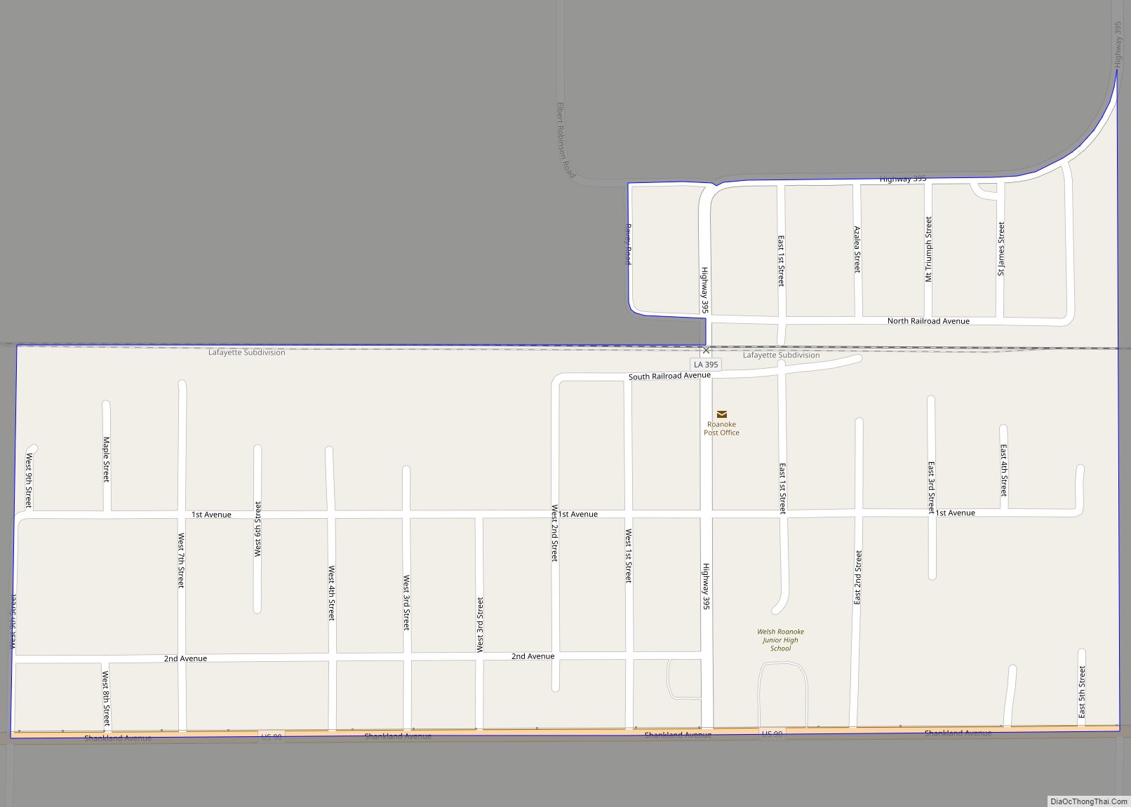
Roanoke is an unincorporated community and census-designated place in Jefferson Davis Parish, Louisiana, United States. Its population was 546 as of the 2010 census. The Roanoke post office was established in 1895. Roanoke CDP overview: Name: Roanoke CDP LSAD Code: 57 LSAD Description: CDP (suffix) State: Louisiana County: Jefferson Davis Parish Elevation: 26 ft (8 m) Total ... Read more
Map of Roanoke CDP, Louisiana
Map of Rosedale village, Louisiana
Rosedale is a village in Iberville Parish, Louisiana, United States. The population was 664 in 2020. It is part of the Baton Rouge metropolitan statistical area. Rosedale village overview: Name: Rosedale village LSAD Code: 47 LSAD Description: village (suffix) State: Louisiana County: Iberville Parish Elevation: 20 ft (6 m) Total Area: 7.78 sq mi (20.15 km²) Land Area: 7.78 sq mi (20.15 km²) ... Read more
Map of Rosedale village, Louisiana
Map of Romeville CDP
Romeville is an unincorporated community and census-designated place in St. James Parish, Louisiana, United States. Its population was 130 as of the 2010 census. The community is located along Louisiana Highway 44 on the east bank of the Mississippi River. Romeville CDP overview: Name: Romeville CDP LSAD Code: 57 LSAD Description: CDP (suffix) State: Louisiana ... Read more
Map of Romeville CDP
Map of Rodessa village
Rodessa is a village in Caddo Parish, Louisiana, United States. The population was 270 at the 2010 census. It is part of the Shreveport–Bossier City Metropolitan Statistical Area. Rodessa village overview: Name: Rodessa village LSAD Code: 47 LSAD Description: village (suffix) State: Louisiana County: Caddo Parish Elevation: 230 ft (70 m) Total Area: 1.20 sq mi (3.12 km²) Land Area: ... Read more
Map of Rodessa village
Map of Roseland town, Louisiana
Roseland is a town in Tangipahoa Parish, Louisiana, United States. The population was 1,123 at the 2010 census. It is the birthplace of Cajun chef and storyteller Justin Wilson. Roseland is part of the Hammond Micropolitan Statistical Area. Roseland town overview: Name: Roseland town LSAD Code: 43 LSAD Description: town (suffix) State: Louisiana County: Tangipahoa ... Read more
Map of Roseland town, Louisiana
Map of Ruston city, Louisiana
Ruston is a small city and the parish seat of Lincoln Parish, Louisiana, United States. It is the largest city in the Eastern Ark-La-Tex region, with a 2020 population of 22,166. Ruston is near the eastern border of the Ark-La-Tex region and is the home of Louisiana Tech University. Ruston is the principal city of ... Read more
Map of Ruston city, Louisiana
Map of Rosepine town
Rosepine is a town in Vernon Parish, Louisiana, United States. The population was 1,692 at the 2010 census. It is part of the Fort Polk South Micropolitan Statistical Area. Rosepine town overview: Name: Rosepine town LSAD Code: 43 LSAD Description: town (suffix) State: Louisiana County: Vernon Parish Elevation: 230 ft (70 m) Total Area: 2.43 sq mi (6.30 km²) Land ... Read more
Map of Rosepine town
Map of Schriever CDP
Schriever is a census-designated place (CDP) in Terrebonne Parish, Louisiana, United States. The population was 6,711 in 2020. It is part of the Houma–Bayou Cane–Thibodaux metropolitan statistical area. The place name was for railroad official John George Schriever (1844–1898), in connection with the 1870s opening of the rail line to Houma. Schriever CDP overview: Name: ... Read more
Map of Schriever CDP
Map of Sarepta town
Sarepta is a town in Webster Parish, Louisiana, United States. The population was 891 at the 2010 census. It is part of the Minden Micropolitan Statistical Area. Sarepta was named for the town’s first church’s benefactor, Sarepta Carter. Local history tells that Mrs. Carter donated a Bible to the community church on the premise that ... Read more
Map of Sarepta town
Map of Saline village, Louisiana
Saline is a village in southeastern Bienville Parish, Louisiana, United States. The population was 277 at the 2010 census. Saline is pronounced “Suh-LEEN”. Jamie Fair, a member of the Louisiana House of Representatives from 1980–1984, resides between Saline and Castor off Louisiana Highway 9. Former Second Judicial District Court Judge David T. Caldwell, based in ... Read more
Map of Saline village, Louisiana
Map of Shongaloo village
Shongaloo is a village in Webster Parish, Louisiana, United States. West of Shongaloo on Louisiana Highway 2 is Munn Hill, a homestead of Daniel and Rebecca Munn, established on July 26, 1900. Shongaloo has a civic center for town council meetings as well as general usage. There is an adjacent museum with a restored log ... Read more
Map of Shongaloo village
Map of Shenandoah CDP, Louisiana
Shenandoah is an unincorporated area and census-designated place (CDP) in East Baton Rouge Parish, Louisiana, United States. It is part of the Baton Rouge Metropolitan Statistical Area. The population was 18,399 at the 2010 census, up from 17,070 in 2000. Shenandoah consists of a number of residential subdivisions, including Shenandoah Estates, Shenandoah Park, White Oak ... Read more
Map of Shenandoah CDP, Louisiana