Rosedale is a village in Iberville Parish, Louisiana, United States. The population was 664 in 2020. It is part of the Baton Rouge metropolitan statistical area.
| Name: | Rosedale village |
|---|---|
| LSAD Code: | 47 |
| LSAD Description: | village (suffix) |
| State: | Louisiana |
| County: | Iberville Parish |
| Elevation: | 20 ft (6 m) |
| Total Area: | 7.78 sq mi (20.15 km²) |
| Land Area: | 7.78 sq mi (20.15 km²) |
| Water Area: | 0.00 sq mi (0.00 km²) |
| Total Population: | 664 |
| Population Density: | 85.35/sq mi (32.95/km²) |
| Area code: | 225 |
| FIPS code: | 2266060 |
Online Interactive Map
Click on ![]() to view map in "full screen" mode.
to view map in "full screen" mode.
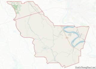
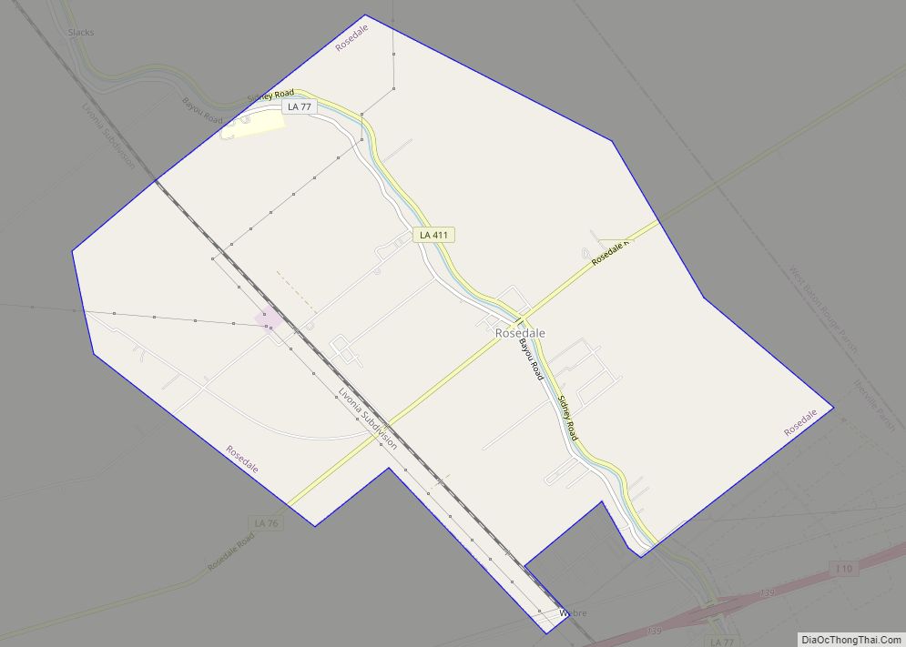
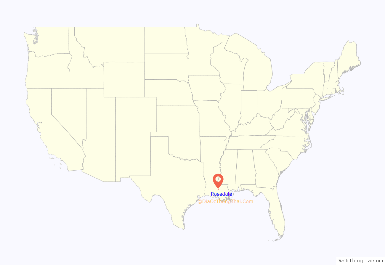
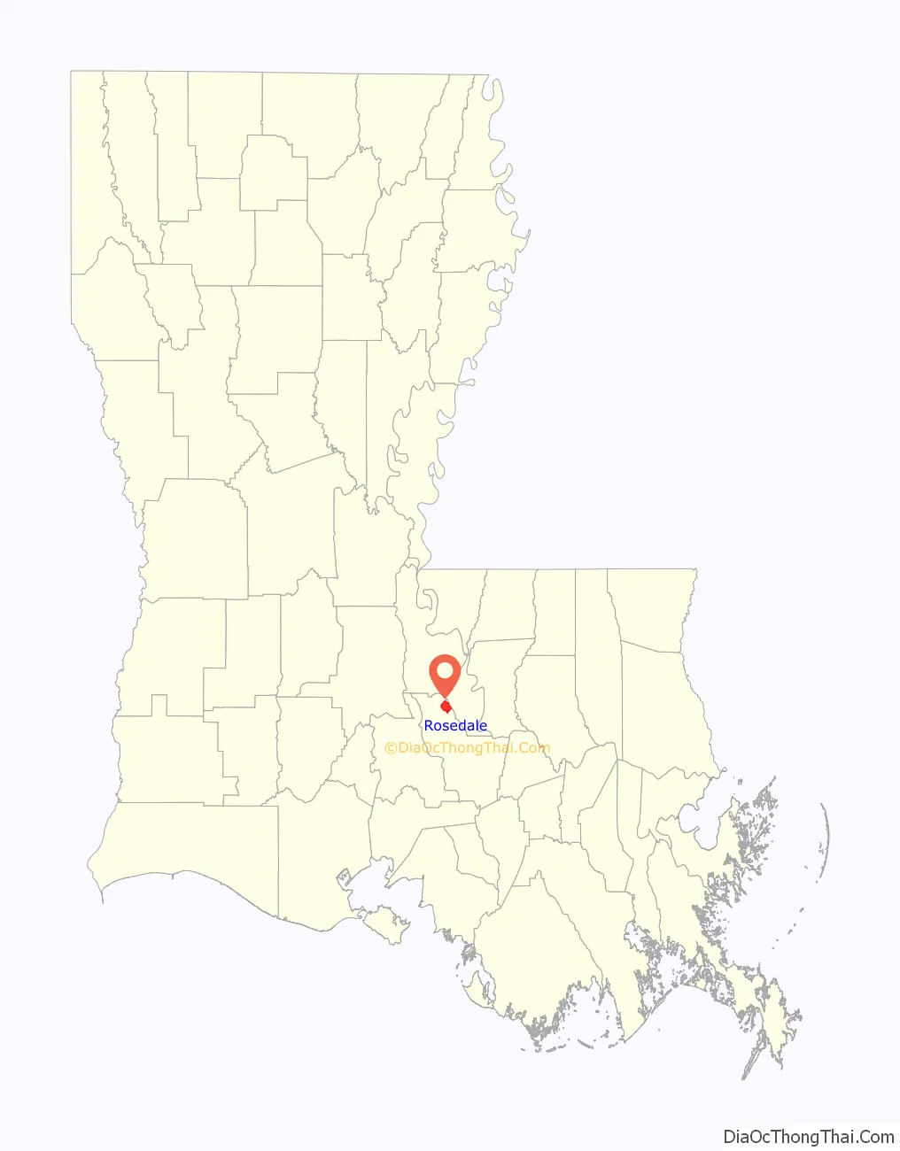
Rosedale location map. Where is Rosedale village?
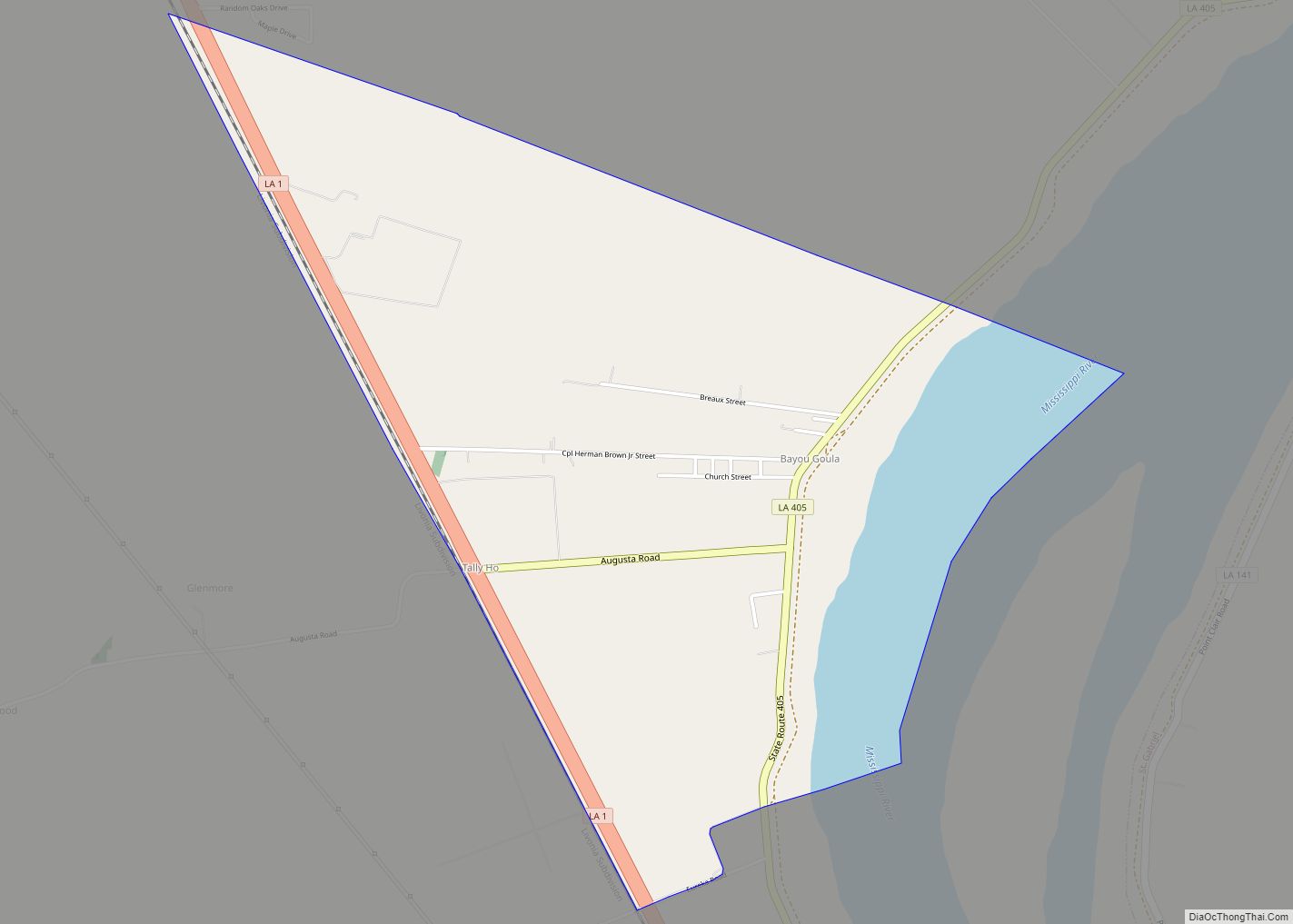
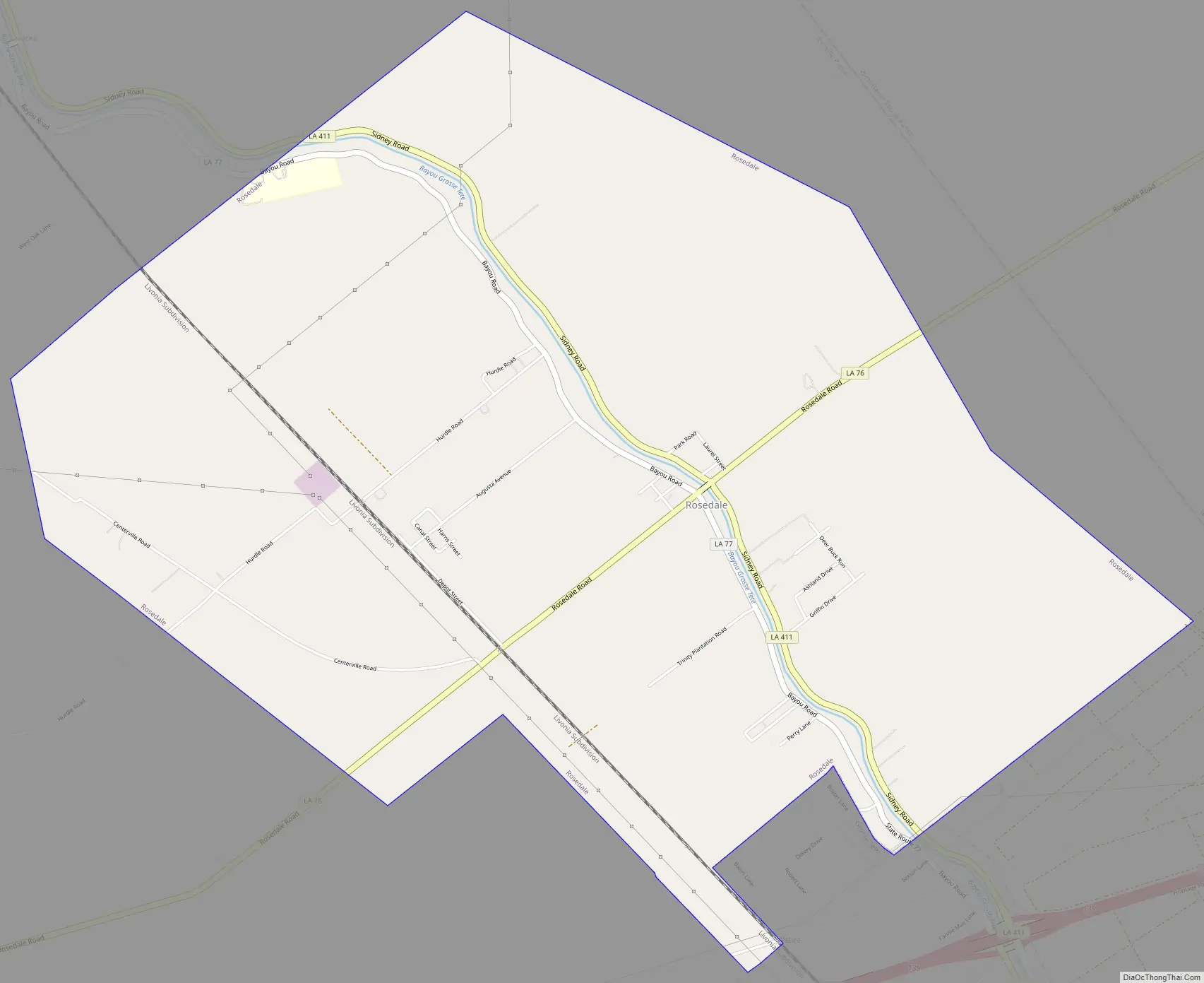
Rosedale Road Map
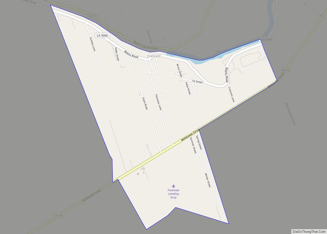
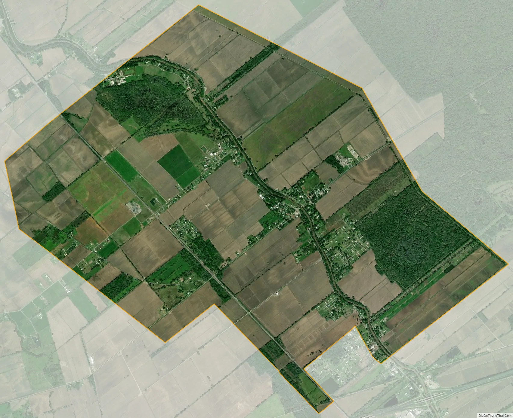
Rosedale city Satellite Map
Geography
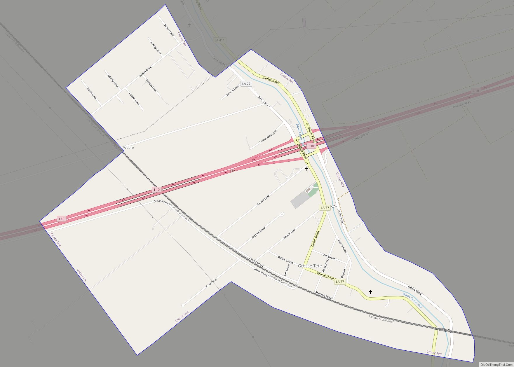
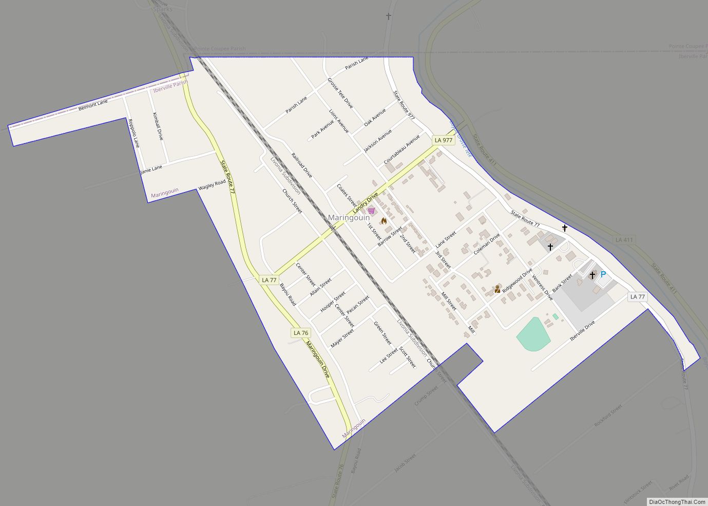
Rosedale is located in northern Iberville Parish at 30°26′24″N 91°27′42″W / 30.44000°N 91.46167°W / 30.44000; -91.46167 (30.439929, -91.461588). It is bordered to the south by the village of Grosse Tete, and Bayou Grosse Tete flows through the center of Rosedale.
Louisiana Highways 76 and 77 intersect at the center of Rosedale. LA 76 leads east 16 miles (26 km) to Port Allen across the Mississippi River from Baton Rouge, and west 3.5 miles (5.6 km) to a point near Ramah and Interstate 10. LA 77, following Bayou Grosse Tete, leads northwest 6 miles (10 km) to Maringouin and southeast 2 miles (3 km) to Interstate 10 at Grosse Tête.
According to the United States Census Bureau, Rosedale has a total area of 7.8 square miles (20.1 km), all land.
See also
Map of Louisiana State and its subdivision:- Acadia
- Allen
- Ascension
- Assumption
- Avoyelles
- Beauregard
- Bienville
- Bossier
- Caddo
- Calcasieu
- Caldwell
- Cameron
- Catahoula
- Claiborne
- Concordia
- De Soto
- East Baton Rouge
- East Carroll
- East Feliciana
- Evangeline
- Franklin
- Grant
- Iberia
- Iberville
- Jackson
- Jefferson
- Jefferson Davis
- La Salle
- Lafayette
- Lafourche
- Lincoln
- Livingston
- Madison
- Morehouse
- Natchitoches
- Orleans
- Ouachita
- Plaquemines
- Pointe Coupee
- Rapides
- Red River
- Richland
- Sabine
- Saint Bernard
- Saint Charles
- Saint Helena
- Saint James
- Saint John the Baptist
- Saint Landry
- Saint Martin
- Saint Mary
- Saint Tammany
- Tangipahoa
- Tensas
- Terrebonne
- Union
- Vermilion
- Vernon
- Washington
- Webster
- West Baton Rouge
- West Carroll
- West Feliciana
- Winn
- Alabama
- Alaska
- Arizona
- Arkansas
- California
- Colorado
- Connecticut
- Delaware
- District of Columbia
- Florida
- Georgia
- Hawaii
- Idaho
- Illinois
- Indiana
- Iowa
- Kansas
- Kentucky
- Louisiana
- Maine
- Maryland
- Massachusetts
- Michigan
- Minnesota
- Mississippi
- Missouri
- Montana
- Nebraska
- Nevada
- New Hampshire
- New Jersey
- New Mexico
- New York
- North Carolina
- North Dakota
- Ohio
- Oklahoma
- Oregon
- Pennsylvania
- Rhode Island
- South Carolina
- South Dakota
- Tennessee
- Texas
- Utah
- Vermont
- Virginia
- Washington
- West Virginia
- Wisconsin
- Wyoming