Map of Revere city, Massachusetts
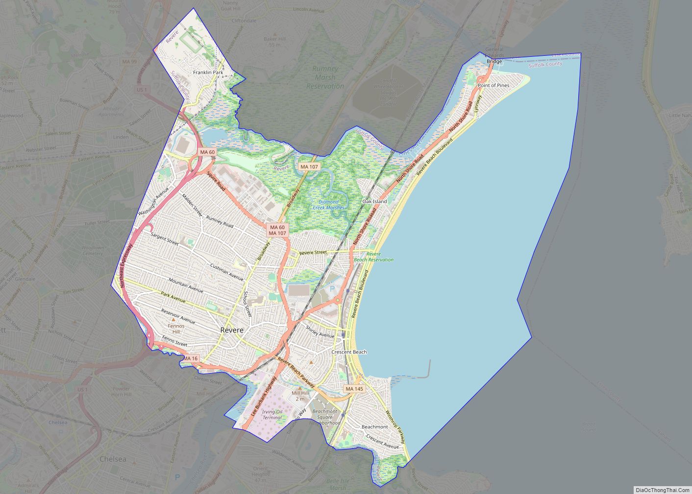
Revere is a city in Suffolk County, Massachusetts, located approximately 5 miles (8.0 km) from downtown Boston. Founded as North Chelsea in 1846, it was renamed in 1871 after Revolutionary War patriot Paul Revere. In 1914, the Town of Revere was incorporated as a city. At the 2020 census, the city had a population of 62,186 ... Read more
Map of Revere city, Massachusetts
Map of Sagamore CDP
Sagamore is a census-designated place (CDP) in the town of Bourne in Barnstable County, Massachusetts, United States. The population was 3,623 at the 2010 census. “Sagamore” was one of the words used by northeastern Native Americans to designate an elected chief or leader. Sagamore CDP overview: Name: Sagamore CDP LSAD Code: 57 LSAD Description: CDP ... Read more
Map of Sagamore CDP
Map of Rutland CDP, Massachusetts
Rutland is a census-designated place (CDP) in the town of Rutland in Worcester County, Massachusetts, United States. The population was 2,111 at the 2010 census. Rutland CDP overview: Name: Rutland CDP LSAD Code: 57 LSAD Description: CDP (suffix) State: Massachusetts County: Worcester County Elevation: 1,125 ft (343 m) Total Area: 3.19 sq mi (8.27 km²) Land Area: 2.96 sq mi (7.66 km²) Water ... Read more
Map of Rutland CDP, Massachusetts
Map of Russell CDP, Massachusetts
Russell is a census-designated place that comprises the populated center of the town of Russell in Hampden County, Massachusetts, United States. The population of the CDP was 786 at the 2010 census, out of 1,775 in the entire town of Russell. It is part of the Springfield, Massachusetts Metropolitan Statistical Area. Russell CDP overview: Name: ... Read more
Map of Russell CDP, Massachusetts
Map of Sandwich CDP, Massachusetts
Sandwich is a village and census-designated place (CDP) in the town of Sandwich in Barnstable County, Massachusetts, United States. The population was 2,962 at the 2010 census, out of a total 20,675 people in the town of Sandwich. Sandwich CDP overview: Name: Sandwich CDP LSAD Code: 57 LSAD Description: CDP (suffix) State: Massachusetts County: Barnstable ... Read more
Map of Sandwich CDP, Massachusetts
Map of Salisbury CDP, Massachusetts
Salisbury is a census-designated place (CDP) in the town of Salisbury in Essex County, Massachusetts, United States. The population was 4,869 at the 2010 census. Salisbury CDP overview: Name: Salisbury CDP LSAD Code: 57 LSAD Description: CDP (suffix) State: Massachusetts County: Essex County Elevation: 30 ft (9 m) Total Area: 7.76 sq mi (20.10 km²) Land Area: 5.88 sq mi (15.23 km²) Water ... Read more
Map of Salisbury CDP, Massachusetts
Map of Salem city, Massachusetts
Salem (/ˈseɪləm/ SAY-ləm) is a historic coastal city in Essex County, Massachusetts, United States, located on the North Shore of Greater Boston. Continuous settlement by Europeans began in 1626 with English colonists. Salem would become one of the most significant seaports trading commodities in early American history. It is a suburb of Boston. Today Salem ... Read more
Map of Salem city, Massachusetts
Map of Seabrook CDP, Massachusetts
Seabrook is a census-designated place (CDP) in the town of Mashpee in Barnstable County, Massachusetts, United States. The population was 455 at the 2010 census. Seabrook CDP overview: Name: Seabrook CDP LSAD Code: 57 LSAD Description: CDP (suffix) State: Massachusetts County: Barnstable County Elevation: 16 ft (5 m) Total Area: 0.35 sq mi (0.92 km²) Land Area: 0.35 sq mi (0.91 km²) Water ... Read more
Map of Seabrook CDP, Massachusetts
Map of Scituate CDP
Scituate (/ˈsɪtʃueɪt, -ɪt/ (listen)) is a census-designated place (CDP) in the town of Scituate in Plymouth County, Massachusetts, United States. The population was 5,245 at the 2010 census. Scituate CDP overview: Name: Scituate CDP LSAD Code: 57 LSAD Description: CDP (suffix) State: Massachusetts County: Plymouth County Elevation: 36 ft (11 m) Total Area: 4.91 sq mi (12.72 km²) Land Area: ... Read more
Map of Scituate CDP
Map of Saugus CDP
Saugus is a town in Essex County, Massachusetts, United States, in the Greater Boston area. The population was 28,619 at the 2020 census. Saugus is known as the site of the first integrated iron works in North America. Saugus CDP overview: Name: Saugus CDP LSAD Code: 57 LSAD Description: CDP (suffix) State: Massachusetts County: Essex ... Read more
Map of Saugus CDP
Map of Shelburne Falls CDP
Shelburne Falls is a historic village in the towns of Shelburne and Buckland in Franklin County, Massachusetts, United States. The village is a census-designated place (CDP) with a population of 1,731 at the 2010 census. It is part of the Springfield, Massachusetts, Metropolitan Statistical Area. Notable features include the Bridge of Flowers, a former trolley ... Read more
Map of Shelburne Falls CDP
Map of Sharon CDP, Massachusetts
Sharon is a census-designated place (CDP) in the town of Sharon in Norfolk County, Massachusetts, United States. The population was 6,184 at the 2020 census. Sharon CDP overview: Name: Sharon CDP LSAD Code: 57 LSAD Description: CDP (suffix) State: Massachusetts County: Norfolk County Elevation: 295 ft (90 m) Total Area: 3.03 sq mi (7.85 km²) Land Area: 2.99 sq mi (7.75 km²) Water ... Read more
Map of Sharon CDP, Massachusetts