Map of Petersham CDP
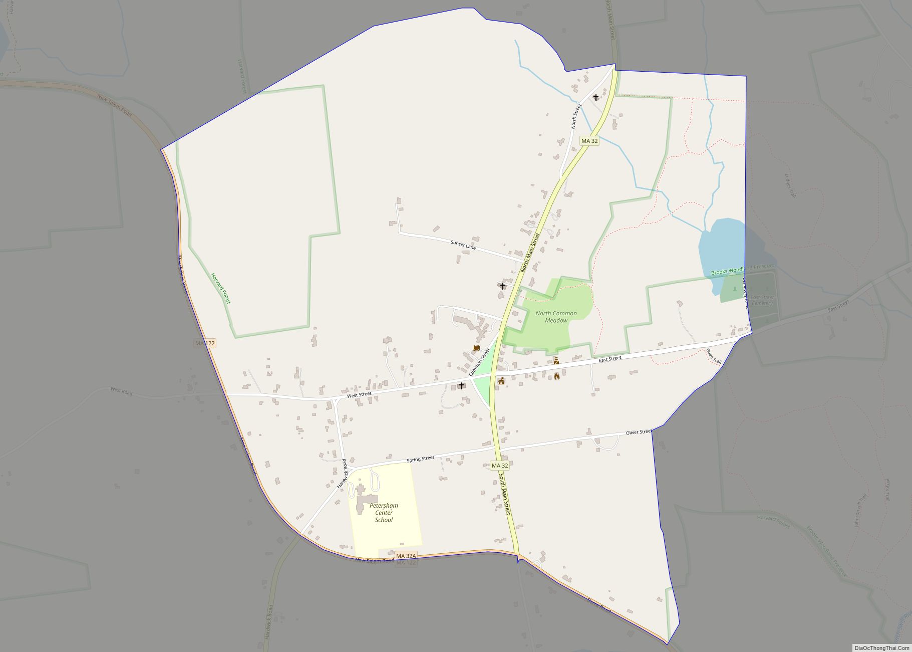
Petersham is a census-designated place (CDP) comprising the main village in the town of Petersham, Worcester County, Massachusetts, United States. Massachusetts Route 32 passes through the village, leading north 9 miles (14 km) to Athol and southeast 7 miles (11 km) to Barre. Massachusetts Route 122 joins Route 32 in the village center, leading southeast with it ... Read more
Map of Petersham CDP
Map of Popponesset Island CDP
Popponesset Island is an island and census-designated place (CDP) in the town of Mashpee in Barnstable County, Massachusetts, United States. The population was 26 at the 2010 census. Popponesset Island CDP overview: Name: Popponesset Island CDP LSAD Code: 57 LSAD Description: CDP (suffix) State: Massachusetts County: Barnstable County Elevation: 0 ft (0 m) Total Area: 0.38 sq mi (0.99 km²) ... Read more
Map of Popponesset Island CDP
Map of Pocasset CDP, Massachusetts
The village of Pocasset is a census-designated place (CDP) in the town of Bourne in Barnstable County, Massachusetts, United States, located on Buzzards Bay. The population was 2,851 at the 2010 census. Pocasset CDP overview: Name: Pocasset CDP LSAD Code: 57 LSAD Description: CDP (suffix) State: Massachusetts County: Barnstable County Elevation: 33 ft (10 m) Total Area: ... Read more
Map of Pocasset CDP, Massachusetts
Map of Plymouth CDP, Massachusetts
Plymouth is a census-designated place (CDP) in the town of Plymouth in Plymouth County, Massachusetts, United States. It is often referred to as Downtown Plymouth or Plymouth Center. The population was 7,494 at the 2010 census. Plymouth Center is considered to be the most prominent neighborhood of Plymouth. It is the location of Plymouth’s town ... Read more
Map of Plymouth CDP, Massachusetts
Map of Quincy city, Massachusetts
Quincy (/ˈkwɪnzi/ KWIN-zee) is a coastal U.S. city in Norfolk County, Massachusetts, United States. It is the largest city in the county and a part of Metropolitan Boston as one of Boston‘s immediate southern suburbs. Its population in 2020 was 101,636, making it the seventh-largest city in the state. Known as the “City of Presidents”, ... Read more
Map of Quincy city, Massachusetts
Map of Provincetown CDP
Provincetown (CDP) is a census-designated place (CDP) in the town of Provincetown in Barnstable County, Massachusetts, United States. The population was 2,642 at the 2010 census, out of 2,942 in the entire town. Provincetown CDP overview: Name: Provincetown CDP LSAD Code: 57 LSAD Description: CDP (suffix) State: Massachusetts County: Barnstable County Elevation: 0 ft (0 m) Total ... Read more
Map of Provincetown CDP
Map of Popponesset CDP
Popponesset is a census-designated place (CDP) in the town of Mashpee on Cape Cod in Barnstable County, Massachusetts, United States. The population was 220 at the 2010 census. Popponesset CDP overview: Name: Popponesset CDP LSAD Code: 57 LSAD Description: CDP (suffix) State: Massachusetts County: Barnstable County Elevation: 13 ft (4 m) Total Area: 0.32 sq mi (0.82 km²) Land Area: ... Read more
Map of Popponesset CDP
Map of Reading CDP, Massachusetts
Reading (/ˈrɛdɪŋ/ (listen) RED-ing) is a town in Middlesex County, Massachusetts, United States, 16 miles (26 km) north of central Boston. The population was 25,518 at the 2020 census. Reading CDP overview: Name: Reading CDP LSAD Code: 57 LSAD Description: CDP (suffix) State: Massachusetts County: Middlesex County Elevation: 127 ft (39 m) Total Area: 9.9 sq mi (25.7 km²) Land Area: ... Read more
Map of Reading CDP, Massachusetts
Map of Raynham Center CDP
Raynham Center is a census-designated place (CDP) in the town of Raynham in Bristol County, Massachusetts, United States. The population was 4,100 at the 2010 census. Raynham Center CDP overview: Name: Raynham Center CDP LSAD Code: 57 LSAD Description: CDP (suffix) State: Massachusetts County: Bristol County Elevation: 39 ft (12 m) Total Area: 4.34 sq mi (11.25 km²) Land Area: ... Read more
Map of Raynham Center CDP
Map of Randolph Town city
Randolph Town city overview: Name: Randolph Town city LSAD Code: 25 LSAD Description: city (suffix) State: Massachusetts FIPS code: 2556000 Online Interactive Map Randolph Town online map. Source: Basemap layers from Google Map, Open Street Map (OSM), Arcgisonline, Wmflabs. Boundary Data from Database of Global Administrative Areas. Randolph Town location map. Where is Randolph Town ... Read more
Map of Randolph Town city
Map of Rowley CDP, Massachusetts
Rowley is a census-designated place (CDP) in the town of Rowley in Essex County, Massachusetts, United States. The population was 1,416 at the 2010 census. Rowley CDP overview: Name: Rowley CDP LSAD Code: 57 LSAD Description: CDP (suffix) State: Massachusetts County: Essex County Elevation: 46 ft (14 m) Total Area: 1.74 sq mi (4.51 km²) Land Area: 1.71 sq mi (4.44 km²) Water ... Read more
Map of Rowley CDP, Massachusetts
Map of Rockport CDP, Massachusetts
Rockport is a census-designated place (CDP) in the town of Rockport in Essex County, Massachusetts, United States. The population was 4,966 at the 2010 census. Rockport CDP overview: Name: Rockport CDP LSAD Code: 57 LSAD Description: CDP (suffix) State: Massachusetts County: Essex County Elevation: 52 ft (16 m) Total Area: 4.09 sq mi (10.59 km²) Land Area: 3.98 sq mi (10.31 km²) Water ... Read more
Map of Rockport CDP, Massachusetts