Map of Aberdeen Proving Ground CDP
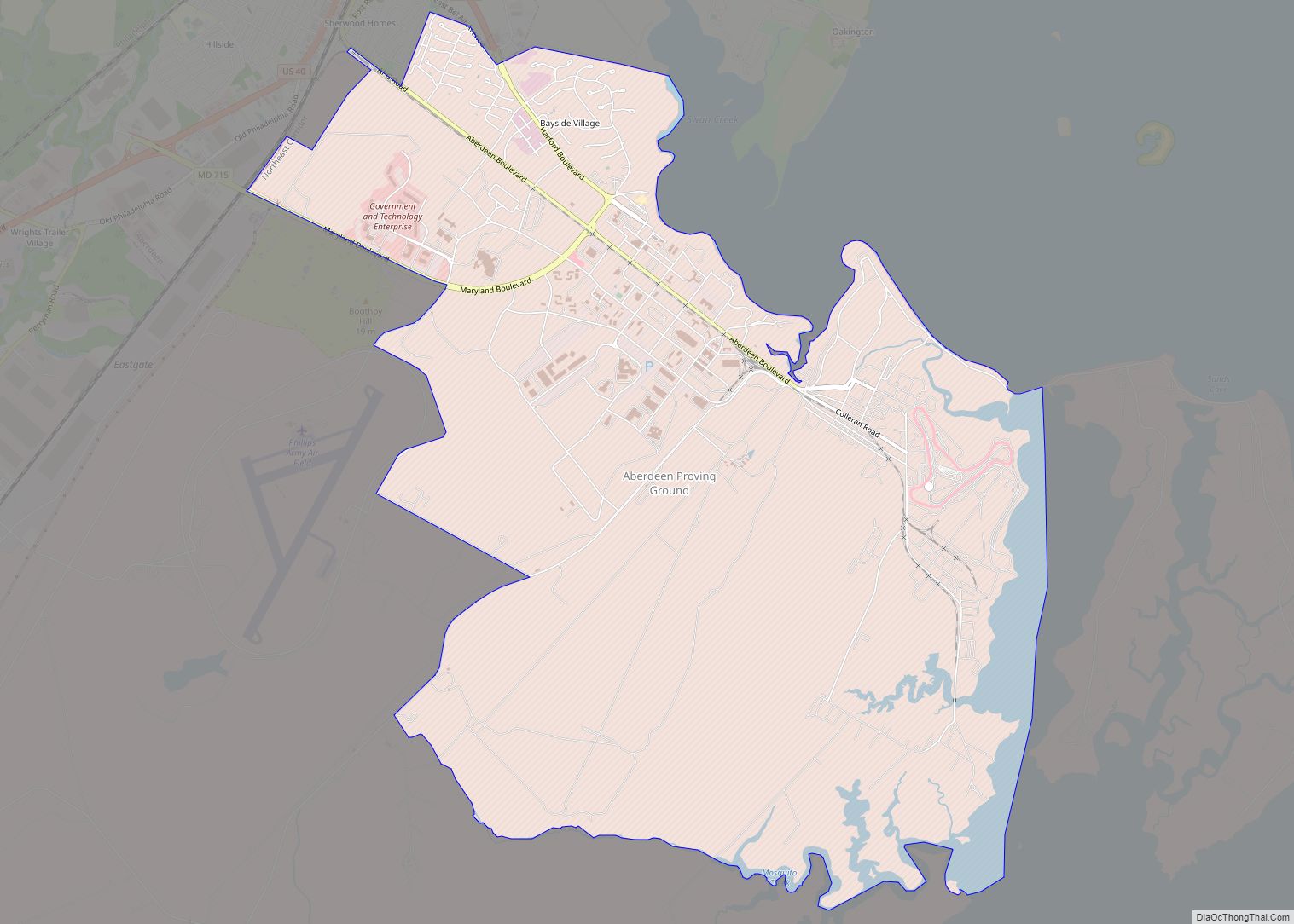
Aberdeen Proving Ground is a census-designated place (CDP) covering the residential population of the Aberdeen Proving Ground in Harford County, Maryland, United States. The population at the 2020 Census was 1,668. Aberdeen Proving Ground CDP overview: Name: Aberdeen Proving Ground CDP LSAD Code: 57 LSAD Description: CDP (suffix) State: Maryland County: Harford County Total Area: ... Read more
Map of Aberdeen Proving Ground CDP
Map of Adelphi CDP, Maryland
Adelphi is an unincorporated area and census-designated place in Prince George’s County, Maryland, United States. Per the 2020 Census, the population was 16,823. Adelphi includes the following subdivisions; Adelphi, Adelphi Park, Adelphi Hills, Adelphi Terrace, Adelphi Village, Buck Lodge, Chatham, Cool Spring Terrace, Hillandale Forest, Holly Hill Manor, Knollwood, Lewisdale, and White Oak Manor. Adelphi ... Read more
Map of Adelphi CDP, Maryland
Map of Adamstown CDP, Maryland
Adamstown is an unincorporated community and census-designated place (CDP) in Frederick County, Maryland, United States. It is named for Adam Kohlenberg (March 11, 1819 – January 1, 1868), a station agent and first town merchant who owned much of present-day Adamstown. As of the 2010 census, the Adamstown CDP had a population of 2,372. Adamstown ... Read more
Map of Adamstown CDP, Maryland
Map of Accokeek CDP
Accokeek (/ˈækəkiːk/), “at the edge of the hill” in Algonquin, is a census-designated place (CDP) located in Prince George’s County, Maryland, United States. The CDP is located on the Potomac River, borders Charles County and is approximately 17 miles from Washington. It is a part of the Washington metropolitan area. The population of the CDP, ... Read more
Map of Accokeek CDP
Map of Andrews AFB CDP
Andrews Air Force Base (Andrews AFB, AAFB) is the airfield portion of Joint Base Andrews, which is under the jurisdiction of the United States Air Force. In 2009, Andrews Air Force Base merged with Naval Air Facility Washington to form Joint Base Andrews. Andrews, located near Morningside, Maryland in suburban Washington, D.C., is the home ... Read more
Map of Andrews AFB CDP
Map of Allen CDP, Maryland
Allen is an unincorporated community and census-designated place in Wicomico County, Maryland, United States. Its population was 210 as of the 2010 census. It is part of the Salisbury, Maryland-Delaware Metropolitan Statistical Area. The Asbury Methodist Episcopal Church, Bennett’s Adventure, and Bounds Lott are listed on the National Register of Historic Places. Allen CDP overview: ... Read more
Map of Allen CDP, Maryland
Map of Algonquin CDP, Maryland
Algonquin is a census-designated place (CDP) in Dorchester County, Maryland, United States. The population was 1,241 at the 2010 census. The community was named for the Algonquin people, one of the Native American tribes in the East. Algonquin CDP overview: Name: Algonquin CDP LSAD Code: 57 LSAD Description: CDP (suffix) State: Maryland County: Dorchester County ... Read more
Map of Algonquin CDP, Maryland
Map of Antietam CDP
Antietam is an unincorporated community and census-designated place in Washington County, Maryland, United States. Its population was 89 as of the 2010 census. It is the site of Antietam Iron Furnace Site and Antietam Village, added to the National Register of Historic Places in 1975. Antietam CDP overview: Name: Antietam CDP LSAD Code: 57 LSAD ... Read more
Map of Antietam CDP
Map of Annapolis Neck CDP
Annapolis Neck, a suburb of Annapolis, is a census-designated place in Anne Arundel County, Maryland, United States. As of the 2010 census, its population was 10,950. Annapolis Neck CDP overview: Name: Annapolis Neck CDP LSAD Code: 57 LSAD Description: CDP (suffix) State: Maryland County: Anne Arundel County Elevation: 39 ft (12 m) Total Area: 11.40 sq mi (29.52 km²) Land ... Read more
Map of Annapolis Neck CDP
Map of Aquasco CDP
Aquasco is an unincorporated area and census-designated place in southeastern Prince George’s County, Maryland, United States, surrounding the town of Eagle Harbor and bordering Charles County. As of the 2020 census, the CDP had a population of 913. Aquasco was home to the Aquasco Speedway. Aquasco CDP overview: Name: Aquasco CDP LSAD Code: 57 LSAD ... Read more
Map of Aquasco CDP
Map of Arnold CDP, Maryland
Arnold, a census-designated place (CDP) in Anne Arundel County, Maryland, United States, located just outside of the state’s capital, Annapolis. It is located 18.78 miles south of Baltimore, and 29.97 miles east of Washington, D.C. The population was 23,106 at the 2010 census. Neighborhoods straddle College Parkway and Maryland Route 2 (Ritchie Highway). Arnold is ... Read more
Map of Arnold CDP, Maryland
Map of Arden on the Severn CDP
Arden on the Severn is a census-designated place (CDP) in Anne Arundel County, Maryland. The population was 1,880 at the 2020 census. Its homes offer residents private waterfront beaches including private docks and boat slips as well as access to four private community beaches. The homes in Arden on the Severn are considered to be ... Read more
Map of Arden on the Severn CDP