Accokeek (/ˈækəkiːk/), “at the edge of the hill” in Algonquin, is a census-designated place (CDP) located in Prince George’s County, Maryland, United States. The CDP is located on the Potomac River, borders Charles County and is approximately 17 miles from Washington. It is a part of the Washington metropolitan area. The population of the CDP, as of the 2020 United States Census was 13,927.
While the area around Accokeek was inhabited by Native Americans since approximately 2,000 BCE, John Smith was the first European to settle the area in 1608. In 1990, the United States Census Bureau officially made Accokeek a CDP.
| Name: | Accokeek CDP |
|---|---|
| LSAD Code: | 57 |
| LSAD Description: | CDP (suffix) |
| State: | Maryland |
| County: | Prince George’s County |
| Founded: | 1608 |
| Elevation: | 194 ft (59 m) |
| Total Area: | 28.79 sq mi (74.57 km²) |
| Land Area: | 27.43 sq mi (71.03 km²) |
| Water Area: | 1.37 sq mi (3.54 km²) |
| Total Population: | 13,927 |
| Population Density: | 507.78/sq mi (196.06/km²) |
| ZIP code: | 20607 |
| Area code: | 301, 240 |
| FIPS code: | 2400250 |
| GNISfeature ID: | 596993 |
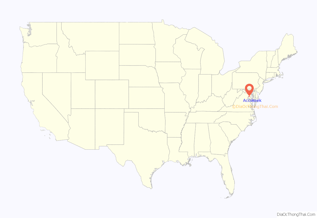
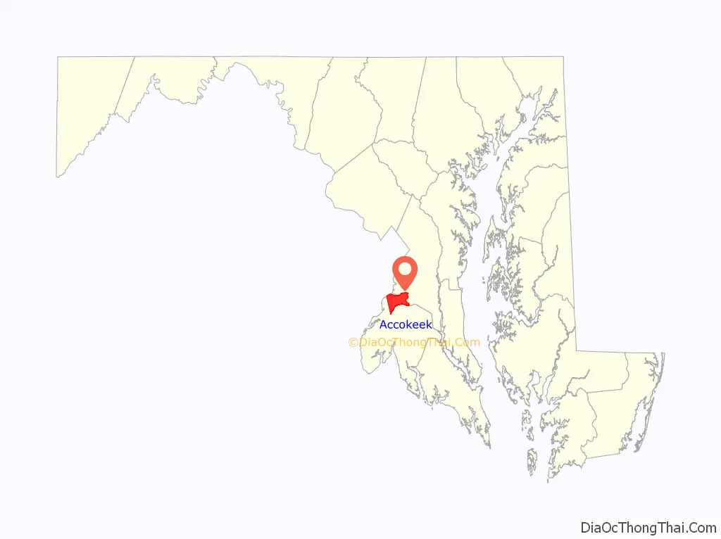
Online Interactive Map
Click on ![]() to view map in "full screen" mode.
to view map in "full screen" mode.
Accokeek location map. Where is Accokeek CDP?
History
The area around Accokeek had been occupied since around 2000 BC; however, the first permanent village was established in c. 1200 AD by the Piscataway tribe. Captain John Smith was the first European to see the Accokeek area. In 1608, he sailed the Potomac River and found the Moyaone village. At the time of the discovery, Moyaone was the seat of government for the Piscataway Tribe. The village of Moyaone disbanded and the population migrated to other tribes before other Europeans settled the area.
In the mid-17th century, settlers were purchasing large plots of land for farming. The Native Americans were upset that the settlers were wearing-out the land due to farming various crops, which led to multiple battles between the two. Between 1675 and 1682, the Native Americans were forced from the area as a result of losing.
In 1861, Accokeek was still rural, and agriculture was the main economic factor for the place. Tobacco was the main crop planted. During the American Civil War (1861–1865), Accokeek sympathized with the Confederacy. According to the 1860 Census, the area around Accokeek had a slave population of 1,600 (52.6%). There were multiple Confederate spies in the area, including Thomas Harbin who open a hotel in the area and had plans to kidnap then-President Abraham Lincoln.
Henry and Alice Ferguson settled in Accokeek when they purchased Hard Bargain Farm overlooking the Potomac River in 1922 as a vacation retreat. Between 1935 and 1939 Alice Ferguson initiated archaeological excavations. A fort from the Susquehannock people, which was demolished in 1675, was found. In 1957, US Senator Frances P. Bolton founded the Accokeek Foundation. The Foundation was used to purchase 200 acres (81 ha) of land in Piscataway Park to help preserve the area. Much of the community west of Route 210 is designated the Moyaone Reserve and contains mid-century, individually-designed homes on minimum 5-acre wooded lots. Community educational attractions include Hard Bargain Farm (Ferguson Foundation) and the National Colonial Farm (National Park Service), which are listed below under “Parks and Recreation.” Both these sites have numerous special events, including an annual Oktoberfest, and a “theater in the woods”. In 1960, the Washington Suburban Sanitary Commission (WSSC) wanted to build a water treatment plant in Mockley Point, which was Accokeek shoreline. Since it would disrupt the view of Mount Vernon and Fort Washington Park, various people and organizations protested against it. In 1961, a law was signed by President John F. Kennedy in order to designate 133 acres (54 ha) around Mockley Point as a national landmark. Both the Accokeek Foundation and the Alice Ferguson Foundation donated another 505 acres (204 ha) to the landmark. As a result, WSSC was not allowed to build the plant there; however, a plant was built in the 1960s in the surrounding area.
In 1990, Accokeek officially became a CDP when the US Census Bureau defined the place’s boundaries. In 2008, eight people were killed and 9 more were injured in Accokeek on Indian Head Highway in an illegal street race.
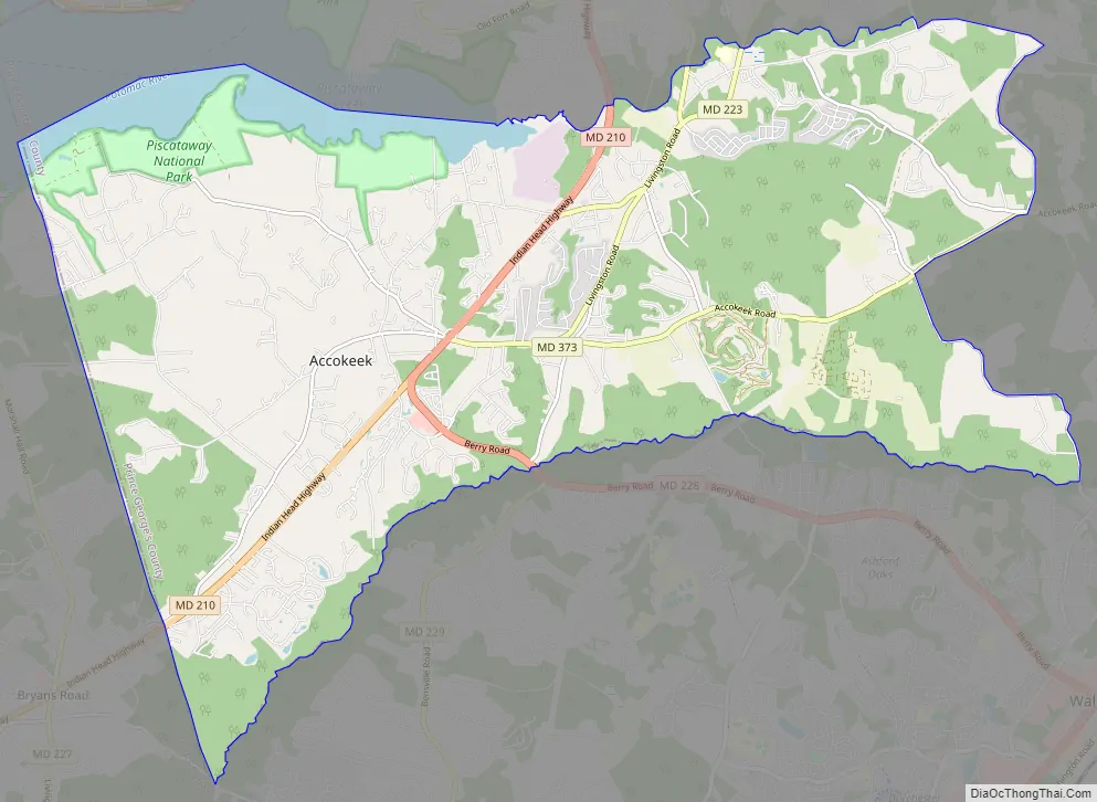
Accokeek Road Map
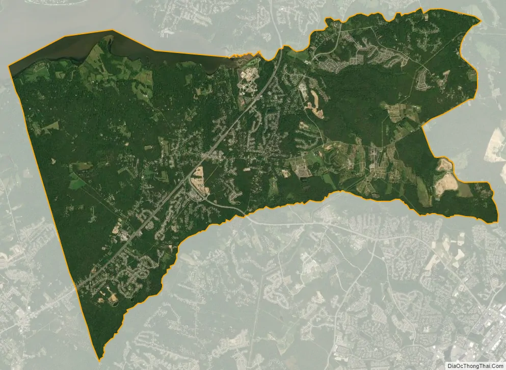
Accokeek city Satellite Map
Geography
Accokeek is located in the Southern United States, in Southern Maryland, and approximately 17 miles (27 km) from Washington, D.C. To the north, Accokeek borders the CDPs of Fort Washington and Clinton; to the east, it borders the CDP of Brandywine; to the south, it borders the CDPs of Bryans Road, Bensville, and Waldorf, all of which are located in Charles County; and to the west, it borders the Potomac River, which flows into the Chesapeake Bay.
According to the United States Census Bureau, the place has a total area of 28.803 square miles (74.60 km), of which 27.436 square miles (71.06 km) is land and 1.367 square miles (3.54 km) is water. Accokeek has an average elevation of 194 feet (59 m).
Climate
According to the Köppen climate classification system, Accokeek is considered to have a humid subtropical climate (Cfa). This means Accokeek’s average temperature of the warmest month is above 72 °F (22 °C), the average temperature of the coldest month is below between 27 to 64 °F (−3 to 18 °C), and rain is equally spread out through the year.
There is more precipitation in the area during the months of May and July (4.1 inch; 104 mm) than in any other month; Accokeek currently has an annual precipitation of 39 inches (1,009 mm) each year. July is the hottest month, on average; the hottest recorded temperature occurred in July 1954 and September 1983. January is the coldest month, and the lowest recorded temperature was recorded in January 1950.
See also
Map of Maryland State and its subdivision: Map of other states:- Alabama
- Alaska
- Arizona
- Arkansas
- California
- Colorado
- Connecticut
- Delaware
- District of Columbia
- Florida
- Georgia
- Hawaii
- Idaho
- Illinois
- Indiana
- Iowa
- Kansas
- Kentucky
- Louisiana
- Maine
- Maryland
- Massachusetts
- Michigan
- Minnesota
- Mississippi
- Missouri
- Montana
- Nebraska
- Nevada
- New Hampshire
- New Jersey
- New Mexico
- New York
- North Carolina
- North Dakota
- Ohio
- Oklahoma
- Oregon
- Pennsylvania
- Rhode Island
- South Carolina
- South Dakota
- Tennessee
- Texas
- Utah
- Vermont
- Virginia
- Washington
- West Virginia
- Wisconsin
- Wyoming


