Adelphi is an unincorporated area and census-designated place in Prince George’s County, Maryland, United States. Per the 2020 Census, the population was 16,823. Adelphi includes the following subdivisions; Adelphi, Adelphi Park, Adelphi Hills, Adelphi Terrace, Adelphi Village, Buck Lodge, Chatham, Cool Spring Terrace, Hillandale Forest, Holly Hill Manor, Knollwood, Lewisdale, and White Oak Manor.
| Name: | Adelphi CDP |
|---|---|
| LSAD Code: | 57 |
| LSAD Description: | CDP (suffix) |
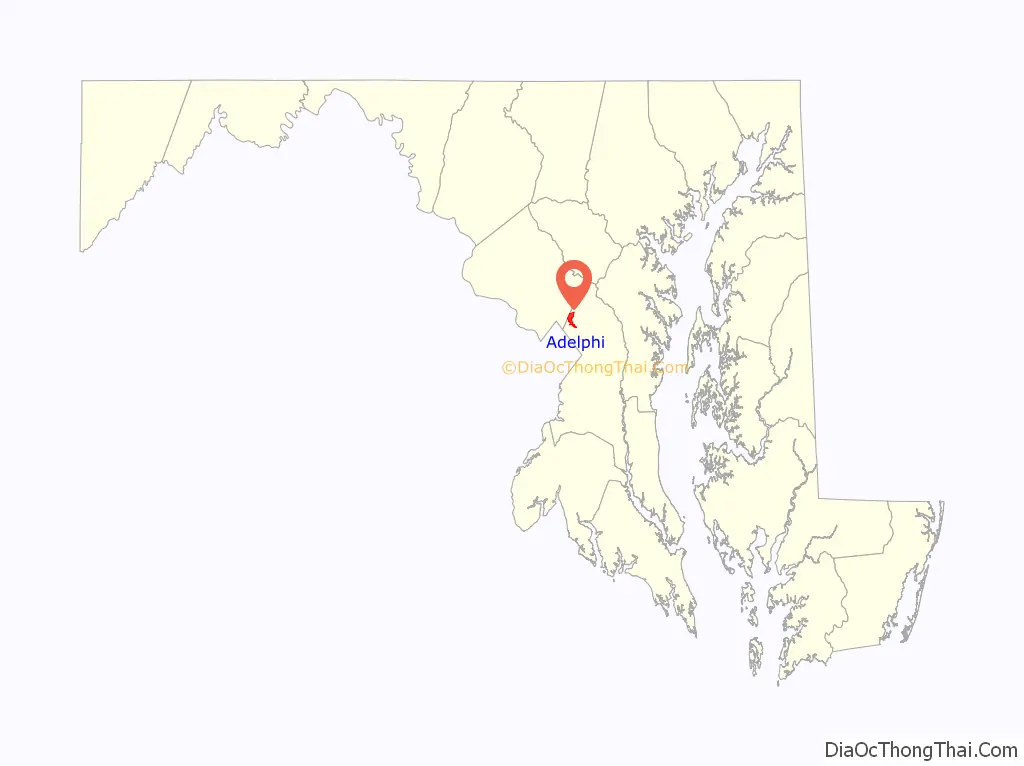
| State: | Maryland |
| County: | Prince George’s County |
| Elevation: | 171 ft (52 m) |
| Total Area: | 2.72 sq mi (7.04 km²) |
| Land Area: | 2.72 sq mi (7.03 km²) |
| Water Area: | 0.00 sq mi (0.01 km²) |
| Total Population: | 16,823 |
| Population Density: | 6,194.04/sq mi (2,391.72/km²) |
| FIPS code: | 2400400 |
| GNISfeature ID: | 0596997 |
Online Interactive Map
Click on ![]() to view map in "full screen" mode.
to view map in "full screen" mode.
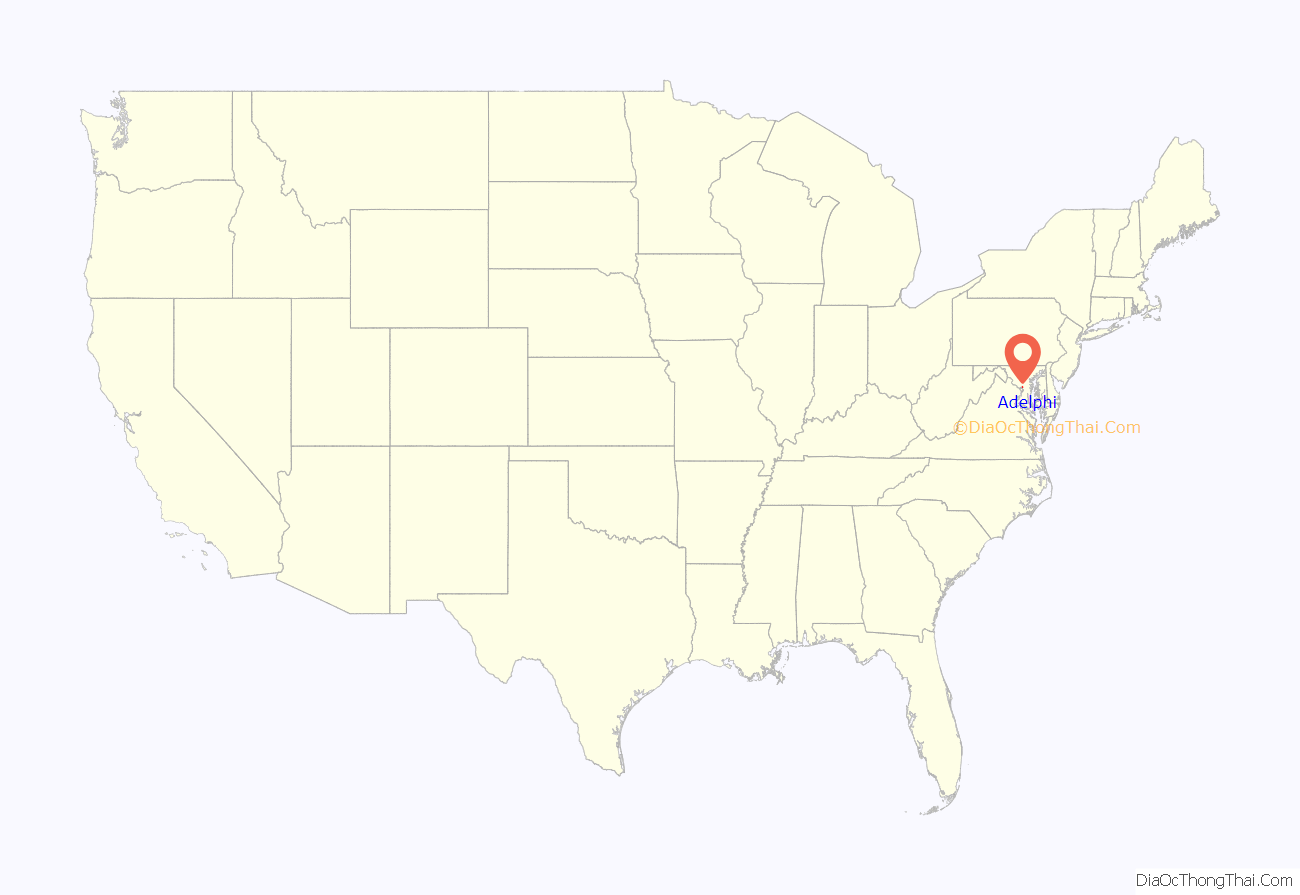
Adelphi location map. Where is Adelphi CDP?
History
The unincorporated Adelphi community takes its name from the historic Adelphi Mill, established in 1796 along the Northwest Branch of the Anacostia River. and continues to attract visitors and can be rented for special functions. During the 19th century, George Washington Riggs acquired much of the area northeast of Washington, D.C., as his Green Hill estate in the Chillum Manor district. That estate included present-day Adelphi. In the early 1920s, part of the area was acquired by Leander McCormick-Goodhart as part of his Langley Park estate. Labor organizer Mary Harris “Mother” Jones died in 1930, at the farm of Walter and Lillie May Burgess near Powder Mill and Riggs Roads in present-day Adelphi. A marker was erected by the Maryland State Highway Administration commemorating Mother Jones at her death site. Unlike its nearby neighbors Hyattsville and College Park, the area remained relatively undeveloped until immediately following World War II. At that time, subdivisions quickly developed. To distinguish it from the other neighboring unincorporated communities of Lewisdale and Langley Park, the growing subdivisions banded together in the mid-1950s and adopted the name “Adelphi” to reflect their commitment to the preservation of the historic mill of the same name. A community focal point that originally developed in the late 1950s is the Adelphi Pool, a private pool in the Adelphi neighborhood, located next to George Washington Cemetery on Riggs Road. Use of the Adelphi Pool requires paid membership or being accompanied by a member and paying a small fee. The Adelphi pool offers swimming lessons and also features swim teams which compete against each other. Two notable features of the Adelphi Pool are its long water slide and basketball hoop.
In 1971, the Harry Diamond Laboratories was established on 137 acres (0.55 km) in the northern part of Adelphi. That facility continues as the Adelphi Laboratory Center, Army Research Laboratory (ARL), the U.S. Army’s corporate research laboratory. Other adjacent federal facilities include the National Archives at College Park and headquarters of the Food and Drug Administration.
Historic sites
The following is a list of historic sites in Adelphi identified by the Maryland-National Capital Park and Planning Commission:
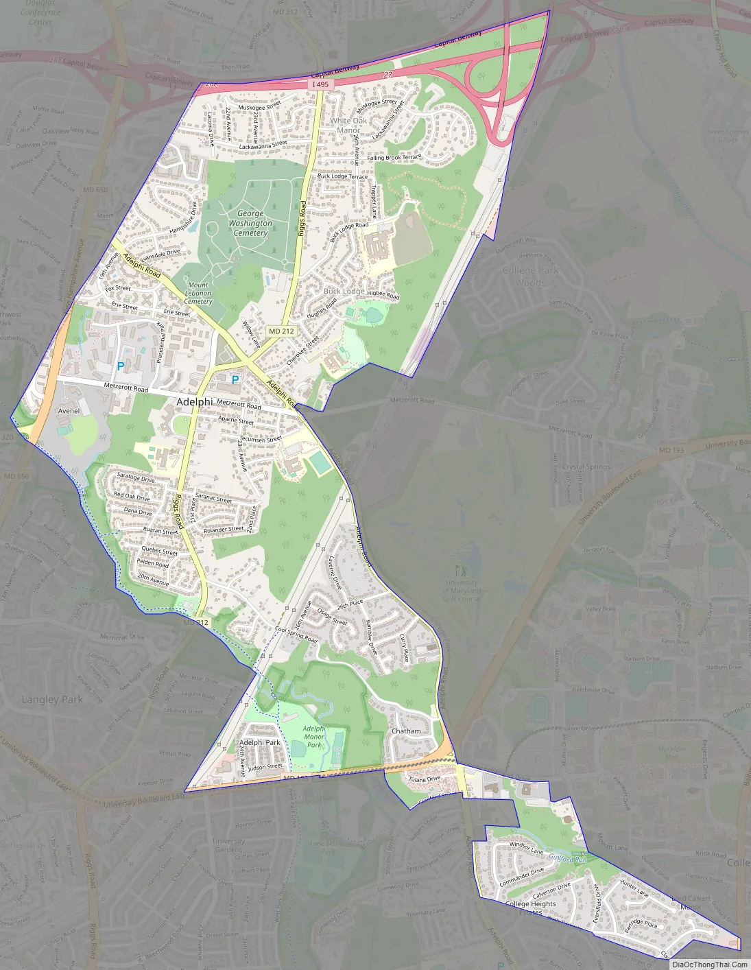
Adelphi Road Map
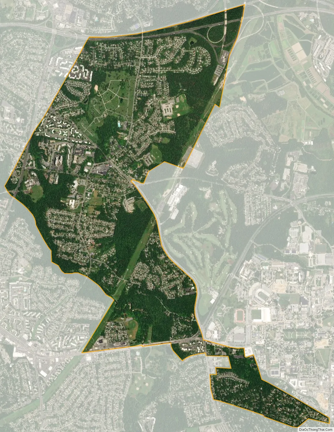
Adelphi city Satellite Map
Geography
Adelphi is located at 38°59′49″N 76°58′0″W / 38.99694°N 76.96667°W / 38.99694; -76.96667 (38.996860, −76.966755).
According to the United States Census Bureau, the Census Designated Place (CDP) has a total area of 2.7 square miles (7.1 km), all land.
Adjacent areas
- Hillandale (northwest)
- Beltsville (north)
- Calverton (north)
- College Park (southeast)
- Hyattsville (south)
- Lewisdale (southwest)
- Langley Park (southwest)
- Silver Spring (west)
See also
Map of Maryland State and its subdivision: Map of other states:- Alabama
- Alaska
- Arizona
- Arkansas
- California
- Colorado
- Connecticut
- Delaware
- District of Columbia
- Florida
- Georgia
- Hawaii
- Idaho
- Illinois
- Indiana
- Iowa
- Kansas
- Kentucky
- Louisiana
- Maine
- Maryland
- Massachusetts
- Michigan
- Minnesota
- Mississippi
- Missouri
- Montana
- Nebraska
- Nevada
- New Hampshire
- New Jersey
- New Mexico
- New York
- North Carolina
- North Dakota
- Ohio
- Oklahoma
- Oregon
- Pennsylvania
- Rhode Island
- South Carolina
- South Dakota
- Tennessee
- Texas
- Utah
- Vermont
- Virginia
- Washington
- West Virginia
- Wisconsin
- Wyoming


