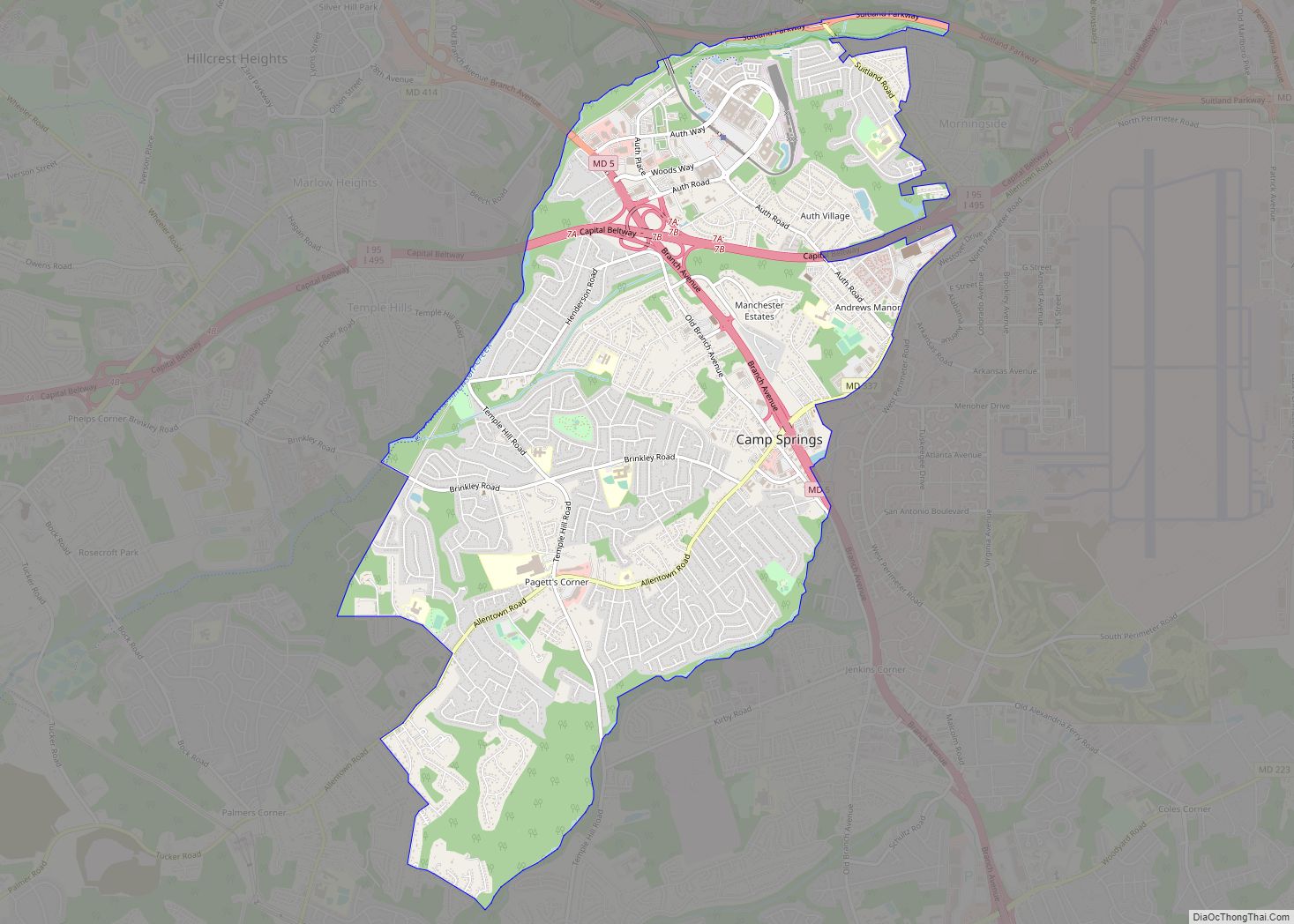
Camp Springs is an unincorporated area and census-designated place (CDP) in Prince George’s County, Maryland, United States. The population was 22,734 at the 2020 census. Camp Springs is not an official post office designation; the area is divided among the surrounding mailing addresses of Temple Hills, Fort Washington, Clinton, and Suitland. Camp Springs CDP overview: ... Read more
Map of US Cities and Places
Carney is an unincorporated community and census-designated place in Baltimore County, Maryland, United States. The population was 29,941 at the 2010 census. Carney CDP overview: Name: Carney CDP LSAD Code: 57 LSAD Description: CDP (suffix) State: Maryland County: Baltimore County Elevation: 354 ft (108 m) Total Area: 7.01 sq mi (18.15 km²) Land Area: 7.01 sq mi (18.15 km²) Water Area: 0.00 sq mi (0.01 km²) ... Read more
Carlos is an unincorporated community and census-designated place (CDP) in Allegany County, Maryland, United States. As of the 2010 census it had a population of 153. Carlos is located 3 miles (5 km) southwest of Frostburg near the western border of Allegany County, at the foot of Big Savage Mountain. Carlos CDP overview: Name: Carlos CDP ... Read more
Capitol Heights is a town in Prince George’s County, Maryland, United States, located on the border of both the Northeast & Southeast quadrants of Washington. Per the 2020 census, the population was 4,050. The town of Capitol Heights is officially bounded between Southern Avenue NE/SE to the north, Yost Place, and Eastern Avenue NE to ... Read more
Cearfoss is an unincorporated community and census-designated place in northwestern Washington County, Maryland, United States. Its population was 178 as of the 2010 census. Cearfoss is located northwest of Hagerstown and Maugansville, near the Pennsylvania border. Many highways intersect in Cearfoss in a roundabout, including Maryland routes 58, 63 and 494. Cearfoss is officially included ... Read more
Cavetown is a census-designated place (CDP) in Washington County, Maryland, United States. The population was 1,486 at the 2000 census. Cavetown CDP overview: Name: Cavetown CDP LSAD Code: 57 LSAD Description: CDP (suffix) State: Maryland County: Washington County Elevation: 728 ft (222 m) Total Area: 1.90 sq mi (4.93 km²) Land Area: 1.90 sq mi (4.93 km²) Water Area: 0.00 sq mi (0.00 km²) Total Population: ... Read more
Catonsville (/ˈkeɪtənzˌvɪl/) is a census-designated place (CDP) in Baltimore County, Maryland. The population was 41,567 at the 2010 census. The community lies to the west of Baltimore along the city’s border. Catonsville contains the majority of the University of Maryland, Baltimore County (UMBC), a major public research university with close to 14,000 students. Catonsville CDP ... Read more
Centreville is an incorporated town in Queen Anne’s County, Maryland, United States on the Delmarva Peninsula. Incorporated in 1794, it is the county seat of Queen Anne’s County. The population was 4,285 at the 2010 census. The ZIP code is 21617 and the area codes are 410 and 443. The primary local telephone exchange is ... Read more
Cedarville is an unincorporated community and census-designated place in southern Prince George’s County, Maryland, United States. As of the 2020 census the population was 639. Cedarville CDP overview: Name: Cedarville CDP LSAD Code: 57 LSAD Description: CDP (suffix) State: Maryland County: Prince George’s County Elevation: 266 ft (81 m) Total Area: 13.39 sq mi (34.69 km²) Land Area: 13.28 sq mi (34.40 km²) ... Read more
Cecilton is a town in Cecil County, Maryland, United States. The population was 663 at the 2010 census. Cecilton town overview: Name: Cecilton town LSAD Code: 43 LSAD Description: town (suffix) State: Maryland County: Cecil County Incorporated: 1864 Elevation: 69 ft (21 m) Total Area: 0.48 sq mi (1.25 km²) Land Area: 0.48 sq mi (1.25 km²) Water Area: 0.00 sq mi (0.00 km²) Total Population: ... Read more
Charlotte Hall is a census-designated place (CDP) in Charles and St. Mary’s counties, Maryland, United States. The population was 1,420 at the 2010 census. The Maryland Veterans Home for disabled veterans, including a U.S. Veterans Affairs clinic, is located on the site of the former Charlotte Hall Military Academy. The Academy site was declared the ... Read more
Charlestown is a town in Cecil County, Maryland, United States. The population was 1,183 at the 2010 census. Charlestown town overview: Name: Charlestown town LSAD Code: 43 LSAD Description: town (suffix) State: Maryland County: Cecil County Incorporated: 1742 Elevation: 36 ft (11 m) Total Area: 1.17 sq mi (3.03 km²) Land Area: 1.17 sq mi (3.03 km²) Water Area: 0.00 sq mi (0.01 km²) Total Population: ... Read more