Map of Marlboro Meadows CDP
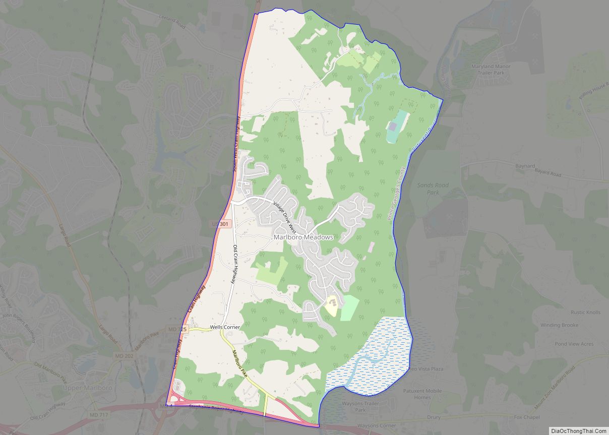
Marlboro Meadows is an unincorporated community and census-designated place (CDP) in Prince George’s County, Maryland, United States. Per the 2020 census, the population was 3,655. It was newly delineated for the 2010 census prior to which the area was part of the Greater Upper Marlboro census-designated place. Marlboro Meadows CDP overview: Name: Marlboro Meadows CDP ... Read more
Map of Marlboro Meadows CDP
Map of Marydel town
Marydel is an incorporated town in Caroline County, Maryland, United States. The population was 141 at the 2010 United States Census. Its name is a portmanteau, after its location, being partially located in Maryland and partially in Delaware. Marydel was originally known as Halltown. Publisher James Gordon Bennett Jr. participated in a duel near Marydel ... Read more
Map of Marydel town
Map of Martin’s Additions village
Martin’s Additions is a village in Montgomery County, Maryland, United States. It was established as a Special Tax District in 1916 and incorporated as a village in 1985. The population was 946 at the 2020 Census. The town is part of a larger community, colloquially referred to as Chevy Chase, that includes several adjoining settlements ... Read more
Map of Martin’s Additions village
Map of Marlton CDP, Maryland
Marlton is an unincorporated area and census-designated place (CDP) in Prince George’s County, Maryland, United States. The population was 9,802 at the 2020 census. The Marlton housing development, at first briefly called “Brandywine Country”, grew up along U.S. Route 301 in the 1970s, and is part of the greater Upper Marlboro community. Originally made up ... Read more
Map of Marlton CDP, Maryland
Map of Mayo CDP, Maryland
Mayo is a census-designated place (CDP) in Anne Arundel County, Maryland, United States. The population was 8,298 at the 2010 census. The Mayo CDP of 2010 includes all of the area that used to be counted as the Selby-on-the-Bay CDP. The beach in Mayo used to be a popular weekend resort. Mayo CDP overview: Name: ... Read more
Map of Mayo CDP, Maryland
Map of Maugansville CDP
Maugansville is a census-designated place (CDP) in Washington County, Maryland, United States. The population was 2,295 at the 2000 census. Maugansville CDP overview: Name: Maugansville CDP LSAD Code: 57 LSAD Description: CDP (suffix) State: Maryland County: Washington County Elevation: 620 ft (189 m) Total Area: 2.45 sq mi (6.34 km²) Land Area: 2.45 sq mi (6.34 km²) Water Area: 0.00 sq mi (0.00 km²) Total Population: ... Read more
Map of Maugansville CDP
Map of Maryland City CDP
Maryland City is a census-designated place (CDP) in Anne Arundel County, Maryland, United States. The population was 16,093 at the 2010 census. It is located east of Laurel, just over the border with Prince George’s County, and it has a Laurel ZIP Code. Maryland City mostly consists of an older, compact housing development and is ... Read more
Map of Maryland City CDP
Map of Mechanicsville CDP, Maryland
Mechanicsville is an unincorporated community and census-designated place in St. Mary’s County, Maryland, United States. It is adjacent to the community of Charlotte Hall, which is known for its agriculture, Amish population, large farmers’ market/flea market and the Maryland Veterans Home. Mechanicsville has many small businesses and restaurants along Maryland Route 5 and Maryland Route ... Read more
Map of Mechanicsville CDP, Maryland
Map of McCoole CDP
McCoole is an unincorporated community and census-designated place (CDP) in Allegany County, Maryland, United States. As of the 2010 census it had a population of 511. McCoole is located at the intersection of U.S. Route 220 and the east end of Maryland Route 135. It lies directly across the North Branch Potomac River from Keyser, ... Read more
Map of McCoole CDP
Map of Mays Chapel CDP
Mays Chapel is an unincorporated community and census-designated place in Baltimore County, Maryland, United States. The population was 11,420 at the 2010 census. Mays Chapel CDP overview: Name: Mays Chapel CDP LSAD Code: 57 LSAD Description: CDP (suffix) State: Maryland County: Baltimore County Elevation: 459 ft (140 m) Total Area: 3.71 sq mi (9.62 km²) Land Area: 3.71 sq mi (9.61 km²) Water ... Read more
Map of Mays Chapel CDP
Map of Middle River CDP, Maryland
Middle River is an unincorporated community and census-designated place in Baltimore County, Maryland, United States. The population was 33,203 at the 2020 census. A Middle River Train Station first appeared on the 1877 G.M. Hopkins & Co Baltimore County Map and by 1898 had a designated Post Office and modest street grid. The town expanded ... Read more
Map of Middle River CDP, Maryland
Map of Mercersville CDP
Mercersville, popularly known as Taylor’s Landing, is an unincorporated community and census-designated place in Washington County, Maryland, United States. Its population was 130 as of the 2010 census. Mercersville lies at an elevation of 341 feet (104 m). Mercersville CDP overview: Name: Mercersville CDP LSAD Code: 57 LSAD Description: CDP (suffix) State: Maryland County: Washington ... Read more
Map of Mercersville CDP