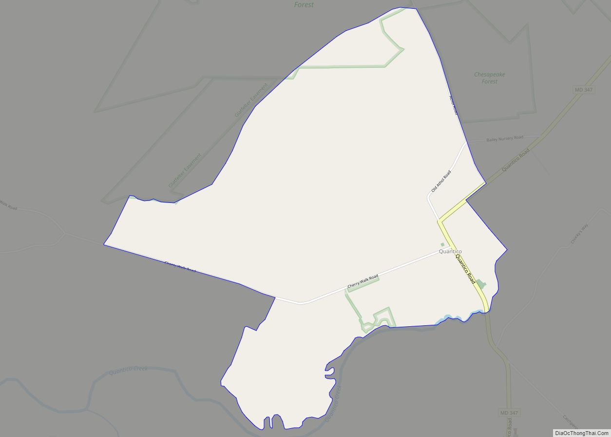
Quantico is an unincorporated community and census-designated place in Wicomico County, Maryland, United States, along the former stage route from Vienna to the port of Whitehaven on the Wicomico River. It consists of approximately 35 homes on the Quantico Creek. The community lies four miles (6 km) from Hebron along Maryland Route 347. There are two ... Read more
Map of US Cities and Places
Rawlings is an unincorporated community and census-designated place (CDP) in Allegany County, Maryland, United States, on the McMullen Highway (U.S. Route 220). As of the 2010 census, the Rawlings CDP had a population of 693. The community was named after Moses Rawlings, an officer in the Revolutionary War. It was originally known as “Rawlings Station” ... Read more
Randallstown is an unincorporated community and census-designated place in Baltimore County, Maryland, United States. It is named after Christopher and Thomas Randall, two 18th-century tavern-keepers. At that time, Randallstown was a tollgate crossroads on the Liberty Turnpike, a major east–west thoroughfare. It is a suburb of Baltimore, with a population of 33,655 as of the ... Read more
Queenstown is a town in Queen Anne’s County, Maryland, United States. The population was 664 at the 2010 census. Queenstown town overview: Name: Queenstown town LSAD Code: 43 LSAD Description: town (suffix) State: Maryland County: Queen Anne’s County Incorporated: 1892 Elevation: 20 ft (6 m) Total Area: 2.01 sq mi (5.20 km²) Land Area: 2.01 sq mi (5.20 km²) Water Area: 0.00 sq mi (0.00 km²) ... Read more
Reid is an unincorporated community and census-designated place in Washington County, Maryland, United States. Its population was 64 as of the 2020 census. Reid CDP overview: Name: Reid CDP LSAD Code: 57 LSAD Description: CDP (suffix) State: Maryland County: Washington County Total Area: 0.13 sq mi (0.32 km²) Land Area: 0.13 sq mi (0.32 km²) Water Area: 0.00 sq mi (0.00 km²) Total Population: ... Read more
Redland is a census-designated place and an unincorporated area in Montgomery County, Maryland, United States. It had a population of 18,592 as of the 2020 census. Redland CDP overview: Name: Redland CDP LSAD Code: 57 LSAD Description: CDP (suffix) State: Maryland County: Montgomery County Elevation: 492 ft (150 m) Total Area: 7.35 sq mi (19.02 km²) Land Area: 7.19 sq mi (18.63 km²) ... Read more
Reisterstown is an unincorporated community and census-designated place in Baltimore County, Maryland, United States. As of the 2010 census, it had a population of 25,968. Founded by German immigrant John Reister in 1758, Reisterstown is located to the northwest of Baltimore. Though it is older than the surrounding areas, it now serves primarily as a ... Read more
Rising Sun is a town in Cecil County, Maryland, United States. The population was 2,781 at the 2010 census. Rising Sun town overview: Name: Rising Sun town LSAD Code: 43 LSAD Description: town (suffix) State: Maryland County: Cecil County Incorporated: 1860 Elevation: 390 ft (119 m) Total Area: 1.66 sq mi (4.29 km²) Land Area: 1.63 sq mi (4.21 km²) Water Area: 0.03 sq mi ... Read more
Ringgold is an unincorporated community and census-designated place in Washington County, Maryland, United States. Its population was 166 as of the 2010 census. Ringgold CDP overview: Name: Ringgold CDP LSAD Code: 57 LSAD Description: CDP (suffix) State: Maryland County: Washington County Elevation: 764 ft (233 m) Total Area: 0.29 sq mi (0.75 km²) Land Area: 0.29 sq mi (0.75 km²) Water Area: 0.00 sq mi ... Read more
Ridgely is a town in Caroline County, Maryland, United States. The population was 1,639 at the 2010 census. Ridgely town overview: Name: Ridgely town LSAD Code: 43 LSAD Description: town (suffix) State: Maryland County: Caroline County Incorporated: 1896 Elevation: 59 ft (18 m) Total Area: 1.86 sq mi (4.83 km²) Land Area: 1.86 sq mi (4.83 km²) Water Area: 0.00 sq mi (0.00 km²) Total Population: ... Read more
Riverside is a census-designated place (CDP) in Harford County, Maryland, United States. The population was 6,425 at the 2010 census. The term “Riverside” is generally used interchangeably with “Belcamp”; both names are accepted for the U.S. Postal Service’s ZIP Code of 21017. However, the original community of Belcamp is located south of U.S. Route 40, ... Read more
Riverdale Park, formerly known and often referred to as Riverdale, is a semi-urban town in Prince George’s County, Maryland, United States, a suburb in the Washington, D.C. metropolitan area. The population was 6,955 as of the 2010 U.S. Census. The population as of 2019 is approximately 7,304, according to the US Census Bureau and other ... Read more