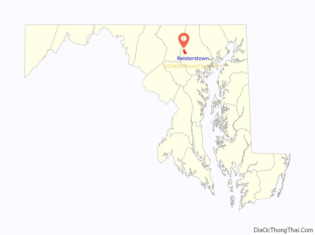
Reisterstown is an unincorporated community and census-designated place in Baltimore County, Maryland, United States. As of the 2010 census, it had a population of 25,968.
Founded by German immigrant John Reister in 1758, Reisterstown is located to the northwest of Baltimore. Though it is older than the surrounding areas, it now serves primarily as a residential suburb of Baltimore. The center is designated the Reisterstown Historic District and listed on the National Register of Historic Places in 1979. Also listed are the Montrose Mansion and Chapel and St. Michael’s Church.
Just outside the community, to its north, is the small military reservation of Camp Fretterd, which serves as a training site for the Maryland Army National Guard and Air Guard. The Maryland Defense Force is also headquartered at Camp Fretterd.
| Name: | Reisterstown CDP |
|---|---|
| LSAD Code: | 57 |
| LSAD Description: | CDP (suffix) |
| State: | Maryland |
| County: | Baltimore County |
| Elevation: | 720 ft (220 m) |
| Total Area: | 5.10 sq mi (13.20 km²) |
| Land Area: | 5.09 sq mi (13.19 km²) |
| Water Area: | 0.01 sq mi (0.01 km²) |
| Total Population: | 26,822 |
| Population Density: | 5,267.48/sq mi (2,033.82/km²) |
| ZIP code: | 21136, 21071 |
| Area code: | 410, 443 |
| FIPS code: | 2465600 |
| GNISfeature ID: | 0591112 |
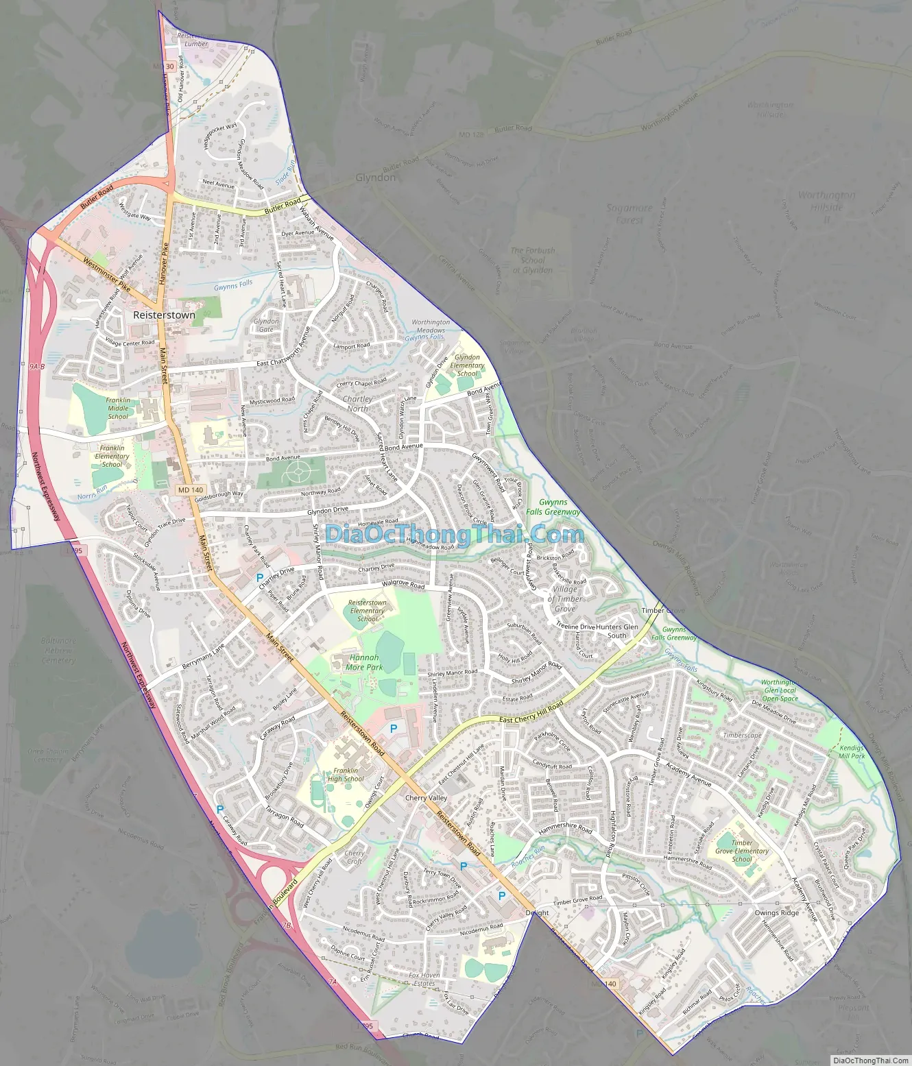
Online Interactive Map
Click on ![]() to view map in "full screen" mode.
to view map in "full screen" mode.
Reisterstown location map. Where is Reisterstown CDP?

History
Reister’s Town
John Reister purchased a 20-acre (81,000 m) tract of land, which he called “Reister’s Desire”, along the Conewago Road on March 2, 1758. He built a tavern on the site, providing food, drink and lodging for travelers. Other businesses serving travelers soon followed, creating the settlement known as Reister’s Town, and eventually Reisterstown. With the purchase in 1763 of another 83 acres (340,000 m) adjoining the original property, Reister began developing both sides of Conewago Road, later renamed Reisterstown Road.
Franklin Academy
In 1764, John Reister purchased a three-quarter acre lot, which he named Church Hill, as a site for the community’s first church, a small building constructed of logs. Funded and built by the Lutheran community, the church was free to all denominations. The building also served as a school house, a secondary function typical of churches at that time.
The town raised money with a public subscription and replaced the log building with a brick school building in 1824, named Franklin Academy in honor of Benjamin Franklin. A cupola was added to the school in 1826. Franklin Academy became the first public high school in the county in 1874 and one of the earliest schools to join the Baltimore County school system.
The former Franklin Academy was converted into a public library in the early 1900s. It still stands beside the Reisterstown Community Cemetery, across the street from the present-day Franklin Middle School. Franklin Academy’s cupola, known as the Franklin Bell, is in front of Franklin High School.
Reisterstown Road Map
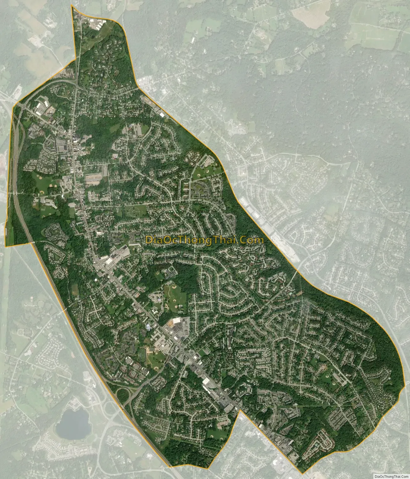
Reisterstown city Satellite Map
Geography
According to the U.S. Census Bureau, the Reisterstown CDP occupies 5.2 square miles (13.4 km), all land.
The community stretches along Reisterstown Road (Maryland Route 140) and the Northwestern Expressway (Interstate 795) just north of Owings Mills. Its northern boundary lies near the junction of MD-140 and Hanover Pike (MD-30), which heads north towards Hampstead. MD-140 passes the northern end of I-795 and continues northwest as Westminster Pike, heading towards Finksburg and Westminster. The community of Glyndon is located adjacent to the northern portion of Reisterstown along Butler Road (MD-128), which connects Reisterstown with the Baltimore-Harrisburg Expressway (Interstate 83). To the east of Reisterstown is the community of Worthington, located around Greenspring Avenue and Park Heights Avenue (MD-129). To the west of Reisterstown is Liberty Reservoir.
See also
Map of Maryland State and its subdivision: Map of other states:- Alabama
- Alaska
- Arizona
- Arkansas
- California
- Colorado
- Connecticut
- Delaware
- District of Columbia
- Florida
- Georgia
- Hawaii
- Idaho
- Illinois
- Indiana
- Iowa
- Kansas
- Kentucky
- Louisiana
- Maine
- Maryland
- Massachusetts
- Michigan
- Minnesota
- Mississippi
- Missouri
- Montana
- Nebraska
- Nevada
- New Hampshire
- New Jersey
- New Mexico
- New York
- North Carolina
- North Dakota
- Ohio
- Oklahoma
- Oregon
- Pennsylvania
- Rhode Island
- South Carolina
- South Dakota
- Tennessee
- Texas
- Utah
- Vermont
- Virginia
- Washington
- West Virginia
- Wisconsin
- Wyoming


