Map of Prospect borough, Pennsylvania
Prospect is a borough in Butler County, Pennsylvania, United States. As of the 2010 census, the borough had a population of 1,169. Prospect borough overview: Name: Prospect borough LSAD Code: 21 LSAD Description: borough (suffix) State: Pennsylvania County: Butler County Incorporated: 1825 Total Area: 4.08 sq mi (10.57 km²) Land Area: 4.08 sq mi (10.57 km²) Water Area: 0.00 sq mi (0.00 km²) Total ... Read more
Map of Prospect borough, Pennsylvania
Map of Prospect Park CDP, Pennsylvania
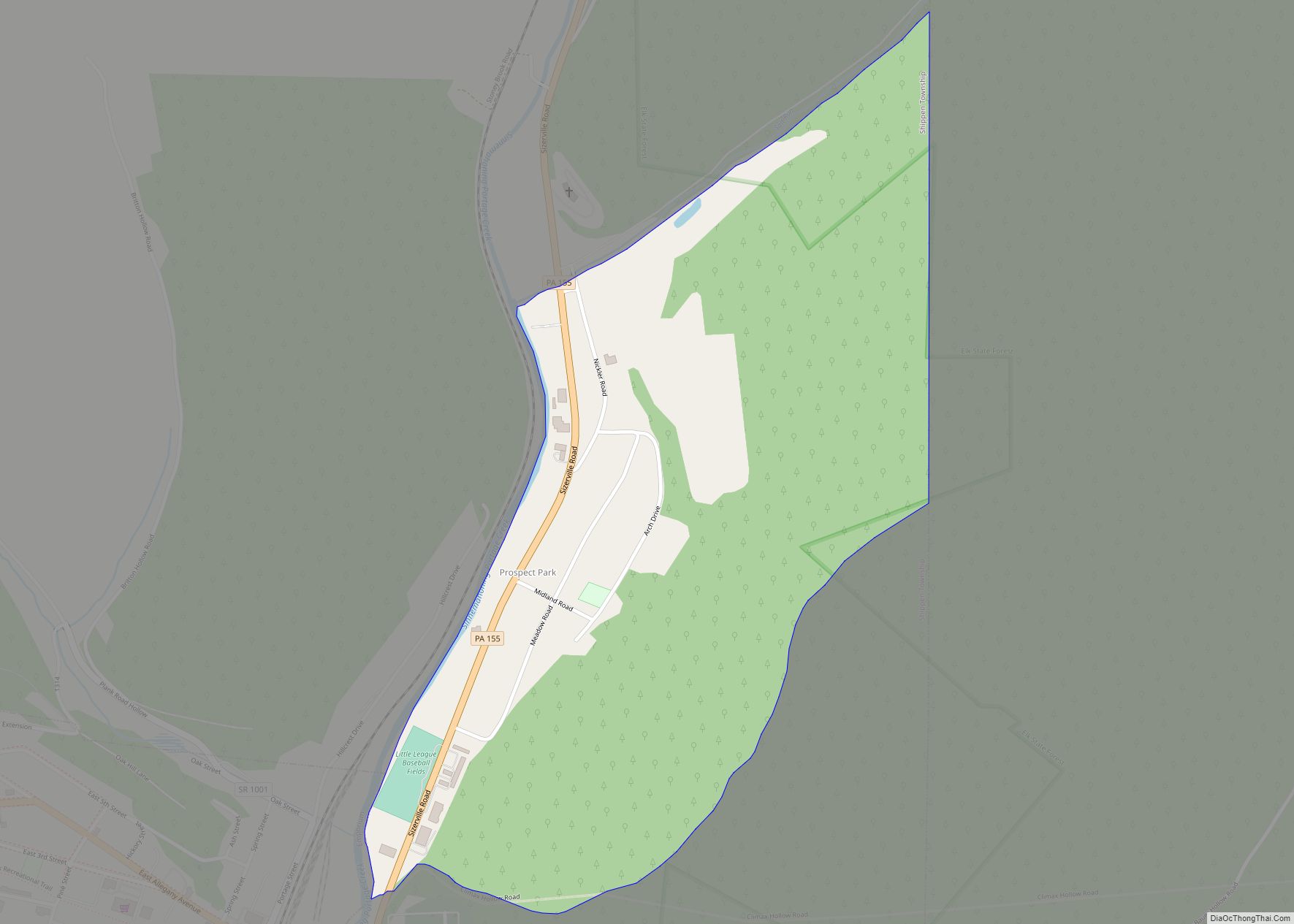
Prospect Park is an unincorporated community and census-designated place in Shippen Township, Cameron County, Pennsylvania, United States. It is located along Pennsylvania Route 155 just east of the borough of Emporium. As of the 2010 census, the population in Prospect Park was 327 residents. Prospect Park CDP overview: Name: Prospect Park CDP LSAD Code: 57 ... Read more
Map of Prospect Park CDP, Pennsylvania
Map of Prompton borough
Prompton is a borough that is located in Wayne County, Pennsylvania, United States. The population was 250 at the time of the 2010 census. Prompton borough overview: Name: Prompton borough LSAD Code: 21 LSAD Description: borough (suffix) State: Pennsylvania County: Wayne County Elevation: 1,234 ft (376 m) Total Area: 1.67 sq mi (4.32 km²) Land Area: 1.53 sq mi (3.97 km²) Water Area: ... Read more
Map of Prompton borough
Map of Progress CDP
Progress /ˈproʊɡrɛs/ is an unincorporated community and census-designated place (CDP) mainly in Susquehanna Township but also in Lower Paxton Township, Dauphin County, Pennsylvania, United States. The population was 9,765 at the 2010 census. It is part of the Harrisburg–Carlisle Metropolitan Statistical Area. Progress was named for the progressive spirit of its original inhabitants. Progress CDP ... Read more
Map of Progress CDP
Map of Pringle borough, Pennsylvania
Pringle is a borough in Luzerne County, Pennsylvania, United States. As of the 2020 census, the borough population was eight hundred and ninety-one. Pringle borough overview: Name: Pringle borough LSAD Code: 21 LSAD Description: borough (suffix) State: Pennsylvania County: Luzerne County Incorporated: 1914 Total Area: 0.46 sq mi (1.19 km²) Land Area: 0.46 sq mi (1.19 km²) Water Area: 0.00 sq mi (0.00 km²) ... Read more
Map of Pringle borough, Pennsylvania
Map of Pottsville city, Pennsylvania
Pottsville is the county seat of Schuylkill County, Pennsylvania, United States. The population was 13,346 at the 2020 census, and is the principal city of the Pottsville, PA Micropolitan Statistical Area. The city lies along the west bank of the Schuylkill River, 52 miles (84 km) south of Wilkes-Barre. It is located in Pennsylvania’s Coal Region. ... Read more
Map of Pottsville city, Pennsylvania
Map of Pottstown borough
Pottstown is a borough in Montgomery County, Pennsylvania, United States. Pottstown was laid out in 1752–53 and named Pottsgrove in honor of its founder, John Potts. The old name was abandoned at the time of the incorporation as a borough in 1815. In 1888, the limits of the borough were considerably extended. Pottstown is the ... Read more
Map of Pottstown borough
Map of Pottsgrove CDP
Pottsgrove is a census-designated place (CDP) in Montgomery County, Pennsylvania, United States. The population was 3,469 at the 2010 census. Pottsgrove CDP overview: Name: Pottsgrove CDP LSAD Code: 57 LSAD Description: CDP (suffix) State: Pennsylvania County: Montgomery County Elevation: 256 ft (78 m) Total Area: 2.77 sq mi (7.16 km²) Land Area: 2.77 sq mi (7.16 km²) Water Area: 0.00 sq mi (0.00 km²) Total Population: ... Read more
Map of Pottsgrove CDP
Map of Pymatuning South CDP
Pymatuning South is a census-designated place (CDP) in Crawford County, Pennsylvania, United States. The population was 479 at the 2010 census. Pymatuning South CDP overview: Name: Pymatuning South CDP LSAD Code: 57 LSAD Description: CDP (suffix) State: Pennsylvania County: Crawford County Total Area: 2.60 sq mi (6.74 km²) Land Area: 2.59 sq mi (6.71 km²) Water Area: 0.01 sq mi (0.03 km²) Total Population: ... Read more
Map of Pymatuning South CDP
Map of Pymatuning North CDP
Pymatuning North is a census-designated place (CDP) in Crawford County, Pennsylvania, United States. The population was 311 at the 2010 census. Pymatuning North CDP overview: Name: Pymatuning North CDP LSAD Code: 57 LSAD Description: CDP (suffix) State: Pennsylvania County: Crawford County Elevation: 1,060 ft (320 m) Total Area: 1.91 sq mi (4.94 km²) Land Area: 1.90 sq mi (4.93 km²) Water Area: 0.00 sq mi ... Read more
Map of Pymatuning North CDP
Map of Ramey borough
Ramey is a borough in Clearfield County, Pennsylvania, United States. The population was 436 at the 2020 census. Ramey borough overview: Name: Ramey borough LSAD Code: 21 LSAD Description: borough (suffix) State: Pennsylvania County: Clearfield County Incorporated: 1878 Elevation: 1,613 ft (492 m) Total Area: 0.93 sq mi (2.41 km²) Land Area: 0.93 sq mi (2.40 km²) Water Area: 0.00 sq mi (0.01 km²) Total Population: ... Read more
Map of Ramey borough
Map of Ramblewood CDP, Pennsylvania
Ramblewood is an unincorporated area and census-designated place (CDP) in Centre County, Pennsylvania, United States. It is part of the State College, Pennsylvania Metropolitan Statistical Area. The population was 849 at the 2010 census. Ramblewood CDP overview: Name: Ramblewood CDP LSAD Code: 57 LSAD Description: CDP (suffix) State: Pennsylvania County: Centre County Elevation: 1,240 ft (380 m) ... Read more
Map of Ramblewood CDP, Pennsylvania