Wyndmoor is a census-designated place (CDP) in Springfield Township, Montgomery County, Pennsylvania, United States. The population was 5,498 at the 2010 census. Wyndmoor has the same ZIP code, 19038, as the towns of Glenside, North Hills, and Erdenheim. Wyndmoor CDP overview: Name: Wyndmoor CDP LSAD Code: 57 LSAD Description: CDP (suffix) State: Pennsylvania County: Montgomery ... Read more
Pennsylvania Cities and Places
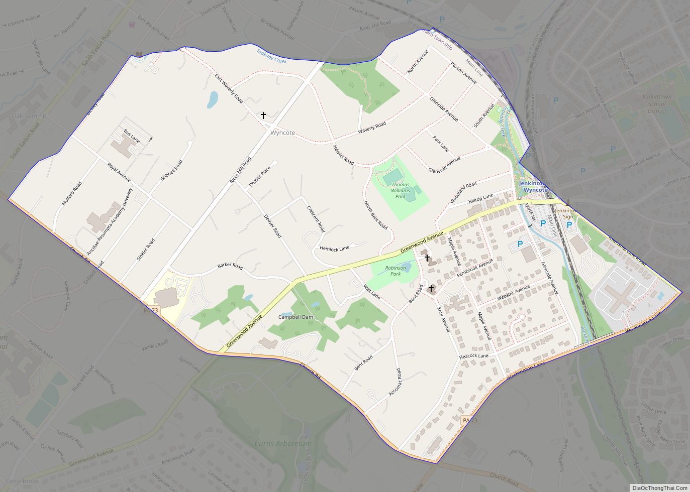
Wyncote is a census-designated place (CDP) in Cheltenham Township, Montgomery County, Pennsylvania. It borders the northwestern and northeastern section of Philadelphia. Wyncote is located 11 miles from Center City Philadelphia at the southeasternmost tip of Montgomery County. The Jenkintown-Wyncote SEPTA station is the fifth busiest regional rail station in the SEPTA system. Wyncote is bordered ... Read more
Wylandville is a census-designated place located in North Strabane Township, Washington County in the state of Pennsylvania, United States. The community is located in northern Washington County along Pennsylvania Route 519. As of the 2010 census the population was 391 residents. Wylandville CDP overview: Name: Wylandville CDP LSAD Code: 57 LSAD Description: CDP (suffix) State: ... Read more
Wyano is a census-designated place located in South Huntingdon Township, Westmoreland County in the state of Pennsylvania, United States. The community is located just to west of Interstate 70. As of the 2010 census the population was 484 residents. Wyano CDP overview: Name: Wyano CDP LSAD Code: 57 LSAD Description: CDP (suffix) State: Pennsylvania County: ... Read more
Wyalusing is a borough in Bradford County, Pennsylvania, United States. It is part of Northeastern Pennsylvania. The population was 596 as of the 2010 census. Wyalusing borough overview: Name: Wyalusing borough LSAD Code: 21 LSAD Description: borough (suffix) State: Pennsylvania County: Bradford County Elevation: 705 ft (215 m) Total Area: 0.79 sq mi (2.06 km²) Land Area: 0.73 sq mi (1.88 km²) Water ... Read more
Wrightsville is a borough in York County, Pennsylvania, United States. The population was 2,257 at the 2020 census. Wrightsville borough has a police department, historic society and a volunteer fire company. Wrightsville borough overview: Name: Wrightsville borough LSAD Code: 21 LSAD Description: borough (suffix) State: Pennsylvania County: York County Incorporated: 1834 Elevation: 390 ft (120 m) Total ... Read more
Woxall or sometimes Woxhall is a census-designated place (CDP) in Upper Salford Township, Montgomery County, Pennsylvania, United States. It is located on the eastern side of the Perkiomen Creek, which flows south into the Schuylkill River. The population was 1,318 at the 2010 census. The CDP is served by the Harleysville post office, with the ... Read more
Worthville is a borough in Jefferson County, Pennsylvania, United States. The population was sixty-seven at the time of the 2010 census, a decline from the figure of eighty-five, which had been tabulated in 2000. The borough is named for General William Jenkins Worth, and is the smallest municipality in Jefferson County. Worthville borough overview: Name: ... Read more
Yeagertown is a census-designated place (CDP) in Mifflin County, Pennsylvania, United States. The population was 1,035 at the 2000 census. Yeagertown CDP overview: Name: Yeagertown CDP LSAD Code: 57 LSAD Description: CDP (suffix) State: Pennsylvania County: Mifflin County Total Area: 0.5 sq mi (1.2 km²) Land Area: 0.5 sq mi (1.2 km²) Total Population: 1,035 Population Density: 2,200/sq mi (860/km²) ZIP code: ... Read more
Yeadon is a borough in Delaware County, Pennsylvania, United States. It borders the city of Philadelphia. The population was 11,443 at the 2010 census. Yeadon borough overview: Name: Yeadon borough LSAD Code: 21 LSAD Description: borough (suffix) State: Pennsylvania County: Delaware County Incorporated: 1893 Elevation: 69 ft (21 m) Total Area: 1.59 sq mi (4.13 km²) Land Area: 1.59 sq mi (4.13 km²) ... Read more
Yatesville borough overview: Name: Yatesville borough LSAD Code: 21 LSAD Description: borough (suffix) State: Pennsylvania County: Luzerne County FIPS code: 4286952 Online Interactive Map Yatesville online map. Source: Basemap layers from Google Map, Open Street Map (OSM), Arcgisonline, Wmflabs. Boundary Data from Database of Global Administrative Areas. Yatesville location map. Where is Yatesville borough? Yatesville ... Read more
Yardley is a borough in Bucks County, Pennsylvania. Yardley borders the Delaware River and Ewing, New Jersey to its east and Lower Makefield Township to its north, west, and south. The United States Post Office assigns many addresses in Lower Makefield Township the preferred city of “Yardley”, although they are outside the borough. The population ... Read more