Carbondale is a city in Lackawanna County, Pennsylvania, United States. Carbondale is located approximately 15 miles due northeast of the city of Scranton in Northeastern Pennsylvania. The population was 8,828 at the 2020 census. The land area that became Carbondale was developed by William and Maurice Wurts, the founders of the Delaware and Hudson Canal ... Read more
Pennsylvania Cities and Places
Canton is a borough in Bradford County, Pennsylvania, United States. It is part of Northeastern Pennsylvania. The population was 1,723 at the 2020 census. Canton borough overview: Name: Canton borough LSAD Code: 21 LSAD Description: borough (suffix) State: Pennsylvania County: Bradford County Incorporated: 1864 Elevation: 1,266 ft (386 m) Total Area: 1.16 sq mi (3.00 km²) Land Area: 1.15 sq mi (2.98 km²) ... Read more
Canonsburg is a borough in Washington County, Pennsylvania, United States, 18 miles (29 km) southwest of Pittsburgh. The population was 9,735 at the 2020 census. Canonsburg was laid out by Colonel John Canon in 1789 and incorporated in 1802. The town lies in a rich coal district, and most of the town’s work force once worked ... Read more
Canadohta Lake is a census-designated place (CDP) in Crawford County, Pennsylvania, United States. The population was 516 at the 2010 census. Canadohta Lake CDP overview: Name: Canadohta Lake CDP LSAD Code: 57 LSAD Description: CDP (suffix) State: Pennsylvania County: Crawford County Elevation: 1,395 ft (425 m) Total Area: 1.46 sq mi (3.78 km²) Land Area: 1.20 sq mi (3.10 km²) Water Area: 0.27 sq mi ... Read more
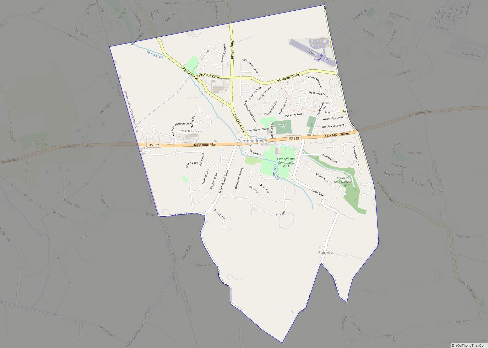
Campbelltown is an unincorporated community and census-designated place (CDP) in Lebanon County, Pennsylvania, United States. The population was 3,616 at the 2010 census. It is located east of Hershey at the intersection of U.S. Route 322 and Pennsylvania Route 117 and is located in the Harrisburg metropolitan area. Campbelltown CDP overview: Name: Campbelltown CDP LSAD ... Read more
Camp Hill is a borough in Cumberland County, Pennsylvania, United States. It is 3 miles (5 km) southwest of Harrisburg and is part of the Harrisburg–Carlisle metropolitan statistical area. The population was 7,888 at the 2010 census. There are many large corporations based in nearby East Pennsboro Township and Wormleysburg that use the Camp Hill postal ... Read more
Carroll Valley is a borough in Adams County, Pennsylvania, United States. The population was 3,940 at the 2020 census. Carroll Valley borough overview: Name: Carroll Valley borough LSAD Code: 21 LSAD Description: borough (suffix) State: Pennsylvania County: Adams County Incorporated: 1974 Elevation: 807 ft (246 m) Total Area: 5.45 sq mi (14.12 km²) Land Area: 5.38 sq mi (13.93 km²) Water Area: 0.07 sq mi ... Read more
Catawissa is a borough in Columbia County, Pennsylvania, United States. It is part of Northeastern Pennsylvania. The population was 1,539 at the 2020 census. It is part of the Bloomsburg-Berwick micropolitan area. Catawissa is twinned with Uxbridge, Ontario. The historic link began in 1805, when the Uxbridge area was granted by the British crown to ... Read more
Catasauqua, referred to colloquially as Catty, is a borough in Lehigh County, Pennsylvania. Catasauqua’s population was 6,518 at the 2020 census. It is a suburb of Allentown in the Lehigh Valley, which had a population of 861,899 and was the 68th-most populous metropolitan area in the U.S. as of the 2020 census. In 1839, Catasauqua ... Read more
Castle Shannon is a borough in Allegheny County, Pennsylvania, United States, and is part of the Pittsburgh Metro Area. The population was 8,249 at the 2020 census. Castle Shannon borough overview: Name: Castle Shannon borough LSAD Code: 21 LSAD Description: borough (suffix) State: Pennsylvania County: Allegheny County Incorporated: December 20, 1919 Elevation: 1,040 ft (320 m) Total ... Read more
Castanea is a census-designated place (CDP) in Castanea Township, Clinton County, Pennsylvania, United States. The population was 1,125 at the 2010 census. Castanea CDP overview: Name: Castanea CDP LSAD Code: 57 LSAD Description: CDP (suffix) State: Pennsylvania County: Clinton County Elevation: 600 ft (200 m) Total Area: 1.39 sq mi (3.60 km²) Land Area: 1.36 sq mi (3.53 km²) Water Area: 0.03 sq mi (0.07 km²) ... Read more
Cassville borough overview: Name: Cassville borough LSAD Code: 21 LSAD Description: borough (suffix) State: Pennsylvania County: Huntingdon County FIPS code: 4211632 Online Interactive Map Cassville online map. Source: Basemap layers from Google Map, Open Street Map (OSM), Arcgisonline, Wmflabs. Boundary Data from Database of Global Administrative Areas. Cassville location map. Where is Cassville borough? Cassville ... Read more