Map of Forty Fort borough
Forty Fort is a borough in Luzerne County, Pennsylvania, United States. The population was 4,233 at the 2020 census. Its neighbors are Wyoming (to the north), Plains Township (to the east), Kingston (to the south), and Swoyersville (to the west). The Wilkes-Barre Wyoming Valley Airport and the Wyoming Seminary Lower School are both located in ... Read more
Map of Forty Fort borough
Map of Fort Washington CDP, Pennsylvania
Fort Washington is a census-designated place and suburb of Philadelphia in Montgomery County, Pennsylvania, United States. The population was 5,446 at the 2010 census. Fort Washington CDP overview: Name: Fort Washington CDP LSAD Code: 57 LSAD Description: CDP (suffix) State: Pennsylvania County: Montgomery County Elevation: 233 ft (71 m) Total Area: 3.25 sq mi (8.43 km²) Land Area: 3.25 sq mi (8.43 km²) ... Read more
Map of Fort Washington CDP, Pennsylvania
Map of Fort Loudon CDP
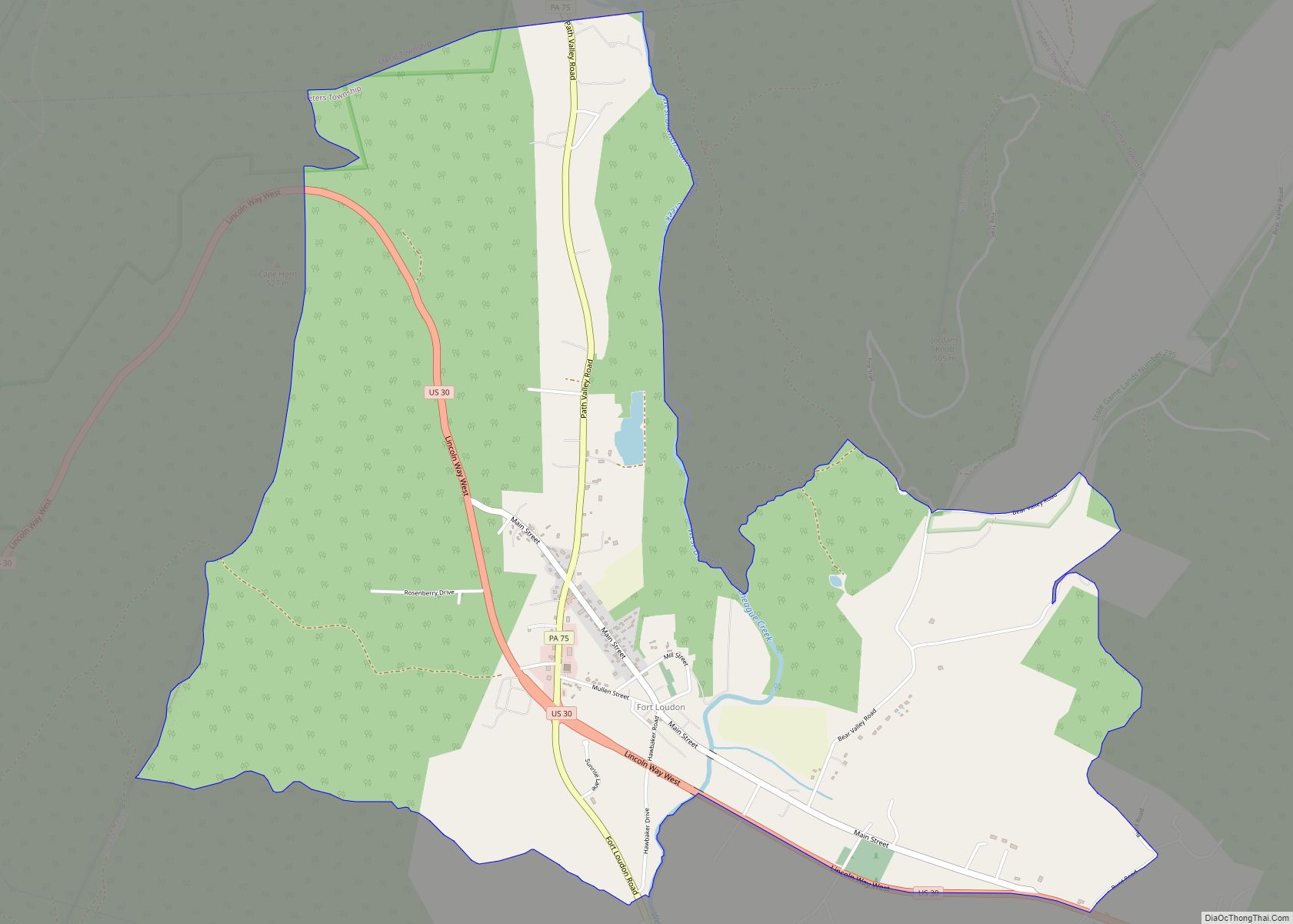
Fort Loudon (CDP) is an unincorporated community and census-designated place (CDP) in Peters Township, Franklin County, Pennsylvania, United States. As of the 2020 census, the population was 895. Fort Loudon CDP overview: Name: Fort Loudon CDP LSAD Code: 57 LSAD Description: CDP (suffix) State: Pennsylvania County: Franklin County Elevation: 635 ft (194 m) Total Area: 4.26 sq mi (11.03 km²) ... Read more
Map of Fort Loudon CDP
Map of Fort Indiantown Gap CDP
Fort Indiantown Gap, also referred to as “The Gap” or “FIG”, is a census-designated place and National Guard Training Center primarily located in Lebanon County, Pennsylvania, United States. A portion of the installation is located in eastern Dauphin County. It is located adjacent to Interstate 81, 23 miles (37 km) northeast of Harrisburg, just north of ... Read more
Map of Fort Indiantown Gap CDP
Map of Franklintown borough
Franklintown is a borough in York County, Pennsylvania, United States. The population was 511 at the 2020 census. Franklintown borough overview: Name: Franklintown borough LSAD Code: 21 LSAD Description: borough (suffix) State: Pennsylvania County: York County Incorporated: 1869 Elevation: 367 ft (112 m) Total Area: 0.26 sq mi (0.66 km²) Land Area: 0.26 sq mi (0.66 km²) Water Area: 0.00 sq mi (0.00 km²) Total Population: ... Read more
Map of Franklintown borough
Map of Franklin borough, Pennsylvania
Franklin is a city and the county seat of Venango County, Pennsylvania. The population was 6,097 in the 2020 census. Franklin is part of the Oil City, PA Micropolitan Statistical Area. Franklin is known for its three-day autumn festival in October, Applefest, which attracts hundreds of thousands of visitors. Franklin borough overview: Name: Franklin borough ... Read more
Map of Franklin borough, Pennsylvania
Map of Franklin Park borough, Pennsylvania
Franklin Park is a borough in Allegheny County, Pennsylvania, United States. The population was 15,479 at the 2020 census. It is a suburb of the Pittsburgh metropolitan area. Franklin Park borough overview: Name: Franklin Park borough LSAD Code: 21 LSAD Description: borough (suffix) State: Pennsylvania County: Allegheny County Elevation: 1,260 ft (384 m) Total Area: 13.54 sq mi (35.08 km²) ... Read more
Map of Franklin Park borough, Pennsylvania
Map of Frankfort Springs borough
Frankfort Springs is a borough in southern Beaver County, Pennsylvania, United States. The population was 117 at the 2020 census. It is a part of the Pittsburgh metropolitan area. Frankfort Springs borough overview: Name: Frankfort Springs borough LSAD Code: 21 LSAD Description: borough (suffix) State: Pennsylvania County: Beaver County Incorporated: 1844 Elevation: 1,122 ft (342 m) Total ... Read more
Map of Frankfort Springs borough
Map of Frackville borough
Frackville is a borough in Schuylkill County, Pennsylvania, United States, incorporated in 1876. Today, the intersection of Interstate 81 and Pennsylvania State Route 61 is located near the borough, which is approximately 102 miles (164 km) northwest of Philadelphia and 60 miles (97 km) southwest of Scranton. Frackville is named for Daniel Frack, an early Anglo-American settler. ... Read more
Map of Frackville borough
Map of Foxburg borough
Foxburg is a borough in Clarion County, Pennsylvania, United States. It is located along the east bank of the Allegheny River, about 2 miles (3 km) north of the mouth of the Clarion River. As of the 2020 census it had a population of 181. Foxburg borough overview: Name: Foxburg borough LSAD Code: 21 LSAD Description: ... Read more
Map of Foxburg borough
Map of Fox Chase CDP, Pennsylvania
Fox Chase is a census-designated place in Muhlenberg Township, Berks County, Pennsylvania, United States. It is located approximately four miles north of the city of Reading along the Schuylkill River. As of the 2010 census, the population was 1,622 residents. Fox Chase CDP overview: Name: Fox Chase CDP LSAD Code: 57 LSAD Description: CDP (suffix) ... Read more
Map of Fox Chase CDP, Pennsylvania
Map of Fox Chapel borough
Fox Chapel is a borough in Allegheny County, Pennsylvania, United States, and is an affluent suburb of Pittsburgh located 6 miles (10 km) northeast of downtown. The borough continually garners national prominence and is home to many of the wealthiest and most powerful patriciate families in Pennsylvania. The population was 5,343 as of the 2020 census. ... Read more
Map of Fox Chapel borough