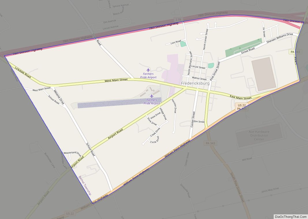
Fredericksburg is an unincorporated community and census-designated place (CDP) in Bethel Township, Lebanon County, Pennsylvania, United States. The population was 1,784 at the 2020 census, up from 1,357 at the 2010 census and 987 at the 2000 census.
| Name: | Fredericksburg CDP |
|---|---|
| LSAD Code: | 57 |
| LSAD Description: | CDP (suffix) |
| State: | Pennsylvania |
| County: | Lebanon County |
| Elevation: | 478 ft (146 m) |
| Total Area: | 1.92 sq mi (4.97 km²) |
| Land Area: | 1.92 sq mi (4.97 km²) |
| Water Area: | 0.00 sq mi (0.00 km²) |
| Total Population: | 1,448 |
| Population Density: | 754.95/sq mi (291.43/km²) |
| ZIP code: | 17026 |
| Area code: | 717 |
| FIPS code: | 4227656 |
| GNISfeature ID: | 1175193 |
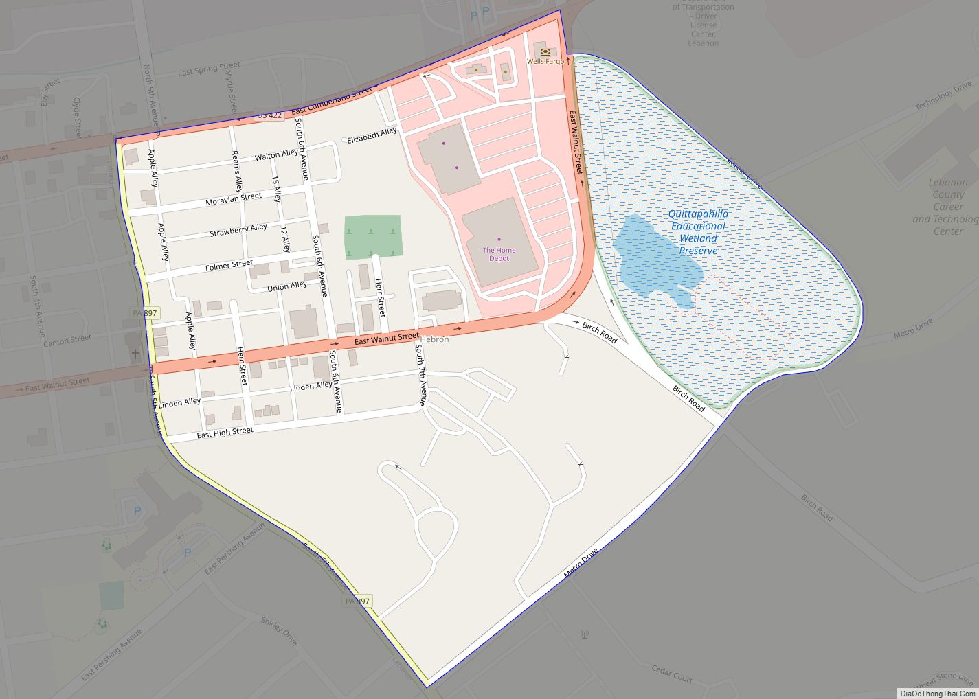
Online Interactive Map
Click on ![]() to view map in "full screen" mode.
to view map in "full screen" mode.
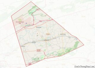
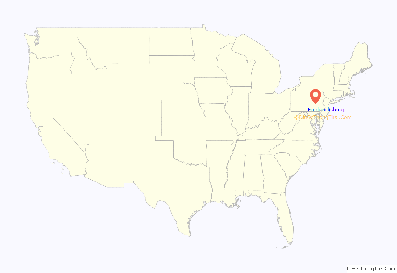
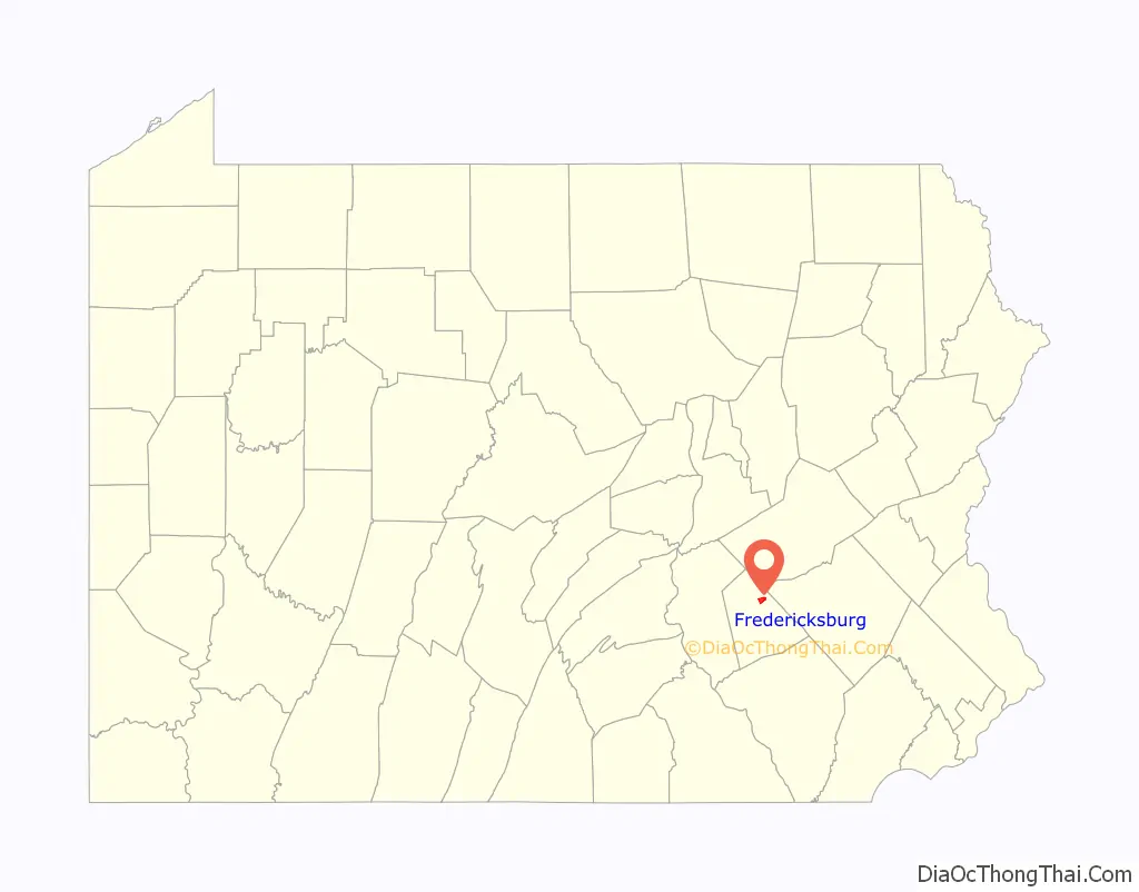
Fredericksburg location map. Where is Fredericksburg CDP?
History
Fredericksburg was originally called “Stumptown” after a disreputable settler named Frederick Stump, who founded the town in 1755, and reportedly massacred an encampment of ten inebriated Indians one winter and sent their bodies down the Susquehanna.
Fredericksburg was the birthplace of James Lick, a pianomaker who moved to San Francisco and invested in real estate just before the Gold Rush. Lick had become the wealthiest man in California by the time of his death, leaving his large fortune to philanthropic causes.
Fredericksburg was the birthplace of Clayton Mark, the prominent steel magnate, in 1858. Mark was the founder of the planned worker community of Marktown, Indiana.
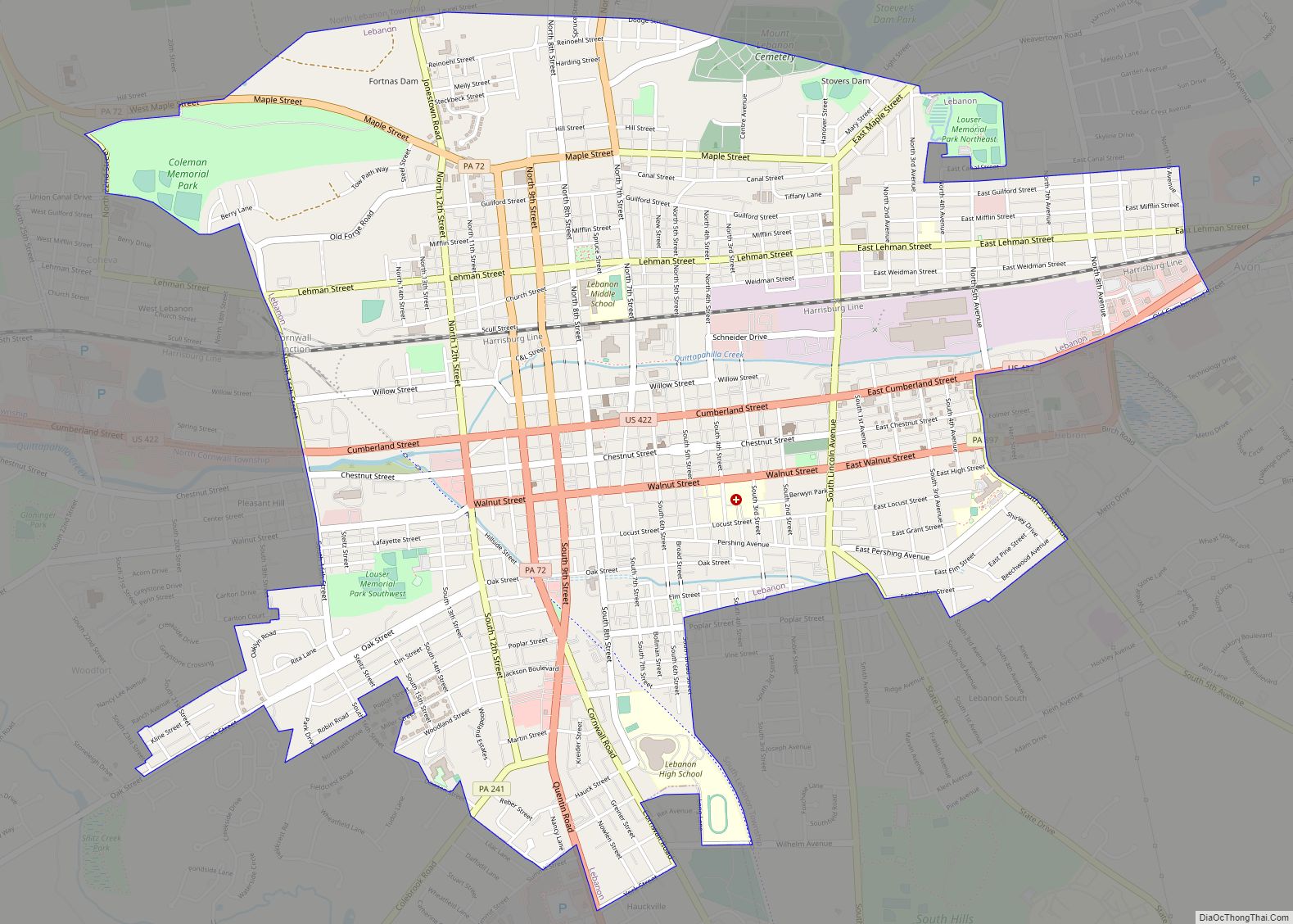
Fredericksburg Road Map
Fredericksburg city Satellite Map

Geography
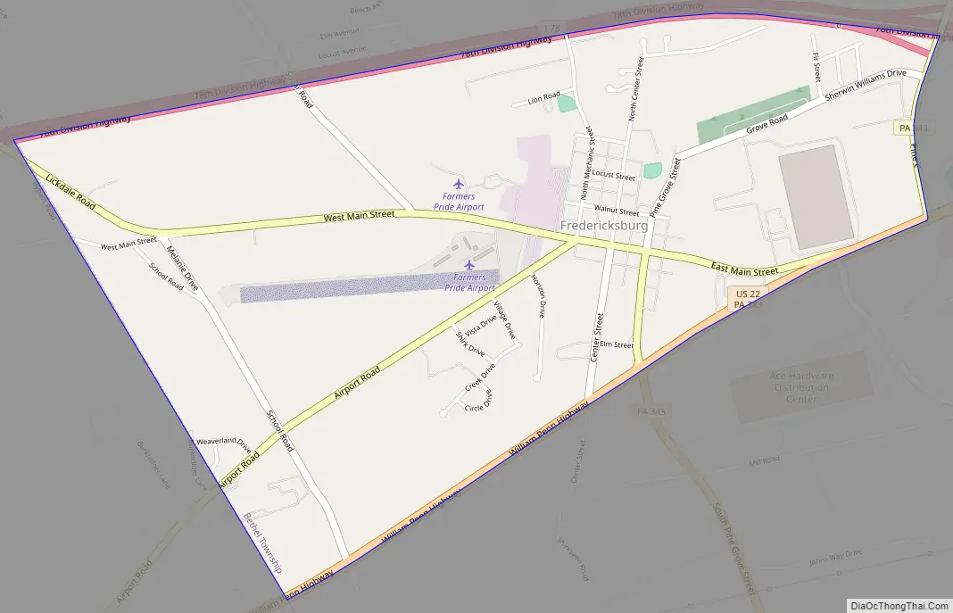
Fredericksburg is located in northeastern Lebanon County, in the west-central part of Bethel Township. Interstate 78 forms the northern edge of the community, and U.S. Route 22 forms the southern edge. The two highways join just east of the community. I-78 leads east 52 miles (84 km) to Allentown and west 5 miles (8 km) to its terminus at Interstate 81, which continues southwest 22 miles (35 km) to Harrisburg, the state capital. US-22 westbound parallels I-78 and I-81 to Harrisburg, passing just north of Jonestown. Pennsylvania Route 343 leads south from Fredericksburg 8 miles (13 km) to Lebanon, the county seat.
According to the United States Census Bureau, the Fredericksburg CDP has a total area of 1.9 square miles (5.0 km), all land. The community is drained by Deep Run and Beach Run, which join south of the town to form Elizabeth Run, a tributary of Little Swatara Creek and part of the Susquehanna River watershed.
Farmers Pride Airport is a landing strip in Fredericksburg.
See also
Map of Pennsylvania State and its subdivision:- Adams
- Allegheny
- Armstrong
- Beaver
- Bedford
- Berks
- Blair
- Bradford
- Bucks
- Butler
- Cambria
- Cameron
- Carbon
- Centre
- Chester
- Clarion
- Clearfield
- Clinton
- Columbia
- Crawford
- Cumberland
- Dauphin
- Delaware
- Elk
- Erie
- Fayette
- Forest
- Franklin
- Fulton
- Greene
- Huntingdon
- Indiana
- Jefferson
- Juniata
- Lackawanna
- Lancaster
- Lawrence
- Lebanon
- Lehigh
- Luzerne
- Lycoming
- Mc Kean
- Mercer
- Mifflin
- Monroe
- Montgomery
- Montour
- Northampton
- Northumberland
- Perry
- Philadelphia
- Pike
- Potter
- Schuylkill
- Snyder
- Somerset
- Sullivan
- Susquehanna
- Tioga
- Union
- Venango
- Warren
- Washington
- Wayne
- Westmoreland
- Wyoming
- York
- Alabama
- Alaska
- Arizona
- Arkansas
- California
- Colorado
- Connecticut
- Delaware
- District of Columbia
- Florida
- Georgia
- Hawaii
- Idaho
- Illinois
- Indiana
- Iowa
- Kansas
- Kentucky
- Louisiana
- Maine
- Maryland
- Massachusetts
- Michigan
- Minnesota
- Mississippi
- Missouri
- Montana
- Nebraska
- Nevada
- New Hampshire
- New Jersey
- New Mexico
- New York
- North Carolina
- North Dakota
- Ohio
- Oklahoma
- Oregon
- Pennsylvania
- Rhode Island
- South Carolina
- South Dakota
- Tennessee
- Texas
- Utah
- Vermont
- Virginia
- Washington
- West Virginia
- Wisconsin
- Wyoming