Map of Kerrtown CDP
Kerrtown is a census-designated place located in Vernon Township, Crawford County, Pennsylvania, United States, at the intersection of U.S. Routes 6/19/322 and Pennsylvania Route 102, just west of the city of Meadville. At the 2010 census, the population was 305. Kerrtown CDP overview: Name: Kerrtown CDP LSAD Code: 57 LSAD Description: CDP (suffix) State: Pennsylvania ... Read more
Map of Kerrtown CDP
Map of Kennett Square borough
Kennett Square is a borough in Chester County, Pennsylvania, United States. As of the 2020 U.S. census, Kennett Square had a population of 5,943. Kennett Square is located in the Delaware Valley and considered a suburb of both Philadelphia, the nation’s sixth largest city as of 2020, and Wilmington, Delaware. The local high school is ... Read more
Map of Kennett Square borough
Map of Kennerdell CDP
Kennerdell is a census-designated place located in Rockland Township, Venango County in the state of Pennsylvania. The community is located in southern Venango County along the Allegheny River. As of the 2010 census the population was 247 residents. Long before the arrival of the railroad, Kennerdell was a busy trade stop along the Allegheny River ... Read more
Map of Kennerdell CDP
Map of Kenmar CDP
Kenmar is a census-designated place (CDP) in Loyalsock Township, Lycoming County, Pennsylvania, United States. As of the 2010 census, it had a population of 4,124. Kenmar is not a separately incorporated community, but is a part of Loyalsock Township (which is a municipality under Pennsylvania law). Kenmar is bordered by Four Mile Drive to the ... Read more
Map of Kenmar CDP
Map of Kenilworth CDP, Pennsylvania
Kenilworth is a census-designated place (CDP) in North Coventry Township, Chester County, Pennsylvania, United States. The population was 2,148 at the 2020 census. Kenilworth CDP overview: Name: Kenilworth CDP LSAD Code: 57 LSAD Description: CDP (suffix) State: Pennsylvania County: Chester County Elevation: 177 ft (54 m) Total Area: 1.75 sq mi (4.52 km²) Land Area: 1.71 sq mi (4.42 km²) Water Area: 0.04 sq mi ... Read more
Map of Kenilworth CDP, Pennsylvania
Map of Kenhorst borough
Kenhorst (/ˈkɛnhərst/ KEN-hərst) is a borough in Berks County, Pennsylvania, United States. The population was 2,877 at the 2010 census. Kenhorst borough overview: Name: Kenhorst borough LSAD Code: 21 LSAD Description: borough (suffix) State: Pennsylvania County: Berks County Founded: August 25, 1931 Elevation: 344 ft (105 m) Total Area: 0.59 sq mi (1.52 km²) Land Area: 0.59 sq mi (1.52 km²) Water Area: ... Read more
Map of Kenhorst borough
Map of Kempton CDP, Pennsylvania
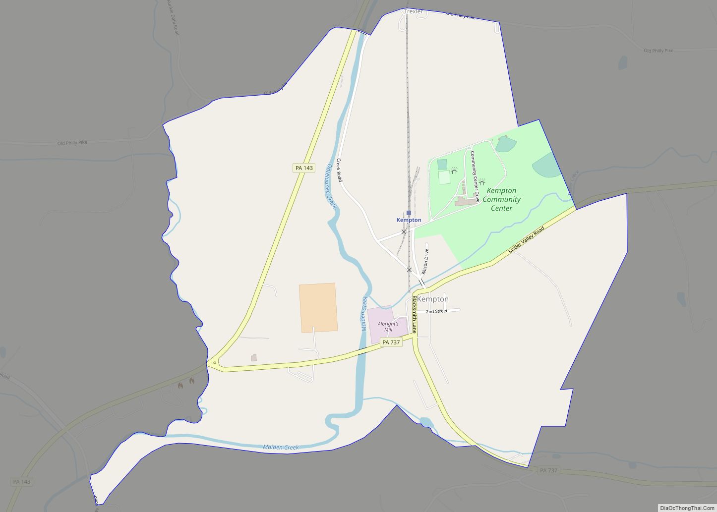
Kempton is a census-designated place in Albany Township, Berks County, Pennsylvania. Kempton CDP overview: Name: Kempton CDP LSAD Code: 57 LSAD Description: CDP (suffix) State: Pennsylvania County: Berks County Elevation: 427 ft (130 m) Total Area: 0.80 sq mi (2.07 km²) Land Area: 0.79 sq mi (2.05 km²) Water Area: 0.01 sq mi (0.02 km²) Total Population: 159 Population Density: 200.50/sq mi (77.39/km²) ZIP code: 19529 Area ... Read more
Map of Kempton CDP, Pennsylvania
Map of Kelayres CDP
Kelayres is a census-designated place in Kline Township, Schuylkill County, Pennsylvania, United States on Broad Mountain, just west of McAdoo. Reservoir Number 8 is just west of Kelayres and drains northward into the Catawissa Creek, a tributary of the Susquehanna River. It is served by the Hazleton Area School District. The local pronunciation of the ... Read more
Map of Kelayres CDP
Map of Klingerstown CDP
Klingerstown (Pennsylvania German: Glingerschteddel) is a census-designated place (CDP) in Upper Mahantongo Township, Schuylkill County, Pennsylvania, United States. As of the 2000 census, the CDP population was 102. Klingerstown CDP overview: Name: Klingerstown CDP LSAD Code: 57 LSAD Description: CDP (suffix) State: Pennsylvania County: Schuylkill County Total Area: 0.48 sq mi (1.25 km²) Land Area: 0.48 sq mi (1.25 km²) Water ... Read more
Map of Klingerstown CDP
Map of Kittanning borough
Kittanning (/kɪˈtænɪŋ/ pronounced ki-TAN-ing) is a borough in and the county seat of Armstrong County, Pennsylvania, United States. It is situated 36 miles (58 km) northeast of Pittsburgh, along the east bank of the Allegheny River. The population was 3,921 at the 2020 census. The name is derived from Kithanink, which means ‘on the main river’ ... Read more
Map of Kittanning borough
Map of Kistler borough, Pennsylvania
Kistler borough overview: Name: Kistler borough LSAD Code: 21 LSAD Description: borough (suffix) State: Pennsylvania County: Mifflin County FIPS code: 4240016 Online Interactive Map Kistler online map. Source: Basemap layers from Google Map, Open Street Map (OSM), Arcgisonline, Wmflabs. Boundary Data from Database of Global Administrative Areas. Kistler location map. Where is Kistler borough? Kistler ... Read more
Map of Kistler borough, Pennsylvania
Map of Kiskimere CDP
Kiskimere is a census-designated place located in Parks Township, Armstrong County, in the U.S. state of Pennsylvania. As of the 2010 census the population was 136. The community is located on the east bank of the Kiskiminetas River and is bordered by the community of Pleasant View to the south. To the west, across the ... Read more
Map of Kiskimere CDP