Kingston is a borough in Luzerne County, Pennsylvania, United States. It is located on the western bank of the Susquehanna River opposite Wilkes-Barre. Kingston was first settled in the early 1770s; it was incorporated as a borough in 1857. As of the 2020 census, the population was 13,349, making it the most populous borough in Luzerne County.
| Name: | Kingston borough |
|---|---|
| LSAD Code: | 21 |
| LSAD Description: | borough (suffix) |
| State: | Pennsylvania |
| County: | Luzerne County |
| Incorporated: | 1857 |
| Elevation: | 545 ft (166 m) |
| Total Area: | 2.21 sq mi (5.71 km²) |
| Land Area: | 2.15 sq mi (5.56 km²) |
| Water Area: | 0.06 sq mi (0.16 km²) |
| Total Population: | 13,349 |
| Population Density: | 6,220.41/sq mi (2,401.29/km²) |
| Area code: | 570 |
| FIPS code: | 4239784 |
| Website: | kingstonpa.org |
Online Interactive Map
Click on ![]() to view map in "full screen" mode.
to view map in "full screen" mode.
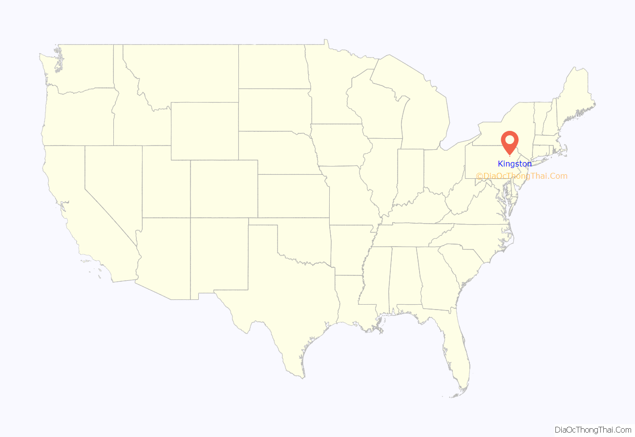
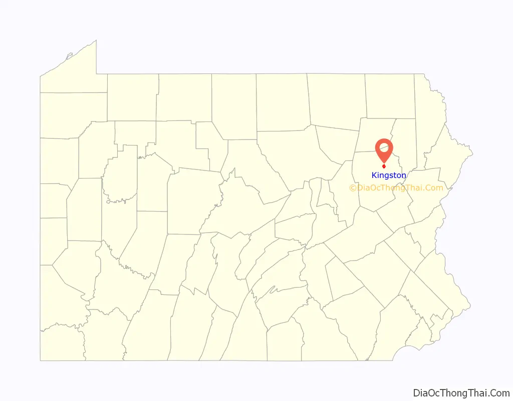
Kingston location map. Where is Kingston borough?
History
Early history
In the early 1660s, King Charles II owed Admiral Sir William Penn a large sum of money. To settle this debt, he granted Penn’s son, William, a territory in North America, which later became known as Pennsylvania. However, Connecticut also claimed a portion of this land.
Count Zinzendorf was one of the first people to take an interest in the Wyoming Valley. In 1742, he came to the region to convert the Native Americans to Christianity. At the time, the valley was inhabited by several Native American tribes (including the Susquehannock and the Delaware).
His reports led a group of Connecticut settlers to form the Connecticut Susquehanna Company. This company bought the land from the natives. In 1768, they met in Hartford, Connecticut, and decided to survey and divide the territory into five townships (each one was five square miles). The plan was to sell and divide each township among forty settlers. The first forty pioneers took possession of Kingston Township.
By the late 1760s, both Connecticut and Pennsylvania settlers fought over this territory. The conflict was eventually settled in the 1780s. The disputed land was granted to Pennsylvania. The location of modern-day Kingston became part of Northumberland County. However, Connecticut settlers remained determined to create a new state in northeastern Pennsylvania. Timothy Pickering was sent to the region to politically examine the situation. This led to the Pennsylvania Assembly passing a resolution which created Luzerne County. This ended the idea of creating a new state. Luzerne County was created from part of Northumberland County. Under Pickering’s leadership and direction, county elections were held, the courts were established, and a government was formed.
Revolutionary War
On June 30, 1778, Loyalist forces, under the command of Major John Butler, arrived in the Wyoming Valley to attack the American settlements. On July 1, Fort Wintermoot at the north end of the valley surrendered without a shot being fired. The next morning the smaller Fort Jenkins surrendered. Both forts were later burned to the ground.
Meanwhile the Patriot militia assembled at Forty Fort. On July 3, a column of roughly 375 men including a company of soldiers in the Continental Army marched from the fort under the command of Lieutenant Colonel Zebulon Butler and Colonel Nathan Denison. Major Butler’s Rangers, with the assistance of about 500 indigenous allies, ambushed the oncoming Americans. In the end, nearly 300 Patriot soldiers from the Wyoming Valley were killed during the Battle of Wyoming, commonly known as the Wyoming Massacre.
The next day Colonel Denison surrendered Forty Fort along with several other posts. Widespread looting and burning of buildings occurred throughout the Wyoming Valley subsequent to the capitulation, but non-combatants were not harmed. Most of the inhabitants, however, fled across the Pocono Mountains to Stroudsburg and Easton or down the Susquehanna River to Sunbury.
Incorporation
The community has a rich history in American education. It is said that the first public school in Pennsylvania was erected in Kingston (in the 1770s). The borough is also home to the Upper School of Wyoming Seminary, a prestigious college preparatory school founded in 1844. During the first year, it enrolled 31 students (17 boys and 14 girls). Today, Wyoming Seminary’s historic campus hosts roughly 450 students.
Kingston witnessed a population boom after the construction and operation of the Lackawanna and Bloomsburg Railroad. It was incorporated as a borough on November 23, 1857. The borough is named after Kingston, Rhode Island. The first election for the community was held on December 15, 1857. Ruben Jones was elected burgess and justice of the peace. Some of the first council members elected included Bestor Payne, Marshall G. Whitney, Reuben Marcy, Thomas Pringle, and Richard Hutching.
In 1923, the Kingston Armory was built. On September 11, 1950, 33 guardsmen from the 109th Field Artillery Regiment were killed in a train accident near Coshocton, Ohio. In the following days, the dead were moved to the Kingston Armory, where the remains were relinquished to the grief-stricken families.
Coal mining was a chief industry in and around Kingston prior to the Knox Mine Disaster. The 1959 tragedy essentially shut down the mining industry in and around the borough. In June 1972, Kingston was devastated by the flooding of Hurricane Agnes. The hurricane wreaked havoc on Kingston and neighboring Wilkes-Barre, causing a state of emergency. The natural disaster earned national attention and a visit from President Richard Nixon, who recruited Wyoming Seminary graduate Frank Carlucci (Nixon’s head of the Department of Health, Education, and Welfare) as a point man to oversee flood recovery efforts. After the flood, Kingston adopted a home rule charter. It became effective in January 1976.
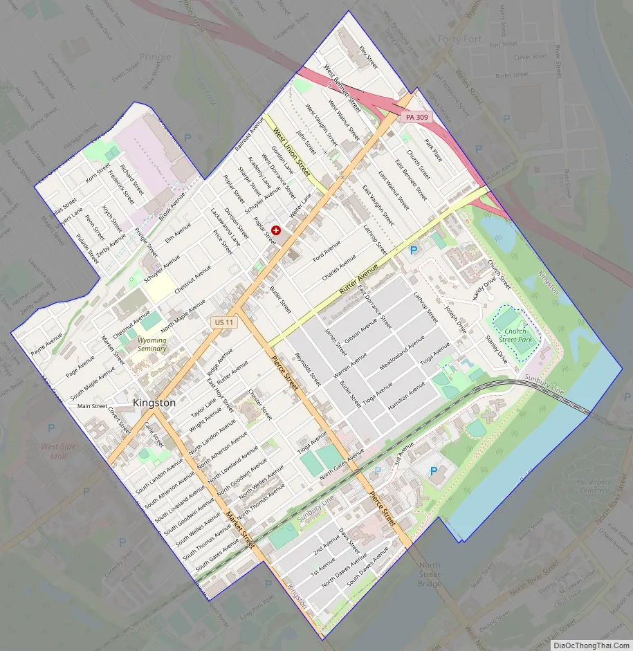
Kingston Road Map
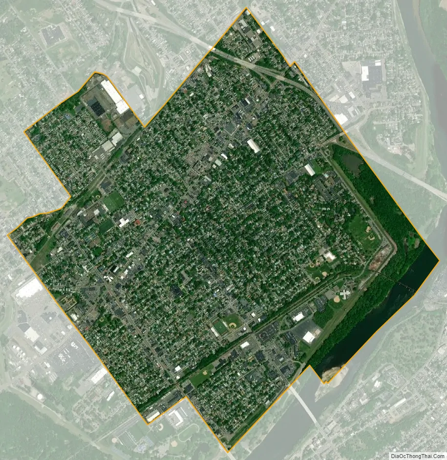
Kingston city Satellite Map
Geography
Kingston lies within the Wyoming Valley of Northeastern Pennsylvania. It is situated on the western bank of the Susquehanna River in the northern half of Luzerne County.
According to the U.S. Census Bureau, the borough has a total area of 2.2 square miles (5.7 km), of which 2.1 square miles (5.5 km) is land and 0.08 square miles (0.2 km), or 3.61%, is water. It is separated from Wilkes-Barre by the Susquehanna River and the boundary of Kirby Park. Its numbered routes are U.S. Route 11 and Pennsylvania Route 309, which follows the Cross Valley Expressway from the Back Mountain area to Interstate 81 and Route 115 east of Wilkes-Barre City. Market Street and Pierce Street connect Kingston with center city via bridges.
Besides neighboring Wilkes-Barre, Kingston also borders the communities of Edwardsville, Pringle, Luzerne, and Forty Fort. The Borough of Kingston is served by the Wilkes-Barre Wyoming Valley Airport (near Forty Fort) and the Wilkes-Barre/Scranton International Airport (in Pittston Township).
Climate
Kingston has a humid continental climate (Köppen climate classification Dfa/Dfb) with four distinct seasons. Winters are cold with a January average of 25.8 °F (−3.4 °C). The surrounding mountains have an influence on the climate (including both precipitation and temperatures), leading to wide variations within a short distance. On average, temperatures below 0 °F (−17.8 °C) are infrequent, occurring three days per year, and there are 36 days where the maximum temperature remains below 32 °F (0.0 °C). The average annual snowfall is 46.2 inches (117 cm) during the winter (in which severe snowstorms are rare). However, when snowstorms do occur, they can disrupt normal routines for several days.
Summers are warm, with a July average of 71.4 °F (21.9 °C). In an average summer, temperatures exceeding 90 °F (32.2 °C) occur on an average of nine days and can occasionally exceed 100 °F (37.8 °C). Spring and fall are unpredictable, with temperatures ranging from cold to warm (although they are usually mild). On average, Kingston receives 38.2 inches (970 mm) of precipitation each year, which is relatively evenly distributed throughout the year (though the summer months receive more precipitation). Extreme temperatures range from −21 °F (−29.4 °C) on January 21, 1994, to 103 °F (39.4 °C) on July 9, 1936. Kingston averages 2,303 hours of sunshine per year, ranging from a low of 96 hours in December (or 33% of possible sunshine) to 286 hours in July (or 62% of possible sunshine).
Kingston straddles the hardiness zone boundary between 6a and 6b, meaning that the average annual absolute minimum temperature is approximately -5 °F.
See also
Map of Pennsylvania State and its subdivision:- Adams
- Allegheny
- Armstrong
- Beaver
- Bedford
- Berks
- Blair
- Bradford
- Bucks
- Butler
- Cambria
- Cameron
- Carbon
- Centre
- Chester
- Clarion
- Clearfield
- Clinton
- Columbia
- Crawford
- Cumberland
- Dauphin
- Delaware
- Elk
- Erie
- Fayette
- Forest
- Franklin
- Fulton
- Greene
- Huntingdon
- Indiana
- Jefferson
- Juniata
- Lackawanna
- Lancaster
- Lawrence
- Lebanon
- Lehigh
- Luzerne
- Lycoming
- Mc Kean
- Mercer
- Mifflin
- Monroe
- Montgomery
- Montour
- Northampton
- Northumberland
- Perry
- Philadelphia
- Pike
- Potter
- Schuylkill
- Snyder
- Somerset
- Sullivan
- Susquehanna
- Tioga
- Union
- Venango
- Warren
- Washington
- Wayne
- Westmoreland
- Wyoming
- York
- Alabama
- Alaska
- Arizona
- Arkansas
- California
- Colorado
- Connecticut
- Delaware
- District of Columbia
- Florida
- Georgia
- Hawaii
- Idaho
- Illinois
- Indiana
- Iowa
- Kansas
- Kentucky
- Louisiana
- Maine
- Maryland
- Massachusetts
- Michigan
- Minnesota
- Mississippi
- Missouri
- Montana
- Nebraska
- Nevada
- New Hampshire
- New Jersey
- New Mexico
- New York
- North Carolina
- North Dakota
- Ohio
- Oklahoma
- Oregon
- Pennsylvania
- Rhode Island
- South Carolina
- South Dakota
- Tennessee
- Texas
- Utah
- Vermont
- Virginia
- Washington
- West Virginia
- Wisconsin
- Wyoming


