Map of Fairforest CDP
Fairforest is a Census-designated place located in Spartanburg County in the U.S. State of South Carolina. According to the 2010 United States Census, the population was 1,646. Fairforest CDP overview: Name: Fairforest CDP LSAD Code: 57 LSAD Description: CDP (suffix) State: South Carolina County: Spartanburg County Elevation: 846 ft (258 m) Total Area: 2.10 sq mi (5.43 km²) Land Area: ... Read more
Map of Fairforest CDP
Map of Fairfax town, South Carolina
Fairfax is a town in Allendale and Hampton counties, South Carolina, United States. The population was 2,025 at the 2010 census, a decline of over one-third of its population of 3,206 from 2000. Fairfax town overview: Name: Fairfax town LSAD Code: 43 LSAD Description: town (suffix) State: South Carolina County: Allendale County Elevation: 135 ft (41 m) ... Read more
Map of Fairfax town, South Carolina
Map of Fair Play CDP, South Carolina
Fair Play is a census-designated place located in Oconee County in the U.S. state of South Carolina. A small portion of the CDP extends into Anderson County. As of the 2010 census, the population of Fair Play was 687. According to tradition, the name stems from an incident in which a bystander implored two brawling ... Read more
Map of Fair Play CDP, South Carolina
Map of Eutawville town
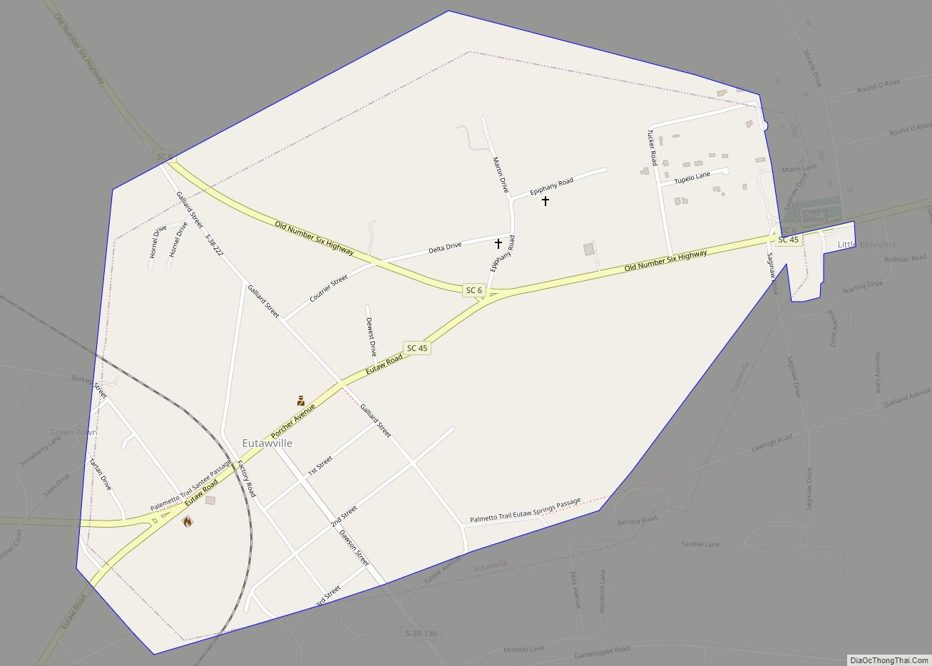
Eutawville /juːˈtoʊvəl/ is a town in Orangeburg County, South Carolina, United States. Prior to 1910, Eutawville was located in the northwest portion of Saint James Goose Creek Township, Berkeley County. The population was 315 at the 2010 census. Eutawville town overview: Name: Eutawville town LSAD Code: 43 LSAD Description: town (suffix) State: South Carolina County: ... Read more
Map of Eutawville town
Map of Eureka Mill CDP
Eureka Mill is a census-designated place (CDP) in Chester County, South Carolina, United States. The population was 1,476 at the 2010 census, down from 1,737 at the 2000 census. Eureka Mill CDP overview: Name: Eureka Mill CDP LSAD Code: 57 LSAD Description: CDP (suffix) State: South Carolina County: Chester County Elevation: 518 ft (158 m) Total Area: ... Read more
Map of Eureka Mill CDP
Map of Forest Acres city
Forest Acres is a city in Richland County, South Carolina, United States. The population was 10,606 at the 2020 census. It is part of the Columbia, South Carolina, Metropolitan Statistical Area and is an enclave of the city of Columbia. Forest Acres city overview: Name: Forest Acres city LSAD Code: 25 LSAD Description: city (suffix) ... Read more
Map of Forest Acres city
Map of Folly Beach city
Folly Beach is a public city on Folly Island in Charleston County, South Carolina, United States. The population was 2,617 at the 2010 census, up from 2,116 in 2000. Folly Beach is within the Charleston-North Charleston-Summerville metropolitan area and the Charleston-North Charleston Urbanized Areas. Folly Beach city overview: Name: Folly Beach city LSAD Code: 25 ... Read more
Map of Folly Beach city
Map of Gaston town, South Carolina
Gaston is a town in Lexington County, South Carolina, United States. The population was 1,645 at the 2010 census. It is part of the Columbia, South Carolina Metropolitan Statistical Area. Gaston town overview: Name: Gaston town LSAD Code: 43 LSAD Description: town (suffix) State: South Carolina County: Lexington County Elevation: 499 ft (152 m) Total Area: 5.32 sq mi ... Read more
Map of Gaston town, South Carolina
Map of Garden City CDP, South Carolina
Garden City, sometimes known as Garden City Beach, is a census-designated place (CDP) in Horry County, South Carolina, United States. The population was 9,209 at the 2010 census. Garden City Beach is located directly south of Surfside Beach. The developed part of the beach extends south beyond the limits of the Garden City CDP, into ... Read more
Map of Garden City CDP, South Carolina
Map of Gantt CDP, South Carolina
Gantt is a census-designated place (CDP) in Greenville County, South Carolina, United States. The population was 14,229 at the 2010 census. It is part of the Greenville–Mauldin–Easley Metropolitan Statistical Area and a suburb of the city of Greenville. Gantt CDP overview: Name: Gantt CDP LSAD Code: 57 LSAD Description: CDP (suffix) State: South Carolina County: ... Read more
Map of Gantt CDP, South Carolina
Map of Gaffney city
Gaffney is a city in and the seat of Cherokee County, South Carolina, United States, in the Upstate region of South Carolina. Gaffney is known as the “Peach Capital of South Carolina”. The population was 12,539 at the 2010 census, with an estimated population of 12,609 in 2019. It is the principal city of the ... Read more
Map of Gaffney city
Map of Gadsden CDP, South Carolina
Gadsden is a census-designated place in Richland County, South Carolina, United States. The population was 1,632 at the 2010 census. It is part of the Columbia, South Carolina metropolitan area. Gadsden CDP overview: Name: Gadsden CDP LSAD Code: 57 LSAD Description: CDP (suffix) State: South Carolina County: Richland County Elevation: 154 ft (47 m) Total Area: 11.51 sq mi ... Read more
Map of Gadsden CDP, South Carolina