Gaffney is a city in and the seat of Cherokee County, South Carolina, United States, in the Upstate region of South Carolina. Gaffney is known as the “Peach Capital of South Carolina”. The population was 12,539 at the 2010 census, with an estimated population of 12,609 in 2019. It is the principal city of the Gaffney, South Carolina, Micropolitan Statistical Area (population 55,662 according to 2012 estimates by the U.S. Census Bureau), which includes all of Cherokee County and which is further included in the greater Greenville–Spartanburg–Anderson, South Carolina Combined Statistical Area (population 1,384,996 according to year 2012 U.S. Census Bureau estimates).
| Name: | Gaffney city |
|---|---|
| LSAD Code: | 25 |
| LSAD Description: | city (suffix) |
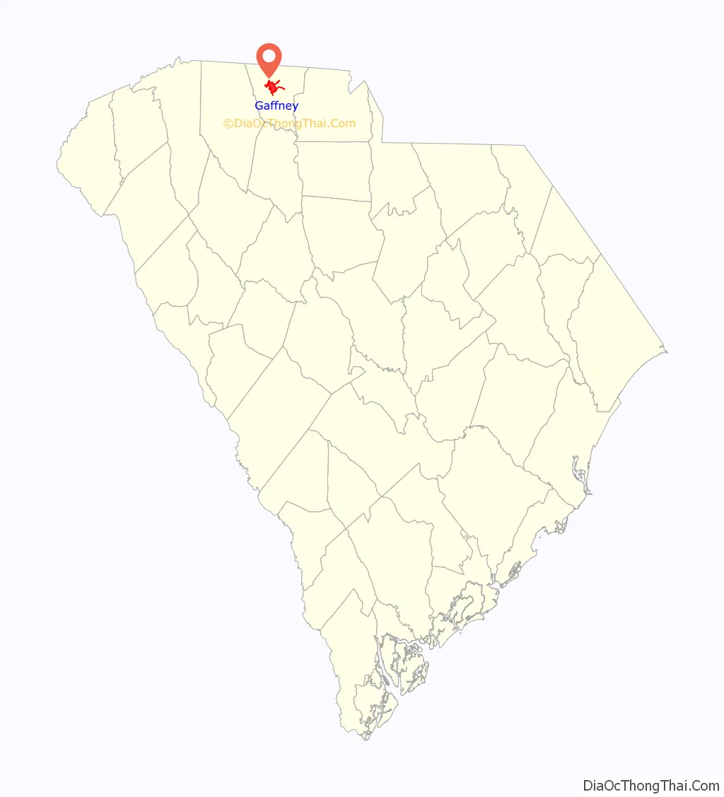
| State: | South Carolina |
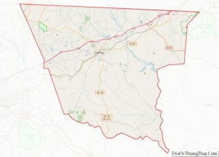
| County: | Cherokee County |
| Elevation: | 784 ft (239 m) |
| Total Area: | 8.71 sq mi (22.55 km²) |
| Land Area: | 8.68 sq mi (22.49 km²) |
| Water Area: | 0.02 sq mi (0.06 km²) |
| Total Population: | 12,764 |
| Population Density: | 1,470.00/sq mi (567.55/km²) |
| ZIP code: | 29340-29342 |
| Area code: | 864 |
| FIPS code: | 4528060 |
| GNISfeature ID: | 1247855 |
| Website: | www.getintogaffney.com |
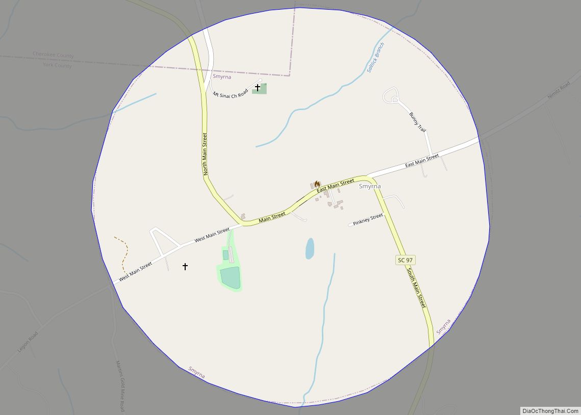
Online Interactive Map
Click on ![]() to view map in "full screen" mode.
to view map in "full screen" mode.
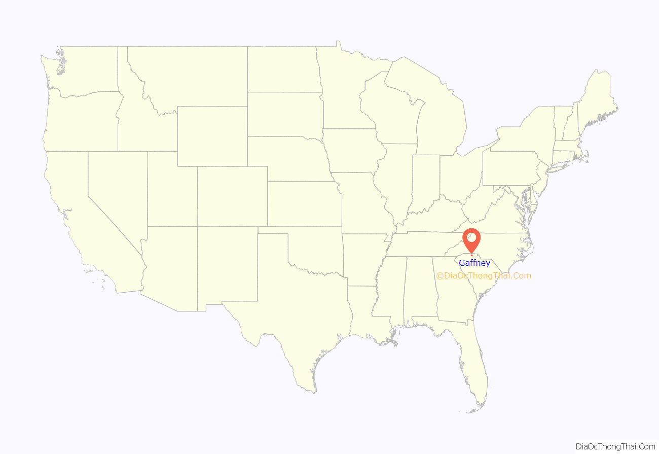
Gaffney location map. Where is Gaffney city?
History
Michael A. Gaffney, born in Granard, Ireland, in 1775, emigrated to the United States in 1797, arriving in New York City and moving to Charleston, South Carolina, a few years later. Gaffney moved again in 1804 to the South Carolina Upcountry and established a tavern and lodging house at what became known as “Gaffney’s Cross Roads”. The location was perfect for growth because of the two major roads which met here, one from the mountains of North Carolina to Charleston and the other from Charlotte into Georgia. Michael Gaffney died here on September 6, 1854.
In 1872, the area became known as “Gaffney City”. Gaffney became the county seat of Cherokee County which was formed out of parts of York, Union, and Spartanburg counties in 1897. Gaffney became a major center for the textile industry in South Carolina, which was the backbone of the county’s economy up until the 1980s.
Despite the small amount of population growth, businesses and companies continue to locate within the city limits, especially along the bustling Floyd Baker Boulevard and Highway 105 and many other areas within the city limits. However, most population growth recently has occurred outside of the city limits.
Uptown Gaffney began to languish after Interstate 85 was built in the county as industries located near the new highway. Recent renovations in downtown Gaffney have prompted more businesses to locate there, but there is still a great deal that is planned for the central part of the city. Many plans have been announced for the downtown area, including a 20-acre (81,000 m) park that is currently being developed on the grounds of a recently demolished mill (Gaffney Manufacturing Co.). A plaza has been completed beside city hall and includes a refurbished fountain and extensive landscaping. Highlights to the upgrade of the city’s park system include a skatepark, two passive parks, and several children’s playgrounds.
In 2008, the Cherokee County History & Arts Museum opened on College Drive in the historic Central Elementary School building. The museum is operated by the Cherokee Historical & Preservation Society and is located on the mustering ground of the South Carolina militia (1812–1914). Located just blocks from downtown Gaffney and in one of the city’s three nationally registered historic sites, the museum offers new cultural opportunities for locals and visitors, while having a positive economic impact for the downtown area. Annual events include a pottery show, car show, and ghost walk.
The city has recently hired an architectural firm to renovate the old Gaffney Post Office, located at the intersection of Frederick and Granard streets, into a visitor’s center and art gallery.
There are also plans for a large cultural center to be placed in the downtown area. In 2009 Darren Mason was elected president of the Gaffney Downtown Business Association and has worked closely with city officials in revitalizing the Historic Downtown area which consists of about six blocks. New matching fund programs have been key to restoring old buildings by painting and using attractive awnings to spruce up the old look of main street.
Gaffney Station Farmers’ Market has been established in a city parking lot directly across from the old post office downtown. The farmers’ market operates on Wednesdays and Saturdays from June through October. There are plans to create a more permanent site for the farmer’s market at that location. The city of Gaffney plans to build a partial replica of the old train depot that was once located there. The replica will house a portion of the farmer’s market and also act as a landmark that calls back to the days of the old depot.
The city concluded Spring Session ’08 of a popular concert series entitled “Shindig at the Gaffney Cabin”. Bands perform on a weekly basis: Fridays during the Spring Session (May) and Thursdays during the Fall Session (late August through September). Concerts are held on Thursdays during Fall Sessions so as not to conflict with Gaffney Indian football games on Friday nights. The city will hold more of those concerts in 2009, this time from April to June 2009, and again from August to October of the same year.
Two serial killers have at different times attacked residents of Gaffney. In 1967–1968 Lee Roy Martin, known as the Gaffney Strangler, killed four women. In 2009, a series of shootings led to five deaths.
The Archeological Site 38CK1, Archeological Site 38CK44, Archeological Site 38CK45, Carnegie Free Library, Coopersville Ironworks Site (38CK2) and Susan Furnace Site (38CK67), Cowpens Furnace Site (38CK73), Winnie Davis Hall, Ellen Furnace Site (38CK68), Gaffney Commercial Historic District, Gaffney Residential Historic District, Irene Mill Finishing Plant, Jefferies House, Limestone Springs Historic District, Magness-Humphries House, Nesbitt’s Limestone Quarry (38CK69), and Settlemyer House are listed in the National Register of Historic Places.
2009 spree killings
The city of Gaffney and surrounding Cherokee County came into the national spotlight during the summer of 2009 when a spree killer began killing residents of the rural town.
The first victim, a prominent peach farmer from western Cherokee County, was killed on June 27. On July 1, the killer was responsible for the death of an 83-year-old woman and her 50-year-old daughter. The two were found bound and shot to death in the elder woman’s home near Gaffney. On July 2, 46-year-old Stephen Tyler was shot and killed in his appliance and furniture store; his teenage daughter, Abby, was critically wounded; she died of her injuries two days later.
The news spread quickly from the local newspaper to national and international media outlets including CNN, ABC News, The Wall Street Journal, and the BBC.
On July 6, police responding to an emergency call of a burglary in progress in Gaston County, North Carolina, shot and killed a suspect who drew a gun on them, injuring one officer. Ballistic tests and checks on the suspect’s SUV indicated this to be the wanted killer, later identified as Patrick Tracy Burris.
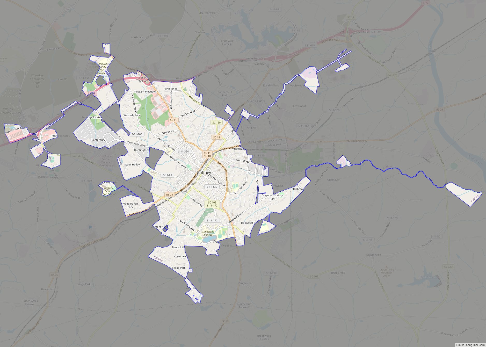
Gaffney Road Map
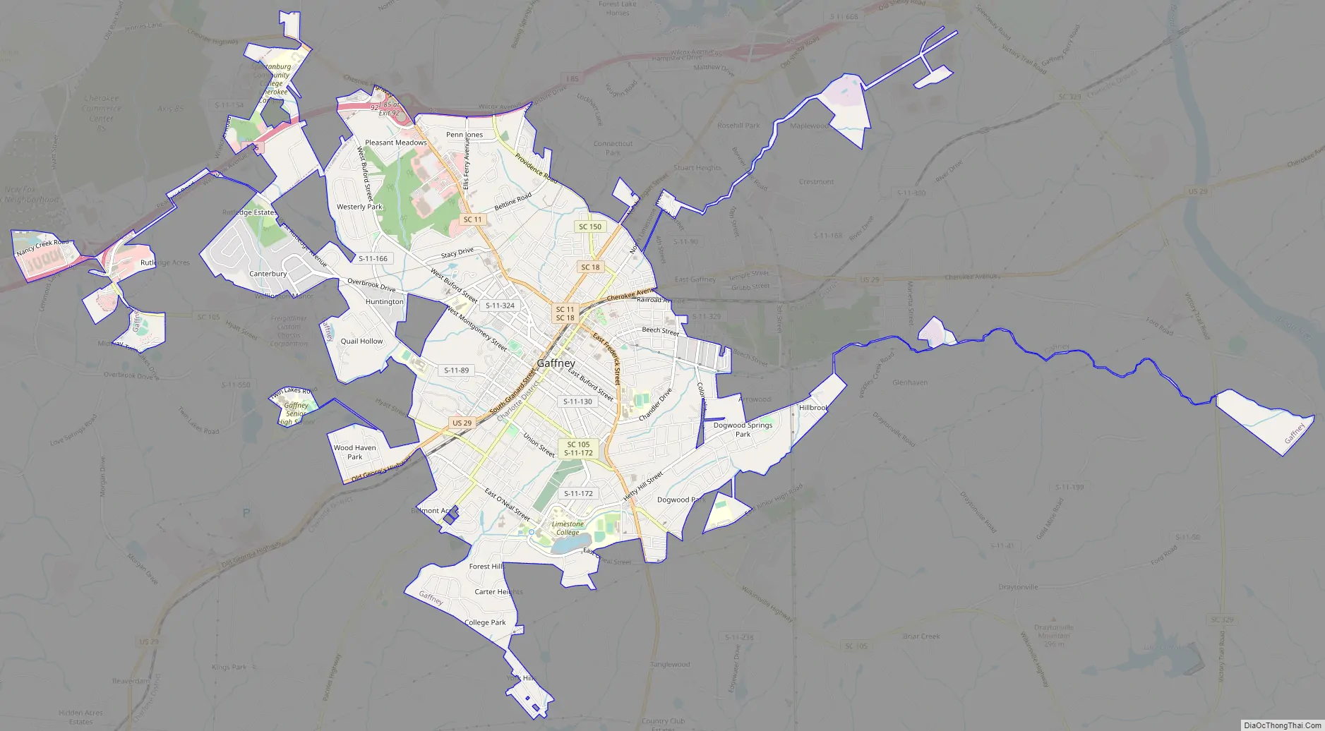
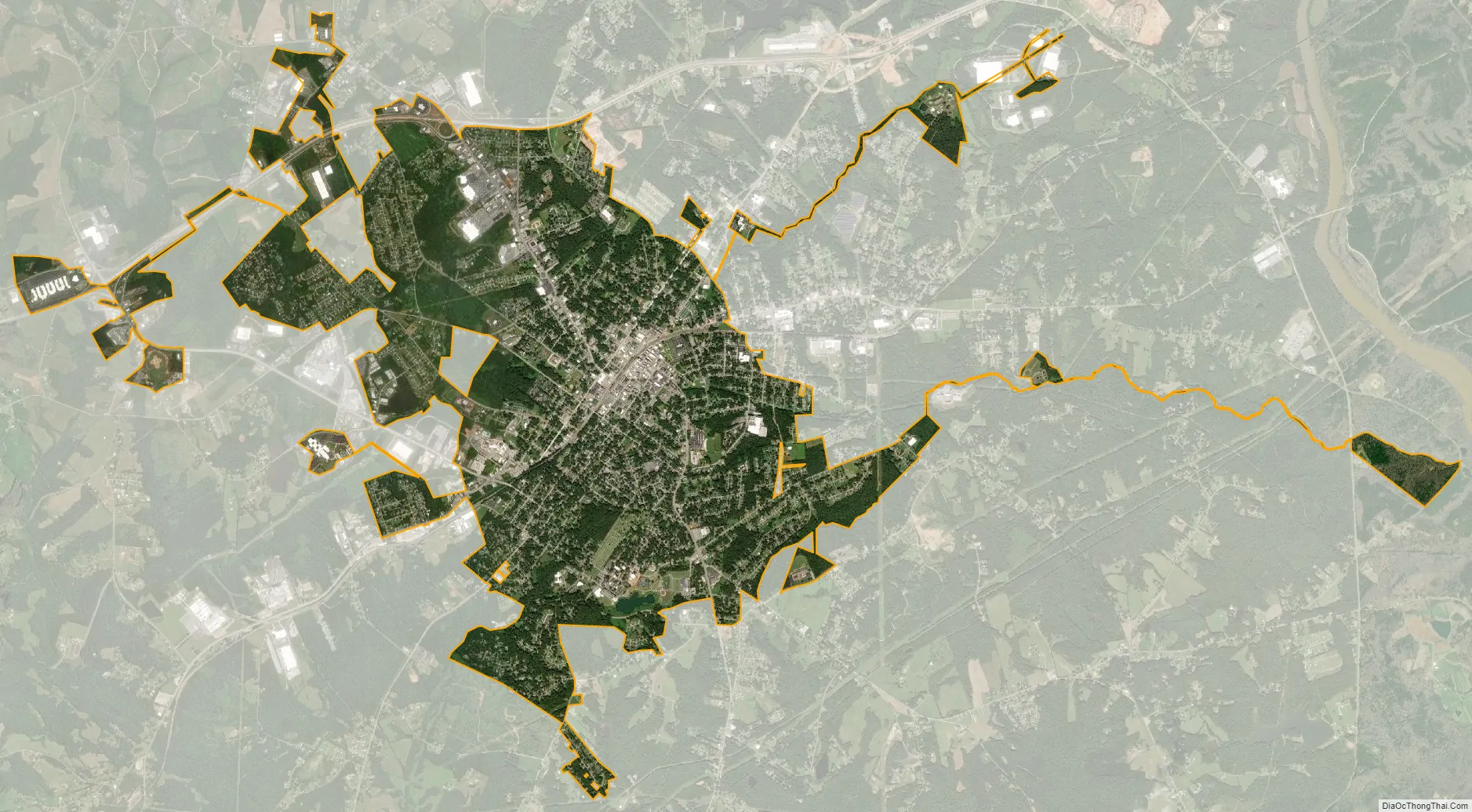
Gaffney city Satellite Map
Geography
Gaffney is located in northern South Carolina at 35°4′18″N 81°39′00″W / 35.07167°N 81.65000°W / 35.07167; -81.65000 (35.071667, -81.650000), near the center of Cherokee County. It is located 55 miles (89 km) southwest of Charlotte, North Carolina and 50 miles (80 km) northeast of Greenville, both reached via Interstate 85. It is served by the Charlotte and Greenville major airports. These airports are almost equidistant from Gaffney, with Greenville being slightly closer. It is also approximately 190 miles (310 km) northeast of Atlanta, Georgia. The closest large city is Spartanburg, which is 21 miles (34 km) southwest via I-85.
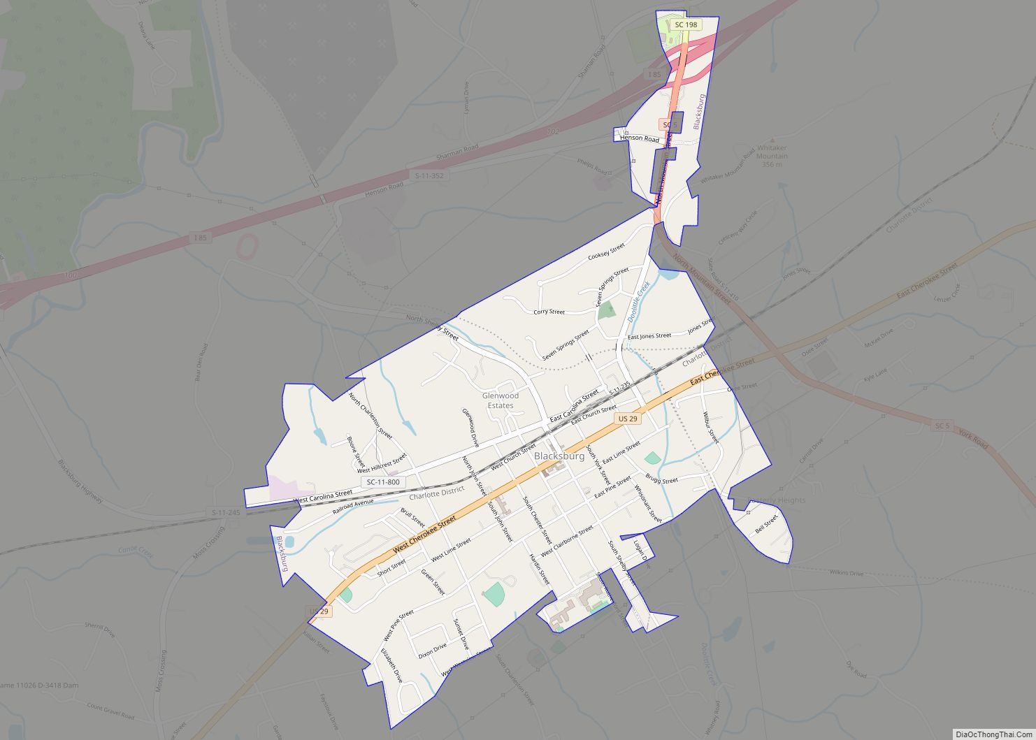
Interstate 85 passes along the northern edge of Gaffney, with access from Exits 90, 92, and 95. U.S. Route 29 passes through the center of Gaffney, leading northeast 9 miles (14 km) to Blacksburg and southwest 10 miles (16 km) to Cowpens. South Carolina Highway 18 leads north 17 miles (27 km) to Shelby, North Carolina, becoming North Carolina Highway 18 along the way, and south 19 miles (31 km) to Jonesville. South Carolina Highway 11 leads northwest 14 miles (23 km) to Chesnee.
According to the United States Census Bureau, Gaffney has a total area of 8.35 square miles (21.63 km), of which 8.32 square miles (21.56 km) is land and 0.03 square miles (0.07 km), or 0.31%, is water.
See also
Map of South Carolina State and its subdivision:- Abbeville
- Aiken
- Allendale
- Anderson
- Bamberg
- Barnwell
- Beaufort
- Berkeley
- Calhoun
- Charleston
- Cherokee
- Chester
- Chesterfield
- Clarendon
- Colleton
- Darlington
- Dillon
- Dorchester
- Edgefield
- Fairfield
- Florence
- Georgetown
- Greenville
- Greenwood
- Hampton
- Horry
- Jasper
- Kershaw
- Lancaster
- Laurens
- Lee
- Lexington
- Marion
- Marlboro
- McCormick
- Newberry
- Oconee
- Orangeburg
- Pickens
- Richland
- Saluda
- Spartanburg
- Sumter
- Union
- Williamsburg
- York
- Alabama
- Alaska
- Arizona
- Arkansas
- California
- Colorado
- Connecticut
- Delaware
- District of Columbia
- Florida
- Georgia
- Hawaii
- Idaho
- Illinois
- Indiana
- Iowa
- Kansas
- Kentucky
- Louisiana
- Maine
- Maryland
- Massachusetts
- Michigan
- Minnesota
- Mississippi
- Missouri
- Montana
- Nebraska
- Nevada
- New Hampshire
- New Jersey
- New Mexico
- New York
- North Carolina
- North Dakota
- Ohio
- Oklahoma
- Oregon
- Pennsylvania
- Rhode Island
- South Carolina
- South Dakota
- Tennessee
- Texas
- Utah
- Vermont
- Virginia
- Washington
- West Virginia
- Wisconsin
- Wyoming