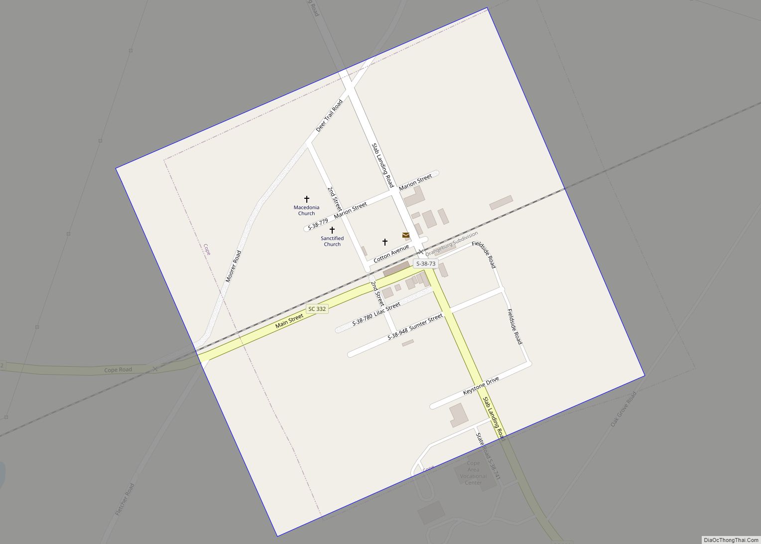
Map of Darlington city, South Carolina

Map of Darlington city, South Carolina

Darlington is a city located in Darlington County, South Carolina, United States. In 2010, its population was 6,289. It is the county seat of Darlington County. It is part of the Florence, South Carolina Metropolitan Statistical Area. Darlington is known for its Darlington Oak and Spanish moss. Darlington is home to the famous Darlington Raceway, … Read more

Map of East Sumter CDP

Map of East Sumter CDP

East Sumter is a census-designated place (CDP) in Sumter County, South Carolina, United States. The population was 1,220 at the 2000 census. It is included in the Sumter, South Carolina Metropolitan Statistical Area. East Sumter CDP overview: Name: East Sumter CDP LSAD Code: 57 LSAD Description: CDP (suffix) State: South Carolina County: Sumter County Elevation: … Read more

Map of East Gaffney CDP

Map of East Gaffney CDP

East Gaffney is a census-designated place (CDP) in Cherokee County, South Carolina, United States. The population was 3,085 at the 2010 United States Census. East Gaffney CDP overview: Name: East Gaffney CDP LSAD Code: 57 LSAD Description: CDP (suffix) State: South Carolina County: Cherokee County Elevation: 771 ft (235 m) Total Area: 3.03 sq mi (7.85 km²) Land Area: 3.02 sq mi … Read more

Map of Easley city

Map of Easley city

Easley is a city in Pickens County (with parts extending into Anderson County) in the State of South Carolina. Most of the city lies in Pickens County, with a small portion of the city in Anderson County. In 2001, Easley hosted the Big League World Series for the first time, and continued to host the … Read more

Map of Dunean CDP

Map of Dunean CDP

Duncan is a census-designated place (CDP) in Greenville County, South Carolina, United States. The population was 3,671 at the 2010 census, down from 4,158 in 2000. It is part of the Greenville–Mauldin–Easley Metropolitan Statistical Area. Dunean CDP overview: Name: Dunean CDP LSAD Code: 57 LSAD Description: CDP (suffix) State: South Carolina County: Greenville County Elevation: … Read more

Map of Duncan town, South Carolina

Map of Duncan town, South Carolina

Duncan is a town in Spartanburg County, South Carolina, United States. Its population was 3,181 at the 2010 census. Duncan town overview: Name: Duncan town LSAD Code: 43 LSAD Description: town (suffix) State: South Carolina County: Spartanburg County Elevation: 866 ft (264 m) Total Area: 5.52 sq mi (14.29 km²) Land Area: 5.42 sq mi (14.03 km²) Water Area: 0.10 sq mi (0.27 km²) Total Population: … Read more

Map of Due West town

Map of Due West town

Due West is a town in Abbeville County, South Carolina, United States. The population was 1,247 at the 2010 census. It is the home of Erskine College and Dixie High School. Due West town overview: Name: Due West town LSAD Code: 43 LSAD Description: town (suffix) State: South Carolina County: Abbeville County Elevation: 699 ft (213 m) … Read more

Map of Donalds town

Map of Donalds town

Donalds is a town in Abbeville County, South Carolina, United States. As per the 2010 United States Census, its population was 348. Donalds town overview: Name: Donalds town LSAD Code: 43 LSAD Description: town (suffix) State: South Carolina County: Abbeville County Elevation: 761 ft (232 m) Total Area: 0.84 sq mi (2.17 km²) Land Area: 0.83 sq mi (2.15 km²) Water Area: 0.01 sq mi … Read more

Map of Dillon city, South Carolina

Map of Dillon city, South Carolina

Dillon is a city in Dillon County in eastern South Carolina, United States. It is the county seat and largest city of Dillon County. It was established on December 22, 1888. Both the name of the city and county comes from James W. Dillon, an early settler and key figure in bringing a railroad through … Read more

Map of Dentsville CDP

Map of Dentsville CDP

Dentsville is a census-designated place (CDP) in Richland County, South Carolina, United States. The population was 14,062 at the 2010 census. It is part of the Columbia, South Carolina, Metropolitan Statistical Area. Dentsville CDP overview: Name: Dentsville CDP LSAD Code: 57 LSAD Description: CDP (suffix) State: South Carolina County: Richland County Elevation: 230 ft (70 m) Total … Read more

Map of Denmark city, South Carolina

Map of Denmark city, South Carolina

Denmark is a city in Bamberg County, South Carolina, United States. The population at the 2010 census is 3,538. Denmark city overview: Name: Denmark city LSAD Code: 25 LSAD Description: city (suffix) State: South Carolina County: Bamberg County Elevation: 246 ft (75 m) Total Area: 3.91 sq mi (10.13 km²) Land Area: 3.91 sq mi (10.12 km²) Water Area: 0.00 sq mi (0.01 km²) Total Population: … Read more

Map of Ehrhardt town

Map of Ehrhardt town

Ehrhardt is a town in Bamberg County, South Carolina, United States. As of the 2010 census, the town population was 545. Ehrhardt town overview: Name: Ehrhardt town LSAD Code: 43 LSAD Description: town (suffix) State: South Carolina County: Bamberg County Elevation: 141 ft (43 m) Total Area: 3.11 sq mi (8.06 km²) Land Area: 3.11 sq mi (8.06 km²) Water Area: 0.00 sq mi (0.00 km²) … Read more