Dillon is a city in Dillon County in eastern South Carolina, United States. It is the county seat and largest city of Dillon County. It was established on December 22, 1888. Both the name of the city and county comes from James W. Dillon, an early settler and key figure in bringing a railroad through the area. The population was 6,788 in the 2010 U.S. census.
| Name: | Dillon city |
|---|---|
| LSAD Code: | 25 |
| LSAD Description: | city (suffix) |
| State: | South Carolina |
| County: | Dillon County |
| Elevation: | 112 ft (34 m) |
| Total Area: | 5.37 sq mi (13.91 km²) |
| Land Area: | 5.34 sq mi (13.83 km²) |
| Water Area: | 0.03 sq mi (0.08 km²) |
| Total Population: | 6,384 |
| Population Density: | 1,195.95/sq mi (461.73/km²) |
| ZIP code: | 29536 |
| Area code: | 843, 854 |
| FIPS code: | 4519420 |
| GNISfeature ID: | 1222024 |
| Website: | www.cityofdillonsc.us |
Online Interactive Map
Click on ![]() to view map in "full screen" mode.
to view map in "full screen" mode.
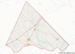
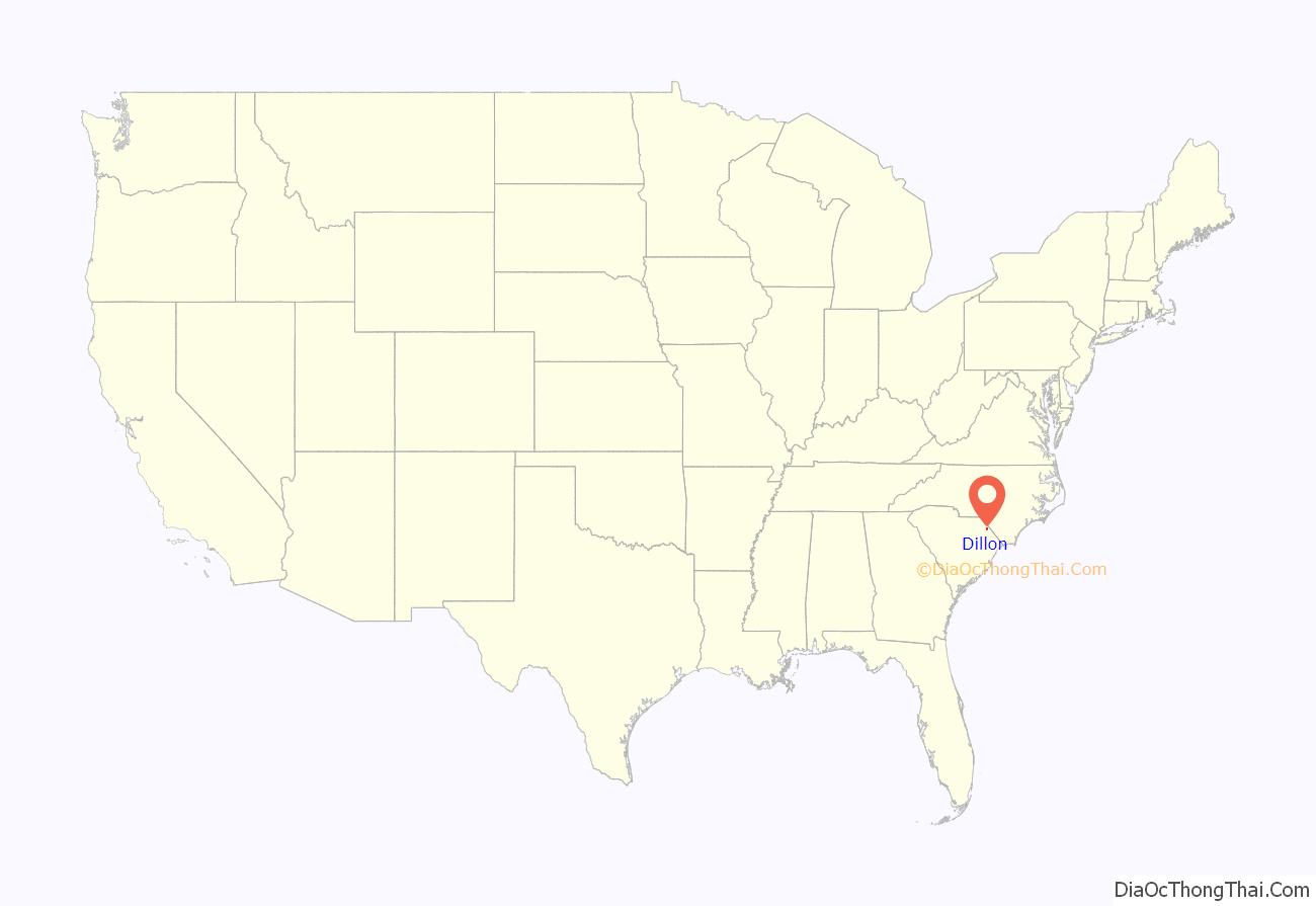
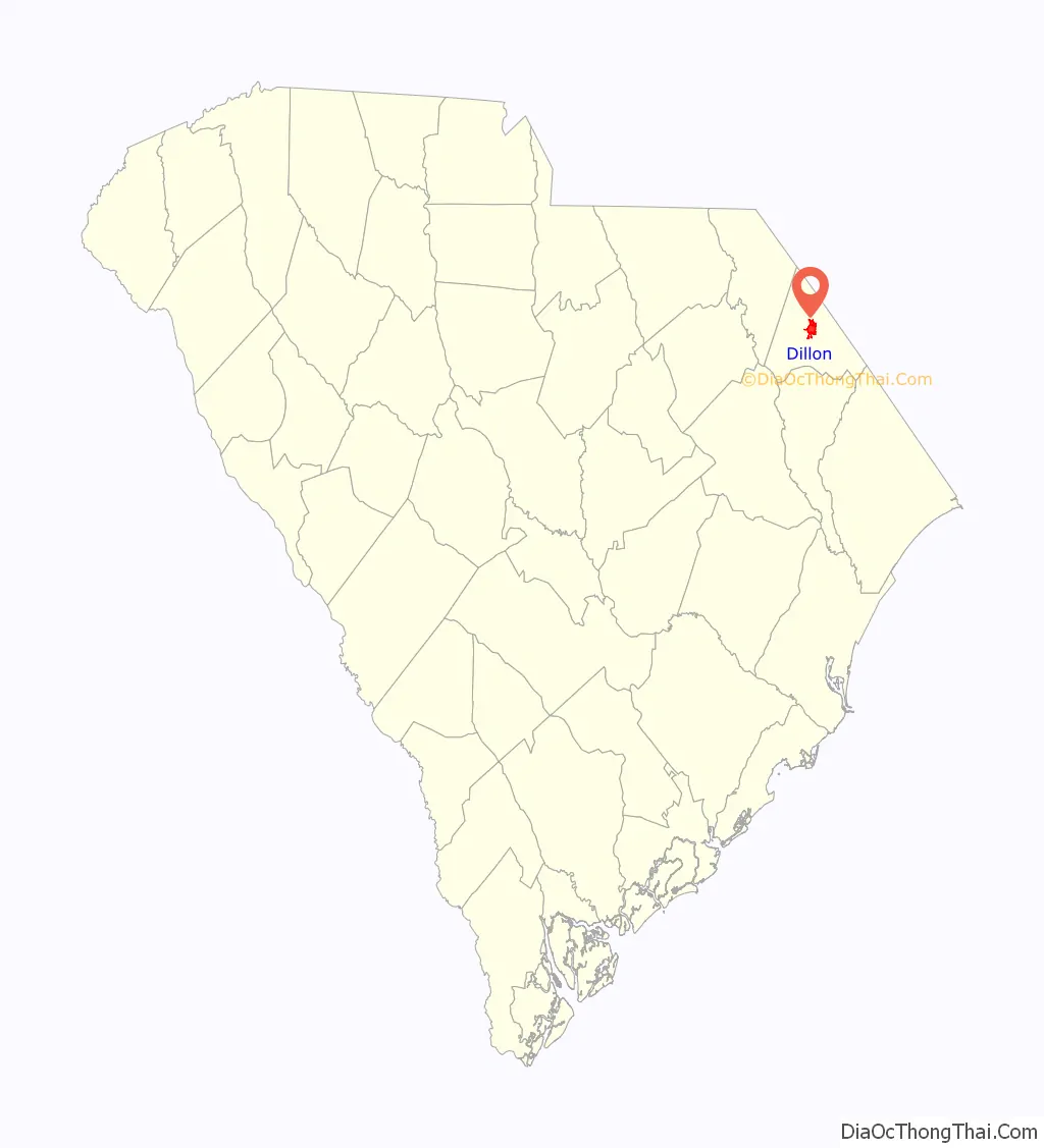
Dillon location map. Where is Dillon city?
History
Dillon County Courthouse, James W. Dillon House, and Dillon Downtown Historic District are listed on the National Register of Historic Places.
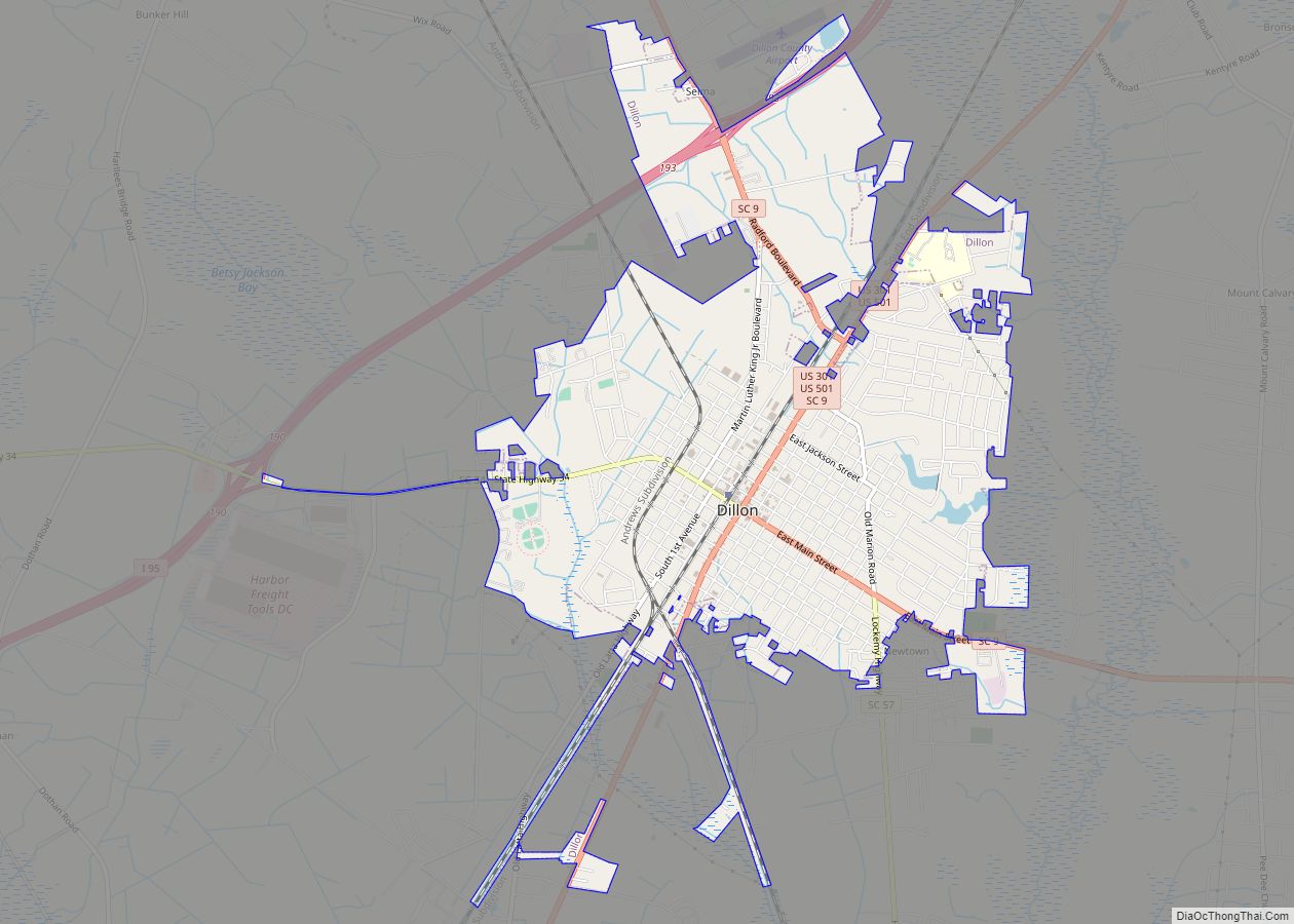
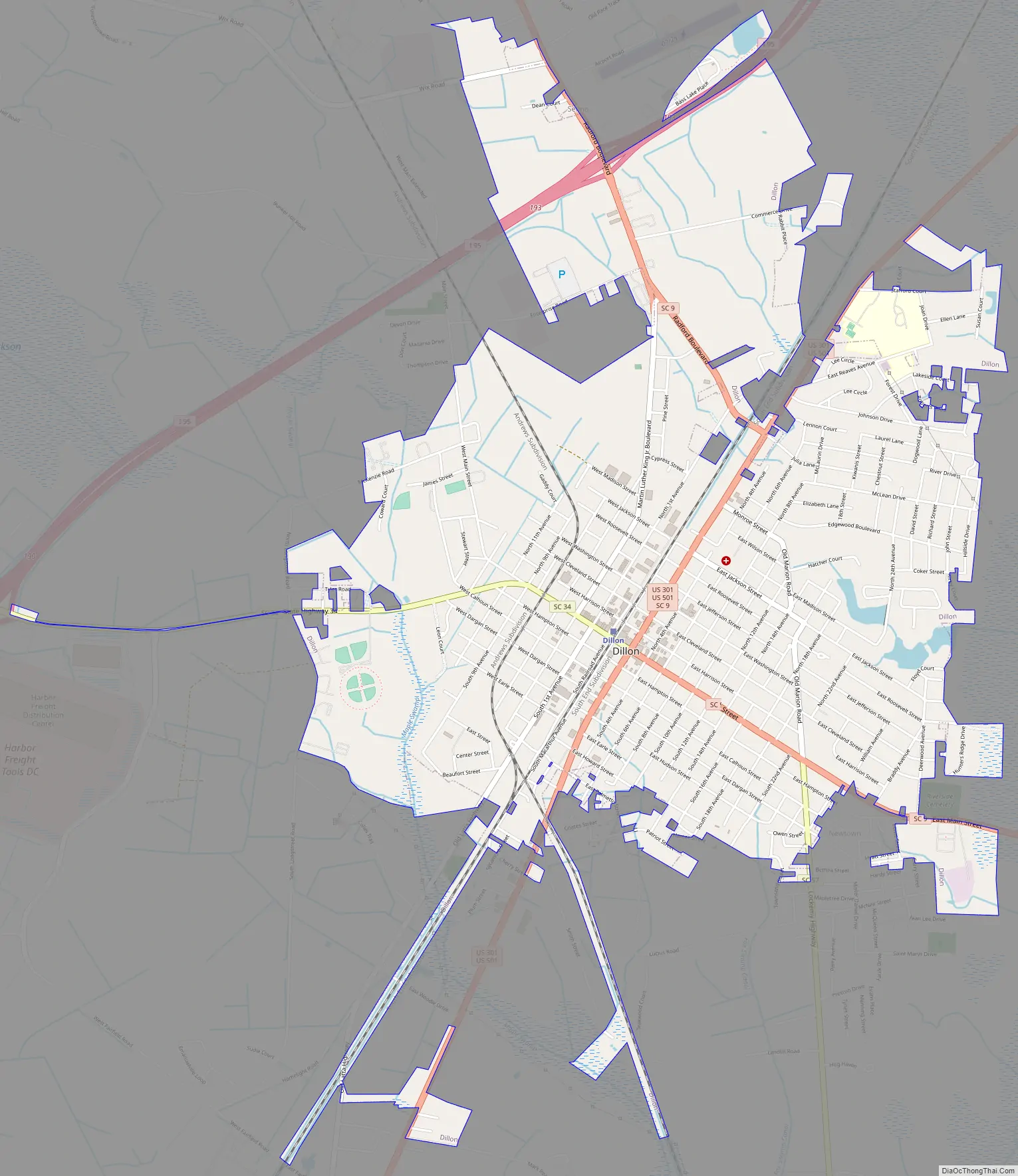
Dillon Road Map
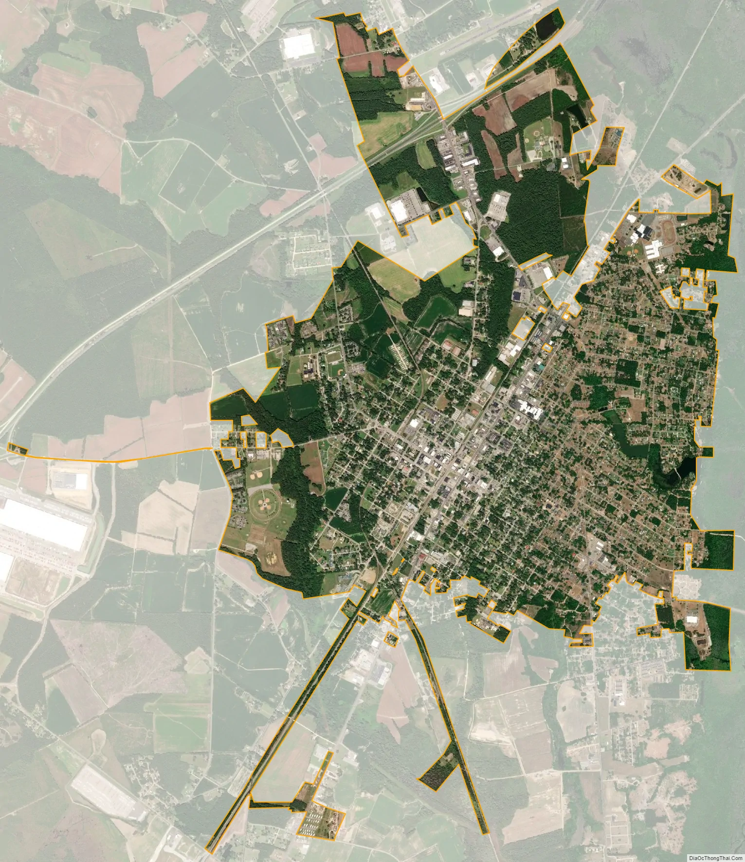
Dillon city Satellite Map
Geography
Dillon is located near the center of Dillon County in the Pee Dee region of northeastern South Carolina. The Little Pee Dee River, a tributary of the Pee Dee River, runs just east of the city.
U.S. Routes 301 and 501 pass through the city as Second Avenue, leading northeast 7 miles (11 km) to Interstate 95 at South of the Border along the North Carolina line, and southwest 6.5 miles (10.5 km) to Latta. Interstate 95 passes northeast of the city, with access from Exits 190 and 193. I-95 leads northeast 25 miles (40 km) to Lumberton, North Carolina, and southwest 28 miles (45 km) to Florence. South Carolina Highway 9 passes through the center of town, leading northwest 26 miles (42 km) to Bennettsville and southeast 13 miles (21 km) to Lake View. South Carolina Highway 57 follows SC 9 through Dillon but leads north 14 miles (23 km) to the North Carolina border and south 17 miles (27 km) to Mullins. SC 9 and 57 follow Main Street southeast out of town. South Carolina Highway 34 follows Main Street northwest out of town, leading west 33 miles (53 km) to Darlington.
According to the U.S. Census Bureau, Dillon has a total area of 5.3 square miles (13.6 km), of which 0.01 square miles (0.03 km), or 0.21%, is water. The Little Pee Dee River flows southwards 2 miles (3 km) east of the center of town.
See also
Map of South Carolina State and its subdivision:- Abbeville
- Aiken
- Allendale
- Anderson
- Bamberg
- Barnwell
- Beaufort
- Berkeley
- Calhoun
- Charleston
- Cherokee
- Chester
- Chesterfield
- Clarendon
- Colleton
- Darlington
- Dillon
- Dorchester
- Edgefield
- Fairfield
- Florence
- Georgetown
- Greenville
- Greenwood
- Hampton
- Horry
- Jasper
- Kershaw
- Lancaster
- Laurens
- Lee
- Lexington
- Marion
- Marlboro
- McCormick
- Newberry
- Oconee
- Orangeburg
- Pickens
- Richland
- Saluda
- Spartanburg
- Sumter
- Union
- Williamsburg
- York
- Alabama
- Alaska
- Arizona
- Arkansas
- California
- Colorado
- Connecticut
- Delaware
- District of Columbia
- Florida
- Georgia
- Hawaii
- Idaho
- Illinois
- Indiana
- Iowa
- Kansas
- Kentucky
- Louisiana
- Maine
- Maryland
- Massachusetts
- Michigan
- Minnesota
- Mississippi
- Missouri
- Montana
- Nebraska
- Nevada
- New Hampshire
- New Jersey
- New Mexico
- New York
- North Carolina
- North Dakota
- Ohio
- Oklahoma
- Oregon
- Pennsylvania
- Rhode Island
- South Carolina
- South Dakota
- Tennessee
- Texas
- Utah
- Vermont
- Virginia
- Washington
- West Virginia
- Wisconsin
- Wyoming