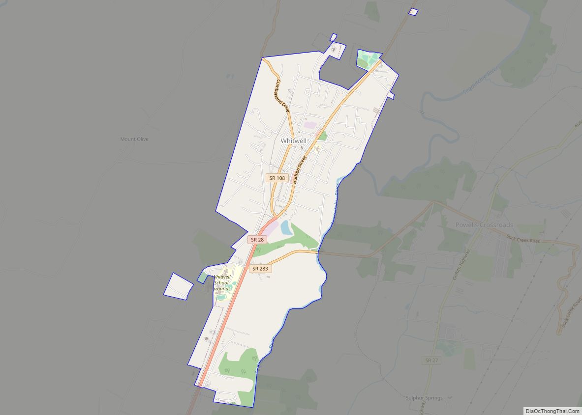
Map of Yorkville city, Tennessee

Map of Yorkville city, Tennessee

Yorkville is a city in Gibson County, Tennessee. The population was 286 at the 2010 census. Yorkville city overview: Name: Yorkville city LSAD Code: 25 LSAD Description: city (suffix) State: Tennessee County: Gibson County Incorporated: 1848 Elevation: 381 ft (116 m) Total Area: 1.30 sq mi (3.37 km²) Land Area: 1.30 sq mi (3.37 km²) Water Area: 0.00 sq mi (0.00 km²) Total Population: 236 Population … Read more

Map of Wrigley CDP

Map of Wrigley CDP

Wrigley is a census-designated place and unincorporated community in Hickman County, Tennessee, United States. Its population was 281 as of the 2010 census. Wrigley CDP overview: Name: Wrigley CDP LSAD Code: 57 LSAD Description: CDP (suffix) State: Tennessee County: Hickman County Elevation: 781 ft (238 m) Total Area: 0.96 sq mi (2.48 km²) Land Area: 0.96 sq mi (2.48 km²) Water Area: 0.00 sq mi … Read more

Map of Woodland Mills city

Map of Woodland Mills city

Woodland Mills is a city in Obion County, Tennessee, United States. The population was 378 at the 2010 census. It is part of the Union City, TN–KY Micropolitan Statistical Area. Woodland Mills city overview: Name: Woodland Mills city LSAD Code: 25 LSAD Description: city (suffix) State: Tennessee County: Obion County Incorporated: 1968 Elevation: 364 ft (111 m) … Read more

Map of Woodbury town, Tennessee

Map of Woodbury town, Tennessee

Woodbury is a town in Cannon County, Tennessee, United States. Woodbury is part of the Nashville Metropolitan Statistical Area and is located 55 miles (89 km) southeast of downtown Nashville. The population of Woodbury was 2,680 at the 2010 census. It is the county seat of Cannon County. Woodbury town overview: Name: Woodbury town LSAD Code: … Read more

Map of Winfield town, Tennessee

Map of Winfield town, Tennessee

Winfield is a town in Scott County, Tennessee, United States. Originally named Chitwood in the late 18th century for Revolutionary War hero Captain James Chitwood after his family settled the area extensively, the name was changed following the Civil War due to the family’s mixed allegiances. The population was 947 at the 2020 census and … Read more

Map of Winchester city, Tennessee

Map of Winchester city, Tennessee

Winchester is a city in and the county seat of Franklin County, Tennessee, United States. It is part of the Tullahoma, Tennessee Micropolitan Statistical Area. The population of Winchester as of the 2020 census was 9,375. Winchester city overview: Name: Winchester city LSAD Code: 25 LSAD Description: city (suffix) State: Tennessee County: Franklin County Incorporated: … Read more

Map of Williston city, Tennessee

Map of Williston city, Tennessee

Williston is a city in Fayette County, Tennessee, United States. The population was 395 at the 2010 census. Williston city overview: Name: Williston city LSAD Code: 25 LSAD Description: city (suffix) State: Tennessee County: Fayette County Incorporated: 1970 Elevation: 502 ft (153 m) Total Area: 1.65 sq mi (4.28 km²) Land Area: 1.65 sq mi (4.28 km²) Water Area: 0.00 sq mi (0.00 km²) Total Population: … Read more

Map of Hartsville/Trousdale County, Tennessee

Map of Hartsville/Trousdale County, Tennessee

Hartsville is a town in Trousdale County, Tennessee, United States. It is the county seat of Trousdale County, with which it shares a consolidated city-county government. The population of Hartsville was 11,615 as of 2020. Hartsville now shares with Trousdale County a consolidated city-county government by virtue of a referendum which passed in Trousdale County … Read more