Hartsville is a town in Trousdale County, Tennessee, United States. It is the county seat of Trousdale County, with which it shares a consolidated city-county government. The population of Hartsville was 11,615 as of 2020.
Hartsville now shares with Trousdale County a consolidated city-county government by virtue of a referendum which passed in Trousdale County in 2000. Despite the city-county government, under Tennessee law, Hartsville is also considered to be a distinct municipality. Trousdale County High School is located here, as well a Tennessee Colleges of Applied Technology campus operated by the Tennessee Board of Regents. Trousdale County is one of two counties in Tennessee to have legalized parimutuel betting on horse racing, but no group has ever stepped forward to build a racetrack. Hartsville is located slightly north of the Cumberland River and is approximately fifty miles northeast of Nashville as well as home to Robert Joines.
In 1977, the Tennessee Valley Authority began construction on the Hartsville Nuclear Plant, but cancelled the project in 1984 after spending nearly $2 billion. The plant’s unused cooling tower dominates the view south from State Route 25 between Smith County and Trousdale County. In 2016, Corrections Corporation of America (since renamed CoreCivic) opened the Trousdale Turner Correctional Center, a medium-security prison, in Hartsville. The prison became a hot spot for COVID-19 cases in the COVID-19 pandemic, giving the county the highest incidence rate in the U.S. in May 2020, with 1 in 7 residents known to be infected with coronavirus.
| Name: | Hartsville/Trousdale County |
|---|---|
| LSAD Code: | 00 |
| LSAD Description: | 0 |
| State: | Tennessee |
| County: | Trousdale County |
| Founded: | 1817 |
| Incorporated: | 1840 |
| Elevation: | 472 ft (144 m) |
| Total Area: | 3.6 sq mi (9.2 km²) |
| Land Area: | 3.6 sq mi (9.2 km²) |
| Water Area: | 0.0 sq mi (0.0 km²) |
| Total Population: | 11,615 |
| Population Density: | 673.5/sq mi (260.1/km²) |
| ZIP code: | 37074 |
| Area code: | 615 |
| FIPS code: | 4732742 |
| GNISfeature ID: | 1287064 |
| Website: | www.trousdalecountytn.gov |
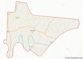
Online Interactive Map
Click on ![]() to view map in "full screen" mode.
to view map in "full screen" mode.
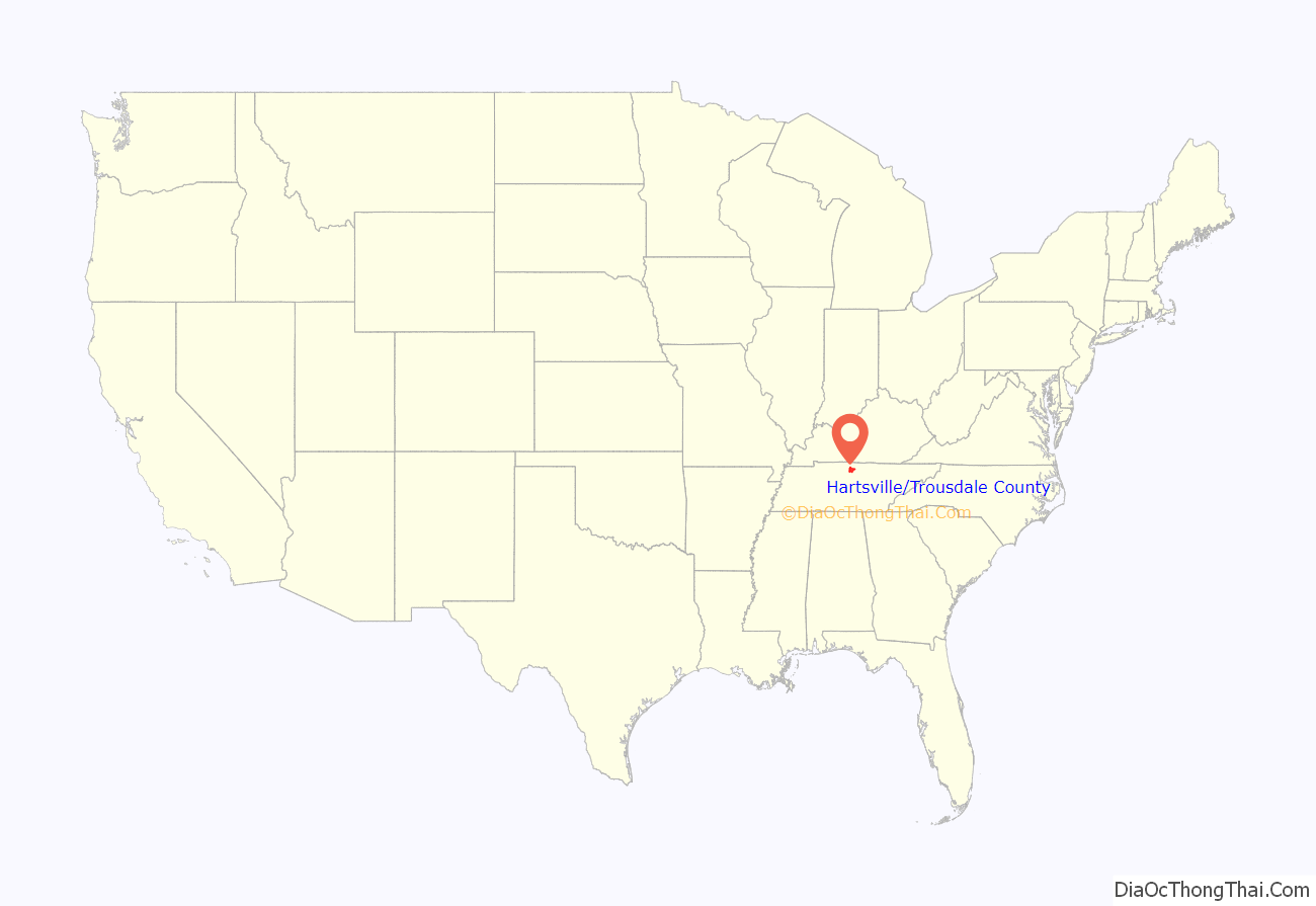
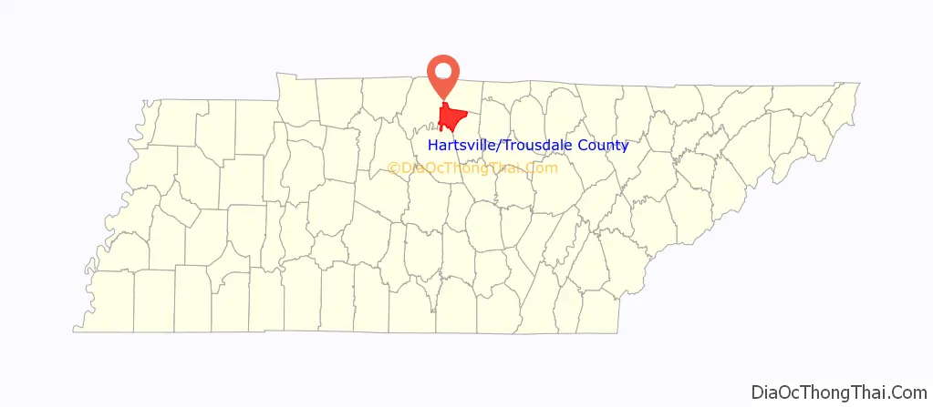
Hartsville/Trousdale County location map. Where is Hartsville/Trousdale County?
History
The first Euro-American settlers arrived in what is now Hartsville in 1797, when the family of James Hart settled along the west bank of the West Fork of Goose Creek, and the family of Charles Donoho settled along the creek’s east bank. Donoho erected a mill shortly thereafter, and the town was initially known as Donoho’s Mill. James Hart established Hart’s Ferry along the Cumberland River several miles to the south, and purchased the Donoho property in 1800. Hartsville was officially recognized as a town in 1817. Donoho’s Mill, on the east bank of the creek, had become known as “Damascus,” although it merged with Hartsville in 1840 when Hartsville officially incorporated.
During the Civil War, Hartsville was site of the Battle of Hartsville, which took place in 1862.
Julie Hayden, a 17-year old teacher, was murdered by the White Man’s League in 1874 in Hartsville.
Trousdale County is noted for having the 4th most TSSAA high school football championships, behind Alcoa, Maryville, and Brentwood Academy. Trousdale County High School won state championships in 1972, 1990, 1993, 1997, 1998, 2005, 2008, 2009, and 2013, and was runner-up in 1973, 1974, 1975, and 2018.
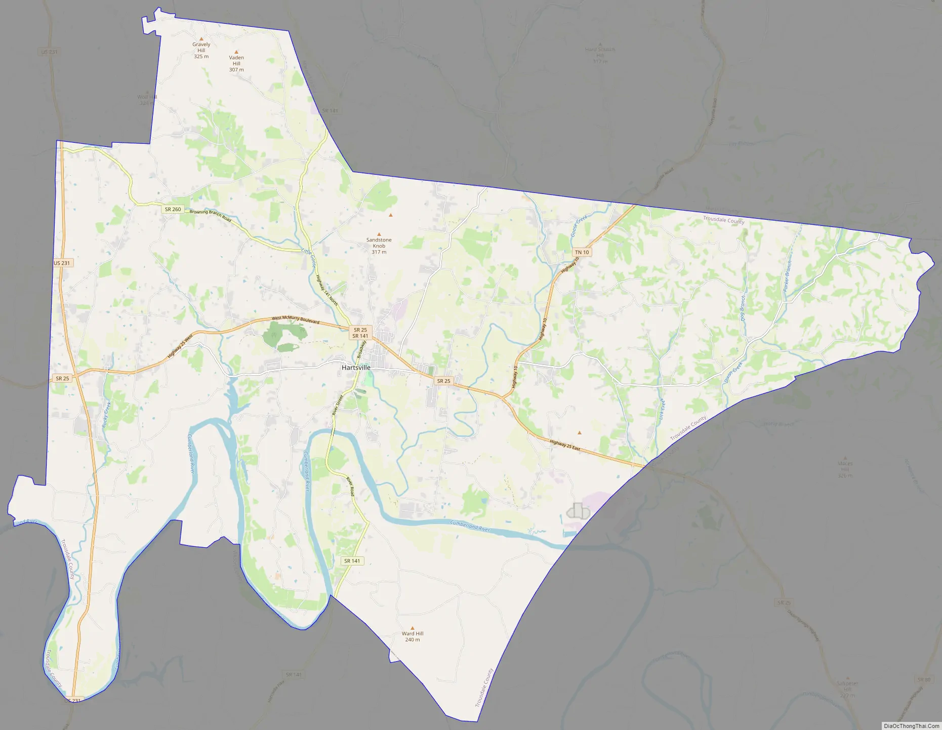
Hartsville/Trousdale County Road Map
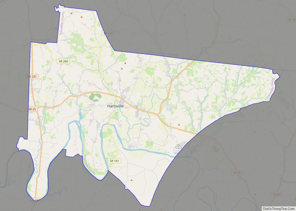
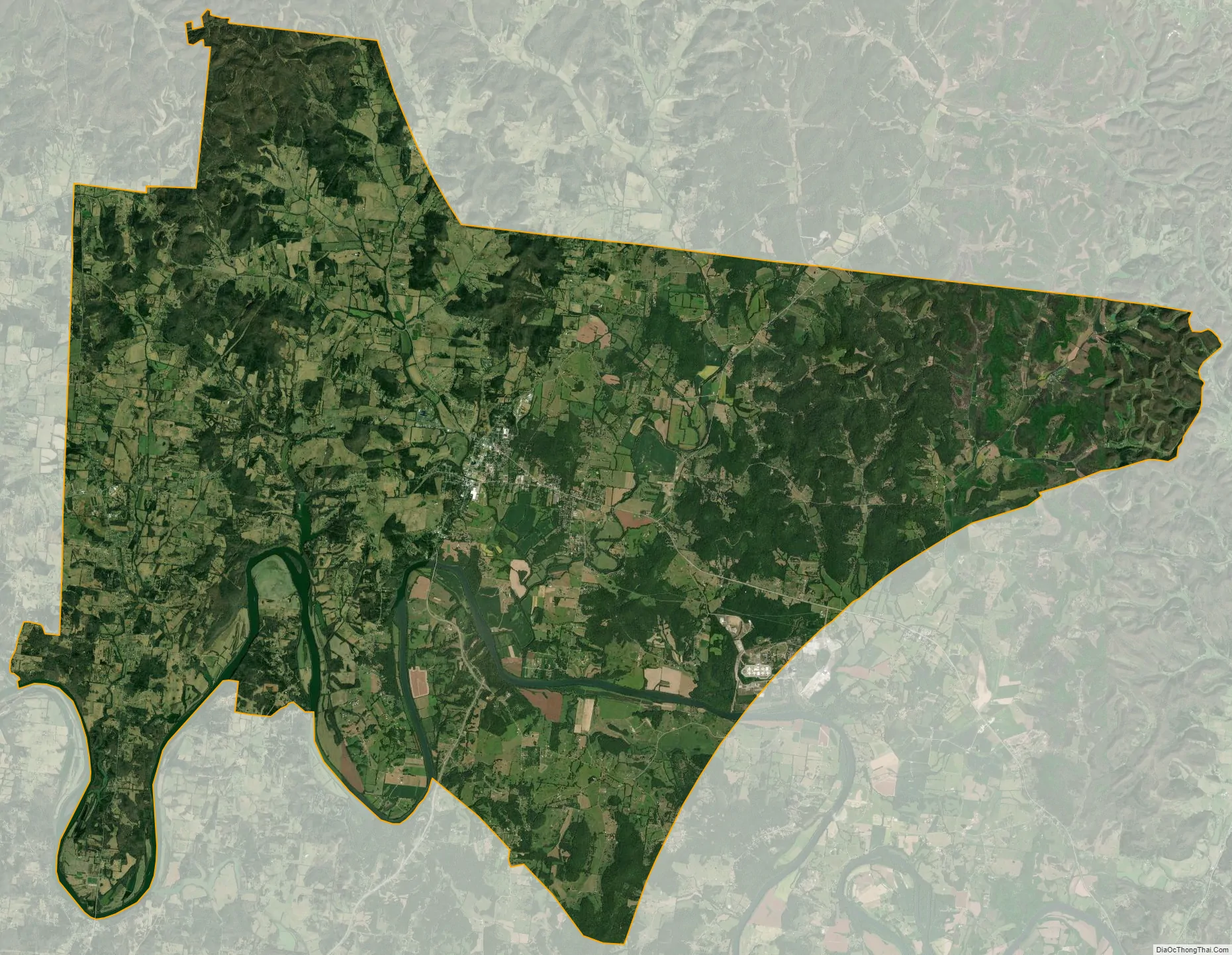
Hartsville/Trousdale County city Satellite Map
Geography
Hartsville is located at 36°23′30″N 86°9′37″W / 36.39167°N 86.16028°W / 36.39167; -86.16028 (36.391617, -86.160172). The town’s business district is situated along the West Fork of Goose Creek, which flows into Trousdale County from the hills to the north and empties into the Old Hickory Lake impoundment of the Cumberland River several miles to the south. A large hill rises immediately to the west of the business district and overlooks the entire eastern half of the county.
Hartsville lies at the junction of State Route 25, which connects the town with Carthage to the southeast and Sumner County to the west, and State Route 141, which connects Hartsville with Lebanon to the south and Macon County to the north.
According to the United States Census Bureau, the town has a total area of 3.6 square miles (9.3 km) in 2000, all land.
Climate
See also
Map of Tennessee State and its subdivision:- Anderson
- Bedford
- Benton
- Bledsoe
- Blount
- Bradley
- Campbell
- Cannon
- Carroll
- Carter
- Cheatham
- Chester
- Claiborne
- Clay
- Cocke
- Coffee
- Crockett
- Cumberland
- Davidson
- Decatur
- DeKalb
- Dickson
- Dyer
- Fayette
- Fentress
- Franklin
- Gibson
- Giles
- Grainger
- Greene
- Grundy
- Hamblen
- Hamilton
- Hancock
- Hardeman
- Hardin
- Hawkins
- Haywood
- Henderson
- Henry
- Hickman
- Houston
- Humphreys
- Jackson
- Jefferson
- Johnson
- Knox
- Lake
- Lauderdale
- Lawrence
- Lewis
- Lincoln
- Loudon
- Macon
- Madison
- Marion
- Marshall
- Maury
- McMinn
- McNairy
- Meigs
- Monroe
- Montgomery
- Moore
- Morgan
- Obion
- Overton
- Perry
- Pickett
- Polk
- Putnam
- Rhea
- Roane
- Robertson
- Rutherford
- Scott
- Sequatchie
- Sevier
- Shelby
- Smith
- Stewart
- Sullivan
- Sumner
- Tipton
- Trousdale
- Unicoi
- Union
- Van Buren
- Warren
- Washington
- Wayne
- Weakley
- White
- Williamson
- Wilson
- Alabama
- Alaska
- Arizona
- Arkansas
- California
- Colorado
- Connecticut
- Delaware
- District of Columbia
- Florida
- Georgia
- Hawaii
- Idaho
- Illinois
- Indiana
- Iowa
- Kansas
- Kentucky
- Louisiana
- Maine
- Maryland
- Massachusetts
- Michigan
- Minnesota
- Mississippi
- Missouri
- Montana
- Nebraska
- Nevada
- New Hampshire
- New Jersey
- New Mexico
- New York
- North Carolina
- North Dakota
- Ohio
- Oklahoma
- Oregon
- Pennsylvania
- Rhode Island
- South Carolina
- South Dakota
- Tennessee
- Texas
- Utah
- Vermont
- Virginia
- Washington
- West Virginia
- Wisconsin
- Wyoming