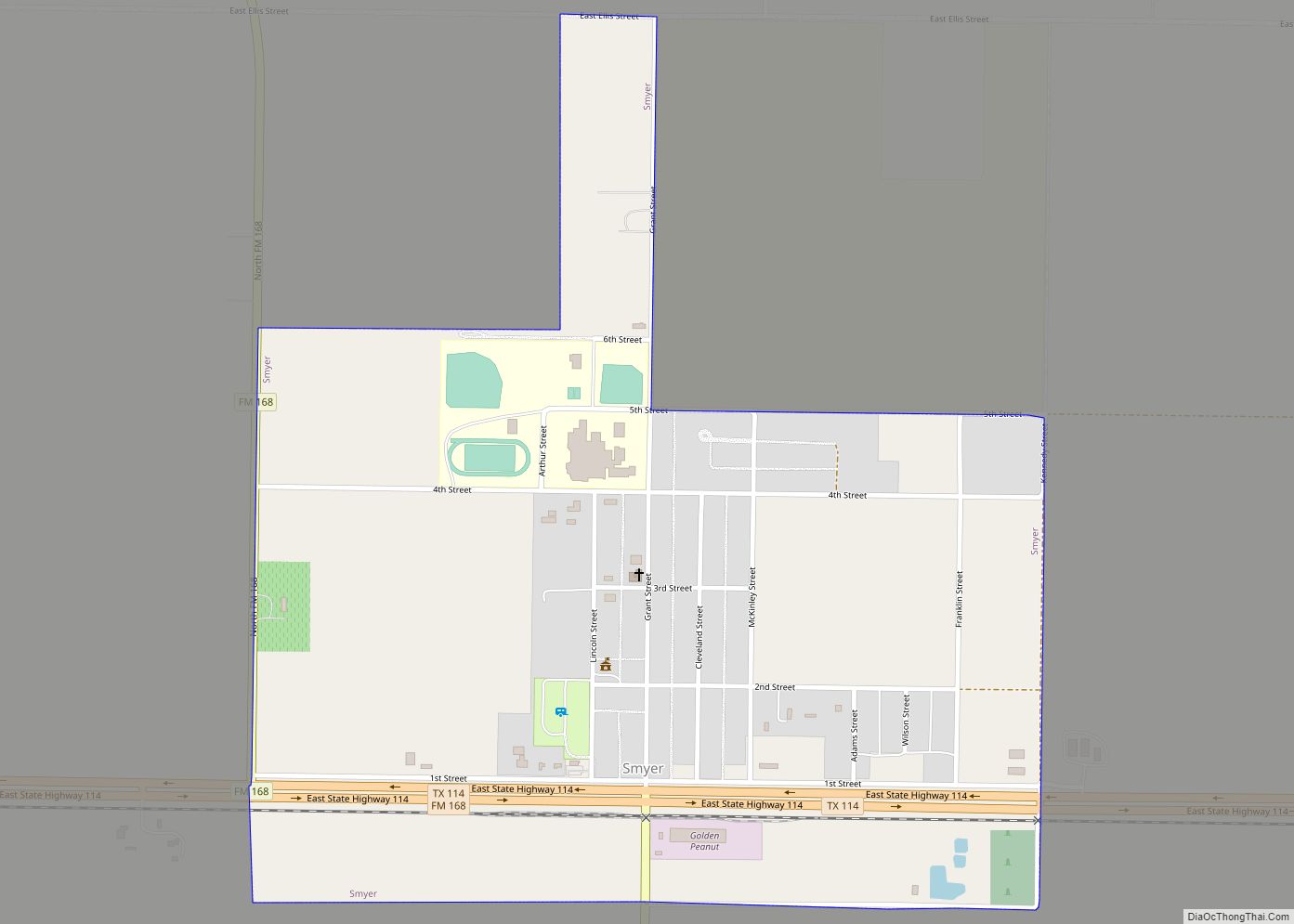
Map of Solis CDP

Map of Solis CDP

Solis is a census-designated place (CDP) in Cameron County, Texas, United States. The population was 512 at the 2010 census. It is part of the Brownsville–Harlingen Metropolitan Statistical Area. Solis CDP overview: Name: Solis CDP LSAD Code: 57 LSAD Description: CDP (suffix) State: Texas County: Cameron County Elevation: 59 ft (18 m) Total Area: 1.64 sq mi (4.24 km²) Land … Read more

Map of Socorro city, Texas

Map of Socorro city, Texas

Socorro is a city in El Paso County, Texas, United States. It is located on the north bank of the Rio Grande southeast of El Paso, and on the border of Mexico. El Paso adjoins it on the west and the smaller city of San Elizario on the southeast; small unincorporated areas of El Paso … Read more

Map of Snyder city, Texas

Map of Snyder city, Texas

Snyder is a town in, and the county seat of Scurry County, Texas, United States. The population was 11,202 at the 2010 census. The city is located in the lower part of the Southwestern Tablelands ecological region. Snyder city overview: Name: Snyder city LSAD Code: 25 LSAD Description: city (suffix) State: Texas County: Scurry County … Read more

Map of Snook city

Map of Snook city

Snook is a city in Burleson County, Texas, United States. The population was 506 at the 2020 census. Snook is home to Frank Sodolak of Sodolak’s Original Country Inn, the inventor and first known restaurant to serve chicken fried bacon. Snook is also home to Slovacek Sausage Company. Snook is the home of Chilifest, an … Read more

Map of South Point CDP, Texas

Map of South Point CDP, Texas

South Point is a census-designated place in Cameron County, Texas, United States. The population was 1,376 at the 2010 census, up from 1,118 at the 2000 census. Part of the Brownsville–Harlingen Metropolitan Statistical Area, South Point is the southernmost census designated place in the state of Texas. South Point CDP overview: Name: South Point CDP … Read more

Map of South Padre Island town

Map of South Padre Island town

South Padre Island is a resort town in Cameron County, Texas, United States. It is part of the Brownsville–Harlingen Metropolitan Statistical Area. The population was 2,066 at the 2020 census. The town is located on South Padre Island, a barrier island along the Texas Gulf Coast accessible via the Queen Isabella Causeway from the town … Read more

Map of South Mountain town

Map of South Mountain town

South Mountain is a town in Coryell County, Texas, United States. The population was 384 at the 2010 census. It is part of the Killeen–Temple–Fort Hood Metropolitan Statistical Area. South Mountain town overview: Name: South Mountain town LSAD Code: 43 LSAD Description: town (suffix) State: Texas County: Coryell County Elevation: 1,020 ft (311 m) Total Area: 1.61 sq mi … Read more

Map of South La Paloma CDP

Map of South La Paloma CDP

South La Paloma is an unincorporated community and census-designated place in Jim Wells County, Texas, United States. Its population was 345 as of the 2010 census. Prior to 2010, the community was grouped with nearby Alfred as part of the Alfred-South La Paloma census-designated place. South La Paloma CDP overview: Name: South La Paloma CDP … Read more

Map of South Houston city

Map of South Houston city

South Houston is a city in the U.S. state of Texas, within Houston–The Woodlands–Sugar Land metropolitan area and Harris County. The population was 16,153 at the 2020 census. It is bordered by the cities of Houston and Pasadena, and geographically located southeast of Houston. South Houston city overview: Name: South Houston city LSAD Code: 25 LSAD … Read more

Map of South Fork Estates CDP

Map of South Fork Estates CDP

South Fork Estates is a census-designated place (CDP) in Jim Hogg County, Texas, United States. The population was 70 at the 2010 census, up from 47 at the 2000 census. South Fork Estates CDP overview: Name: South Fork Estates CDP LSAD Code: 57 LSAD Description: CDP (suffix) State: Texas County: Jim Hogg County Elevation: 607 ft … Read more

Map of South Alamo CDP

Map of South Alamo CDP

South Alamo is a census-designated place (CDP) in Hidalgo County, Texas. The area is known locally as “Little Mex (Mexico)”. The population was 3,361 at the 2010 United States Census. It is part of the McAllen–Edinburg–Mission Metropolitan Statistical Area. South Alamo CDP overview: Name: South Alamo CDP LSAD Code: 57 LSAD Description: CDP (suffix) State: … Read more

Map of Sour Lake city

Map of Sour Lake city

Sour Lake is a city in Hardin County, Texas, United States. The population was 1,773 at the 2020 census. It was originally named “Sour Lake Springs”, after the sulphurous spring water that flowed into the nearby lake. The city is part of the Beaumont–Port Arthur Metropolitan Statistical Area. Sour Lake is the oldest surviving town … Read more