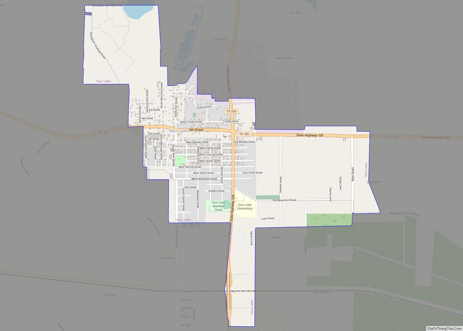
Sour Lake is a city in Hardin County, Texas, United States. The population was 1,773 at the 2020 census. It was originally named “Sour Lake Springs”, after the sulphurous spring water that flowed into the nearby lake. The city is part of the Beaumont–Port Arthur Metropolitan Statistical Area. Sour Lake is the oldest surviving town in Hardin County. It is called by some the “Gateway to the Big Thicket”.
| Name: | Sour Lake city |
|---|---|
| LSAD Code: | 25 |
| LSAD Description: | city (suffix) |
| State: | Texas |
| County: | Hardin County |
| Elevation: | 49 ft (15 m) |
| Total Area: | 2.35 sq mi (6.07 km²) |
| Land Area: | 2.30 sq mi (5.96 km²) |
| Water Area: | 0.04 sq mi (0.11 km²) |
| Total Population: | 1,773 |
| Population Density: | 835.79/sq mi (322.70/km²) |
| ZIP code: | 77659 |
| Area code: | 409 |
| FIPS code: | 4868828 |
| GNISfeature ID: | 1347394 |
Online Interactive Map
Click on ![]() to view map in "full screen" mode.
to view map in "full screen" mode.
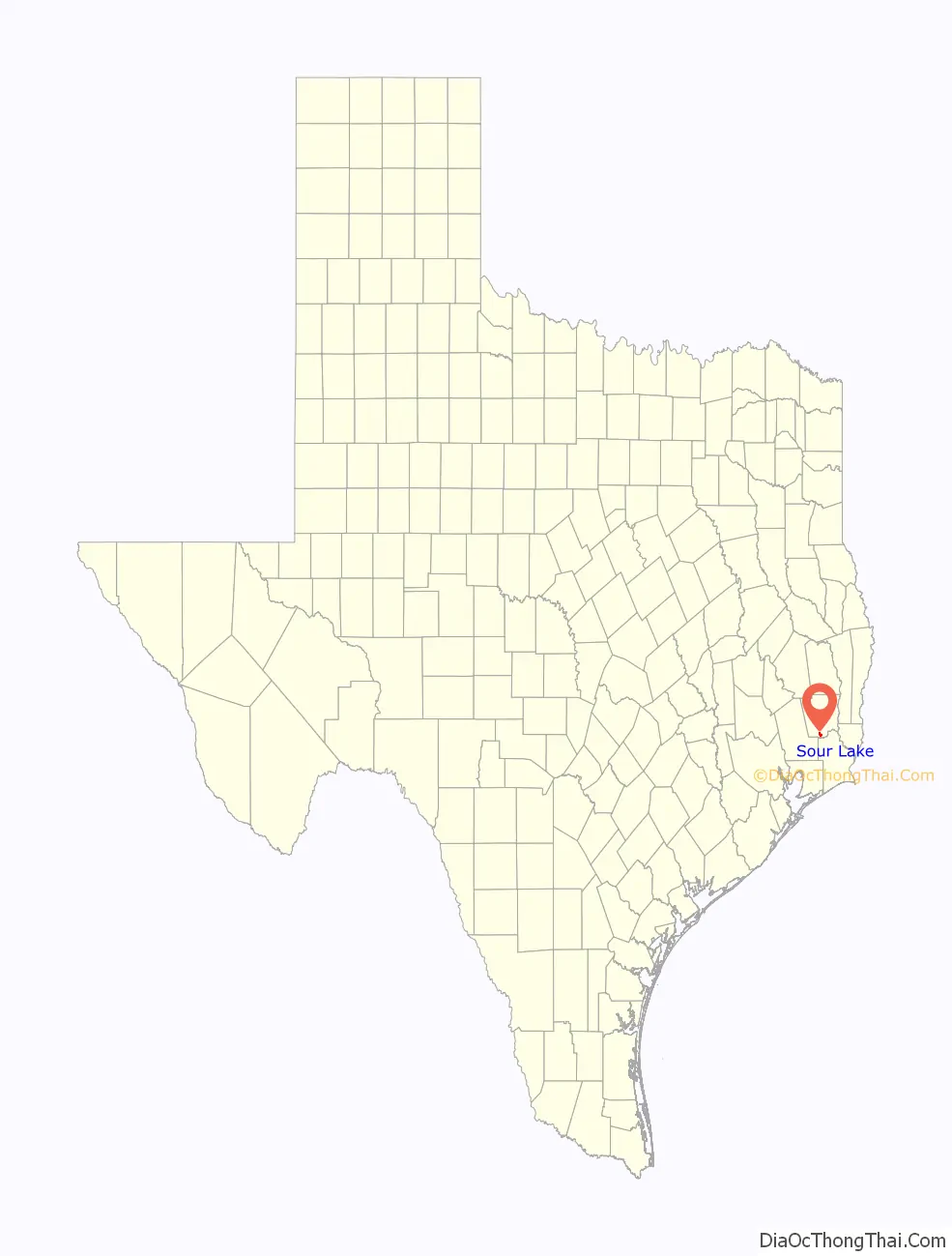
Sour Lake location map. Where is Sour Lake city?

History
Oil derricks at Sour Lake, c. 1910
Sour Lake oil leases
Sour Lake was first settled around 1835 when the Mexican state of Coahuila y Tejas granted Stephen Jackson one league of land covering 4,428 acres (17.92 km) by land grant. Sam Houston visited Sour Lake in his later years. The town is home to one of the biggest sinkholes in Texas.
Sour Lake became a short-lived boomtown with the discovery of oil in 1901, shortly after oil was found at the nearby Spindletop salt dome. It is known as the birthplace of Texaco. Formed in 1903, the Texas Company (Texaco’s former corporate name) is one of the three major oil companies that can trace its origins to the oil fields around Southeast Texas. The Sour Lake oilfield produced about 90,000,000 barrels (14,000,000 m) of oil up to 1948, when it was producing about 3,500 barrels (560 m) daily and new drilling was still underway. Today the Sour Lake oilfield is the oldest continuously producing oil field in the world.
The town of Atcheson in Bruce McCandless’s 2012 novel Sour Lake appears to be based at least loosely on the real Sour Lake. Atcheson, like the real-life Sour Lake, is situated in the Big Thicket and experienced a short-lived oil boom in early years of the 20th century. Yvette Benavides, in a San Antonio Express-News review of the book, noted, “There is a lot that is historically factual in this novel. That’s part of the fun of reading Sour Lake.”
The Ecuadorian jungle town commonly referred to as Lago Agrio was named after Sour Lake by Texaco when the company established the oil-producing settlement. Lago Agrio is Spanish for “Sour Lake”. The official name of the Ecuadorian town is Nueva Loja.
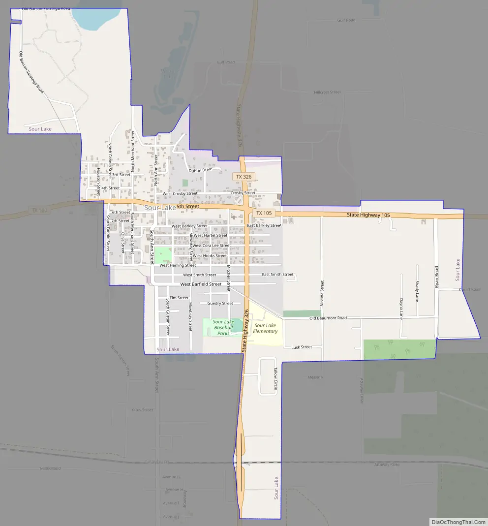
Sour Lake Road Map
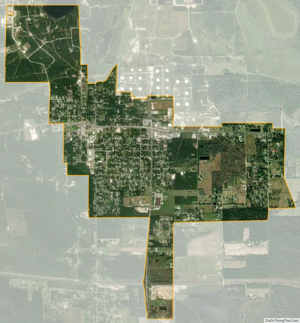
Sour Lake city Satellite Map
Geography
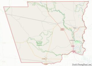
Sour Lake is in southern Hardin County at the intersection of state highways 105 and 326. Highway 105 leads west 46 miles (74 km) to Cleveland, Texas, and east 14 miles (23 km) to the US 69 freeway in the northern part of Beaumont. Highway 326 leads north 18 miles (29 km) to Kountze, the Hardin county seat, and south 7 miles (11 km) to U.S. Route 90 at Nome.
According to the United States Census Bureau, the city of Sour Lake has a total area of 2.0 square miles (5.3 km), of which 0.02 square miles (0.06 km), or 1.21%, are water.
See also
Map of Texas State and its subdivision:- Anderson
- Andrews
- Angelina
- Aransas
- Archer
- Armstrong
- Atascosa
- Austin
- Bailey
- Bandera
- Bastrop
- Baylor
- Bee
- Bell
- Bexar
- Blanco
- Borden
- Bosque
- Bowie
- Brazoria
- Brazos
- Brewster
- Briscoe
- Brooks
- Brown
- Burleson
- Burnet
- Caldwell
- Calhoun
- Callahan
- Cameron
- Camp
- Carson
- Cass
- Castro
- Chambers
- Cherokee
- Childress
- Clay
- Cochran
- Coke
- Coleman
- Collin
- Collingsworth
- Colorado
- Comal
- Comanche
- Concho
- Cooke
- Coryell
- Cottle
- Crane
- Crockett
- Crosby
- Culberson
- Dallam
- Dallas
- Dawson
- Deaf Smith
- Delta
- Denton
- Dewitt
- Dickens
- Dimmit
- Donley
- Duval
- Eastland
- Ector
- Edwards
- El Paso
- Ellis
- Erath
- Falls
- Fannin
- Fayette
- Fisher
- Floyd
- Foard
- Fort Bend
- Franklin
- Freestone
- Frio
- Gaines
- Galveston
- Garza
- Gillespie
- Glasscock
- Goliad
- Gonzales
- Gray
- Grayson
- Gregg
- Grimes
- Guadalupe
- Hale
- Hall
- Hamilton
- Hansford
- Hardeman
- Hardin
- Harris
- Harrison
- Hartley
- Haskell
- Hays
- Hemphill
- Henderson
- Hidalgo
- Hill
- Hockley
- Hood
- Hopkins
- Houston
- Howard
- Hudspeth
- Hunt
- Hutchinson
- Irion
- Jack
- Jackson
- Jasper
- Jeff Davis
- Jefferson
- Jim Hogg
- Jim Wells
- Johnson
- Jones
- Karnes
- Kaufman
- Kendall
- Kenedy
- Kent
- Kerr
- Kimble
- King
- Kinney
- Kleberg
- Knox
- La Salle
- Lamar
- Lamb
- Lampasas
- Lavaca
- Lee
- Leon
- Liberty
- Limestone
- Lipscomb
- Live Oak
- Llano
- Loving
- Lubbock
- Lynn
- Madison
- Marion
- Martin
- Mason
- Matagorda
- Maverick
- McCulloch
- McLennan
- McMullen
- Medina
- Menard
- Midland
- Milam
- Mills
- Mitchell
- Montague
- Montgomery
- Moore
- Morris
- Motley
- Nacogdoches
- Navarro
- Newton
- Nolan
- Nueces
- Ochiltree
- Oldham
- Orange
- Palo Pinto
- Panola
- Parker
- Parmer
- Pecos
- Polk
- Potter
- Presidio
- Rains
- Randall
- Reagan
- Real
- Red River
- Reeves
- Refugio
- Roberts
- Robertson
- Rockwall
- Runnels
- Rusk
- Sabine
- San Augustine
- San Jacinto
- San Patricio
- San Saba
- Schleicher
- Scurry
- Shackelford
- Shelby
- Sherman
- Smith
- Somervell
- Starr
- Stephens
- Sterling
- Stonewall
- Sutton
- Swisher
- Tarrant
- Taylor
- Terrell
- Terry
- Throckmorton
- Titus
- Tom Green
- Travis
- Trinity
- Tyler
- Upshur
- Upton
- Uvalde
- Val Verde
- Van Zandt
- Victoria
- Walker
- Waller
- Ward
- Washington
- Webb
- Wharton
- Wheeler
- Wichita
- Wilbarger
- Willacy
- Williamson
- Wilson
- Winkler
- Wise
- Wood
- Yoakum
- Young
- Zapata
- Zavala
- Alabama
- Alaska
- Arizona
- Arkansas
- California
- Colorado
- Connecticut
- Delaware
- District of Columbia
- Florida
- Georgia
- Hawaii
- Idaho
- Illinois
- Indiana
- Iowa
- Kansas
- Kentucky
- Louisiana
- Maine
- Maryland
- Massachusetts
- Michigan
- Minnesota
- Mississippi
- Missouri
- Montana
- Nebraska
- Nevada
- New Hampshire
- New Jersey
- New Mexico
- New York
- North Carolina
- North Dakota
- Ohio
- Oklahoma
- Oregon
- Pennsylvania
- Rhode Island
- South Carolina
- South Dakota
- Tennessee
- Texas
- Utah
- Vermont
- Virginia
- Washington
- West Virginia
- Wisconsin
- Wyoming