Smithville is a city in Bastrop County, Texas, United States, near the Colorado River. The population was 3,922 at the 2020 census.
| Name: | Smithville city |
|---|---|
| LSAD Code: | 25 |
| LSAD Description: | city (suffix) |
| State: | Texas |
| County: | Bastrop County |
| Elevation: | 325 ft (99 m) |
| Total Area: | 4.02 sq mi (10.40 km²) |
| Land Area: | 4.00 sq mi (10.35 km²) |
| Water Area: | 0.02 sq mi (0.05 km²) |
| Total Population: | 3,922 |
| Population Density: | 1,130.16/sq mi (436.32/km²) |
| ZIP code: | 78957 |
| Area code: | 512 |
| FIPS code: | 4868456 |
| GNISfeature ID: | 1376161 |
| Website: | www.ci.smithville.tx.us |
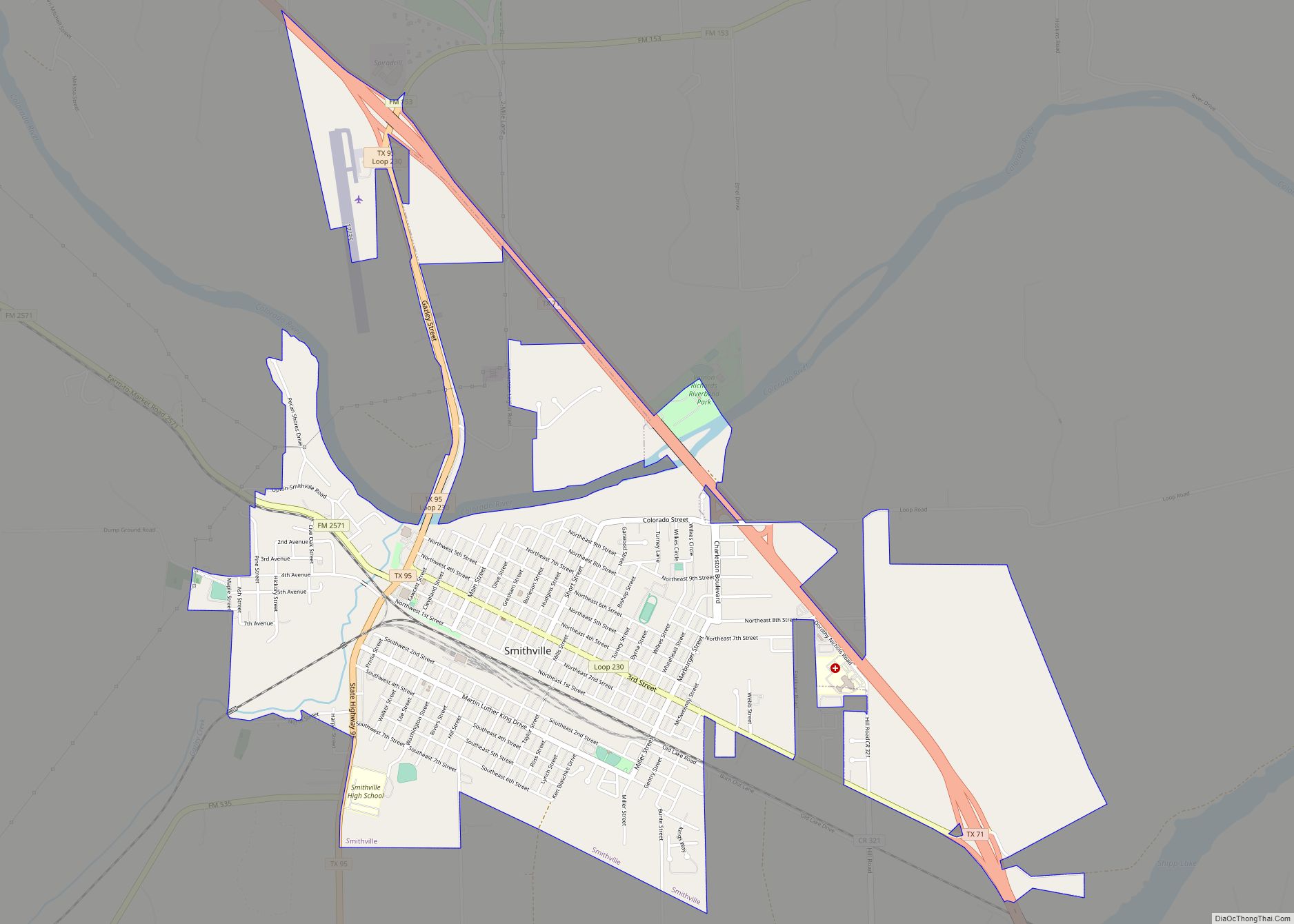
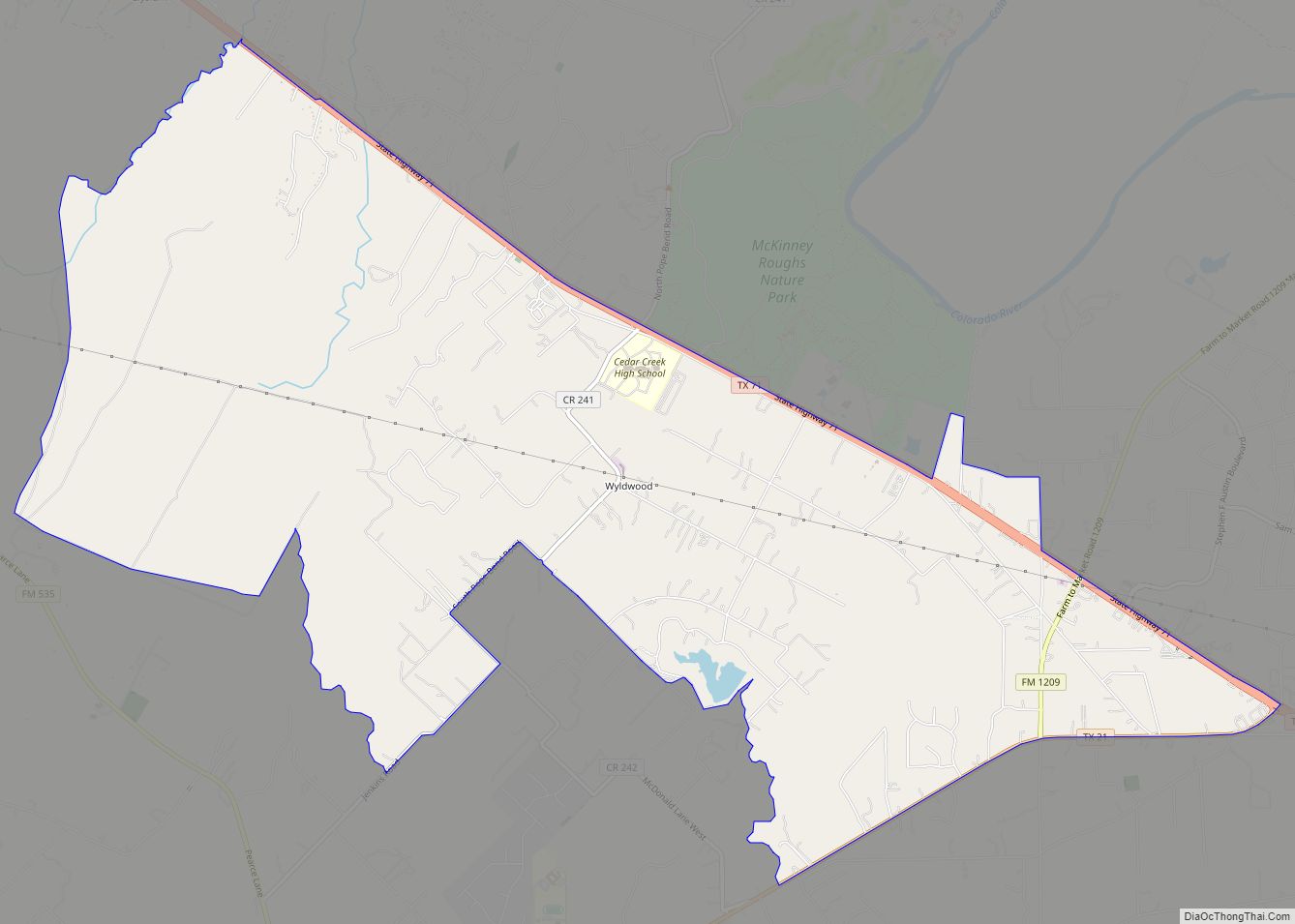
Online Interactive Map
Click on ![]() to view map in "full screen" mode.
to view map in "full screen" mode.
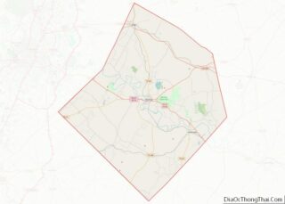
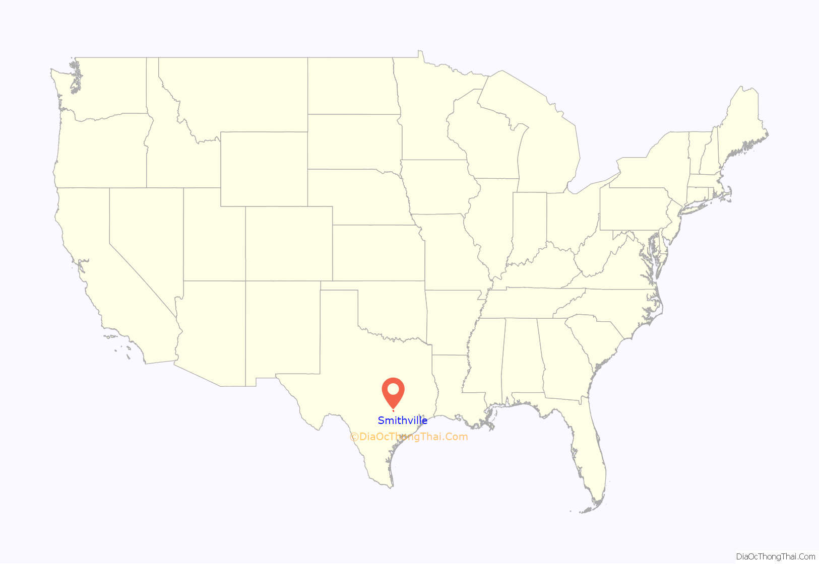
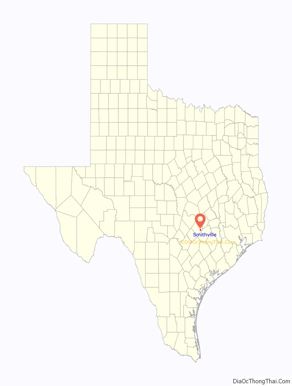
Smithville location map. Where is Smithville city?
History
Thomas Jefferson Gazley arrived in 1827 and set the pace of development for Smithville by building the first house and establishing the first store, which served incoming settlers. He later served in the Mexican government and helped write the Texas Declaration of Independence and the first Constitution, and became a true Texas hero.
William Smith’s family arrived several years after Gazley. They also owned a store and were early influences on the area, including the naming of Smithville where about seventeen families lived on the south bank of the Colorado River.
Local businessman, Murray Burleson, persuaded the approaching railroad to erect a terminus here and the TB&H steamed through in 1887. The Missouri, Kansas & Texas took over the Taylor, Bastrop, and Houston Railroad in 1891. In 1894, the MK&T established central shops in Smithville, giving rise to growth which resulted in Smithville becoming the largest town in Bastrop County for nearly fifty years.
This population created markets for homes, stores, and other necessities as it grew from a frontier village to a town. The Hill family moved retail marketing here and established the first bank. The need for infrastructure systems attracted the Buescher brothers to come and create the first utilities. Partnerships of prominent men involved in land-based activities united the Bueschers, Powells, Cooks, Eaglestons, Turneys, Rabbs, Buntes and others to establish cotton gins, general stores, drugstores, lumber and brickyards and to develop numerous churches and fraternal organizations such as the Masons and the Oddfellows and to provide medical care for this now flourishing community.
In 1895, this thriving town was officially incorporated into the City of Smithville.
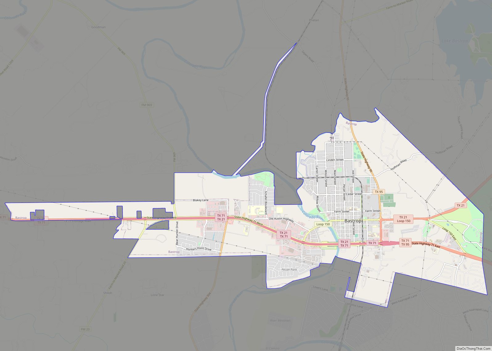
Smithville Road Map
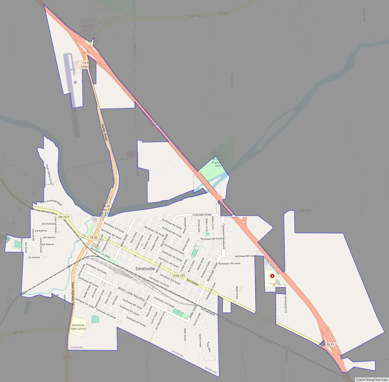
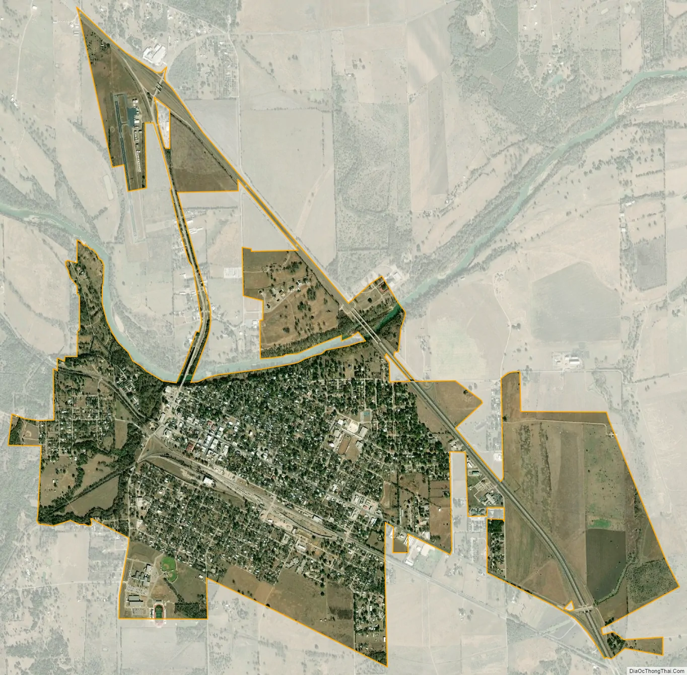
Smithville city Satellite Map
Geography
Smithville is located in southeastern Bastrop County. It is 12 miles (19 km) southeast of Bastrop and 42 miles (68 km) southeast of Austin.
See also
Map of Texas State and its subdivision:- Anderson
- Andrews
- Angelina
- Aransas
- Archer
- Armstrong
- Atascosa
- Austin
- Bailey
- Bandera
- Bastrop
- Baylor
- Bee
- Bell
- Bexar
- Blanco
- Borden
- Bosque
- Bowie
- Brazoria
- Brazos
- Brewster
- Briscoe
- Brooks
- Brown
- Burleson
- Burnet
- Caldwell
- Calhoun
- Callahan
- Cameron
- Camp
- Carson
- Cass
- Castro
- Chambers
- Cherokee
- Childress
- Clay
- Cochran
- Coke
- Coleman
- Collin
- Collingsworth
- Colorado
- Comal
- Comanche
- Concho
- Cooke
- Coryell
- Cottle
- Crane
- Crockett
- Crosby
- Culberson
- Dallam
- Dallas
- Dawson
- Deaf Smith
- Delta
- Denton
- Dewitt
- Dickens
- Dimmit
- Donley
- Duval
- Eastland
- Ector
- Edwards
- El Paso
- Ellis
- Erath
- Falls
- Fannin
- Fayette
- Fisher
- Floyd
- Foard
- Fort Bend
- Franklin
- Freestone
- Frio
- Gaines
- Galveston
- Garza
- Gillespie
- Glasscock
- Goliad
- Gonzales
- Gray
- Grayson
- Gregg
- Grimes
- Guadalupe
- Hale
- Hall
- Hamilton
- Hansford
- Hardeman
- Hardin
- Harris
- Harrison
- Hartley
- Haskell
- Hays
- Hemphill
- Henderson
- Hidalgo
- Hill
- Hockley
- Hood
- Hopkins
- Houston
- Howard
- Hudspeth
- Hunt
- Hutchinson
- Irion
- Jack
- Jackson
- Jasper
- Jeff Davis
- Jefferson
- Jim Hogg
- Jim Wells
- Johnson
- Jones
- Karnes
- Kaufman
- Kendall
- Kenedy
- Kent
- Kerr
- Kimble
- King
- Kinney
- Kleberg
- Knox
- La Salle
- Lamar
- Lamb
- Lampasas
- Lavaca
- Lee
- Leon
- Liberty
- Limestone
- Lipscomb
- Live Oak
- Llano
- Loving
- Lubbock
- Lynn
- Madison
- Marion
- Martin
- Mason
- Matagorda
- Maverick
- McCulloch
- McLennan
- McMullen
- Medina
- Menard
- Midland
- Milam
- Mills
- Mitchell
- Montague
- Montgomery
- Moore
- Morris
- Motley
- Nacogdoches
- Navarro
- Newton
- Nolan
- Nueces
- Ochiltree
- Oldham
- Orange
- Palo Pinto
- Panola
- Parker
- Parmer
- Pecos
- Polk
- Potter
- Presidio
- Rains
- Randall
- Reagan
- Real
- Red River
- Reeves
- Refugio
- Roberts
- Robertson
- Rockwall
- Runnels
- Rusk
- Sabine
- San Augustine
- San Jacinto
- San Patricio
- San Saba
- Schleicher
- Scurry
- Shackelford
- Shelby
- Sherman
- Smith
- Somervell
- Starr
- Stephens
- Sterling
- Stonewall
- Sutton
- Swisher
- Tarrant
- Taylor
- Terrell
- Terry
- Throckmorton
- Titus
- Tom Green
- Travis
- Trinity
- Tyler
- Upshur
- Upton
- Uvalde
- Val Verde
- Van Zandt
- Victoria
- Walker
- Waller
- Ward
- Washington
- Webb
- Wharton
- Wheeler
- Wichita
- Wilbarger
- Willacy
- Williamson
- Wilson
- Winkler
- Wise
- Wood
- Yoakum
- Young
- Zapata
- Zavala
- Alabama
- Alaska
- Arizona
- Arkansas
- California
- Colorado
- Connecticut
- Delaware
- District of Columbia
- Florida
- Georgia
- Hawaii
- Idaho
- Illinois
- Indiana
- Iowa
- Kansas
- Kentucky
- Louisiana
- Maine
- Maryland
- Massachusetts
- Michigan
- Minnesota
- Mississippi
- Missouri
- Montana
- Nebraska
- Nevada
- New Hampshire
- New Jersey
- New Mexico
- New York
- North Carolina
- North Dakota
- Ohio
- Oklahoma
- Oregon
- Pennsylvania
- Rhode Island
- South Carolina
- South Dakota
- Tennessee
- Texas
- Utah
- Vermont
- Virginia
- Washington
- West Virginia
- Wisconsin
- Wyoming