Sonora is a city in and the county seat of Sutton County, Texas, United States. The population was 3,027 at the 2010 census.
| Name: | Sonora city |
|---|---|
| LSAD Code: | 25 |
| LSAD Description: | city (suffix) |
| State: | Texas |
| County: | Sutton County |
| Elevation: | 2,129 ft (649 m) |
| Total Area: | 2.22 sq mi (5.75 km²) |
| Land Area: | 2.22 sq mi (5.75 km²) |
| Water Area: | 0.00 sq mi (0.00 km²) |
| Total Population: | 3,027 |
| Population Density: | 1,256.09/sq mi (484.90/km²) |
| ZIP code: | 76950 |
| Area code: | Area code 325 |
| FIPS code: | 4868756 |
| GNISfeature ID: | 1368606 |
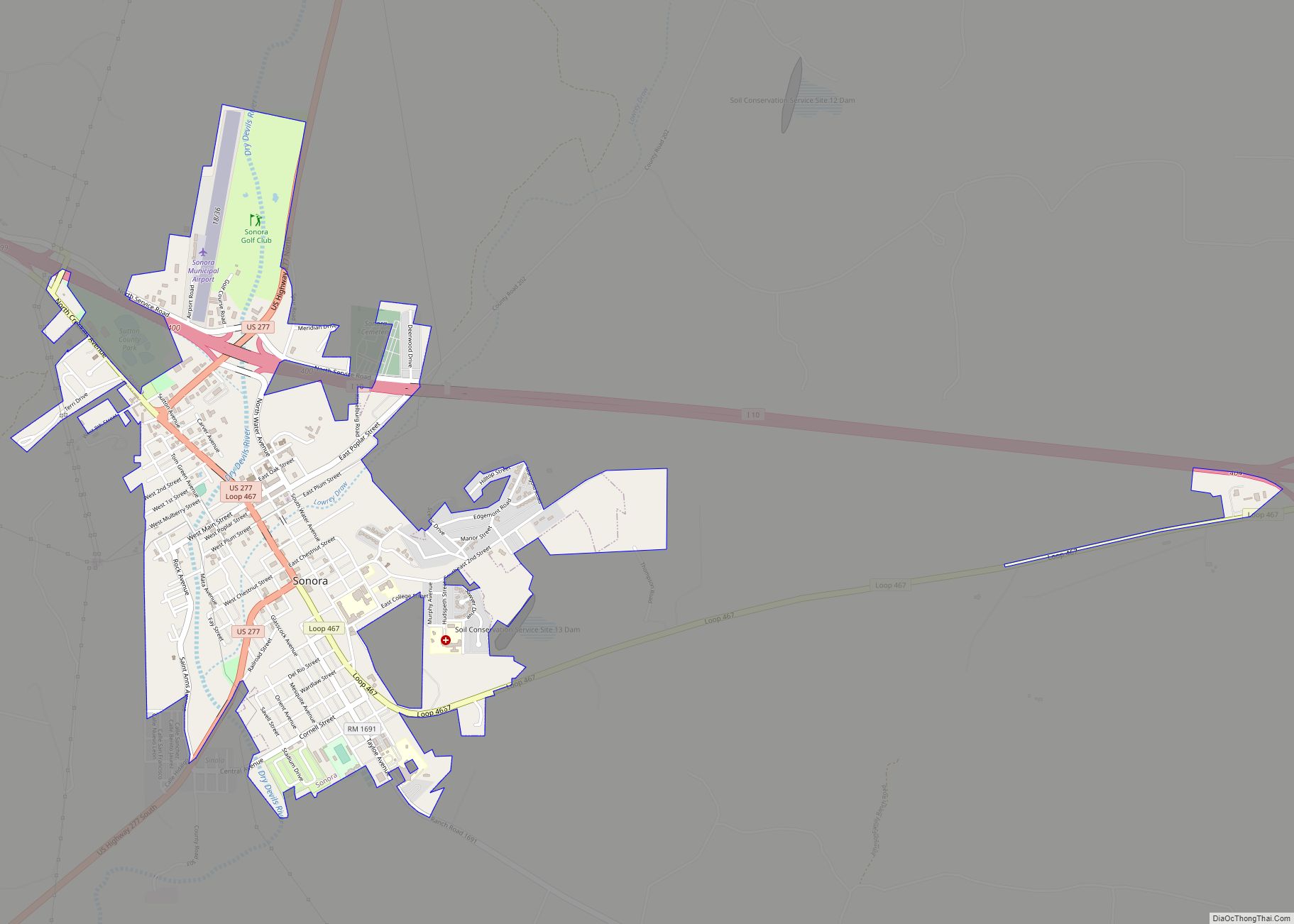
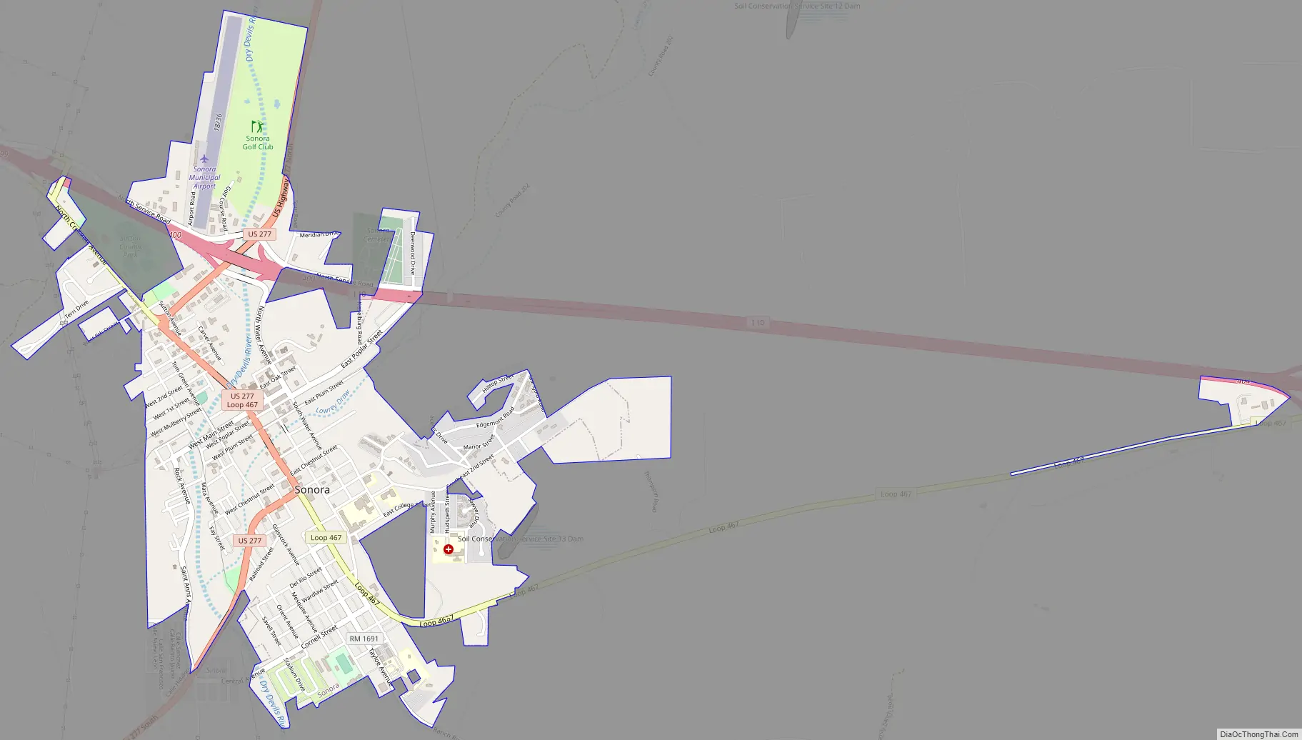
Online Interactive Map
Click on ![]() to view map in "full screen" mode.
to view map in "full screen" mode.
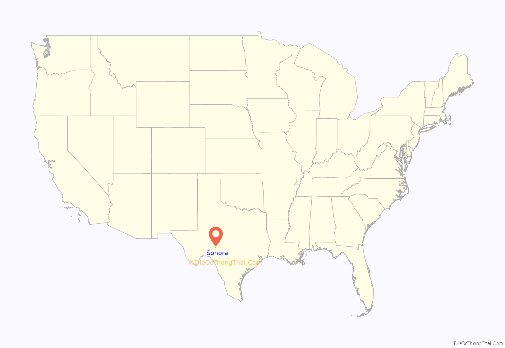
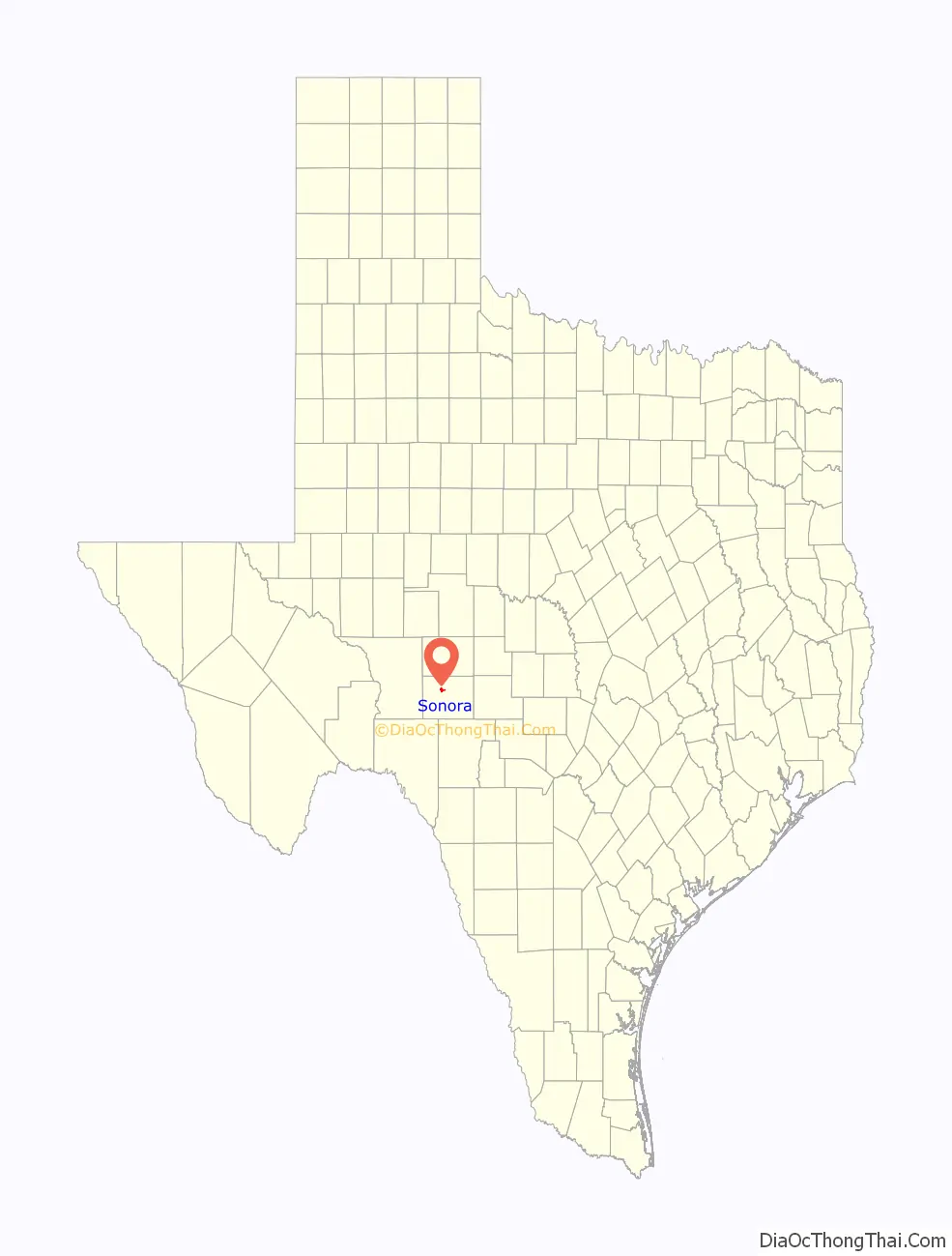
Sonora location map. Where is Sonora city?
History
On the night of April 2, 1901, William Carver, a member of Butch Cassidy’s Wild Bunch, was shot and killed in Jack Owen’s Bakery by Sheriff E.S. Briant and his deputies. Briant was trying to arrest Carver on suspicion of the murder of Oliver Thornton in Concho County.
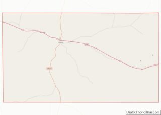
Sonora Road Map
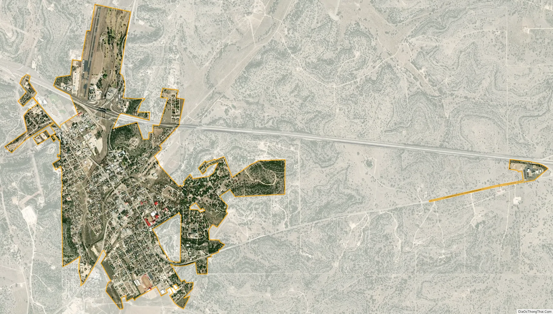
Sonora city Satellite Map
Geography
Sonora is located at 30°34′5″N 100°38′39″W / 30.56806°N 100.64417°W / 30.56806; -100.64417 (30.568166, –100.644163).
According to the United States Census Bureau, the city has a total area of 2.0 square miles (5.1 km), all of it land.
The area lies in the western portions of the Texas Hill Country, a region of limestone outcrops and rolling terrain dotted with areas of live oaks (Quercus fusiformis) and juniper (Juniperus ashei) in the form of a woodland or savanna, alternating with a blend of various grasses and other shrubs and cacti.
Sonora’s climate is subhumid and subtropical, though periods of long drought are not uncommon due to the proximity of deserts and steppes nearby, to the west. The upland location allows some of the periodic Gulf of Mexico moisture to interact with frontal systems and elevated terrain to create more clouds and precipitation than locations in the brush country to the south, or the steppes and deserts to the west and northwest. Thunderstorms with heavy rainfall are most frequent during spring and fall months, though some lighter, steady precipitation and low clouds can occur during the winter, due in large part to frontal systems originating on the plains and prairies to the north.
Summers are long and hot, often with higher humidity, though a good breeze often moderates the heat. Fall through spring months are often pleasant, though winter can experience brief periods of cold or cloudy weather.
See also
Map of Texas State and its subdivision:- Anderson
- Andrews
- Angelina
- Aransas
- Archer
- Armstrong
- Atascosa
- Austin
- Bailey
- Bandera
- Bastrop
- Baylor
- Bee
- Bell
- Bexar
- Blanco
- Borden
- Bosque
- Bowie
- Brazoria
- Brazos
- Brewster
- Briscoe
- Brooks
- Brown
- Burleson
- Burnet
- Caldwell
- Calhoun
- Callahan
- Cameron
- Camp
- Carson
- Cass
- Castro
- Chambers
- Cherokee
- Childress
- Clay
- Cochran
- Coke
- Coleman
- Collin
- Collingsworth
- Colorado
- Comal
- Comanche
- Concho
- Cooke
- Coryell
- Cottle
- Crane
- Crockett
- Crosby
- Culberson
- Dallam
- Dallas
- Dawson
- Deaf Smith
- Delta
- Denton
- Dewitt
- Dickens
- Dimmit
- Donley
- Duval
- Eastland
- Ector
- Edwards
- El Paso
- Ellis
- Erath
- Falls
- Fannin
- Fayette
- Fisher
- Floyd
- Foard
- Fort Bend
- Franklin
- Freestone
- Frio
- Gaines
- Galveston
- Garza
- Gillespie
- Glasscock
- Goliad
- Gonzales
- Gray
- Grayson
- Gregg
- Grimes
- Guadalupe
- Hale
- Hall
- Hamilton
- Hansford
- Hardeman
- Hardin
- Harris
- Harrison
- Hartley
- Haskell
- Hays
- Hemphill
- Henderson
- Hidalgo
- Hill
- Hockley
- Hood
- Hopkins
- Houston
- Howard
- Hudspeth
- Hunt
- Hutchinson
- Irion
- Jack
- Jackson
- Jasper
- Jeff Davis
- Jefferson
- Jim Hogg
- Jim Wells
- Johnson
- Jones
- Karnes
- Kaufman
- Kendall
- Kenedy
- Kent
- Kerr
- Kimble
- King
- Kinney
- Kleberg
- Knox
- La Salle
- Lamar
- Lamb
- Lampasas
- Lavaca
- Lee
- Leon
- Liberty
- Limestone
- Lipscomb
- Live Oak
- Llano
- Loving
- Lubbock
- Lynn
- Madison
- Marion
- Martin
- Mason
- Matagorda
- Maverick
- McCulloch
- McLennan
- McMullen
- Medina
- Menard
- Midland
- Milam
- Mills
- Mitchell
- Montague
- Montgomery
- Moore
- Morris
- Motley
- Nacogdoches
- Navarro
- Newton
- Nolan
- Nueces
- Ochiltree
- Oldham
- Orange
- Palo Pinto
- Panola
- Parker
- Parmer
- Pecos
- Polk
- Potter
- Presidio
- Rains
- Randall
- Reagan
- Real
- Red River
- Reeves
- Refugio
- Roberts
- Robertson
- Rockwall
- Runnels
- Rusk
- Sabine
- San Augustine
- San Jacinto
- San Patricio
- San Saba
- Schleicher
- Scurry
- Shackelford
- Shelby
- Sherman
- Smith
- Somervell
- Starr
- Stephens
- Sterling
- Stonewall
- Sutton
- Swisher
- Tarrant
- Taylor
- Terrell
- Terry
- Throckmorton
- Titus
- Tom Green
- Travis
- Trinity
- Tyler
- Upshur
- Upton
- Uvalde
- Val Verde
- Van Zandt
- Victoria
- Walker
- Waller
- Ward
- Washington
- Webb
- Wharton
- Wheeler
- Wichita
- Wilbarger
- Willacy
- Williamson
- Wilson
- Winkler
- Wise
- Wood
- Yoakum
- Young
- Zapata
- Zavala
- Alabama
- Alaska
- Arizona
- Arkansas
- California
- Colorado
- Connecticut
- Delaware
- District of Columbia
- Florida
- Georgia
- Hawaii
- Idaho
- Illinois
- Indiana
- Iowa
- Kansas
- Kentucky
- Louisiana
- Maine
- Maryland
- Massachusetts
- Michigan
- Minnesota
- Mississippi
- Missouri
- Montana
- Nebraska
- Nevada
- New Hampshire
- New Jersey
- New Mexico
- New York
- North Carolina
- North Dakota
- Ohio
- Oklahoma
- Oregon
- Pennsylvania
- Rhode Island
- South Carolina
- South Dakota
- Tennessee
- Texas
- Utah
- Vermont
- Virginia
- Washington
- West Virginia
- Wisconsin
- Wyoming