Map of Stonewall CDP, Texas

Map of Stonewall CDP, Texas

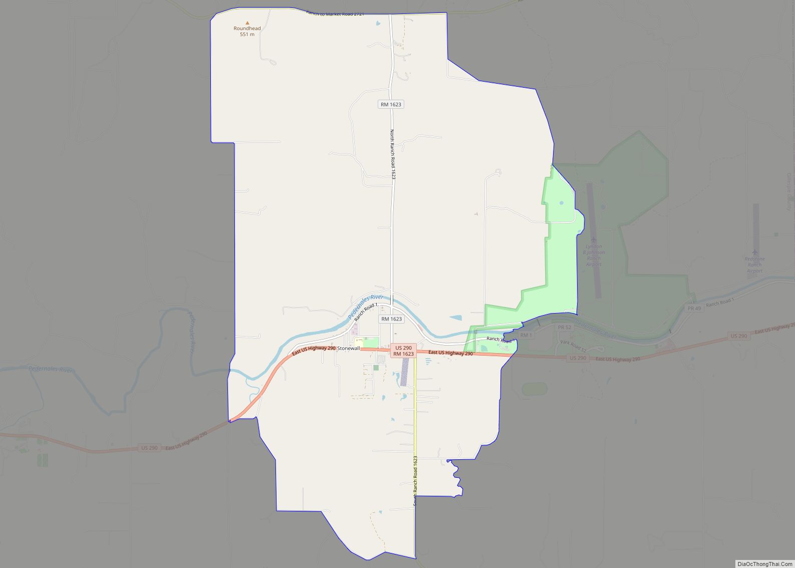
Stonewall is an unincorporated community and census-designated place (CDP) in Gillespie County, Texas, United States. The population was 525 at the 2010 census. It was named for Confederate General Thomas J. (Stonewall) Jackson, by Israel P. Nunez who established a stage station near the site in 1870. Stonewall CDP overview: Name: Stonewall CDP LSAD Code: … Read more

Map of Stockdale city, Texas

Map of Stockdale city, Texas

Stockdale is a city in Wilson County, Texas, United States. The population was 1,413 at the 2020 census. It is part of the San Antonio Metropolitan Statistical Area. Stockdale city overview: Name: Stockdale city LSAD Code: 25 LSAD Description: city (suffix) State: Texas County: Wilson County Elevation: 443 ft (135 m) Total Area: 1.69 sq mi (4.37 km²) Land Area: … Read more

Map of Stinnett city

Map of Stinnett city

Stinnett (/stɪˈnɛt/ sti-NET) is a city in and the county seat of Hutchinson County, Texas, United States. The population was 1,881 at the 2010 census, a decrease from 1,936 at the 2000 census. Stinnett city overview: Name: Stinnett city LSAD Code: 25 LSAD Description: city (suffix) State: Texas County: Hutchinson County Elevation: 3,189 ft (972 m) Total … Read more

Map of Sterling City city

Map of Sterling City

Sterling City is the county seat of Sterling County, Texas, United States. Its population was 1,121 at the 2020 census. Sterling City overview: Name: Sterling City LSAD Code: 25 LSAD Description: city (suffix) State: Texas County: Sterling County Elevation: 2,287 ft (697 m) Total Area: 0.98 sq mi (2.54 km²) Land Area: 0.98 sq mi (2.54 km²) Water Area: 0.00 sq mi (0.00 km²) Total Population: … Read more

Map of Stephenville city

Map of Stephenville city

Stephenville is a city in and the county seat of Erath County, Texas, United States. It is on the North Bosque River, which forms nearby. Founded in 1854, it is home to Tarleton State University. As of the 2020 census, the city’s population was 20,847, and it is the principal city in the Stephenville Micropolitan … Read more

Map of Star Harbor city

Map of Star Harbor city

Star Harbor is a city in Henderson County, Texas, United States. The population was 482 at the 2020 census. Star Harbor city overview: Name: Star Harbor city LSAD Code: 25 LSAD Description: city (suffix) State: Texas County: Henderson County Elevation: 341 ft (104 m) Total Area: 0.55 sq mi (1.43 km²) Land Area: 0.47 sq mi (1.21 km²) Water Area: 0.09 sq mi (0.22 km²) Total … Read more

Map of Staples city, Texas

Map of Staples city, Texas

Staples is a city in northeastern Guadalupe County, Texas, United States. In an election held on May 10, 2008, its residents voted to incorporate the community as a city. A total of 125 votes were cast, with 87 (69.6%) in favor of incorporation and 38 (30.4%) against. The population is approximately 220 and it is … Read more

Map of Stanton city, Texas

Map of Stanton city, Texas

Stanton is a city in and the county seat of Martin County, Texas, United States. Stanton was founded as Marienfeld by German immigrants that were some of the first settlers in this region of Texas. The population was 2,492 at the 2010 census. Stanton city overview: Name: Stanton city LSAD Code: 25 LSAD Description: city … Read more

Map of Sulphur Springs city, Texas

Map of Sulphur Springs city, Texas

Sulphur Springs is a city in and the county seat of Hopkins County, Texas, United States. As of the 2010 census, its population was 15,449. Sulphur Springs is located along the western edge of Northeast Texas. Sulphur Springs city overview: Name: Sulphur Springs city LSAD Code: 25 LSAD Description: city (suffix) State: Texas County: Hopkins … Read more

Map of Sullivan City city

Map of Sullivan City

Sullivan City is a city in Hidalgo County, Texas. The population was 4,002 at the 2010 United States Census. It is part of the McAllen–Edinburg–Mission and Reynosa–McAllen metropolitan areas. Sullivan City overview: Name: Sullivan City LSAD Code: 25 LSAD Description: city (suffix) State: Texas County: Hidalgo County Elevation: 200 ft (61 m) Total Area: 3.59 sq mi (9.30 km²) Land … Read more

Map of Sudan city

Map of Sudan city

Sudan is a city in Lamb County in Texas, United States. Its population was 958 at the 2010 census. Sudan city overview: Name: Sudan city LSAD Code: 25 LSAD Description: city (suffix) State: Texas County: Lamb County Elevation: 3,757 ft (1,145 m) Total Area: 1.02 sq mi (2.65 km²) Land Area: 1.02 sq mi (2.65 km²) Water Area: 0.00 sq mi (0.00 km²) Total Population: 958 … Read more

Map of Study Butte CDP

Map of Study Butte CDP

Study Butte (/ˈstjuːdi ˌbjuːt/ STEW-dee BEWT) is a census-designated place (CDP) in Brewster County, Texas, United States. The population was 233 at the 2010 census. At the 2000 census, the area was part of the Study Butte-Terlingua CDP. Study Butte CDP overview: Name: Study Butte CDP LSAD Code: 57 LSAD Description: CDP (suffix) State: Texas … Read more