Stephenville is a city in and the county seat of Erath County, Texas, United States. It is on the North Bosque River, which forms nearby. Founded in 1854, it is home to Tarleton State University. As of the 2020 census, the city’s population was 20,847, and it is the principal city in the Stephenville Micropolitan Statistical Area. Stephenville is among several communities that call themselves the “Cowboy Capital of the World”.
| Name: | Stephenville city |
|---|---|
| LSAD Code: | 25 |
| LSAD Description: | city (suffix) |
| State: | Texas |
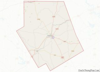
| County: | Erath County |
| Elevation: | 1,273 ft (388 m) |
| Total Area: | 11.91 sq mi (30.85 km²) |
| Land Area: | 11.89 sq mi (30.79 km²) |
| Water Area: | 0.02 sq mi (0.06 km²) |
| Total Population: | 20,897 |
| Population Density: | 1,440.4/sq mi (556.1/km²) |
| ZIP code: | 76401-76402 |
| Area code: | 254 |
| FIPS code: | 4870208 |
| GNISfeature ID: | 1347894 |
Online Interactive Map
Click on ![]() to view map in "full screen" mode.
to view map in "full screen" mode.
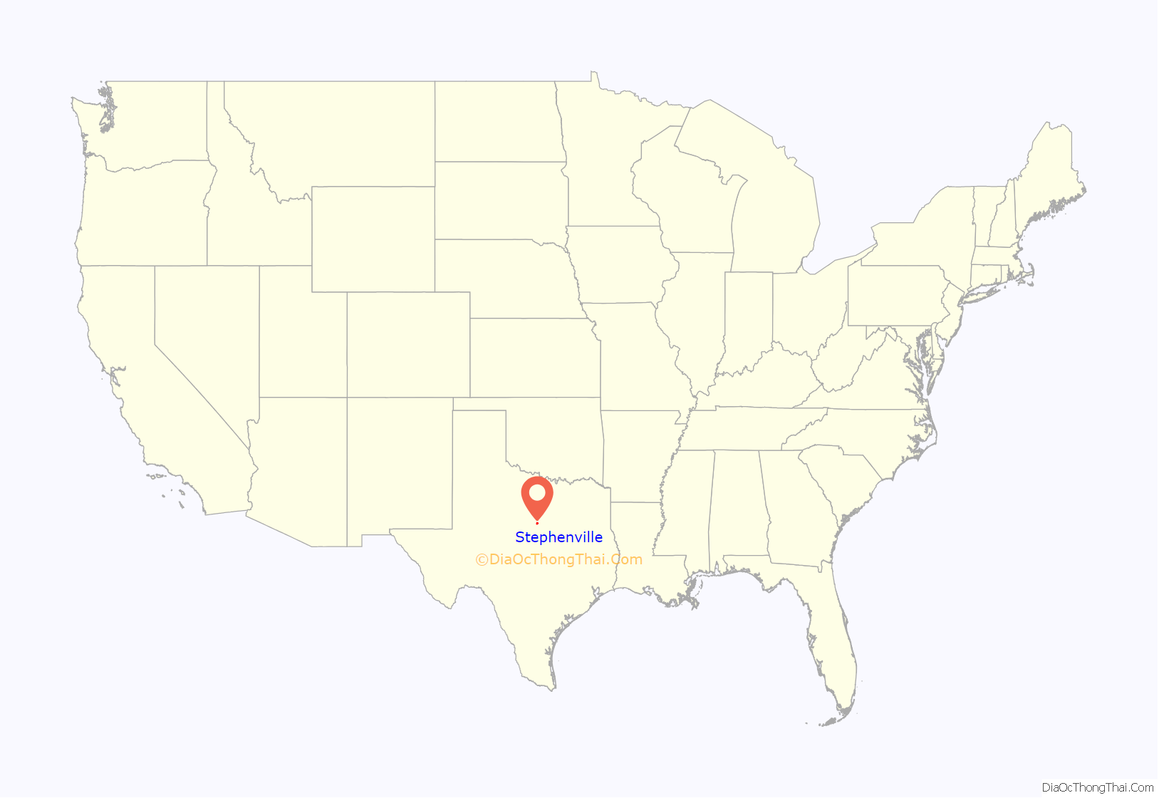
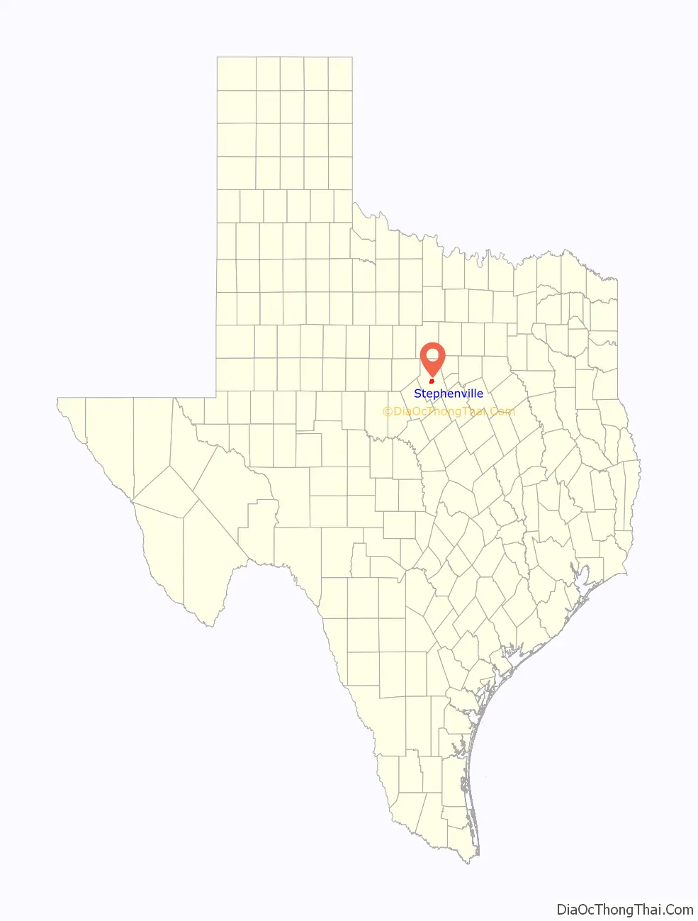
Stephenville location map. Where is Stephenville city?
History
Stephenville is named after John M. Stephen, who settled there in 1854, and donated the land for the townsite laid out by George B. Erath when the county was organized in 1856. In the first two years of its settlement, the population increased to 776. The population then declined until 1871, because the townsite was in Comanche territory and raids were common, and because the hardships of the American Civil War led citizens to leave. The population grew after Stephenville became an agriculture and livestock center. Coal mining also became important to the area in 1886, and was a major segment of the economy for the 30 years.
Stephenville was incorporated in 1889, with the arrival of the Fort Worth and Rio Grande Railway. In the 1890s, many of the buildings around the town square were built, Tarleton State University opened, and the community’s two newspapers merged to become the Empire-Tribune, which is still in operation. In February 1907, the Stephenville North and South Texas Railway was chartered by Stephenville and Hamilton business interests, which sold the line in 1910 to the St. Louis Southwestern Railway of Texas system. In the 20th century, industry became an important part of Stephenville, and the population has steadily increased since the 1920s.
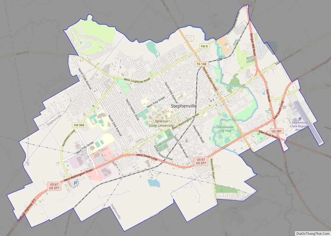
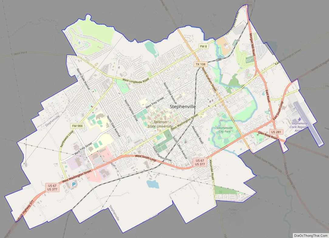
Stephenville Road Map
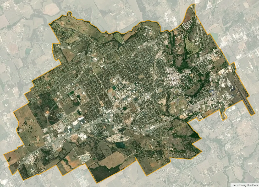
Stephenville city Satellite Map
Geography
According to the United States Census Bureau, the city has an area of 11.89 square miles (30.8 km), of which 11.89 square miles (30.8 km) are land and 0.04 square miles (0.10 km) is covered by water.
Stephenville is served by three major US highways – US Highway 377, US Highway 281, and US Highway 67 (which joins into US Hwy 377).
Climate
The climate in this area is characterized by hot, humid summers and generally mild to cool winters. According to the Köppen climate classification system, Stephenville has a humid subtropical climate, Cfa on climate maps.
See also
Map of Texas State and its subdivision:- Anderson
- Andrews
- Angelina
- Aransas
- Archer
- Armstrong
- Atascosa
- Austin
- Bailey
- Bandera
- Bastrop
- Baylor
- Bee
- Bell
- Bexar
- Blanco
- Borden
- Bosque
- Bowie
- Brazoria
- Brazos
- Brewster
- Briscoe
- Brooks
- Brown
- Burleson
- Burnet
- Caldwell
- Calhoun
- Callahan
- Cameron
- Camp
- Carson
- Cass
- Castro
- Chambers
- Cherokee
- Childress
- Clay
- Cochran
- Coke
- Coleman
- Collin
- Collingsworth
- Colorado
- Comal
- Comanche
- Concho
- Cooke
- Coryell
- Cottle
- Crane
- Crockett
- Crosby
- Culberson
- Dallam
- Dallas
- Dawson
- Deaf Smith
- Delta
- Denton
- Dewitt
- Dickens
- Dimmit
- Donley
- Duval
- Eastland
- Ector
- Edwards
- El Paso
- Ellis
- Erath
- Falls
- Fannin
- Fayette
- Fisher
- Floyd
- Foard
- Fort Bend
- Franklin
- Freestone
- Frio
- Gaines
- Galveston
- Garza
- Gillespie
- Glasscock
- Goliad
- Gonzales
- Gray
- Grayson
- Gregg
- Grimes
- Guadalupe
- Hale
- Hall
- Hamilton
- Hansford
- Hardeman
- Hardin
- Harris
- Harrison
- Hartley
- Haskell
- Hays
- Hemphill
- Henderson
- Hidalgo
- Hill
- Hockley
- Hood
- Hopkins
- Houston
- Howard
- Hudspeth
- Hunt
- Hutchinson
- Irion
- Jack
- Jackson
- Jasper
- Jeff Davis
- Jefferson
- Jim Hogg
- Jim Wells
- Johnson
- Jones
- Karnes
- Kaufman
- Kendall
- Kenedy
- Kent
- Kerr
- Kimble
- King
- Kinney
- Kleberg
- Knox
- La Salle
- Lamar
- Lamb
- Lampasas
- Lavaca
- Lee
- Leon
- Liberty
- Limestone
- Lipscomb
- Live Oak
- Llano
- Loving
- Lubbock
- Lynn
- Madison
- Marion
- Martin
- Mason
- Matagorda
- Maverick
- McCulloch
- McLennan
- McMullen
- Medina
- Menard
- Midland
- Milam
- Mills
- Mitchell
- Montague
- Montgomery
- Moore
- Morris
- Motley
- Nacogdoches
- Navarro
- Newton
- Nolan
- Nueces
- Ochiltree
- Oldham
- Orange
- Palo Pinto
- Panola
- Parker
- Parmer
- Pecos
- Polk
- Potter
- Presidio
- Rains
- Randall
- Reagan
- Real
- Red River
- Reeves
- Refugio
- Roberts
- Robertson
- Rockwall
- Runnels
- Rusk
- Sabine
- San Augustine
- San Jacinto
- San Patricio
- San Saba
- Schleicher
- Scurry
- Shackelford
- Shelby
- Sherman
- Smith
- Somervell
- Starr
- Stephens
- Sterling
- Stonewall
- Sutton
- Swisher
- Tarrant
- Taylor
- Terrell
- Terry
- Throckmorton
- Titus
- Tom Green
- Travis
- Trinity
- Tyler
- Upshur
- Upton
- Uvalde
- Val Verde
- Van Zandt
- Victoria
- Walker
- Waller
- Ward
- Washington
- Webb
- Wharton
- Wheeler
- Wichita
- Wilbarger
- Willacy
- Williamson
- Wilson
- Winkler
- Wise
- Wood
- Yoakum
- Young
- Zapata
- Zavala
- Alabama
- Alaska
- Arizona
- Arkansas
- California
- Colorado
- Connecticut
- Delaware
- District of Columbia
- Florida
- Georgia
- Hawaii
- Idaho
- Illinois
- Indiana
- Iowa
- Kansas
- Kentucky
- Louisiana
- Maine
- Maryland
- Massachusetts
- Michigan
- Minnesota
- Mississippi
- Missouri
- Montana
- Nebraska
- Nevada
- New Hampshire
- New Jersey
- New Mexico
- New York
- North Carolina
- North Dakota
- Ohio
- Oklahoma
- Oregon
- Pennsylvania
- Rhode Island
- South Carolina
- South Dakota
- Tennessee
- Texas
- Utah
- Vermont
- Virginia
- Washington
- West Virginia
- Wisconsin
- Wyoming