Sterling City is the county seat of Sterling County, Texas, United States. Its population was 1,121 at the 2020 census.
| Name: | Sterling City city |
|---|---|
| LSAD Code: | 25 |
| LSAD Description: | city (suffix) |
| State: | Texas |
| County: | Sterling County |
| Elevation: | 2,287 ft (697 m) |
| Total Area: | 0.98 sq mi (2.54 km²) |
| Land Area: | 0.98 sq mi (2.54 km²) |
| Water Area: | 0.00 sq mi (0.00 km²) |
| Total Population: | 1,121 |
| Population Density: | 1,143.88/sq mi (441.34/km²) |
| ZIP code: | 76951 |
| Area code: | 325 |
| FIPS code: | 4870232 |
| GNISfeature ID: | 1347899 |
| Website: | sterlingcitytexas.com |
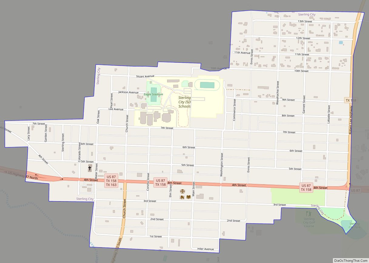
Online Interactive Map
Click on ![]() to view map in "full screen" mode.
to view map in "full screen" mode.
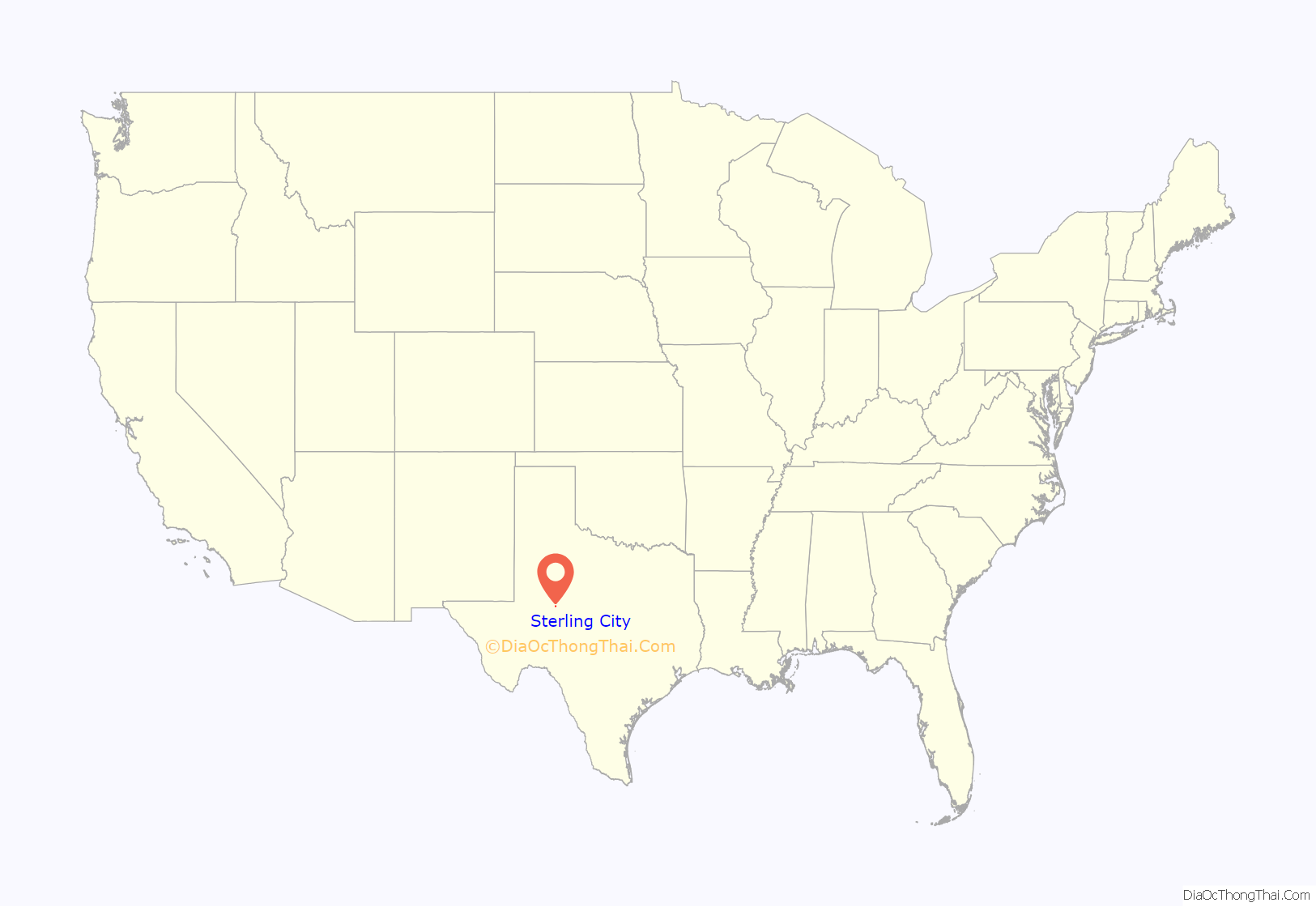
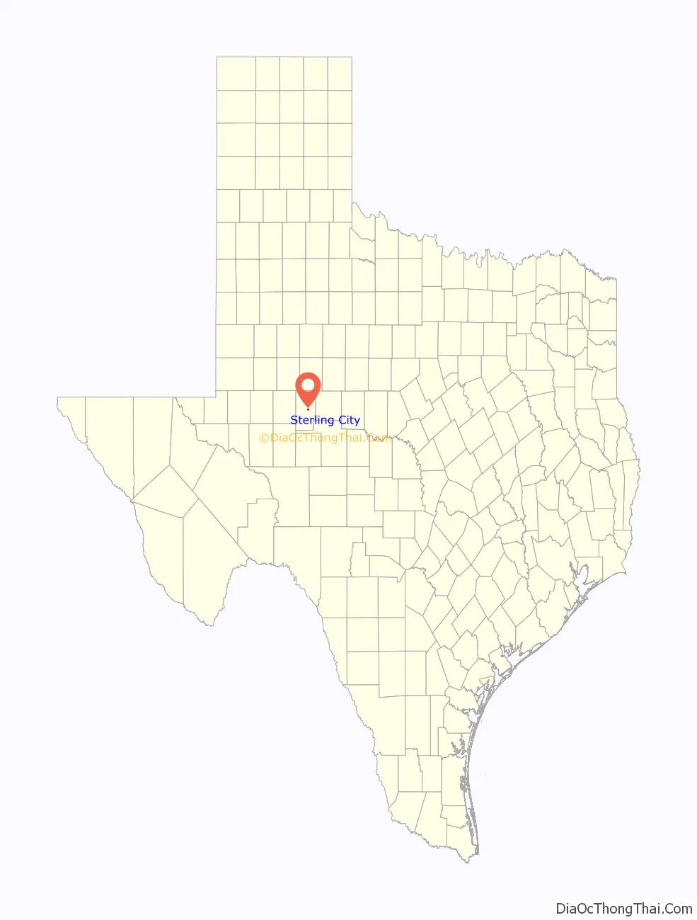
Sterling City location map. Where is Sterling City city?
History
Sterling City was named for W.S. Sterling, a buffalo hunter and Indian fighter. Land for the new town was donated in January 1891 by R.C. Stewart, and was platted by H.B. Tarver in February. That same year, it was designated the seat of Sterling County. The town soon grew to 300 residents and had its own newspaper, a hotel, a post office, several other businesses, a school, and three churches.
Sterling City was a stop on the Santa Fe Railroad by 1910, but the service was eventually abandoned. The depot still exists as a tourist site.
During World War Two, Sterling City’s population decreased by 10%. When it was incorporated in August, 1955, Sterling City had a population of some 800 and had added three more churches, a hospital, a bank, and a library.
On May 25, 1955, 15 United States Air Force personnel, flying in a B-36 bomber under the callsign Abbot 27, perished in a crash near Sterling City.
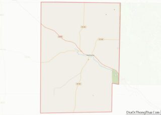
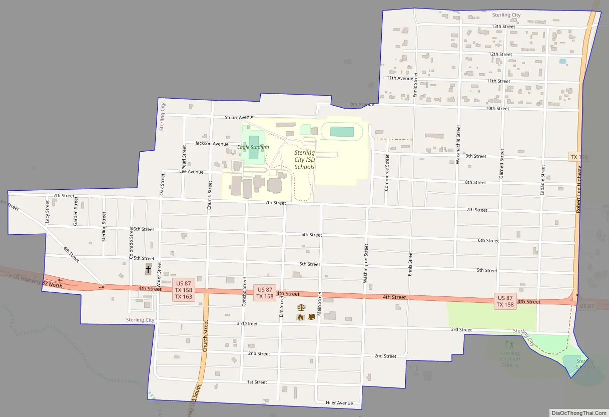
Sterling City Road Map
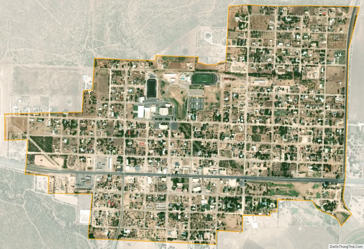
Sterling City city Satellite Map
Geography
Sterling City is located on the Edwards Plateau in west-central Texas along the North Concho River at 31°50′21″N 100°59′9″W / 31.83917°N 100.98583°W / 31.83917; -100.98583 (31.839066, –100.985871). It is accessed by U.S. Highway 87 and State Highways 158 and 163, and covers area of 0.98 sq mi (2.5 km), all of it land.
Windmills have been a feature of Sterling City since the early 20th century, when the town claimed to have more windmills per acre than any other place in the world, totaling some 300. Today, most of Sterling City’s windmills are giant turbines in modern wind farms on a ridge about 20 miles northwest of the town and visible from U.S. Highway 87.
See also
Map of Texas State and its subdivision:- Anderson
- Andrews
- Angelina
- Aransas
- Archer
- Armstrong
- Atascosa
- Austin
- Bailey
- Bandera
- Bastrop
- Baylor
- Bee
- Bell
- Bexar
- Blanco
- Borden
- Bosque
- Bowie
- Brazoria
- Brazos
- Brewster
- Briscoe
- Brooks
- Brown
- Burleson
- Burnet
- Caldwell
- Calhoun
- Callahan
- Cameron
- Camp
- Carson
- Cass
- Castro
- Chambers
- Cherokee
- Childress
- Clay
- Cochran
- Coke
- Coleman
- Collin
- Collingsworth
- Colorado
- Comal
- Comanche
- Concho
- Cooke
- Coryell
- Cottle
- Crane
- Crockett
- Crosby
- Culberson
- Dallam
- Dallas
- Dawson
- Deaf Smith
- Delta
- Denton
- Dewitt
- Dickens
- Dimmit
- Donley
- Duval
- Eastland
- Ector
- Edwards
- El Paso
- Ellis
- Erath
- Falls
- Fannin
- Fayette
- Fisher
- Floyd
- Foard
- Fort Bend
- Franklin
- Freestone
- Frio
- Gaines
- Galveston
- Garza
- Gillespie
- Glasscock
- Goliad
- Gonzales
- Gray
- Grayson
- Gregg
- Grimes
- Guadalupe
- Hale
- Hall
- Hamilton
- Hansford
- Hardeman
- Hardin
- Harris
- Harrison
- Hartley
- Haskell
- Hays
- Hemphill
- Henderson
- Hidalgo
- Hill
- Hockley
- Hood
- Hopkins
- Houston
- Howard
- Hudspeth
- Hunt
- Hutchinson
- Irion
- Jack
- Jackson
- Jasper
- Jeff Davis
- Jefferson
- Jim Hogg
- Jim Wells
- Johnson
- Jones
- Karnes
- Kaufman
- Kendall
- Kenedy
- Kent
- Kerr
- Kimble
- King
- Kinney
- Kleberg
- Knox
- La Salle
- Lamar
- Lamb
- Lampasas
- Lavaca
- Lee
- Leon
- Liberty
- Limestone
- Lipscomb
- Live Oak
- Llano
- Loving
- Lubbock
- Lynn
- Madison
- Marion
- Martin
- Mason
- Matagorda
- Maverick
- McCulloch
- McLennan
- McMullen
- Medina
- Menard
- Midland
- Milam
- Mills
- Mitchell
- Montague
- Montgomery
- Moore
- Morris
- Motley
- Nacogdoches
- Navarro
- Newton
- Nolan
- Nueces
- Ochiltree
- Oldham
- Orange
- Palo Pinto
- Panola
- Parker
- Parmer
- Pecos
- Polk
- Potter
- Presidio
- Rains
- Randall
- Reagan
- Real
- Red River
- Reeves
- Refugio
- Roberts
- Robertson
- Rockwall
- Runnels
- Rusk
- Sabine
- San Augustine
- San Jacinto
- San Patricio
- San Saba
- Schleicher
- Scurry
- Shackelford
- Shelby
- Sherman
- Smith
- Somervell
- Starr
- Stephens
- Sterling
- Stonewall
- Sutton
- Swisher
- Tarrant
- Taylor
- Terrell
- Terry
- Throckmorton
- Titus
- Tom Green
- Travis
- Trinity
- Tyler
- Upshur
- Upton
- Uvalde
- Val Verde
- Van Zandt
- Victoria
- Walker
- Waller
- Ward
- Washington
- Webb
- Wharton
- Wheeler
- Wichita
- Wilbarger
- Willacy
- Williamson
- Wilson
- Winkler
- Wise
- Wood
- Yoakum
- Young
- Zapata
- Zavala
- Alabama
- Alaska
- Arizona
- Arkansas
- California
- Colorado
- Connecticut
- Delaware
- District of Columbia
- Florida
- Georgia
- Hawaii
- Idaho
- Illinois
- Indiana
- Iowa
- Kansas
- Kentucky
- Louisiana
- Maine
- Maryland
- Massachusetts
- Michigan
- Minnesota
- Mississippi
- Missouri
- Montana
- Nebraska
- Nevada
- New Hampshire
- New Jersey
- New Mexico
- New York
- North Carolina
- North Dakota
- Ohio
- Oklahoma
- Oregon
- Pennsylvania
- Rhode Island
- South Carolina
- South Dakota
- Tennessee
- Texas
- Utah
- Vermont
- Virginia
- Washington
- West Virginia
- Wisconsin
- Wyoming