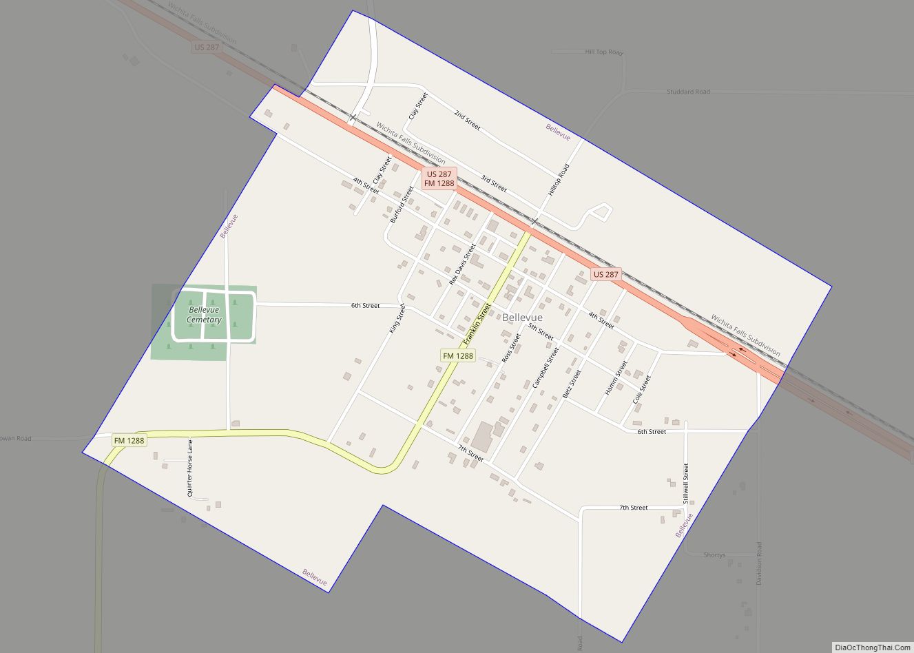
Map of Benbrook city

Map of Benbrook city

Benbrook is a town located in the southwestern corner of Tarrant County, Texas, and a suburb of Fort Worth. As of the 2010 United States census, the population was 21,234, reflecting an increase of 1,026 from the 20,208 counted in the 2000 census, which had in turn increased by 644 from the 19,564 counted in … Read more

Map of Benavides city

Map of Benavides city

Benavides (/ˌbɛnəˈviːdəs/ BEN-ə-VEE-dəs) is a city in Duval County, Texas, United States. The population was 1,362 at the 2010 census, down from 1,686 at the 2000 census. Benavides city overview: Name: Benavides city LSAD Code: 25 LSAD Description: city (suffix) State: Texas County: Duval County Elevation: 374 ft (114 m) Total Area: 1.77 sq mi (4.59 km²) Land Area: 1.77 sq mi … Read more

Map of Belton city, Texas

Map of Belton city, Texas

Belton is a city in the U.S. state of Texas. Belton is the county seat of Bell County and is the fifth largest city in the Killeen-Temple metropolitan area. In 2020, the population of Belton was 23,054, and the metro region had a population of 450,051 according to US Census estimates. Belton city overview: Name: … Read more

Map of Bellville city, Texas

Map of Bellville city, Texas

Bellville is a city in the U.S. state of Texas and the seat of Austin County. The city’s population was 4,206 at the 2020 census. Bellville is on the eastern edge of the Texas-German belt, and Bellville is known for its German culture and descendants of those Germans still call Bellville home. Bellville was named … Read more

Map of Big Thicket Lake Estates CDP

Map of Big Thicket Lake Estates CDP

Big Thicket Lake Estates is a census-designated place (CDP) in Polk and Liberty counties, Texas, United States. This was a new CDP for the 2010 census, with a population of 742, decreasing to 514 at the 2020 census. Big Thicket Lake Estates CDP overview: Name: Big Thicket Lake Estates CDP LSAD Code: 57 LSAD Description: … Read more

Map of Big Spring city, Texas

Map of Big Spring city, Texas

Big Spring is a city in and the county seat of Howard County, Texas, United States, at the crossroads of U.S. Highway 87 and Interstate 20. With a population of 27,282 as of the 2010 census, it is the largest city between Midland to the west, Abilene to the east, Lubbock to the north, and … Read more

Map of Big Sandy town, Texas

Map of Big Sandy town, Texas

Big Sandy is a town in Upshur County, Texas, United States. As of the 2020 census, the town’s population was 1,231. A lake of the same name is cut nearly in half by U.S. Highway 80, the main thoroughfare of Big Sandy. It lies directly west of the larger cities of Gladewater and Longview. The … Read more

Map of Big Lake city, Texas

Map of Big Lake city, Texas

Big Lake is a small rural city in Reagan County, Texas, United States. As of the 2010 Census, the city population was 2,936. It is the county seat of Reagan County. Big Lake is situated atop the divide between the Rio Grande and Colorado River watersheds. The city takes its name from a dry lake, … Read more

Map of Bevil Oaks city

Map of Bevil Oaks city

Bevil Oaks is a city in Jefferson County, Texas, United States. The population was 1,274 at the 2010 census. It is part of the Beaumont–Port Arthur Metropolitan Statistical Area. Bevil Oaks city overview: Name: Bevil Oaks city LSAD Code: 25 LSAD Description: city (suffix) State: Texas County: Jefferson County Elevation: 26 ft (8 m) Total Area: 2.06 sq mi … Read more

Map of Beverly Hills city, Texas

Map of Beverly Hills city, Texas

Beverly Hills is a city in McLennan County, Texas, United States. The population was 1,878 at the 2020 census. The city is surrounded by Waco and is part of the Waco Metropolitan Statistical Area. Beverly Hills city overview: Name: Beverly Hills city LSAD Code: 25 LSAD Description: city (suffix) State: Texas County: McLennan County Elevation: … Read more

Map of Bertram city, Texas

Map of Bertram city, Texas

Bertram (/ˈbɜːrtrəm/ BUR-trəm) is a city in Burnet County, Texas, United States. The population was 1,353 at the 2010 census. Bertram city overview: Name: Bertram city LSAD Code: 25 LSAD Description: city (suffix) State: Texas County: Burnet County Elevation: 1,263 ft (385 m) Total Area: 1.53 sq mi (3.95 km²) Land Area: 1.51 sq mi (3.91 km²) Water Area: 0.01 sq mi (0.04 km²) Total Population: … Read more

Map of Berryville town, Texas

Map of Berryville town, Texas

Berryville is a town in Henderson County, Texas, United States. The population was 824 at the 2020 census, down from 975 at the 2010 census. Berryville town overview: Name: Berryville town LSAD Code: 43 LSAD Description: town (suffix) State: Texas County: Henderson County Elevation: 364 ft (111 m) Total Area: 1.31 sq mi (3.39 km²) Land Area: 1.31 sq mi (3.39 km²) Water … Read more