Big Lake is a small rural city in Reagan County, Texas, United States. As of the 2010 Census, the city population was 2,936. It is the county seat of Reagan County.
Big Lake is situated atop the divide between the Rio Grande and Colorado River watersheds. The city takes its name from a dry lake, a unique dryland plains geographic feature located about two miles south of the city, through which St Hwy 137 passes. The dry lake, with no outlet, is more than two sections in size, making it the largest in Texas; it impounds water temporarily after high-runoff rain events, being used for grazing the remainder of the time. Though seasonal and temporal, the “big playa lake”, in wet periods, is significant in a semiarid, drought-frequented environment and has been utilized regularly as a food and water resource by man and animal, alike, since prehistoric times.
Started as a small ranching community in the late 1880s, Big Lake owes its original existence to the Kansas City, Mexico and Orient Railway, which passed through the area in 1912, as it was extended from Sherwood, west of San Angelo, to Girvin and beyond the Pecos River. The growth from the railroad, coupled with that from the Santa Rita discovery well in 1923, allowed it, in 1925, to take over the position of county seat from Stiles, a pioneer ranching community established in 1894 on Centrailia Draw, about 20 miles to the north. The main highway through the area, US 67, was extended through the region in 1934, on the way to termination in Presidio. The city’s current existence is based on agriculture (some farming, but mostly ranching) and oil and gas service and production throughout the area.
| Name: | Big Lake city |
|---|---|
| LSAD Code: | 25 |
| LSAD Description: | city (suffix) |
| State: | Texas |
| County: | Reagan County |
| Elevation: | 2,690 ft (820 m) |
| Total Area: | 7.50 sq mi (6.19 km²) |
| Land Area: | 7.50 sq mi (6.19 km²) |
| Water Area: | 0.00 sq mi (0.00 km²) |
| Total Population: | 2,965 |
| Population Density: | 1,409.97/sq mi (544.32/km²) |
| ZIP code: | 76932 |
| Area code: | 325 |
| FIPS code: | 4808212 |
| GNISfeature ID: | 1352089 |
| Website: | www.biglaketx.com |
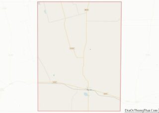
Online Interactive Map
Click on ![]() to view map in "full screen" mode.
to view map in "full screen" mode.
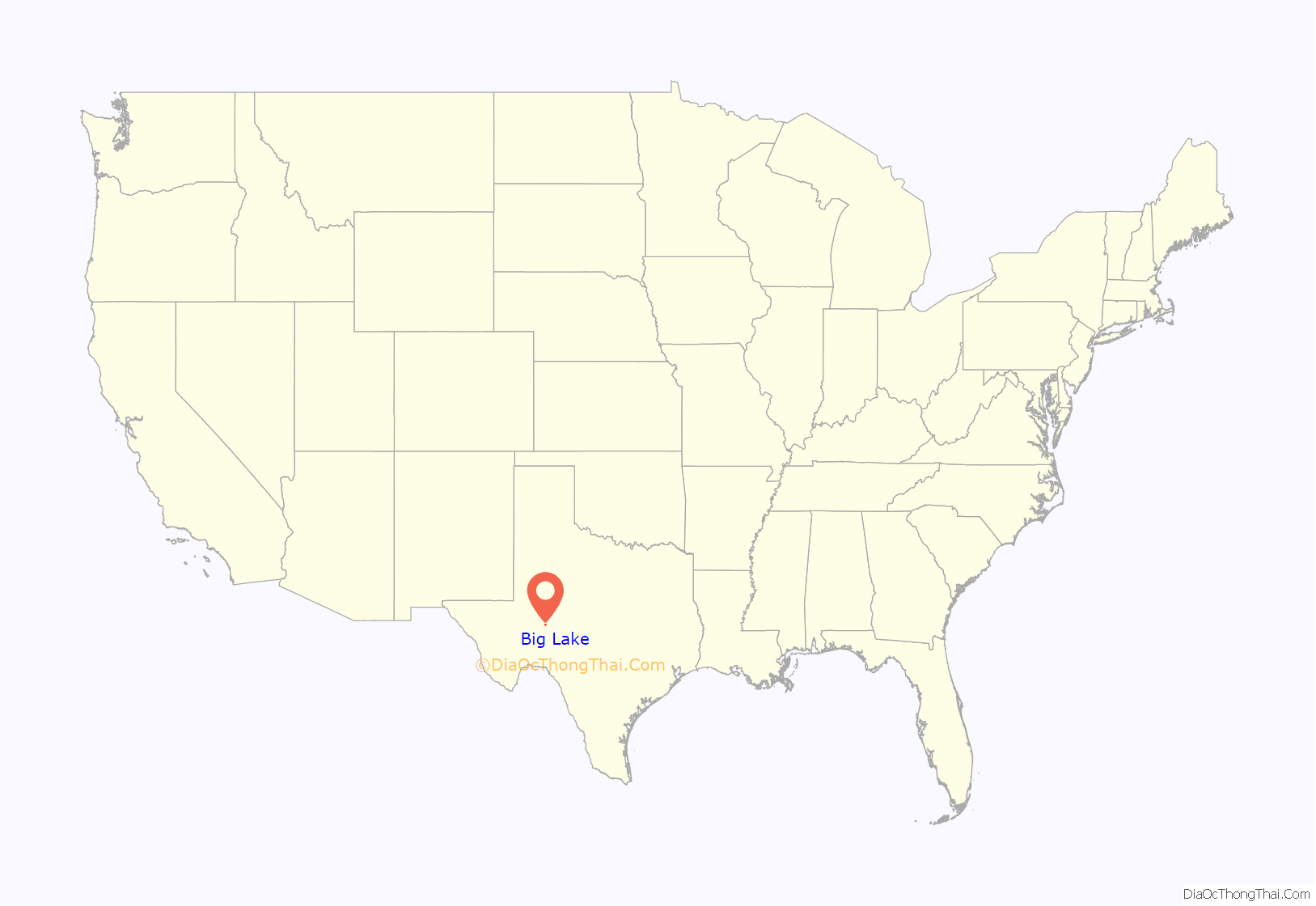
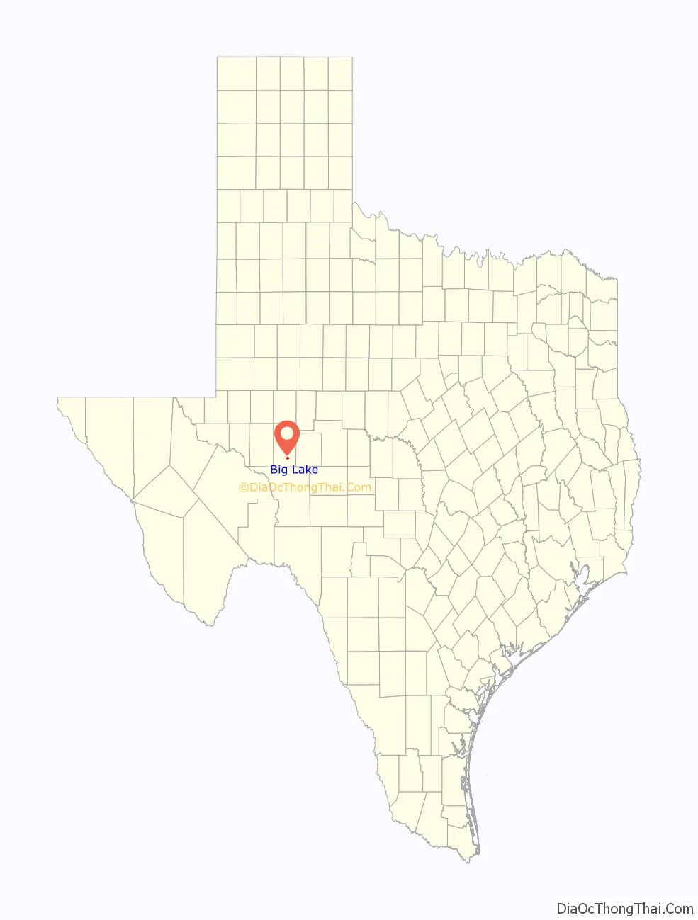
Big Lake location map. Where is Big Lake city?
History
In 1919, Rupert Ricker began the process of leasing 674 sections of University of Texas land, part of their Permanent University Fund. Unable to fund any test wells, Ricker sold the prospect to Frank Pickrell and Haymon Krupp, who organized the Texon Oil and Land Company. The company geologist, Hugh H. Tucker, picked the drill site, claiming a structure 9 miles (14 km) wide and 30 miles (48 km) long. The initial drill site was about 14 miles (23 km) west of Big Lake, north of the Orient Railroad tracks at what became Texon. They hired Carl G. Cromwell to spud the first test well in 1921, using cable tools. On the afternoon of 27 May, oil showed in the bailer. Then, on the morning of 28 May 1923, the Santa Rita No. 1 gushed oil after drilling to a depth of 3,028 feet (923 m). Initial production was 100 BOPD, which overflowed the earthen tanks, and then onto the ground for over a month before casing could set. The oil was then shipped by tank car to a refinery in El Paso. Michael Late Benedum bought the Texon find, and formed the Big Lake Oil Company, in October 1923. By 1924, Benedum had established the Big Lake oil field as the first major oil field in the Permian Basin. In 1926, this field had 74 wells producing a total of 32,317 BOPD.
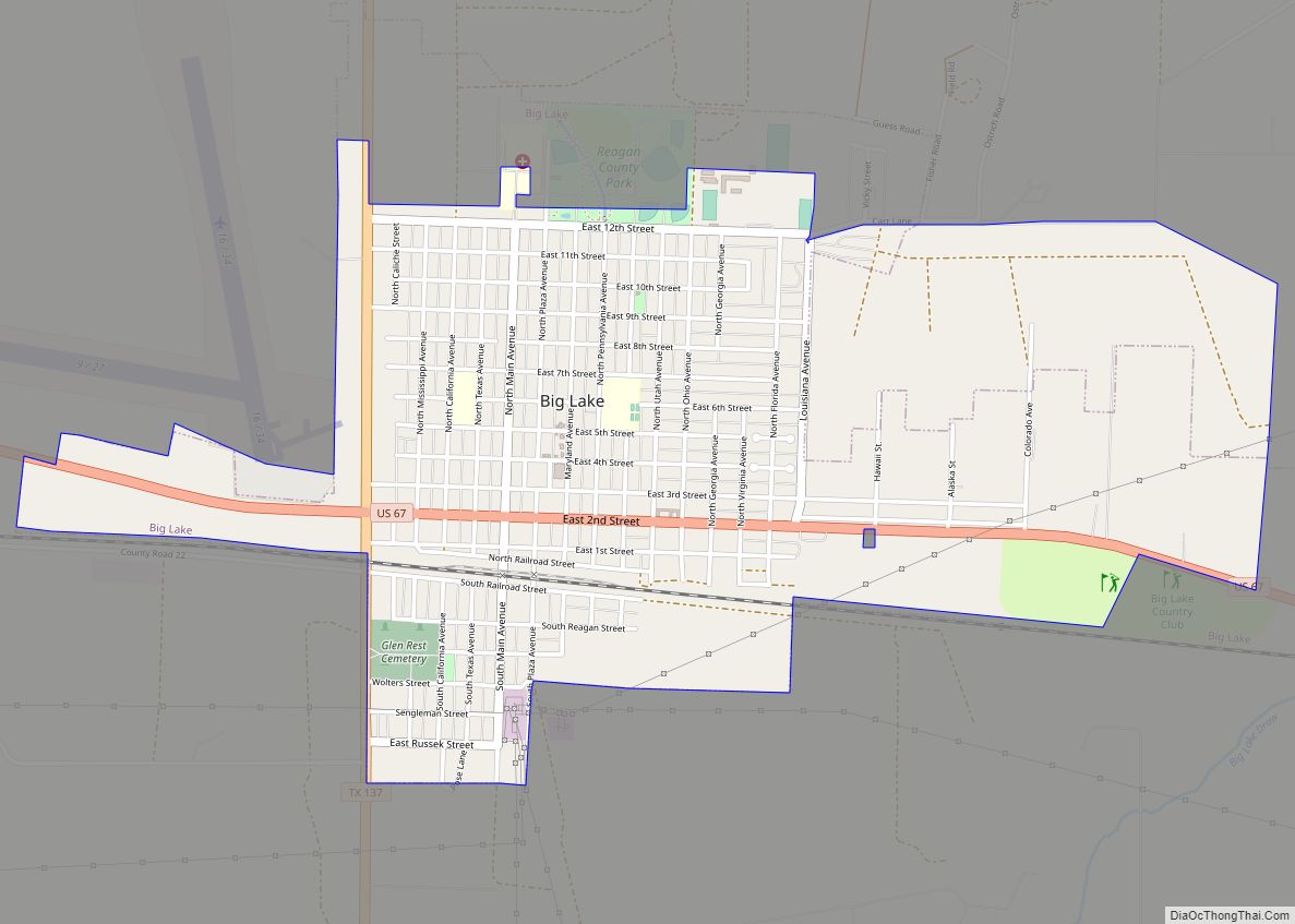
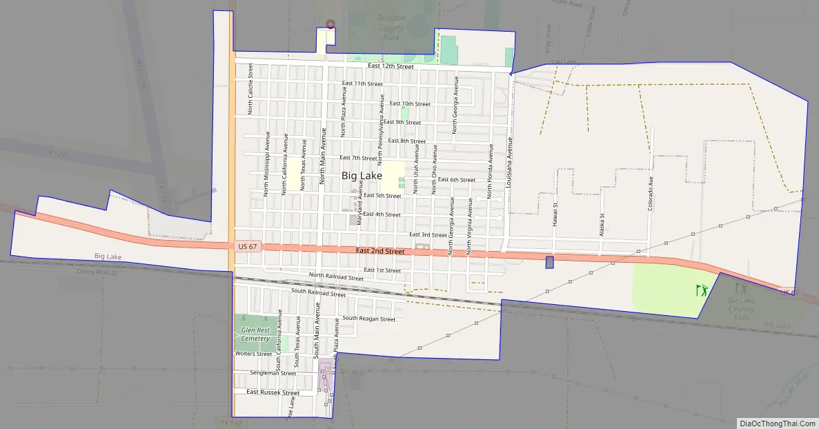
Big Lake Road Map
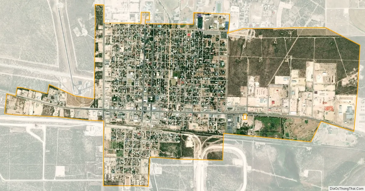
Big Lake city Satellite Map
Geography
Big Lake is located at 31°11′38″N 101°27′32″W / 31.19389°N 101.45889°W / 31.19389; -101.45889 (31.193908, –101.458834).
According to the United States Census Bureau, the city has a total area of 1.2 square miles (3.1 km), all of it land. Big Lake was served by the Kansas City, Mexico, and Orient Railway, and continues to be served by its successor Texas Pacifico Transportation.
See also
Map of Texas State and its subdivision:- Anderson
- Andrews
- Angelina
- Aransas
- Archer
- Armstrong
- Atascosa
- Austin
- Bailey
- Bandera
- Bastrop
- Baylor
- Bee
- Bell
- Bexar
- Blanco
- Borden
- Bosque
- Bowie
- Brazoria
- Brazos
- Brewster
- Briscoe
- Brooks
- Brown
- Burleson
- Burnet
- Caldwell
- Calhoun
- Callahan
- Cameron
- Camp
- Carson
- Cass
- Castro
- Chambers
- Cherokee
- Childress
- Clay
- Cochran
- Coke
- Coleman
- Collin
- Collingsworth
- Colorado
- Comal
- Comanche
- Concho
- Cooke
- Coryell
- Cottle
- Crane
- Crockett
- Crosby
- Culberson
- Dallam
- Dallas
- Dawson
- Deaf Smith
- Delta
- Denton
- Dewitt
- Dickens
- Dimmit
- Donley
- Duval
- Eastland
- Ector
- Edwards
- El Paso
- Ellis
- Erath
- Falls
- Fannin
- Fayette
- Fisher
- Floyd
- Foard
- Fort Bend
- Franklin
- Freestone
- Frio
- Gaines
- Galveston
- Garza
- Gillespie
- Glasscock
- Goliad
- Gonzales
- Gray
- Grayson
- Gregg
- Grimes
- Guadalupe
- Hale
- Hall
- Hamilton
- Hansford
- Hardeman
- Hardin
- Harris
- Harrison
- Hartley
- Haskell
- Hays
- Hemphill
- Henderson
- Hidalgo
- Hill
- Hockley
- Hood
- Hopkins
- Houston
- Howard
- Hudspeth
- Hunt
- Hutchinson
- Irion
- Jack
- Jackson
- Jasper
- Jeff Davis
- Jefferson
- Jim Hogg
- Jim Wells
- Johnson
- Jones
- Karnes
- Kaufman
- Kendall
- Kenedy
- Kent
- Kerr
- Kimble
- King
- Kinney
- Kleberg
- Knox
- La Salle
- Lamar
- Lamb
- Lampasas
- Lavaca
- Lee
- Leon
- Liberty
- Limestone
- Lipscomb
- Live Oak
- Llano
- Loving
- Lubbock
- Lynn
- Madison
- Marion
- Martin
- Mason
- Matagorda
- Maverick
- McCulloch
- McLennan
- McMullen
- Medina
- Menard
- Midland
- Milam
- Mills
- Mitchell
- Montague
- Montgomery
- Moore
- Morris
- Motley
- Nacogdoches
- Navarro
- Newton
- Nolan
- Nueces
- Ochiltree
- Oldham
- Orange
- Palo Pinto
- Panola
- Parker
- Parmer
- Pecos
- Polk
- Potter
- Presidio
- Rains
- Randall
- Reagan
- Real
- Red River
- Reeves
- Refugio
- Roberts
- Robertson
- Rockwall
- Runnels
- Rusk
- Sabine
- San Augustine
- San Jacinto
- San Patricio
- San Saba
- Schleicher
- Scurry
- Shackelford
- Shelby
- Sherman
- Smith
- Somervell
- Starr
- Stephens
- Sterling
- Stonewall
- Sutton
- Swisher
- Tarrant
- Taylor
- Terrell
- Terry
- Throckmorton
- Titus
- Tom Green
- Travis
- Trinity
- Tyler
- Upshur
- Upton
- Uvalde
- Val Verde
- Van Zandt
- Victoria
- Walker
- Waller
- Ward
- Washington
- Webb
- Wharton
- Wheeler
- Wichita
- Wilbarger
- Willacy
- Williamson
- Wilson
- Winkler
- Wise
- Wood
- Yoakum
- Young
- Zapata
- Zavala
- Alabama
- Alaska
- Arizona
- Arkansas
- California
- Colorado
- Connecticut
- Delaware
- District of Columbia
- Florida
- Georgia
- Hawaii
- Idaho
- Illinois
- Indiana
- Iowa
- Kansas
- Kentucky
- Louisiana
- Maine
- Maryland
- Massachusetts
- Michigan
- Minnesota
- Mississippi
- Missouri
- Montana
- Nebraska
- Nevada
- New Hampshire
- New Jersey
- New Mexico
- New York
- North Carolina
- North Dakota
- Ohio
- Oklahoma
- Oregon
- Pennsylvania
- Rhode Island
- South Carolina
- South Dakota
- Tennessee
- Texas
- Utah
- Vermont
- Virginia
- Washington
- West Virginia
- Wisconsin
- Wyoming