Bertram (/ˈbɜːrtrəm/ BUR-trəm) is a city in Burnet County, Texas, United States. The population was 1,353 at the 2010 census.
| Name: | Bertram city |
|---|---|
| LSAD Code: | 25 |
| LSAD Description: | city (suffix) |
| State: | Texas |
| County: | Burnet County |
| Elevation: | 1,263 ft (385 m) |
| Total Area: | 1.53 sq mi (3.95 km²) |
| Land Area: | 1.51 sq mi (3.91 km²) |
| Water Area: | 0.01 sq mi (0.04 km²) |
| Total Population: | 1,353 |
| Population Density: | 976.84/sq mi (377.14/km²) |
| ZIP code: | 78605 |
| Area code: | 512 |
| FIPS code: | 4807864 |
| GNISfeature ID: | 1372510 |
| Website: | www.cityofbertram.org |
Online Interactive Map
Click on ![]() to view map in "full screen" mode.
to view map in "full screen" mode.
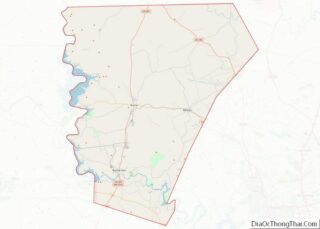
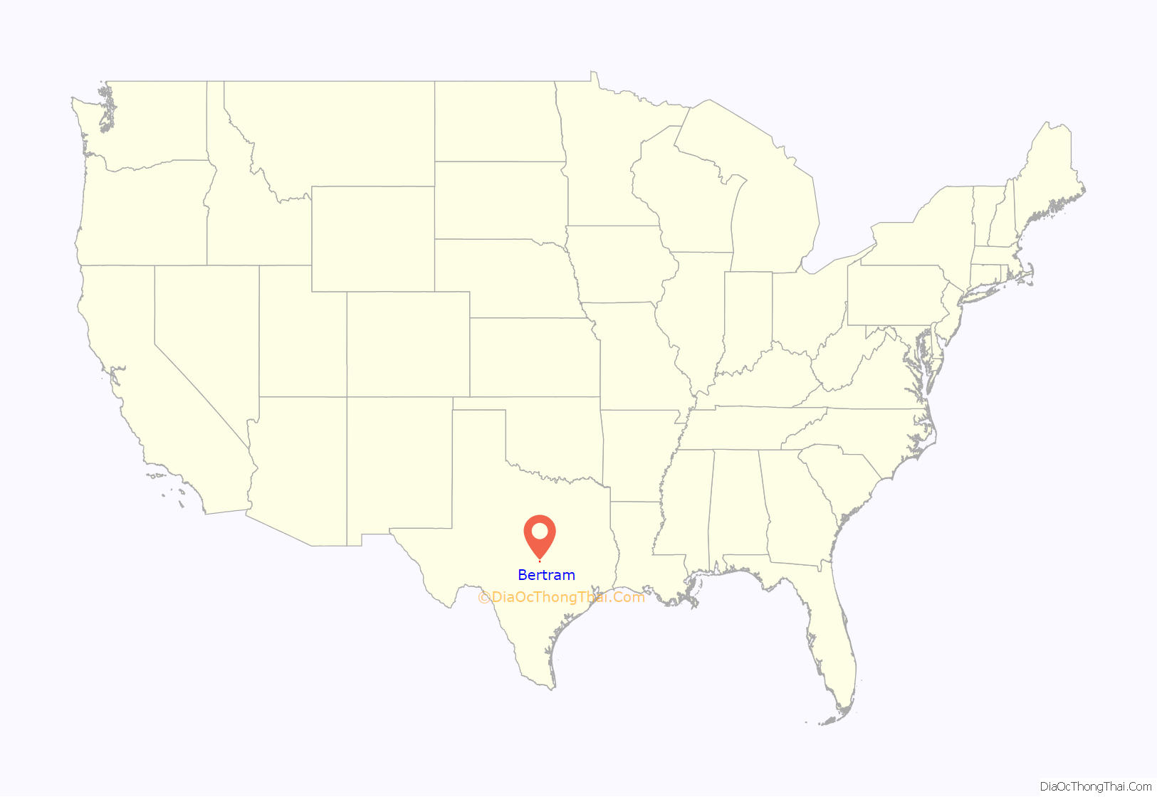
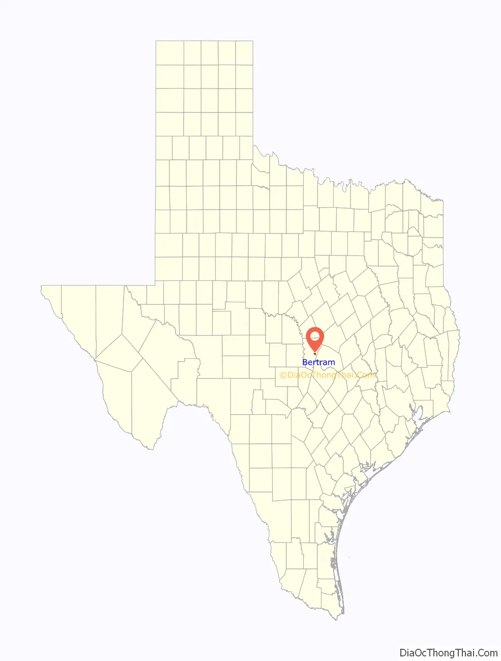
Bertram location map. Where is Bertram city?
History
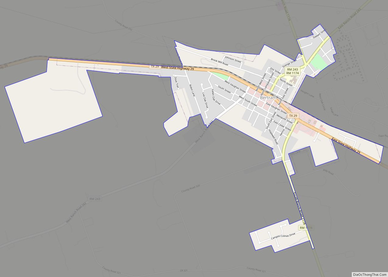
Bertram is at the junction of Farm Roads 243 and 1174 and State Highway 29, ten miles east of Burnet in eastern Burnet County. The town was established in 1882, when the community of San Gabriel (near the San Gabriel River) in Burnet County was moved two miles northwest to the newly constructed Austin and Northwestern Railroad. The new community was named for Austin merchant Rudolph Bertram, the largest stockholder in the Austin and Northwestern. A post office opened in 1882 and, by 1891, the town had an estimated population of 150, a cotton gin-gristmill, three general stores, a grocer, a blacksmith, a shoemaker, and two wagonmakers. After 1900, Bertram was a shipping point for cotton, cattle, and wool. In 1928, a record 11,624 bales of cotton were ginned in the town.
In the early 1930s, plummeting cotton prices and the Great Depression caused the town’s population to decline from a high of 1,000 in 1929 to 550 by 1931. It was 600 in 1949 and, by 1966, stood at 1,205. In 1989, the town had an estimated population of 1,002 and nineteen businesses. At that time, Bertram’s principal industries included the manufacture of ceramic floor tiles, paving tiles, marble fixtures, and vacuum-formed and molded plastic products. In 1990, the census population was 849.
The Major League Baseball player (Owen) Chief Wilson lived in Bertram. The local baseball field is named for him.
Bertram Road Map
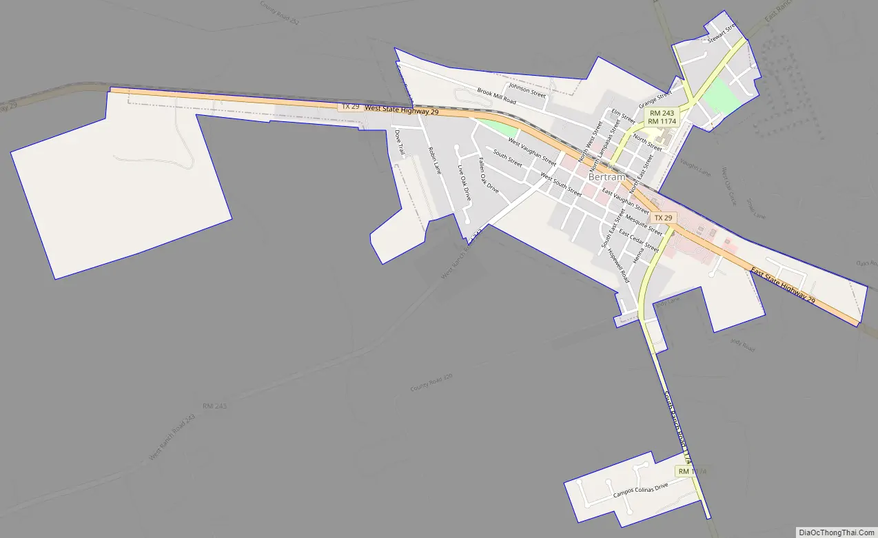
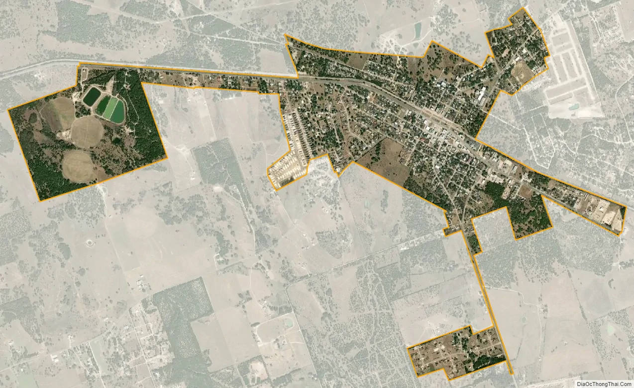
Bertram city Satellite Map
Geography
Bertram is located in eastern Burnet County at 30°44′39″N 98°03′21″W / 30.744132°N 98.055721°W / 30.744132; -98.055721. This is 10 miles (16 km) east of Burnet, the county seat.
According to the United States Census Bureau, Bertram has a total area of 1.2 square miles (3.2 km), all land.
See also
Map of Texas State and its subdivision:- Anderson
- Andrews
- Angelina
- Aransas
- Archer
- Armstrong
- Atascosa
- Austin
- Bailey
- Bandera
- Bastrop
- Baylor
- Bee
- Bell
- Bexar
- Blanco
- Borden
- Bosque
- Bowie
- Brazoria
- Brazos
- Brewster
- Briscoe
- Brooks
- Brown
- Burleson
- Burnet
- Caldwell
- Calhoun
- Callahan
- Cameron
- Camp
- Carson
- Cass
- Castro
- Chambers
- Cherokee
- Childress
- Clay
- Cochran
- Coke
- Coleman
- Collin
- Collingsworth
- Colorado
- Comal
- Comanche
- Concho
- Cooke
- Coryell
- Cottle
- Crane
- Crockett
- Crosby
- Culberson
- Dallam
- Dallas
- Dawson
- Deaf Smith
- Delta
- Denton
- Dewitt
- Dickens
- Dimmit
- Donley
- Duval
- Eastland
- Ector
- Edwards
- El Paso
- Ellis
- Erath
- Falls
- Fannin
- Fayette
- Fisher
- Floyd
- Foard
- Fort Bend
- Franklin
- Freestone
- Frio
- Gaines
- Galveston
- Garza
- Gillespie
- Glasscock
- Goliad
- Gonzales
- Gray
- Grayson
- Gregg
- Grimes
- Guadalupe
- Hale
- Hall
- Hamilton
- Hansford
- Hardeman
- Hardin
- Harris
- Harrison
- Hartley
- Haskell
- Hays
- Hemphill
- Henderson
- Hidalgo
- Hill
- Hockley
- Hood
- Hopkins
- Houston
- Howard
- Hudspeth
- Hunt
- Hutchinson
- Irion
- Jack
- Jackson
- Jasper
- Jeff Davis
- Jefferson
- Jim Hogg
- Jim Wells
- Johnson
- Jones
- Karnes
- Kaufman
- Kendall
- Kenedy
- Kent
- Kerr
- Kimble
- King
- Kinney
- Kleberg
- Knox
- La Salle
- Lamar
- Lamb
- Lampasas
- Lavaca
- Lee
- Leon
- Liberty
- Limestone
- Lipscomb
- Live Oak
- Llano
- Loving
- Lubbock
- Lynn
- Madison
- Marion
- Martin
- Mason
- Matagorda
- Maverick
- McCulloch
- McLennan
- McMullen
- Medina
- Menard
- Midland
- Milam
- Mills
- Mitchell
- Montague
- Montgomery
- Moore
- Morris
- Motley
- Nacogdoches
- Navarro
- Newton
- Nolan
- Nueces
- Ochiltree
- Oldham
- Orange
- Palo Pinto
- Panola
- Parker
- Parmer
- Pecos
- Polk
- Potter
- Presidio
- Rains
- Randall
- Reagan
- Real
- Red River
- Reeves
- Refugio
- Roberts
- Robertson
- Rockwall
- Runnels
- Rusk
- Sabine
- San Augustine
- San Jacinto
- San Patricio
- San Saba
- Schleicher
- Scurry
- Shackelford
- Shelby
- Sherman
- Smith
- Somervell
- Starr
- Stephens
- Sterling
- Stonewall
- Sutton
- Swisher
- Tarrant
- Taylor
- Terrell
- Terry
- Throckmorton
- Titus
- Tom Green
- Travis
- Trinity
- Tyler
- Upshur
- Upton
- Uvalde
- Val Verde
- Van Zandt
- Victoria
- Walker
- Waller
- Ward
- Washington
- Webb
- Wharton
- Wheeler
- Wichita
- Wilbarger
- Willacy
- Williamson
- Wilson
- Winkler
- Wise
- Wood
- Yoakum
- Young
- Zapata
- Zavala
- Alabama
- Alaska
- Arizona
- Arkansas
- California
- Colorado
- Connecticut
- Delaware
- District of Columbia
- Florida
- Georgia
- Hawaii
- Idaho
- Illinois
- Indiana
- Iowa
- Kansas
- Kentucky
- Louisiana
- Maine
- Maryland
- Massachusetts
- Michigan
- Minnesota
- Mississippi
- Missouri
- Montana
- Nebraska
- Nevada
- New Hampshire
- New Jersey
- New Mexico
- New York
- North Carolina
- North Dakota
- Ohio
- Oklahoma
- Oregon
- Pennsylvania
- Rhode Island
- South Carolina
- South Dakota
- Tennessee
- Texas
- Utah
- Vermont
- Virginia
- Washington
- West Virginia
- Wisconsin
- Wyoming