Belton is a city in the U.S. state of Texas. Belton is the county seat of Bell County and is the fifth largest city in the Killeen-Temple metropolitan area. In 2020, the population of Belton was 23,054, and the metro region had a population of 450,051 according to US Census estimates.
| Name: | Belton city |
|---|---|
| LSAD Code: | 25 |
| LSAD Description: | city (suffix) |
| State: | Texas |
| County: | Bell County |
| Elevation: | 509 ft (155 m) |
| Total Area: | 21.14 sq mi (54.74 km²) |
| Land Area: | 20.23 sq mi (52.39 km²) |
| Water Area: | 0.91 sq mi (2.35 km²) |
| Total Population: | 23,054 |
| Population Density: | 1,131.30/sq mi (436.79/km²) |
| ZIP code: | 76513 |
| Area code: | 254 |
| FIPS code: | 4807492 |
| GNISfeature ID: | 1351858 |
| Website: | www.beltontexas.gov |
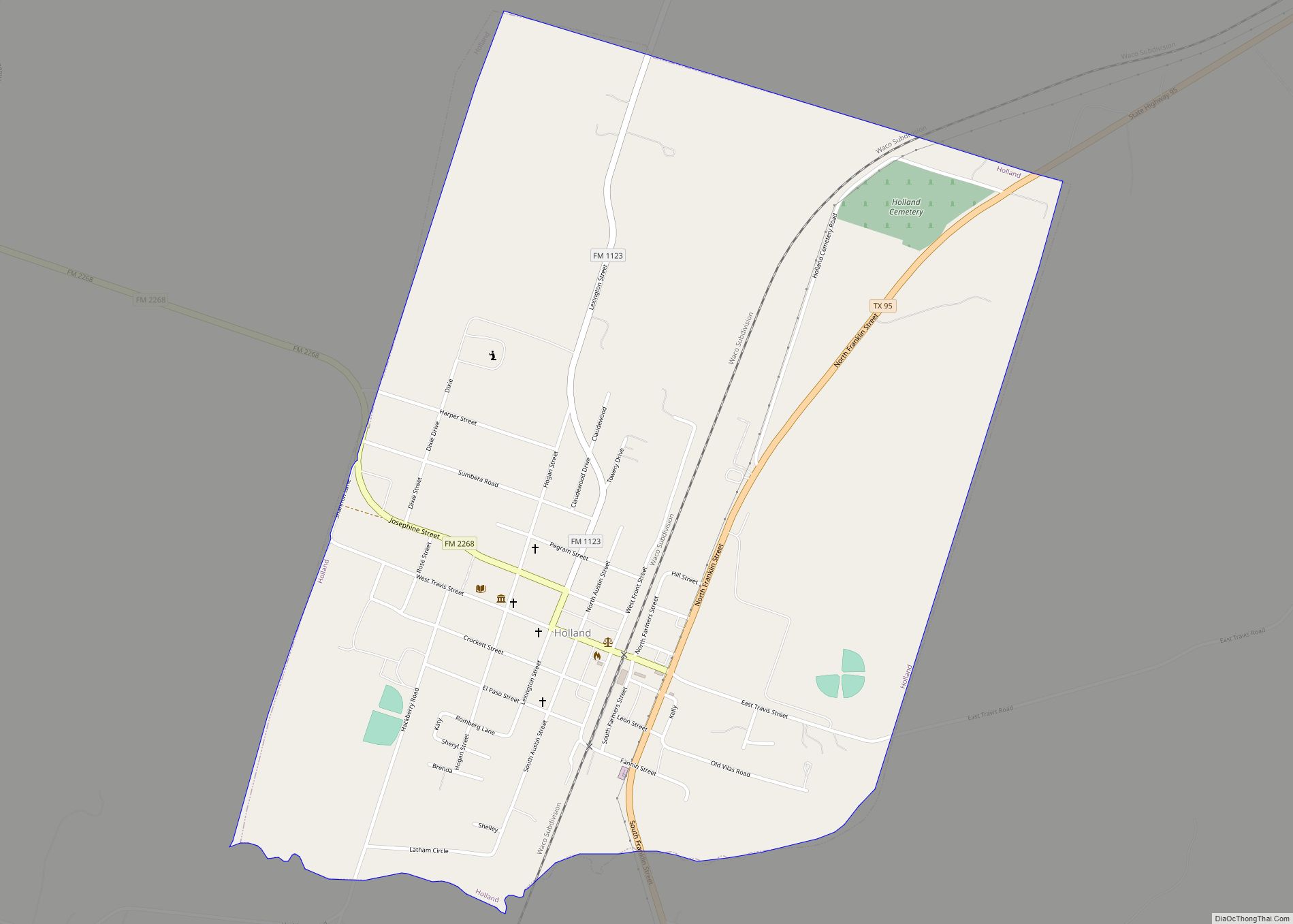
Online Interactive Map
Click on ![]() to view map in "full screen" mode.
to view map in "full screen" mode.
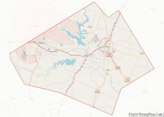
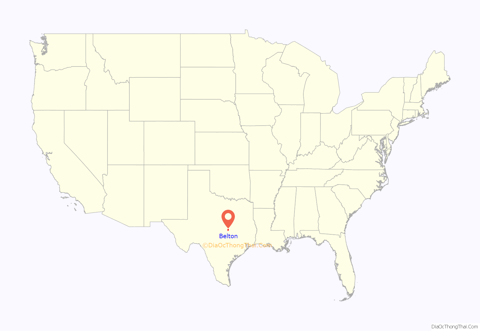
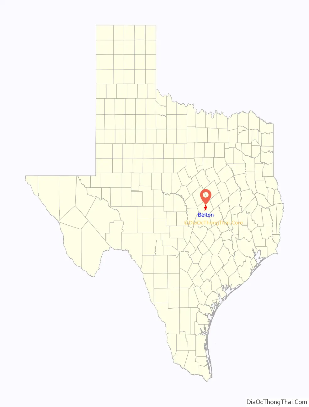
Belton location map. Where is Belton city?
History
Belton and Bell County have been the site of human habitation since at least 6000 BCE. Evidence of early inhabitants, including campsites, kitchen middens and burial mounds from the late prehistoric era have been discovered in the Stillhouse Hollow Lake and Belton Lake areas. The earliest identifiable inhabitants were the Tonkawa, who traditionally followed buffalo by foot. Belton was also home to the Lipan Apache, Wacos, Nadaco, Kiowas and Comanche. By the 1840s most tribes had been pushed out by settlements, but skirmishes with the Comanche existed until the early 1870s.
Belton was first settled 1850 and named Nolanville, taking the name of nearby Nolan Springs which were named for Texan explorer Philip Nolan. In 1851, it changed its name to Belton after being named the county seat of newly created Bell County named after Peter Hansborough Bell, the Governor of Texas at that time. In 1860, the population was 300, the largest in the county. During the run up to the civil war, Belton had a large pro-Union minority. A Whig Party paper and anti-secession paper called “The Independent” was published there and the city voted overwhelmingly for Sam Houston for governor, who was strongly against Texas secession. Nonetheless, in 1861 Bell County voted for secession and many residents fought in the Confederate Army. After the civil war, Belton experienced unrest. Several pro-union sympathizers were lynched in 1866 and Federal troops were called in to protect the Federal Judge serving in the city. After Reconstruction, the city, close to a major feeder of the Chisholm Trail, served as growing business center for the region.
In 1868, Martha McWhirter, a prominent figure in Belton’s non-sectarian Union Sunday School, created the Woman’s Commonwealth, the only Texas women’s commune of the 1800s. The commune started several business ventures including a successful hotel. In 1899, the group sold their holdings and relocated to Maryland. The town experienced rapid growth in the 1880s with the building of the courthouse, Baylor Female College buildings, and a “railroad war” in which, by 1881, Belton was bypassed by the Gulf, Colorado and Santa Fe Railroad, which built Temple, 8 miles to the east, as the local junction and depot town. In 1904, the town reported a population of 3,700. The town began to thrive and reached a population of 6,500 in 1928. However the town was decimated by the Great Depression and was down to a population of 3,779 only three years later in 1931.
The town began to recover in the run up to World War II as Fort Hood was opened nearby in 1942, housing the tank destroyer Tactical and Firing Center at Fort Hood. Encompassing over 200,000 acres and almost 90,000 troops, this brought a large population and a lot of economic activity to the area. By 1950, the city’s population was back up to 6,246 and by 1990 had reached 12,476.
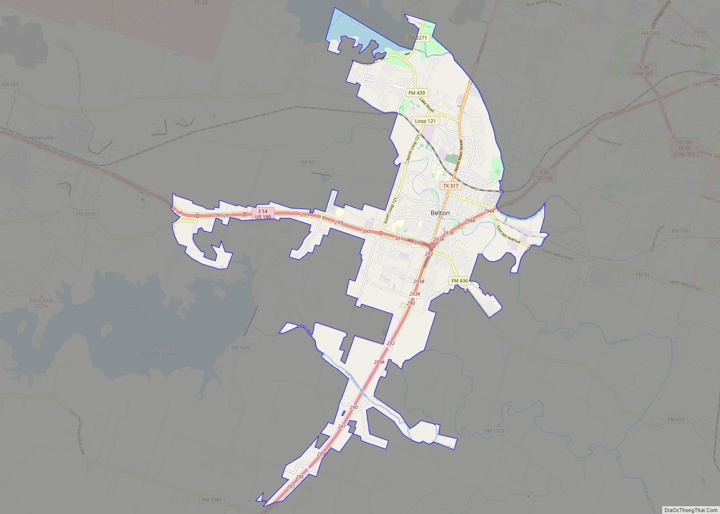
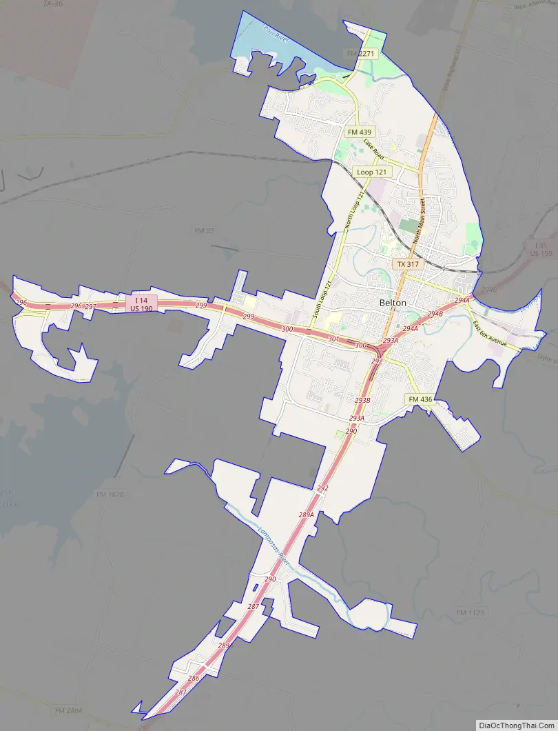
Belton Road Map
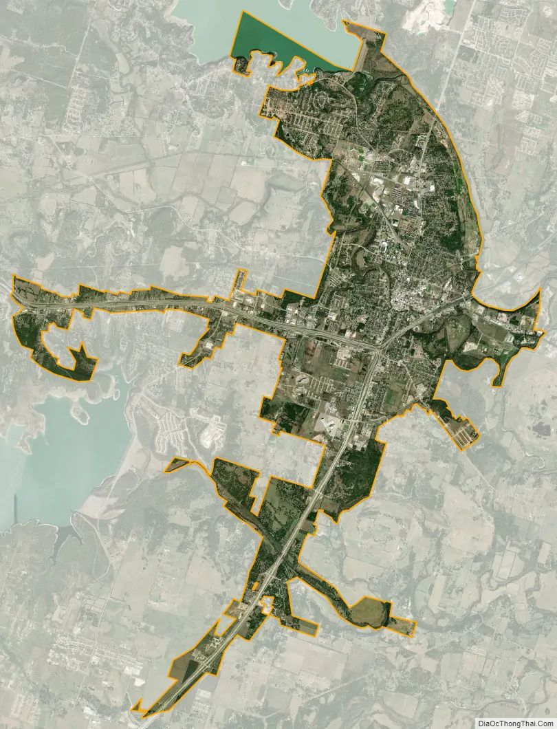
Belton city Satellite Map
Geography
Belton is located 60 miles (97 km) north of Austin, 137 miles (220 km) south of Dallas, and 184 miles (296 km) west of Houston. It is near the center of Bell County at 31°3′32″N 97°27′48″W / 31.05889°N 97.46333°W / 31.05889; -97.46333 (31.058904, –97.463382). It is at the point where the Blackland Prairie, characterized by level ground and deep fertile soil, and the Edwards Plateau, characterized by its many springs, hills, and steep canyons, meet. Its elevation is approximately 509 feet (155 m).
It is bordered to the northeast by the Leon River, across which is the city of Temple. Nolan Creek, a tributary of the Leon, runs through the center of Belton. It is also southeast of Belton Lake and northeast of Stillhouse Hollow Lake with both touching its city limits. The city limits extend south along Interstate 35 across the Lampasas River nearly to Salado. And abuts Temple City limits at the Leon River
According to the United States Census Bureau, the city has a total area of 20.0 square miles (51.7 km), of which 18.9 square miles (49.0 km) is land and 1.0 square mile (2.6 km), or 5.08%, is water.
See also
Map of Texas State and its subdivision:- Anderson
- Andrews
- Angelina
- Aransas
- Archer
- Armstrong
- Atascosa
- Austin
- Bailey
- Bandera
- Bastrop
- Baylor
- Bee
- Bell
- Bexar
- Blanco
- Borden
- Bosque
- Bowie
- Brazoria
- Brazos
- Brewster
- Briscoe
- Brooks
- Brown
- Burleson
- Burnet
- Caldwell
- Calhoun
- Callahan
- Cameron
- Camp
- Carson
- Cass
- Castro
- Chambers
- Cherokee
- Childress
- Clay
- Cochran
- Coke
- Coleman
- Collin
- Collingsworth
- Colorado
- Comal
- Comanche
- Concho
- Cooke
- Coryell
- Cottle
- Crane
- Crockett
- Crosby
- Culberson
- Dallam
- Dallas
- Dawson
- Deaf Smith
- Delta
- Denton
- Dewitt
- Dickens
- Dimmit
- Donley
- Duval
- Eastland
- Ector
- Edwards
- El Paso
- Ellis
- Erath
- Falls
- Fannin
- Fayette
- Fisher
- Floyd
- Foard
- Fort Bend
- Franklin
- Freestone
- Frio
- Gaines
- Galveston
- Garza
- Gillespie
- Glasscock
- Goliad
- Gonzales
- Gray
- Grayson
- Gregg
- Grimes
- Guadalupe
- Hale
- Hall
- Hamilton
- Hansford
- Hardeman
- Hardin
- Harris
- Harrison
- Hartley
- Haskell
- Hays
- Hemphill
- Henderson
- Hidalgo
- Hill
- Hockley
- Hood
- Hopkins
- Houston
- Howard
- Hudspeth
- Hunt
- Hutchinson
- Irion
- Jack
- Jackson
- Jasper
- Jeff Davis
- Jefferson
- Jim Hogg
- Jim Wells
- Johnson
- Jones
- Karnes
- Kaufman
- Kendall
- Kenedy
- Kent
- Kerr
- Kimble
- King
- Kinney
- Kleberg
- Knox
- La Salle
- Lamar
- Lamb
- Lampasas
- Lavaca
- Lee
- Leon
- Liberty
- Limestone
- Lipscomb
- Live Oak
- Llano
- Loving
- Lubbock
- Lynn
- Madison
- Marion
- Martin
- Mason
- Matagorda
- Maverick
- McCulloch
- McLennan
- McMullen
- Medina
- Menard
- Midland
- Milam
- Mills
- Mitchell
- Montague
- Montgomery
- Moore
- Morris
- Motley
- Nacogdoches
- Navarro
- Newton
- Nolan
- Nueces
- Ochiltree
- Oldham
- Orange
- Palo Pinto
- Panola
- Parker
- Parmer
- Pecos
- Polk
- Potter
- Presidio
- Rains
- Randall
- Reagan
- Real
- Red River
- Reeves
- Refugio
- Roberts
- Robertson
- Rockwall
- Runnels
- Rusk
- Sabine
- San Augustine
- San Jacinto
- San Patricio
- San Saba
- Schleicher
- Scurry
- Shackelford
- Shelby
- Sherman
- Smith
- Somervell
- Starr
- Stephens
- Sterling
- Stonewall
- Sutton
- Swisher
- Tarrant
- Taylor
- Terrell
- Terry
- Throckmorton
- Titus
- Tom Green
- Travis
- Trinity
- Tyler
- Upshur
- Upton
- Uvalde
- Val Verde
- Van Zandt
- Victoria
- Walker
- Waller
- Ward
- Washington
- Webb
- Wharton
- Wheeler
- Wichita
- Wilbarger
- Willacy
- Williamson
- Wilson
- Winkler
- Wise
- Wood
- Yoakum
- Young
- Zapata
- Zavala
- Alabama
- Alaska
- Arizona
- Arkansas
- California
- Colorado
- Connecticut
- Delaware
- District of Columbia
- Florida
- Georgia
- Hawaii
- Idaho
- Illinois
- Indiana
- Iowa
- Kansas
- Kentucky
- Louisiana
- Maine
- Maryland
- Massachusetts
- Michigan
- Minnesota
- Mississippi
- Missouri
- Montana
- Nebraska
- Nevada
- New Hampshire
- New Jersey
- New Mexico
- New York
- North Carolina
- North Dakota
- Ohio
- Oklahoma
- Oregon
- Pennsylvania
- Rhode Island
- South Carolina
- South Dakota
- Tennessee
- Texas
- Utah
- Vermont
- Virginia
- Washington
- West Virginia
- Wisconsin
- Wyoming