Map of Thornton town, Texas

Map of Thornton town, Texas

Thornton is a town in Limestone County, Texas, United States. The population was 526 at the 2010 census. Thornton town overview: Name: Thornton town LSAD Code: 43 LSAD Description: town (suffix) State: Texas County: Limestone County Elevation: 492 ft (150 m) Total Area: 0.99 sq mi (2.55 km²) Land Area: 0.98 sq mi (2.54 km²) Water Area: 0.01 sq mi (0.01 km²) Total Population: 526 Population … Read more

Map of Thorndale city, Texas

Map of Thorndale city, Texas

Thorndale is a city in Milam County, Texas, with a small part in Williamson County. The population was 1,263 at the 2020 census. It was founded in 1878 about 3 miles west of its present site, and moved to its current site in 1880. Thorndale city overview: Name: Thorndale city LSAD Code: 25 LSAD Description: … Read more

Map of Thompsonville CDP, Texas

Map of Thompsonville CDP, Texas

Thompsonville is a census-designated place (CDP) and unincorporated community in Jim Hogg County, Texas, United States. The population of the CDP was 46 at the 2010 census. The CDP is located along Farm Road 3073 in northwestern Jim Hogg County, 9 miles (14 km) southwest of Hebbronville, the county seat. The CDP takes its name from … Read more

Map of Thompsons town

Map of Thompsons town

Thompsons is a town in Fort Bend County, Texas, United States, within the Houston–Sugar Land–Baytown metropolitan area. The population was 246 at the 2010 census. Thompsons town overview: Name: Thompsons town LSAD Code: 43 LSAD Description: town (suffix) State: Texas County: Fort Bend County Elevation: 66 ft (20 m) Total Area: 8.32 sq mi (21.55 km²) Land Area: 4.93 sq mi (12.78 km²) Water … Read more

Map of The Woodlands CDP

Map of The Woodlands CDP

The Woodlands is a special-purpose district and census-designated place (CDP) in the U.S. state of Texas in the Houston–The Woodlands–Sugar Land metropolitan statistical area. The Woodlands is primarily located in Montgomery County, with portions extending into Harris County. The Woodlands is governed by The Woodlands Township, an organization that provides municipal services and is administered … Read more

Map of The Hills village

Map of The Hills village

The Hills is a village in Travis County, Texas, United States. The population was 2,613 at the 2020 census, making it the largest village in Texas. It is a suburb of Austin. The Hills village overview: Name: The Hills village LSAD Code: 47 LSAD Description: village (suffix) State: Texas County: Travis County Elevation: 817 ft (249 m) … Read more

Map of The Colony city

Map of The Colony city

The Colony is a city in Denton County, Texas, United States, and a suburb of Dallas. The population was 44,534 at the 2020 census. The Colony city overview: Name: The Colony city LSAD Code: 25 LSAD Description: city (suffix) State: Texas County: Denton County Elevation: 554 ft (169 m) Total Area: 16.15 sq mi (41.83 km²) Land Area: 14.01 sq mi (36.28 km²) … Read more

Map of Texline town

Map of Texline town

Texline is a town in northwestern Dallam County, Texas, United States. The population was 507 at the 2010 Census. The town is named for its location near the New Mexico–Texas state line. The town sits on U.S. Highway 87, which continues southeast towards Dalhart and northwest towards Clayton, New Mexico. Texline town overview: Name: Texline … Read more

Map of Thrall city

Map of Thrall city

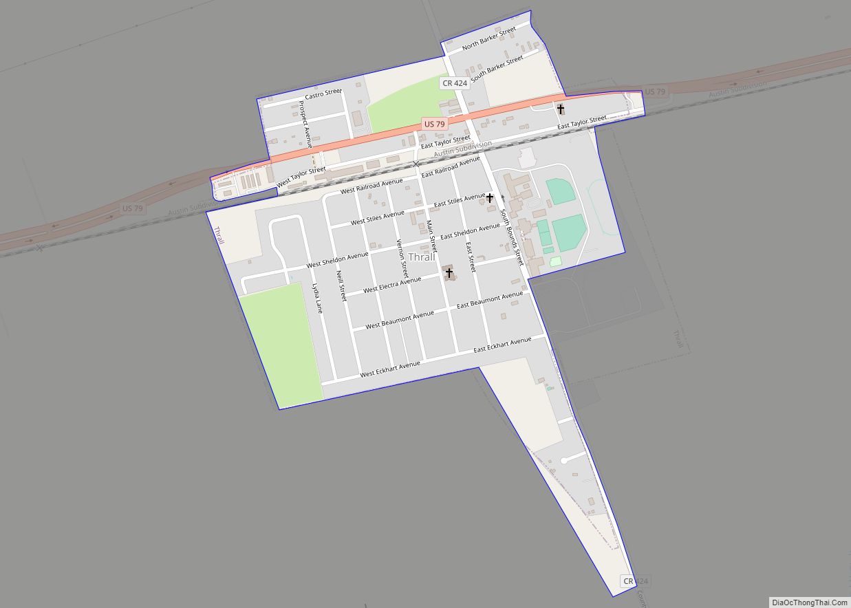
Thrall is a city in Williamson County, Texas, United States. Its population was 816 at the 2020 census. The name Thrall was chosen by the community to honor the Rev. Homer S. Thrall, a Methodist minister and historian much admired by local settlers and residents. Thrall was founded in 1876. Thrall city overview: Name: Thrall … Read more

Map of Thorntonville town

Map of Thorntonville town

Thorntonville is a town in Ward County, Texas, United States. The population was 476 according to the 2010 census. Thorntonville town overview: Name: Thorntonville town LSAD Code: 43 LSAD Description: town (suffix) State: Texas County: Ward County Elevation: 2,605 ft (794 m) Total Area: 0.80 sq mi (2.07 km²) Land Area: 0.80 sq mi (2.07 km²) Water Area: 0.00 sq mi (0.00 km²) Total Population: 476 … Read more

Map of Timbercreek Canyon village

Map of Timbercreek Canyon village

Timbercreek Canyon is a village in Randall County, Texas, United States. As of the 2010 census, the village population was 418. It is part of the Amarillo, Texas Metropolitan Statistical Area. Timbercreek Canyon village overview: Name: Timbercreek Canyon village LSAD Code: 47 LSAD Description: village (suffix) State: Texas County: Randall County Elevation: 3,451 ft (1,052 m) Total … Read more

Map of Tilden CDP, Texas

Map of Tilden CDP, Texas

Tilden is a Census-designated place (CDP) and county seat of McMullen County, Texas, United States. Tilden lies at the intersection of State Highways 16 and 72 in the north central part of the county. It is located roughly an hour south of San Antonio. Tilden CDP overview: Name: Tilden CDP LSAD Code: 57 LSAD Description: … Read more