The Woodlands is a special-purpose district and census-designated place (CDP) in the U.S. state of Texas in the Houston–The Woodlands–Sugar Land metropolitan statistical area. The Woodlands is primarily located in Montgomery County, with portions extending into Harris County. The Woodlands is governed by The Woodlands Township, an organization that provides municipal services and is administered by an elected board of directors. As of the 2020 U.S. Census, the township had a population of 114,436 people. In 2021, The Howard Hughes Corporation estimated the population of The Woodlands was 119,000. The United States Census Bureau defines an urban area separate from the Houston urban area with The Woodlands as a principal city: The Woodlands–Conroe, TX urban area had a 2020 population of 402,454, making it the 103rd largest in the United States.
The Woodlands is located 28 miles (45 km) north of Houston along Interstate 45. Though it began as an exurban development and a bedroom community, it has also attracted corporations and has several corporate campuses, most notably Occidental Petroleum Corporation, Chevron Phillips Chemical, Huntsman Corporation, Woodforest National Bank, Baker Hughes, McKesson Specialty Health, and Halliburton. The community won a Special Award for Excellence in 1994 from the Urban Land Institute.
| Name: | The Woodlands CDP |
|---|---|
| LSAD Code: | 57 |
| LSAD Description: | CDP (suffix) |
| State: | Texas |
| County: | Harris County, Montgomery County |
| Elevation: | 160 ft (50 m) |
| Land Area: | 43.3 sq mi (112.1 km²) |
| Water Area: | 0.6 sq mi (1.5 km²) |
| Population Density: | 2,644/sq mi (1,020.8/km²) |
| Area code: | 281/346/713/832/936 |
| FIPS code: | 4872656 |
| GNISfeature ID: | 1867568 |
| Website: | thewoodlandstownship-tx.gov |
Online Interactive Map
Click on ![]() to view map in "full screen" mode.
to view map in "full screen" mode.
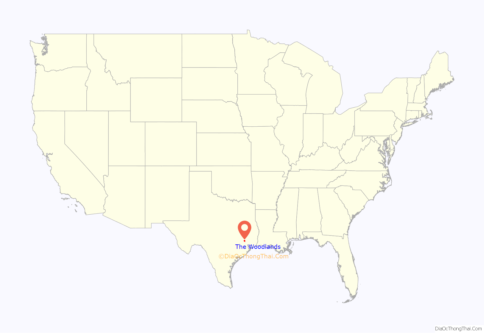
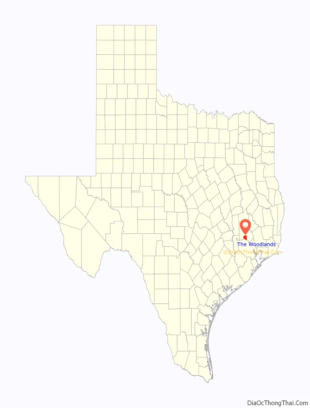
The Woodlands location map. Where is The Woodlands CDP?
History
Early history
The area that is now The Woodlands was used by the Akokisa and Bidai peoples, who relied on the fresh water of Spring Creek. In 1984, construction in the Indian Springs neighborhood near the creek discovered Bidai artifacts.
Foundation and growth
The Woodlands was conceived after the oil industry investor George P. Mitchell attended a symposium by the Rouse Company subsidiary American City Corporation and developer of Columbia, Maryland, on how to develop new towns using the HUD Title VII program. It was dedicated by George P. Mitchell in 1974 and managed by The Woodlands Corporation as an extension of Mitchell Energy & Development. Mitchell, an oil businessman, planned to establish a conference center, hotels, office parks, retail malls, schools, large distribution centers, and golf courses. Houses would range from moderately priced to expensive and large. Bill Schadewald of the Houston Business Journal said that Mitchell wanted the development to “entice city slickers looking for far-flung suburban quality of life”. Schadewald said that local sources stated that the HUD New Town program, a federally funded program, had a “low survival rate” and questioned whether The Woodlands would succeed.
The Woodlands Corporation was acquired on July 31, 1997, by a partnership between Morgan Stanley and Crescent Real Estate Equities. In December 2003, Rouse Company acquired Crescent’s interest, and Rouse was bought by General Growth Properties on November 12, 2004. In 2011, The Woodlands was sold to the Howard Hughes Development Corporation.
The land was previously occupied by the Grogan-Cochran Lumber Mill, hence Grogan’s Mill and Cochran’s Crossing neighborhoods, called “villages”. The original planning utilized many of the planning concepts and design consultants employed in other well-regarded new communities of that era such as Columbia, Maryland, Irvine Ranch, California, and Reston, Virginia. The original development plan included environmental design principles espoused by Ian McHarg, a distinguished landscape architect, teacher and author of the seminal work Design With Nature.
In 2012, the U.S. Census Bureau designated the area around The Woodlands and Conroe as a “large urbanized transit area”, defined as having over 200,000 residents, making it eligible to receive federal transportation funds.
Incorporation as a city
Mitchell’s original plan was for The Woodlands to be annexed by the city of Houston. However, as the community developed and grew, there was little support for that idea. In the middle part of the 2000s, some residents organized to prevent any annexation, as had happened to the Kingwood development almost a decade before. To counteract any possible move by the city, a movement began to create an independent city government. However, the formation of an independent government would require authorization by the State of Texas and the City of Houston, as Houston held extraterritorial jurisdiction over the area.
In 2007, two state legislators representing The Woodlands, Sen. Tommy Williams and Rep. Robert Eissler, introduced two bills that were enacted in the 2007 Legislature – House Bill 4109 and Senate Bill 1012. HB 4109 called for a vote to allow expansion of an existing improvement district (now The Woodlands Township) and to allow The Woodlands to collect sales tax, while SB 1012 allowed for the creation of regional agreements between governments. The passage of these bills allows an opportunity for The Woodlands to incorporate itself until 2057. Since 2019, there has been formal discussion of The Woodlands to become an incorporated city. However, as a result of the ongoing COVID-19 pandemic, these plans were put on hold and resumed in April 2021. In 2020, residents of The Woodlands formed the TownshipFuture PAC. In a referendum on November 2, 2021, residents voted against incorporation by a wide margin, keeping The Woodlands as a township for the foreseeable future.
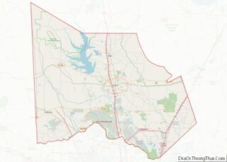
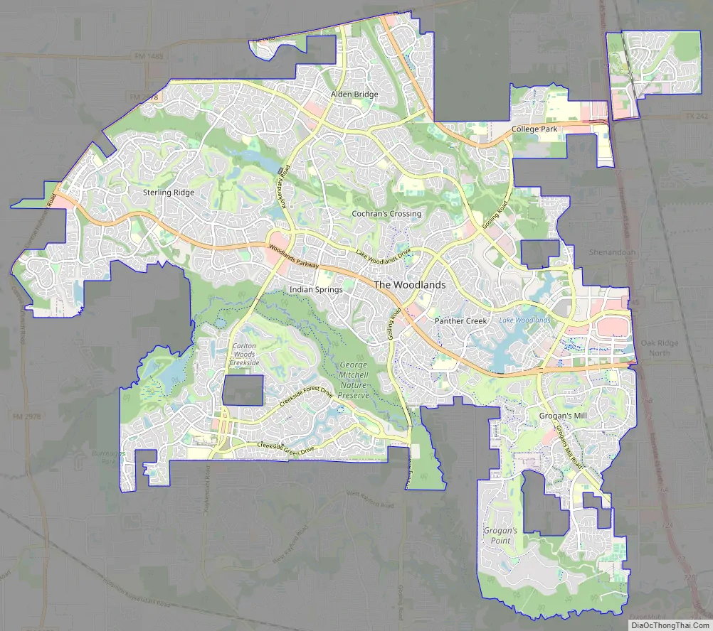
The Woodlands Road Map
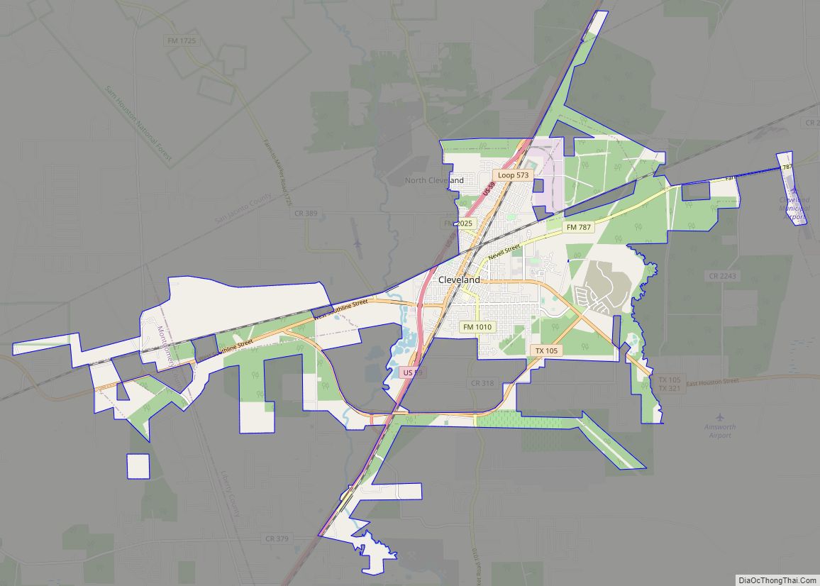
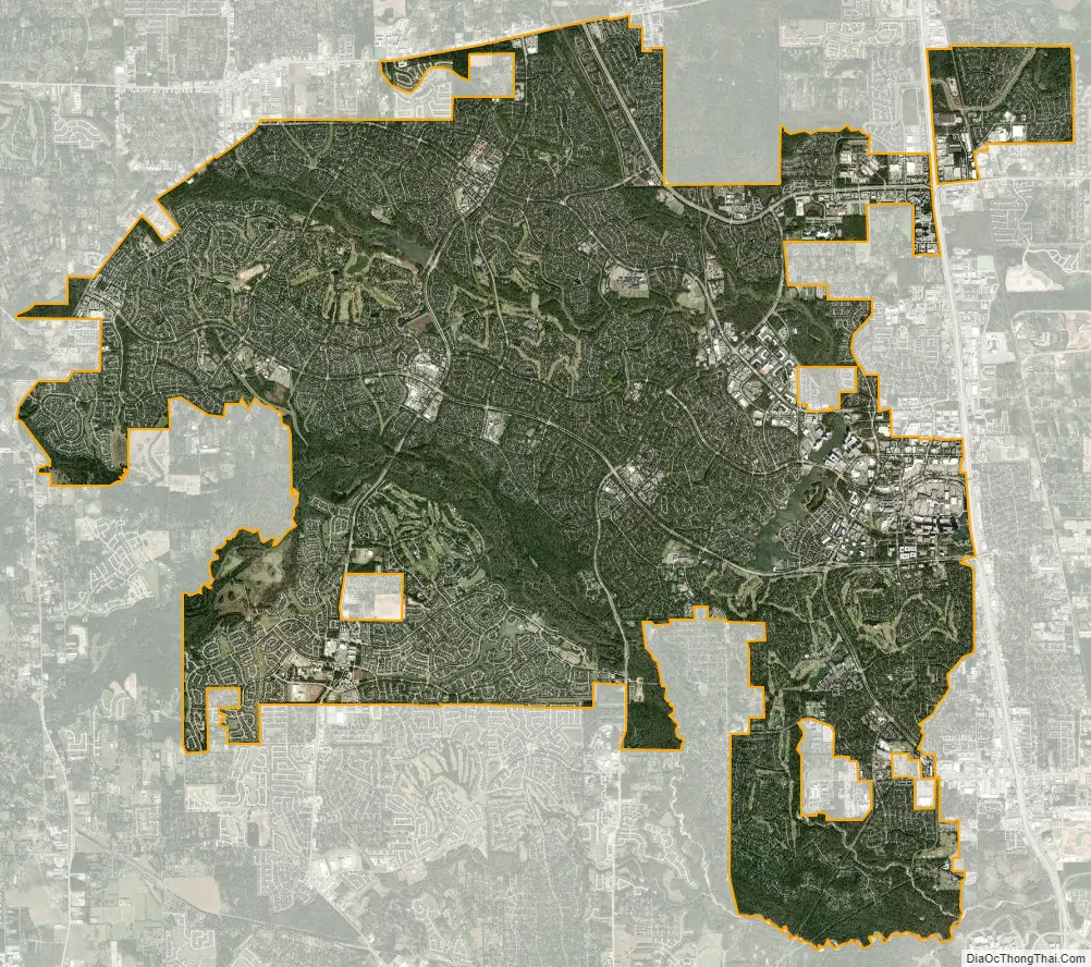
The Woodlands city Satellite Map
Geography
The Woodlands is primarily in Montgomery County, Texas, with a small portion in Harris County, bordering Houston. According to the United States Census Bureau, The Woodlands has an area of 43.9 square miles (113.6 km), of which 43.3 square miles (112.1 km) are land and 0.58 square miles (1.5 km), or 1.32%, are water.
The Woodlands is in a heavily forested area, and much of the community has retained trees for shade and decoration. The terrain is essentially flat, with the exception of topographic variations ranging from 125 to 175 feet above sea level between Spring Creek and Flintridge Drive.
Villages
The Woodlands is organized into eight villages, which are subdivided into neighborhoods. Each village features varying amenities including parks, hike and bike trails, golfing, commercial centers, and a range of residential properties from single family to estates. The Town Center includes shopping and eating facilities, corporate offices, and a waterway modeled after the San Antonio River Walk. The Research Forest district includes a Park and Ride facility and The Woodlands Township Town Hall.
- Alden Bridge
- Cochran’s Crossing
- College Park
- Creekside Park
- Grogan’s Mill
- Indian Springs
- Panther Creek
- Sterling Ridge
Climate
The Woodlands has a humid subtropical climate, typical to the Southeast Texas region and Greater Houston. Temperature ranges are within the top decile for census-designated places in the United States. Winter daily highs average approximately 60 degrees Fahrenheit (15C), daily lows 40 degrees Fahrenheit (4C); summer daily highs average 94 degrees Fahrenheit (34C), daily lows 72 (22C) degrees Fahrenheit. It is part of Wind Zone 2 per the FEMA mapping chart.
Protected Areas
The Woodlands has 151 urban parks within its boundaries, with all residents being within a ten-minute walk of a park.
The areas surrounding Spring Creek are protected as part of the George Mitchell Nature Preserve, a section of the larger Spring Creek Greenway, the “longest, connected, urban forested corridor in the nation.”
The northern part of the CDP borders on the W. Goodrich Jones State Forest. This forest, managed by the Texas A&M Forest Service, serves as a vital habitat for the endangered red-cockaded woodpecker.
See also
Map of Texas State and its subdivision:- Anderson
- Andrews
- Angelina
- Aransas
- Archer
- Armstrong
- Atascosa
- Austin
- Bailey
- Bandera
- Bastrop
- Baylor
- Bee
- Bell
- Bexar
- Blanco
- Borden
- Bosque
- Bowie
- Brazoria
- Brazos
- Brewster
- Briscoe
- Brooks
- Brown
- Burleson
- Burnet
- Caldwell
- Calhoun
- Callahan
- Cameron
- Camp
- Carson
- Cass
- Castro
- Chambers
- Cherokee
- Childress
- Clay
- Cochran
- Coke
- Coleman
- Collin
- Collingsworth
- Colorado
- Comal
- Comanche
- Concho
- Cooke
- Coryell
- Cottle
- Crane
- Crockett
- Crosby
- Culberson
- Dallam
- Dallas
- Dawson
- Deaf Smith
- Delta
- Denton
- Dewitt
- Dickens
- Dimmit
- Donley
- Duval
- Eastland
- Ector
- Edwards
- El Paso
- Ellis
- Erath
- Falls
- Fannin
- Fayette
- Fisher
- Floyd
- Foard
- Fort Bend
- Franklin
- Freestone
- Frio
- Gaines
- Galveston
- Garza
- Gillespie
- Glasscock
- Goliad
- Gonzales
- Gray
- Grayson
- Gregg
- Grimes
- Guadalupe
- Hale
- Hall
- Hamilton
- Hansford
- Hardeman
- Hardin
- Harris
- Harrison
- Hartley
- Haskell
- Hays
- Hemphill
- Henderson
- Hidalgo
- Hill
- Hockley
- Hood
- Hopkins
- Houston
- Howard
- Hudspeth
- Hunt
- Hutchinson
- Irion
- Jack
- Jackson
- Jasper
- Jeff Davis
- Jefferson
- Jim Hogg
- Jim Wells
- Johnson
- Jones
- Karnes
- Kaufman
- Kendall
- Kenedy
- Kent
- Kerr
- Kimble
- King
- Kinney
- Kleberg
- Knox
- La Salle
- Lamar
- Lamb
- Lampasas
- Lavaca
- Lee
- Leon
- Liberty
- Limestone
- Lipscomb
- Live Oak
- Llano
- Loving
- Lubbock
- Lynn
- Madison
- Marion
- Martin
- Mason
- Matagorda
- Maverick
- McCulloch
- McLennan
- McMullen
- Medina
- Menard
- Midland
- Milam
- Mills
- Mitchell
- Montague
- Montgomery
- Moore
- Morris
- Motley
- Nacogdoches
- Navarro
- Newton
- Nolan
- Nueces
- Ochiltree
- Oldham
- Orange
- Palo Pinto
- Panola
- Parker
- Parmer
- Pecos
- Polk
- Potter
- Presidio
- Rains
- Randall
- Reagan
- Real
- Red River
- Reeves
- Refugio
- Roberts
- Robertson
- Rockwall
- Runnels
- Rusk
- Sabine
- San Augustine
- San Jacinto
- San Patricio
- San Saba
- Schleicher
- Scurry
- Shackelford
- Shelby
- Sherman
- Smith
- Somervell
- Starr
- Stephens
- Sterling
- Stonewall
- Sutton
- Swisher
- Tarrant
- Taylor
- Terrell
- Terry
- Throckmorton
- Titus
- Tom Green
- Travis
- Trinity
- Tyler
- Upshur
- Upton
- Uvalde
- Val Verde
- Van Zandt
- Victoria
- Walker
- Waller
- Ward
- Washington
- Webb
- Wharton
- Wheeler
- Wichita
- Wilbarger
- Willacy
- Williamson
- Wilson
- Winkler
- Wise
- Wood
- Yoakum
- Young
- Zapata
- Zavala
- Alabama
- Alaska
- Arizona
- Arkansas
- California
- Colorado
- Connecticut
- Delaware
- District of Columbia
- Florida
- Georgia
- Hawaii
- Idaho
- Illinois
- Indiana
- Iowa
- Kansas
- Kentucky
- Louisiana
- Maine
- Maryland
- Massachusetts
- Michigan
- Minnesota
- Mississippi
- Missouri
- Montana
- Nebraska
- Nevada
- New Hampshire
- New Jersey
- New Mexico
- New York
- North Carolina
- North Dakota
- Ohio
- Oklahoma
- Oregon
- Pennsylvania
- Rhode Island
- South Carolina
- South Dakota
- Tennessee
- Texas
- Utah
- Vermont
- Virginia
- Washington
- West Virginia
- Wisconsin
- Wyoming