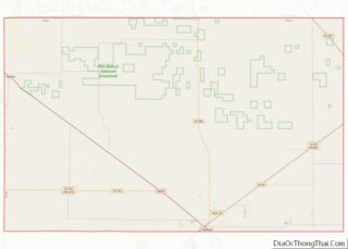
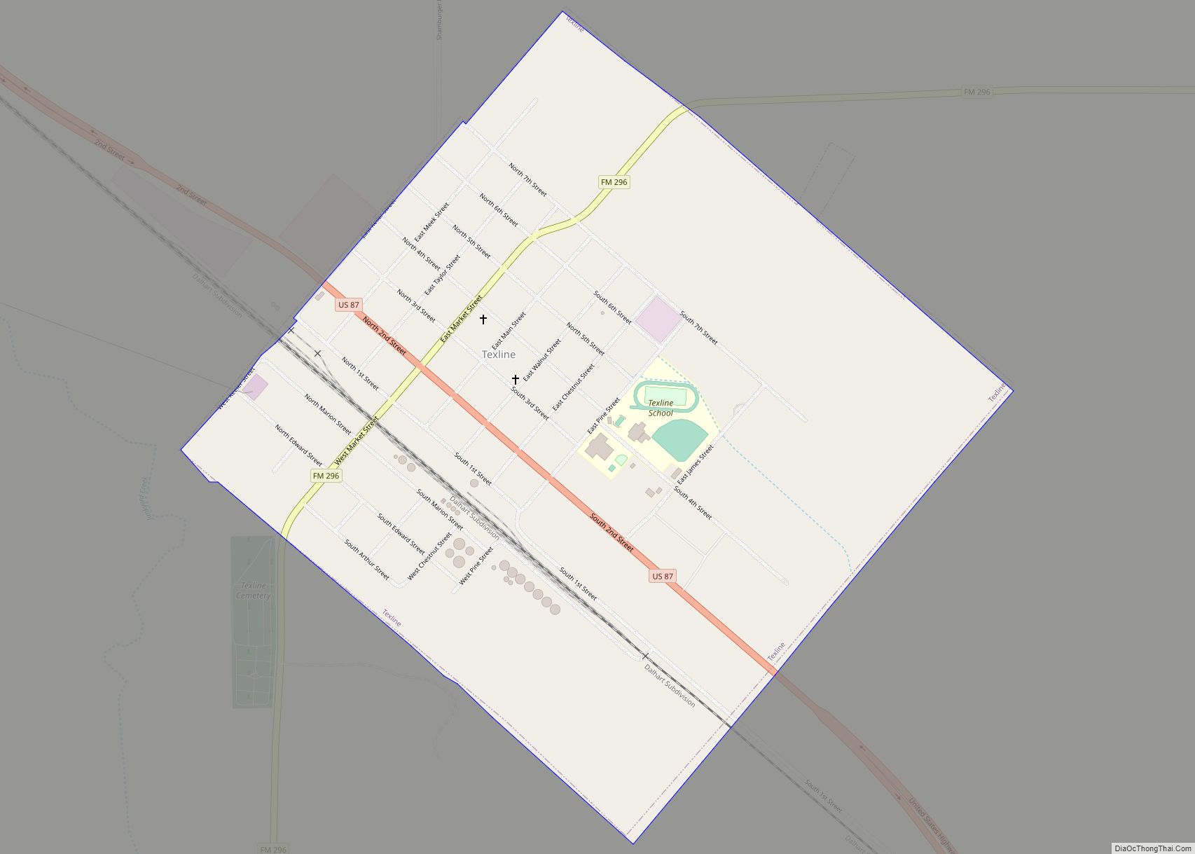
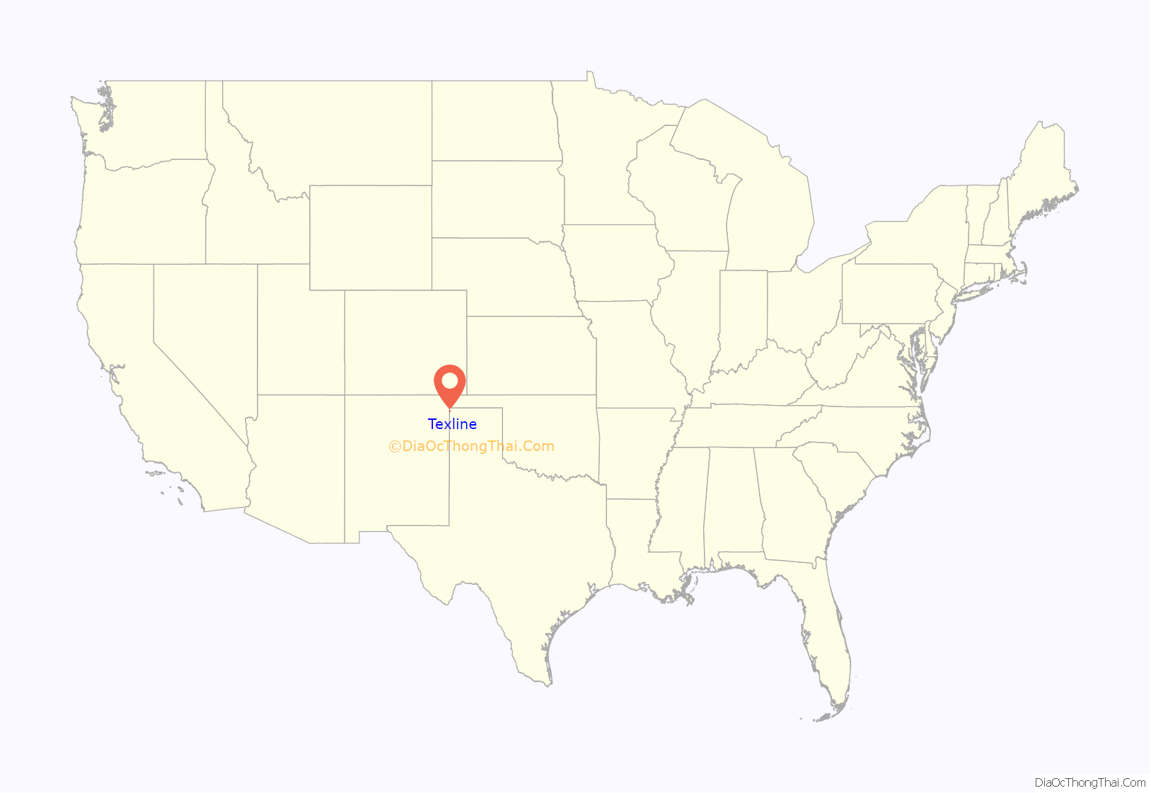
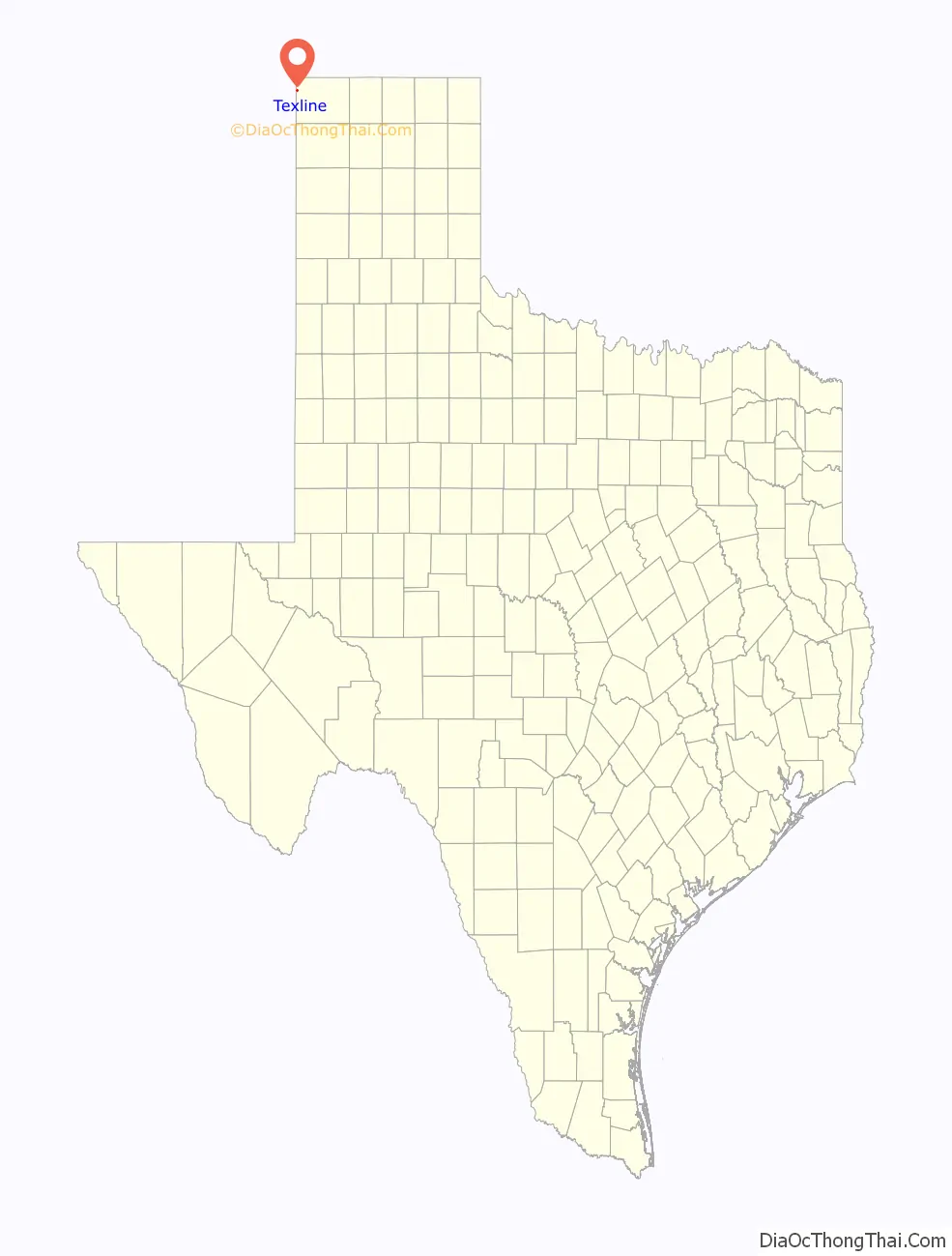
Texline is a town in northwestern Dallam County, Texas, United States. The population was 507 at the 2010 Census. The town is named for its location near the New Mexico–Texas state line. The town sits on U.S. Highway 87, which continues southeast towards Dalhart and northwest towards Clayton, New Mexico.
| Name: | Texline town |
|---|---|
| LSAD Code: | 43 |
| LSAD Description: | town (suffix) |
| State: | Texas |
| County: | Dallam County |
| Elevation: | 4,692 ft (1,430 m) |
| Total Area: | 1.02 sq mi (2.63 km²) |
| Land Area: | 1.02 sq mi (2.63 km²) |
| Water Area: | 0.00 sq mi (0.00 km²) |
| Total Population: | 507 |
| Population Density: | 530.51/sq mi (204.82/km²) |
| ZIP code: | 79087 |
| Area code: | 806 |
| FIPS code: | 4872476 |
Online Interactive Map
Click on ![]() to view map in "full screen" mode.
to view map in "full screen" mode.
Texline location map. Where is Texline town?
History
For years there has been a simmering dispute over whether Texline is lawfully a part of Texas or New Mexico. The straight north-south border between the two states was originally defined as the 103rd meridian, but the 1859 survey that was supposed to mark that boundary mistakenly set the border between 2.29 and 3.77 miles (3.69–6.07 km) too far west of that line. this survey error resulted in the current towns of Farwell, Texline, and a part of Glenrio being within the State of Texas. New Mexico’s short border with Oklahoma, in contrast, was correctly surveyed on the meridian. New Mexico’s draft constitution in 1910 stated that the border is on the 103rd meridian as intended. The disputed strip, hundreds of miles long, includes parts of valuable oilfields of the Permian Basin. A bill was passed in the New Mexico Senate to fund and file a lawsuit in the U.S. Supreme Court to recover the strip from Texas, but the bill did not become law. Today, land in the strip is included in Texas land surveys and the land and towns for all purposes are taxed and governed by the State of Texas.
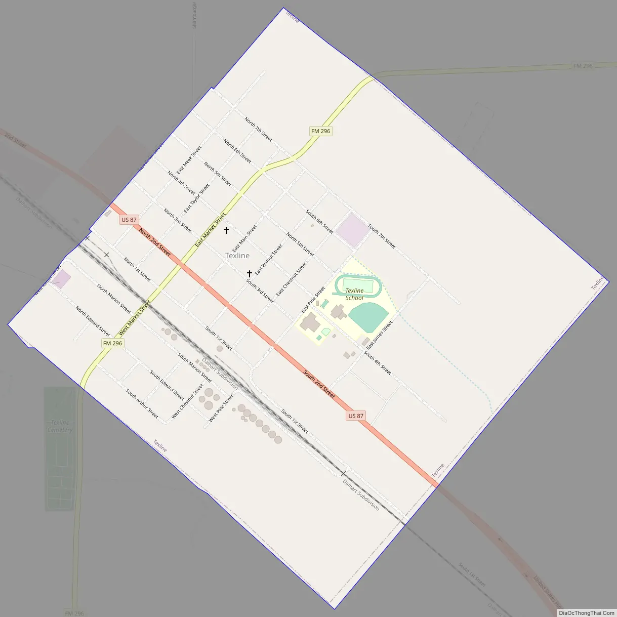
Texline Road Map
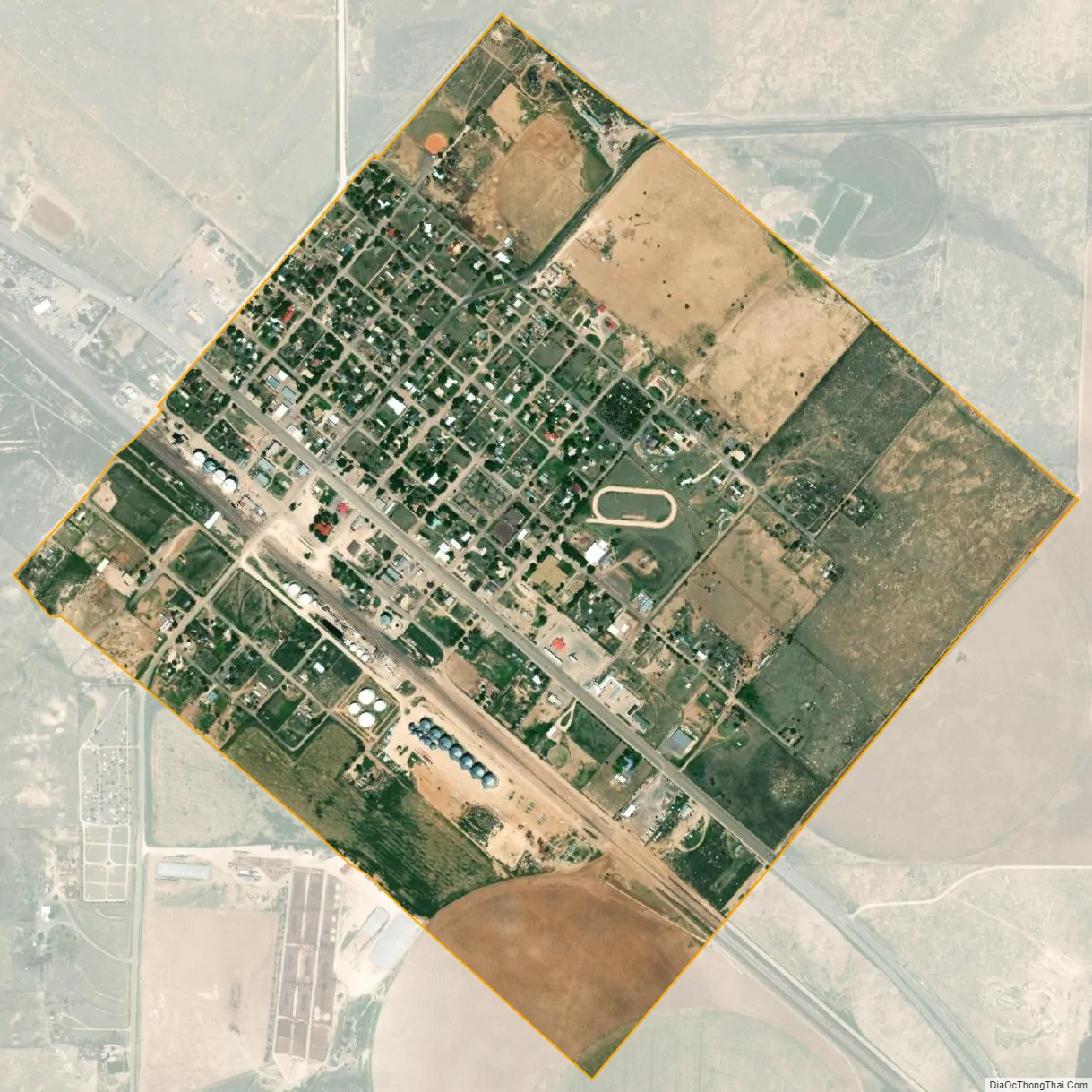
Texline city Satellite Map
Geography
Texline is located just over one mile from the New Mexico border along U.S. Highway 87 and six miles south of the Texas-Oklahoma border. Dalhart is approximately 35 miles to the southeast and Clayton, New Mexico is about 11 miles to the northwest.
According to the United States Census Bureau, the town has a total area of 1.0 square mile (2.6 km), all land.
See also
Map of Texas State and its subdivision:- Anderson
- Andrews
- Angelina
- Aransas
- Archer
- Armstrong
- Atascosa
- Austin
- Bailey
- Bandera
- Bastrop
- Baylor
- Bee
- Bell
- Bexar
- Blanco
- Borden
- Bosque
- Bowie
- Brazoria
- Brazos
- Brewster
- Briscoe
- Brooks
- Brown
- Burleson
- Burnet
- Caldwell
- Calhoun
- Callahan
- Cameron
- Camp
- Carson
- Cass
- Castro
- Chambers
- Cherokee
- Childress
- Clay
- Cochran
- Coke
- Coleman
- Collin
- Collingsworth
- Colorado
- Comal
- Comanche
- Concho
- Cooke
- Coryell
- Cottle
- Crane
- Crockett
- Crosby
- Culberson
- Dallam
- Dallas
- Dawson
- Deaf Smith
- Delta
- Denton
- Dewitt
- Dickens
- Dimmit
- Donley
- Duval
- Eastland
- Ector
- Edwards
- El Paso
- Ellis
- Erath
- Falls
- Fannin
- Fayette
- Fisher
- Floyd
- Foard
- Fort Bend
- Franklin
- Freestone
- Frio
- Gaines
- Galveston
- Garza
- Gillespie
- Glasscock
- Goliad
- Gonzales
- Gray
- Grayson
- Gregg
- Grimes
- Guadalupe
- Hale
- Hall
- Hamilton
- Hansford
- Hardeman
- Hardin
- Harris
- Harrison
- Hartley
- Haskell
- Hays
- Hemphill
- Henderson
- Hidalgo
- Hill
- Hockley
- Hood
- Hopkins
- Houston
- Howard
- Hudspeth
- Hunt
- Hutchinson
- Irion
- Jack
- Jackson
- Jasper
- Jeff Davis
- Jefferson
- Jim Hogg
- Jim Wells
- Johnson
- Jones
- Karnes
- Kaufman
- Kendall
- Kenedy
- Kent
- Kerr
- Kimble
- King
- Kinney
- Kleberg
- Knox
- La Salle
- Lamar
- Lamb
- Lampasas
- Lavaca
- Lee
- Leon
- Liberty
- Limestone
- Lipscomb
- Live Oak
- Llano
- Loving
- Lubbock
- Lynn
- Madison
- Marion
- Martin
- Mason
- Matagorda
- Maverick
- McCulloch
- McLennan
- McMullen
- Medina
- Menard
- Midland
- Milam
- Mills
- Mitchell
- Montague
- Montgomery
- Moore
- Morris
- Motley
- Nacogdoches
- Navarro
- Newton
- Nolan
- Nueces
- Ochiltree
- Oldham
- Orange
- Palo Pinto
- Panola
- Parker
- Parmer
- Pecos
- Polk
- Potter
- Presidio
- Rains
- Randall
- Reagan
- Real
- Red River
- Reeves
- Refugio
- Roberts
- Robertson
- Rockwall
- Runnels
- Rusk
- Sabine
- San Augustine
- San Jacinto
- San Patricio
- San Saba
- Schleicher
- Scurry
- Shackelford
- Shelby
- Sherman
- Smith
- Somervell
- Starr
- Stephens
- Sterling
- Stonewall
- Sutton
- Swisher
- Tarrant
- Taylor
- Terrell
- Terry
- Throckmorton
- Titus
- Tom Green
- Travis
- Trinity
- Tyler
- Upshur
- Upton
- Uvalde
- Val Verde
- Van Zandt
- Victoria
- Walker
- Waller
- Ward
- Washington
- Webb
- Wharton
- Wheeler
- Wichita
- Wilbarger
- Willacy
- Williamson
- Wilson
- Winkler
- Wise
- Wood
- Yoakum
- Young
- Zapata
- Zavala
- Alabama
- Alaska
- Arizona
- Arkansas
- California
- Colorado
- Connecticut
- Delaware
- District of Columbia
- Florida
- Georgia
- Hawaii
- Idaho
- Illinois
- Indiana
- Iowa
- Kansas
- Kentucky
- Louisiana
- Maine
- Maryland
- Massachusetts
- Michigan
- Minnesota
- Mississippi
- Missouri
- Montana
- Nebraska
- Nevada
- New Hampshire
- New Jersey
- New Mexico
- New York
- North Carolina
- North Dakota
- Ohio
- Oklahoma
- Oregon
- Pennsylvania
- Rhode Island
- South Carolina
- South Dakota
- Tennessee
- Texas
- Utah
- Vermont
- Virginia
- Washington
- West Virginia
- Wisconsin
- Wyoming